Montevideo is the capital and largest city of Uruguay. According to the 2011 census, the city proper has a population of 1,319,108 in an area of 201 square kilometers (78 sq mi). Montevideo is situated on the southern coast of the country, on the northeastern bank of the Río de la Plata.

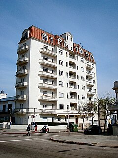
Pocitos is an upscale beach barrio in Uruguay's capital city, Montevideo.

Centro is the inner city barrio of Montevideo, Uruguay. Its main avenue is 18 de Julio Avenue. It is delimited by La Paz Str. to the North, Florida Str. and Andes Str. to the West, Canelones Str. to the South and Barrios Amorin Str. to the East. It used to be the main commercial venue of the city, but after the opening of the first malls, many small stores started closing down. Now, that process is being reverted and the area is coming back to life.

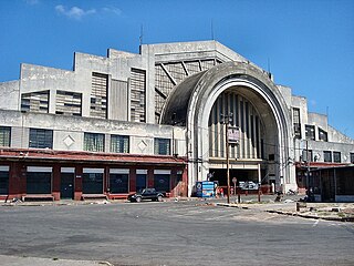
Tres Cruces is a barrio of Montevideo, Uruguay. Its name means "three crossings", referring to the three major transportation routes which intersect in the area: Avenida 18 de Julio, Bulevar Artigas and Avenida 8 de Octubre. It is also the starting point of Italia Avenue.

Aguada is a barrio of Montevideo, Uruguay. Its name indicates water flow and originates from the springs and well it used to have which supplied the original city and the boats with drinking water.

Cordón is a central barrio of Montevideo, Uruguay, located directly East of the Centro. Its main avenue is 18 de Julio Avenue. It is delimited by Miguelete Str. and La Paz Str. to the North, Dr. Barrios Amorin Str. to the West, Canelones Str. to the South and Dr. Joaquin Requena Str., and Rivera & Artigas Avenues to the East.

La Comercial is a barrio of Montevideo, Uruguay.

La Blanqueada is a barrio of Montevideo, Uruguay.

Unión is a neighbourhood of Montevideo, Uruguay.

Mercado Modelo is a central municipal fruit and vegetable wholesale market in of Montevideo, Uruguay. The area around the installations, which occupy several blocks of the Mercado Modelo–Bolívar barrio, has also taken on the name of the market, hence the composite name of the entire barrio. The central building has an area of 19,000 square metres (200,000 sq ft), to which more buildings were added in 1996 of an area of 15,000 square metres (160,000 sq ft), while the overall area of the market is 70,000 square metres (750,000 sq ft).

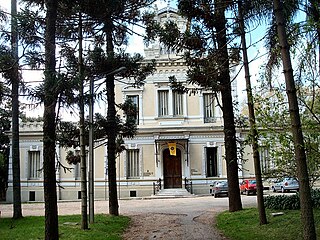
Jacinto Vera is a barrio of Montevideo, Uruguay, named after Jacinto Vera, the first Catholic bishop of Montevideo. It is home to the ex-Military School, now the Army Command.

Paso de las Duranas is a cultural center in Montevideo, Uruguay.

Villa del Cerro is a barrio of Montevideo, Uruguay.

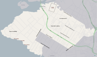
Paso de la Arena, also known by the composite name Paso de la Arena–Los Bulevares–Rincón del Cerro–Santiago Vázquez is a barrio of Montevideo, Uruguay. It shares borders with Lezica–Melilla and Conciliación to the north and northeast, with Nuevo París and La Paloma–Tomkinson to the east and southeast, with Casabó–Pajas Blancas to the south and with the Río de la Plata to the southwest, west and northwest.

Lezica–Melilla is a barrio of Montevideo, Uruguay.

Colón Sudeste–Abayubá is a composite barrio of Montevideo, Uruguay.

The Church of Our Lady of Sorrows, popularly known as Tierra Santa, is a Roman Catholic parish church in Montevideo, Uruguay.

The Church of Our Lady of Sorrows, popularly known as Iglesia del Reducto, is a Roman Catholic parish church in Montevideo, Uruguay.
The Waldensian Evangelical Church of Rio de la Plata is a waldensians denomination present in Uruguay and Argentina, founded in 1858, by Italian immigrants, previously linked to Waldensian Evangelical Church.


