Laua-an, Antique

Last updated
Laua-an
Municipality
Municipality of Laua-an
Ph locator antique laua-an.png
Map of Antique with Laua-an highlighted
Philippines location map (square).svg
Red pog.svg
Laua-an
Location within the Philippines
Coordinates: 11°09′N122°03′E / 11.15°N 122.05°E / 11.15; 122.05 Coordinates: 11°09′N122°03′E / 11.15°N 122.05°E / 11.15; 122.05
Country Flag of the Philippines.svg  Philippines
Region Western Visayas (Region VI)
Province Antique
District Lone district
Founded January 1, 1915
Barangays 40 (see Barangays)
Government [1]
  Type Sangguniang Bayan
   Mayor Francisco G. Baladjay Jr.
  Electorate 16,835 voters (2016)
Area [2]
  Total 100.72 km2 (38.89 sq mi)
Population (2015 census) [3]
  Total 26,072
  Density 260/km2 (670/sq mi)
Time zone PST (UTC+8)
ZIP code 5705
PSGC 060609000
IDD : area code +63(0)36
Climate type tropical climate
Income class 4th municipal income class
Website elgu.ncc.gov.ph/ecommunity/lauaan-antique/

Laua-an, officially the Municipality of Laua-an, (Kinaray-a : Banwa kang Laua-an; Hiligaynon : Banwa sang Laua-an; Filipino : Bayan ng Laua-an), is a 4th class municipality in the province of Antique, Philippines. According to the 2015 census, it has a population of 26,072 people. [3]

Hiligaynon language Austronesian language spoken in the Western Visayas region of the Philippines

The Hiligaynon language, also often referred to by most of its speakers simply as Ilonggo, is an Austronesian regional language spoken in the Philippines by about 9.1 million people, mainly in Western Visayas and Soccsksargen, most of whom belong to the Visayan ethnic group, mainly the Hiligaynons. It is the second-most widely spoken language and a member of the so-named Visayan language family and is more distantly related to other Philippine languages.

Filipino language official language of the Philippines

Filipino is the national language of the Philippines. Filipino is also designated, along with English, as an official language of the country. It is a standardized variety of the Tagalog language, an Austronesian regional language that is widely spoken in the Philippines. As of 2007, Tagalog is the first language of 28 million people, or about one-third of the Philippine population, while 45 million speak Tagalog as their second language. Tagalog is among the 185 languages of the Philippines identified in the Ethnologue. Officially, Filipino is defined by the Commission on the Filipino Language as "the native dialect, spoken and written, in Metro Manila, the National Capital Region, and in other urban centers of the archipelago."

Antique (province) Province in Western Visayas, Philippines

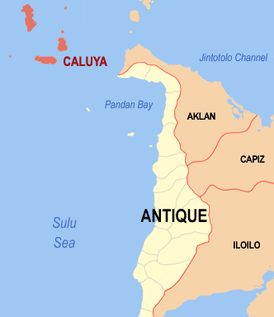
Antique is a province of the Philippines located in the region of Western Visayas. The province capital is San Jose, the most populous town in Antique. The province is situated in the western section of Panay Island and borders Aklan, Capiz and Iloilo to the east, while facing the Sulu Sea to the west.

Contents

Laua-an celebrates its Pahinis Festival every January.

History

The municipality of Laua-an formerly named as Nalupa Nuevo (pueblo near the mouth of the river) was already a pueblo before the Spanish-American war. Capitan Luis Sarmiento was the first Capitan del Pueblo of Laua-an. When the Filipino-American War broke out, Barbaza became an integral part of Laua-an, because its Municipal Hall was burned. The seat of government of Laua-an was then transferred to Barbaza through a resolution approved by the council under the leadership of Capitan Justiano Barrientos. Pursuant to the provisions of Act No. 1748 and as per Executive Order No. 14 of Governor General James F. Smith, the seat of the Municipal Government of Laua-an was transferred to Barbaza effective June 1, 1908. Many of the inhabitants of Poblacion and Barangay Guisijan filed a petition to the Governor-General that Laua-an be separated from Barbaza with a promise that the municipal building of Laua-an will be constructed at their own expense. Upon the recommendation of the Provincial Board and pursuant to the provision of Act. No. 1748, the 11 Municipalities of Antique was increased to 12 as established by Act. No. 961 which was amended by act No. 987. Pursuant to Executive Order No. 129 issued by Governor Francis Burton Harrison, Laua-an was declared as a Municipality on January 1, 1915. [4]

Geography

Laua-an is located at 11°09′N122°03′E / 11.15°N 122.05°E / 11.15; 122.05 . It is 56 kilometres (35 mi) from the provincial capital, San Jose de Buenavista.

According to the Philippine Statistics Authority, the municipality has a land area of 100.72 square kilometres (38.89 sq mi) [2] constituting 3.69% of the 2,729.17-square-kilometre- (1,053.74 sq mi) total area of Antique.

Philippine Statistics Authority Philippines principal government institution in charge of statistics and census data

The Philippine Statistics Authority (PSA) was created on September 12, 2013 when the Philippine Statistical Act of 2013 was signed by President Benigno S. Aquino III. The new government authority was created by merging the National Statistics Office, the National Statistical Coordination Board, the Bureau of Agricultural Statistics, and the Bureau of Labor and Employment Statistics.

Barangays

Laua-an is politically subdivided into 40 barangays. [5] , 12 of which are located along the coast and the rest are considered inland/upland barangays located along two big rivers of Paningayan and Cairawan. It has a total of 85 sitios, The total land area of Laua-an is approximately 18,692,456.5 hectares, representing 7.41% of the total land area of the Province of Antique. Of the total land area 7,832,222.9 has. Or 42% is alienable and disposable land and 10,860,2336 has. Or 58% is classified as timber land. Total Population of Laua-an in 2009 as per survey conducted by the Municipal Social Work and Development Office (MSWDO), reached to 26,959 in which 13,468 are males and 13,491 are females with total households of 5,392.

Barangay administrative division in the Philippines

A barangay or baranggay (, formerly referred to as barrio, is the smallest administrative division in the Philippines and is the native Filipino term for a village, district or ward. In metropolitan areas, the term often refers to an inner city neighbourhood, a suburb or a suburban neighborhood. The word barangay originated from balangay, a kind of boat used by a group of Austronesian peoples when they migrated to the Philippines.

PSGC Barangay Population ±% p.a.
2015 [3] 2010 [6]
060609043 Bagongbayan 2.7% 706 659 1.32%
060609002 Banban 0.6% 147 129 2.52%
060609003 Bongbongan 1.0% 250 265 −1.10%
060609004 Cabariwan 2.5% 660 620 1.20%
060609005 Cadajug 4.4% 1,153 1,110 0.73%
060609006 Canituan 2.2% 568 572 −0.13%
060609007 Capnayan 1.4% 365 319 2.60%
060609008 Casit-an 4.6% 1,200 1,157 0.70%
060609010 Guiamon 1.0% 249 239 0.78%
060609009 Guinbanga-an 7.2% 1,879 1,864 0.15%
060609011 Guisijan 9.2% 2,404 2,382 0.18%
060609012 Igtadiao 1.1% 294 262 2.22%
060609013 Intao 2.5% 660 672 −0.34%
060609014 Jaguikican 3.4% 874 896 −0.47%
060609015 Jinalinan 0.8% 202 220 −1.61%
060609016 Lactudan 0.9% 247 274 −1.96%
060609017 Latazon 1.8% 476 494 −0.70%
060609018 Laua-an 1.5% 379 349 1.58%
060609020 Liberato 1.6% 411 463 −2.24%
060609021 Lindero 6.3% 1,649 1,560 1.06%
060609022 Liya-liya 1.6% 422 395 1.27%
060609019 Loon 2.8% 743 735 0.21%
060609023 Lugta 2.8% 719 576 4.31%
060609024 Lupa-an 2.1% 559 557 0.07%
060609025 Magyapo 1.0% 257 242 1.15%
060609026 Maria 5.0% 1,311 1,364 −0.75%
060609027 Mauno 2.0% 524 457 2.64%
060609028 Maybunga 2.0% 525 343 8.44%
060609029 Necesito (Paniatan) 1.2% 307 339 −1.87%
060609030 Oloc 4.5% 1,168 994 3.12%
060609031 Omlot 1.0% 260 233 2.11%
060609032 Pandanan 1.4% 359 346 0.70%
060609034 Paningayan 1.5% 384 360 1.24%
060609035 Pascuala 0.7% 194 202 −0.77%
060609036 Poblacion (Centro) 7.6% 1,975 1,933 0.41%
060609038 San Ramon 0.6% 167 139 3.56%
060609039 Santiago 2.6% 670 622 1.43%
060609040 Tibacan 0.7% 177 230 −4.86%
060609041 Tigunhao 1.3% 343 375 −1.68%
060609042 Virginia 0.9% 235 263 −2.12%
Total 26,072 25,211 0.64%

Demographics

Population census of Laua-an
YearPop.±% p.a.
1903 8,915    
1918 10,340+0.99%
1939 12,614+0.95%
1948 15,438+2.27%
1960 12,967−1.44%
1970 15,461+1.77%
1975 17,498+2.51%
1980 18,785+1.43%
1990 19,865+0.56%
1995 21,069+1.11%
2000 23,258+2.14%
2007 23,808+0.32%
2010 25,211+2.11%
2015 26,072+0.64%
Source: Philippine Statistics Authority [3] [6] [7] [8]

In the 2015 census, Laua-an had a population of 26,072. [3] The population density was 260 inhabitants per square kilometre (670/sq mi).

In the 2016 electoral roll, it had 16,835 registered voters. [9]

Economy

Muscovado brown sugarcane sugar Brown sugar examples.JPG
Muscovado brown sugarcane sugar

Laua-an has an agricultural-based economy with rice, sugarcane and corn as primary crops. About 4,267,264 has. are devoted to agricultural crop production representing 22.83% of the total land area of the municipality. Laua-an produce Rice, Corn, Vegetables, Peanuts, Mango, Banana, Abaca and other crops. It has 42 Day Care Centers, 12 Complete Elementary Schools and 4 Secondary Schools. In Health services, it has 1 Rural Health Center, 8 Brgy. Health Stations and 13 Health & Nutrition Posts. Laua-an has a total of 76.065 km. of Barangay roads; 2.160 km. of municipal roads; 2.450 km. of provincial roads and 11.125 km. of National Roads. A mini-hydro project is being constructed at Brguy. San Ramon by Sun West Water and Electric Company and at Sitio Sadsadan, Brgy. Maybunga and Villa Siga Bugasong. Four cell sites (Globe, Sun and Smart) were installed at Brgy. Poblacion, Bagongbayan and Liya-Liya rerspectively. It is observed that even upland barangays have signal which contributed to the improvement of information technology in the area.

Farming is the major occupation of the people and fishing is the secondary source of income. The deep sea waters of Sulu Sea is abundant with fish and marine life like sardines, tuna, squids, mackerel, crabs and other seafoods which is a source of living for most residents.

Tourism

Among the tourist attractions are Mount Igmatongtong in barangay Capnayan, Maybunga Water falls in barangay Maybunga, and Estaka Hill in barangay Poblacion. Estaca Hill in the Poblacion provides a strategic place to view the barangay Poblacion, the Sulu Sea and its environs.

Festivals

Cut sugarcane Cut sugarcane.jpg
Cut sugarcane

Pre-Catholic pre-Spanish Indianized Srivijaya-era Pahinis Festival similar to Makar Sankranti, is celebrated annually to feature the muscovado sugar industry of the town, the technology of which dates back to the Spanish era. "Pahinis" means to clean and prepare the tools for sugarcane milling which corresponds to a celebration to thank God for a fine harvest of sugarcane.

The town celebrates its centennial foundation in January 2015. Weeklong celebration features Pahinis Festival Mardi Gras; LGU, professionals, senior citizens and barangay night; Bugal Kang Laua-an (Pride of Laua-an) Awards Night; and Search for Hara de Pahinis (Pahinis Queen) Beauty Pageant and Coronation Night. The winner of this pageant represents the municipality during the Search for Lin-ay kang Antique (Miss Antique) during the Binirayan Festival in the capital town of San Jose de Buenavista every last week of December. Other events include boat racing along the Sulu Sea, and Aring Beach Festival at the last night of the celebration in Barangay Cadajug.

Related Research Articles

San Remigio, Antique Municipality of the Philippines in the province of Antique

San Remigio, officially the Municipality of San Remigio,, is a 3rd class municipality in the province of Antique, Philippines. According to the 2015 census, it has a population of 31,935 people.

Madalag, Aklan Municipality of the Philippines in the province of Aklan

Madalag, officially the Municipality of Madalag,, is a 4th class municipality in the province of Aklan, Philippines. According to the 2015 census, it has a population of 18,389 people.

Hinigaran Municipality of the Philippines in the province of Negros Occidental

Hinigaran, officially the Municipality of Hinigaran, is a 1st class municipality in the province of Negros Occidental, Philippines. According to the 2015 census, it has a population of 85,602 people.

Victorias Component City in Western Visayas, Philippines

Victorias, officially the City of Victorias, or simply Victorias City, is a 4th class city in the province of Negros Occidental, Philippines. According to the 2015 census, it has a population of 87,933 people.

Barbaza Municipality of the Philippines in the province of Antique

Barbaza, officially the Municipality of Barbaza,, is a 4th class municipality in the province of Antique, Philippines. According to the 2015 census, it has a population of 22,704 people.

Belison Municipality of the Philippines in the province of Antique

Belison, officially the Municipality of Belison, is a 5th class municipality in the province of Antique, Philippines. According to the 2015 census, it has a population of 13,539 people.

Caluya Municipality of the Philippines in the province of Antique

Caluya, officially the Municipality of Caluya,, is a 1st class municipality in the province of Antique, Philippines. According to the 2015 census, it has a population of 35,496 people.

Culasi Municipality of the Philippines in the province of Antique

Culasi, officially the Municipality of Culasi,, is a 3rd class municipality in the province of Antique, Philippines. According to the 2015 census, it has a population of 41,228 people. The municipality is known as the home of Mount Madia-as, an enchanted mountain sacred to ancient Visayans as it is home to the god of death, Sidapa, boy-god of the moon, Bulan, and god of meteors, Bulalakaw.

Hamtic Municipality of the Philippines in the province of Antique

Hamtic, officially the Municipality of Hamtic,, is a 3rd class municipality in the province of Antique, Philippines. According to the 2015 census, it has a population of 48,592 people.

Libertad, Antique Municipality of the Philippines in the province of Antique

Libertad, officially the Municipality of Libertad,, is a 5th class municipality in the province of Antique, Philippines. According to the 2015 census, it has a population of 16,429 people.

Patnongon Municipality of the Philippines in the province of Antique

Patnongon, officially the Municipality of Patnongon,, is a 3rd class municipality in the province of Antique, Philippines. According to the 2015 census, it has a population of 37,176 people.

Tibiao Municipality of the Philippines in the province of Antique

Tibiao, officially the Municipality of Tibiao,, is a 4th class municipality in the province of Antique, Philippines. According to the 2015 census, it has a population of 26,748 people.

Valderrama, Antique Municipality of the Philippines in the province of Antique

Valderrama, officially the Municipality of Valderrama,, is a 4th class municipality in the province of Antique, Philippines. According to the 2015 census, it has a population of 19,124 people. The area is home to the indigenous Iraynun-Bukidnon, speakers of a dialect of the Kiniray-a language, who have crafted the only rice terrace clusters in the Visayas through indigenous knowledge and sheer vernacular capabilities. The rice terraces of the Iraynun-Bukidnon are divided into three terraced fields, namely, Lublub rice terraces, Baking rice terraces, and San Agustin rice terraces. All of the rice terrace clusters have been researched on by the National Commission for Culture and the Arts and various scholars from the University of the Philippines. There have been campaigns to nominate the Iraynun-Bukidnon Rice Terraces, along with the central Panay mountain range, into the UNESCO World Heritage List.

Tiwi, Albay Municipality in Bicol Region, Philippines

Tiwi,, is a 1st class municipality in the Province of Albay, Philippines. According to the 2015 census, it has a population of 53,120 people.

Badiangan, Iloilo Municipality of the Philippines in the province of Iloilo

Badiangan, officially the Municipality of Badiangan, is a 4th class municipality in the province of Iloilo, Philippines. According to the 2015 census, it has a population of 27,005 people.

Calinog, Iloilo Municipality of the Philippines in the province of Iloilo

Calinog, officially the Municipality of Calinog, is a 1st class municipality in the province of Iloilo, Philippines. According to the 2015 census, it has a population of 60,413 people.

Guimbal, Iloilo Municipality of the Philippines in the province of Iloilo

Guimbal, officially the Municipality of Guimbal,, is a 4th class municipality in the province of Iloilo, Philippines. According to the 2015 census, it has a population of 33,820 people.

Lambunao Municipality of the Philippines in the province of Iloilo

Lambunao, officially the Municipality of Lambunao, is a 1st class municipality in the province of Iloilo, Philippines. According to the 2015 census, it has a population of 73,640 people.

Leon, Iloilo Municipality of the Philippines in the province of Iloilo

Leon, officially the Municipality of Leon, is a 2nd class municipality in the province of Iloilo, Philippines. According to the 2015 census, it has a population of 49,875 people.

Oton, Iloilo Municipality of the Philippines in the province of Iloilo

Oton, officially the Municipality of Oton, is a 1st class municipality in the province of Iloilo, Philippines. According to the 2015 census, it has a population of 89,115 people.

References

  1. "Municipality". Quezon City, Philippines: Department of the Interior and Local Government. Retrieved 31 May 2013.
  2. 1 2 "Province: Antique". PSGC Interactive. Quezon City, Philippines: Philippine Statistics Authority . Retrieved 12 November 2016.
  3. 1 2 3 4 5 Census of Population (2015). "Region VI (Western Visayas)". Total Population by Province, City, Municipality and Barangay. PSA . Retrieved 20 June 2016.
  4. http://lauaanantiquephilippines.blogspot.com/2016/09/history.html
  5. "Municipal: Laua-an, Antique". PSGC Interactive. Quezon City, Philippines: Philippine Statistics Authority . Retrieved 8 January 2016.
  6. 1 2 Census of Population and Housing (2010). "Region VI (Western Visayas)". Total Population by Province, City, Municipality and Barangay. NSO . Retrieved 29 June 2016.
  7. Censuses of Population (1903–2007). "Region VI (Western Visayas)". Table 1. Population Enumerated in Various Censuses by Province/Highly Urbanized City: 1903 to 2007. NSO.
  8. "Province of Antique". Municipality Population Data. Local Water Utilities Administration Research Division. Retrieved 17 December 2016.
  9. "2016 National and Local Elections Statistics". Commission on Elections. 2016.