Caluya, Antique

Last updated
Caluya
Municipality
Municipality of Caluya

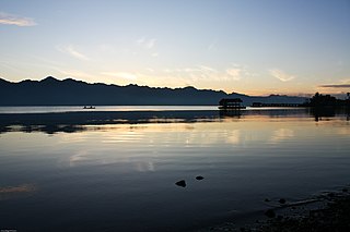
Unong lake full.jpg

Unong Lake
Ph locator antique caluya.png
Map of Antique with Caluya highlighted
Philippines location map (square).svg
Red pog.svg
Caluya
Location within the Philippines
Coordinates: 11°54′N121°31′E / 11.9°N 121.52°E / 11.9; 121.52 Coordinates: 11°54′N121°31′E / 11.9°N 121.52°E / 11.9; 121.52
Country Flag of the Philippines.svg  Philippines
Region Western Visayas (Region VI)
Province Antique
District Lone district
Barangays 18 (see Barangays)
Government [1]
  Type Sangguniang Bayan
   Mayor Genevive G. Lim
  Electorate 18,801 voters (2016)
Area [2]
  Total 132.13 km2 (51.02 sq mi)
Population (2015 census) [3]
  Total 35,496
  Density 270/km2 (700/sq mi)
Demonym(s) Caluyanon
Time zone PST (UTC+8)
ZIP code 5711
PSGC 060605000
IDD : area code +63(0)36
Climate type tropical climate
Income class 1st municipal income class
Website elgu.ncc.gov.ph/ecommunity/caluya-antique/

Caluya, officially the Municipality of Caluya, (Kinaray-a : Banwa kang Caluya; Hiligaynon : Banwa sang Caluya; Filipino : Bayan ng Caluya), is a 1st class municipality in the province of Antique, Philippines. According to the 2015 census, it has a population of 35,496 people. [3]

Hiligaynon language Austronesian language spoken in the Western Visayas region of the Philippines

The Hiligaynon language, also often referred to by most of its speakers simply as Ilonggo, is an Austronesian regional language spoken in the Philippines by about 9.1 million people, mainly in Western Visayas and Soccsksargen, most of whom belong to the Visayan ethnic group, mainly the Hiligaynons. It is the second-most widely spoken language and a member of the so-named Visayan language family and is more distantly related to other Philippine languages.

Filipino language official language of the Philippines

Filipino is the national language of the Philippines. Filipino is also designated, along with English, as an official language of the country. It is a standardized variety of the Tagalog language, an Austronesian regional language that is widely spoken in the Philippines. As of 2007, Tagalog is the first language of 28 million people, or about one-third of the Philippine population, while 45 million speak Tagalog as their second language. Tagalog is among the 185 languages of the Philippines identified in the Ethnologue. Officially, Filipino is defined by the Commission on the Filipino Language as "the native dialect, spoken and written, in Metro Manila, the National Capital Region, and in other urban centers of the archipelago."

Antique (province) Province in Western Visayas, Philippines

Antique is a province of the Philippines located in the region of Western Visayas. The province capital is San Jose, the most populous town in Antique. The province is situated in the western section of Panay Island and borders Aklan, Capiz and Iloilo to the east, while facing the Sulu Sea to the west.

Contents

Semirara Island has an area of 55 square kilometres (21 sq mi), and is home to the Panian Mine, a vast open-pit coal mine in operation since 1999, and the Unong Mine (in production from 1984 to 2000). [4]

History

The Island of Caluya was once called Polo Pandan by Moro pirates searching for commercial ships as target victims. These pirates with their pillager vintas called "Salipsipan" utilized the place for haven and rest after divesting ships of valuable belongings. In fear of the pirates, only few fishermen dared to fish in the area. The Moro pirates called the place Polo Pandan because the entire coastal area was covered by pandan screw pines.

Moro people ethnic group

The collective term Moro people refers to the 13 Islamized ethnolinguistic groups of Mindanao, Sulu and Palawan. As Muslim-majority ethnic groups, they form largest non-Christian majority population in the country, and comprise about 5% of the total Philippine population, or 5 million people. Most Moros are followers of Sunni Islam of the Shafi'i madh'hab.

Several years later, fishermen from other islands, who were catching turtles for Chinese traders using their fish gears called "Panalog", accidentally landed in Polo Pandan in search of drinking water. They were surprised to see footprints of humans in the sand but no houses could be seen. They found a potable spring coming from the roots of a Dankalan Tree. They brought the good news to other fishermen and settled by the shore near that spring. They made huts (Barong-barong) for their families and continued with their fishing activities. Soon the Moro pirates landed at the other side of the island. The settlers feared for the safety of their families, so they transferred their huts to the hilltop and called the place "Minoro or Barabanwa".

One day, while all the man settlers were out looking for food and fishing, the Moro pirates surfaced and an amazon named Merin gathered all women to defend their settlement. The Moro leader, upon seeing the amazons, ordered his men to retreat for according to him, the women were weak or maluya in vernacular. Thus the name Polo Pandan was changed to maluya in honor of famous hero Merin. The island soon became Caluya.

Spanish settlement

The Spanish settlement in Caluya was presumed to be established in 1850. Spanish friars came to the island to propagate their colonization of the archipelago. The settlement was called Barangay and the first Cabeza de Barangay was Balbino Alojado (later changed his surname to Ysug) succeeded by Luciano Boctot and then by Surato Bunga-Bunga. All other Cabezas de Barangay was not recorded.

Later on, the Cabeza de Barangay became Capitan de Barangay. The first Capitan de Barangay was Lozaro Decena succeeded by Luciano Tabangay and then by Mariano Escultor.

In the year 1893, believed to be in the month of May, the Barangay was changed to Pueblo or town by the Spanish Government, hence the founding of the Municipality of Caluya.

American regime

The American Government started in 1901. Caluya was run by the people from Bulalacao, Oriental Mindoro and became its town. The first officials were appointed by Americans but later, the officials were elected by the people. The head of the local government was the Town President or Presidente del Pueblo. Appointed President from 1901 to 1910 was Feliciano Erodias. Next was Valentin Escultor in 1911. Then they held the first election in 1913 and the first elected President was Moises Lucena. In 1916, the President was Elias Tameta; 1919, Luis Erodias; 1922, Agustin Madarcos; 1925, Pedro Janairo; and 1928, Ruperto Tabinas.

Bulalacao, Oriental Mindoro Municipality of the Philippines in the province of Oriental Mindoro

Bulalacao, officially the Municipality of Bulalacao, is a 3rd class municipality in the province of Oriental Mindoro, Philippines. According to the 2015 census, it has a population of 39,107 people.

In 1934, the head of the town was changed to a town Mayor. The 1st town Mayor was Claro Erodias who served up to 1938. Ruperto Tabinas was the town Mayor when the World War II broke out.

World War II 1939–1945 global war

World War II, also known as the Second World War, was a global war that lasted from 1939 to 1945. The vast majority of the world's countries—including all the great powers—eventually formed two opposing military alliances: the Allies and the Axis. A state of total war emerged, directly involving more than 100 million people from over 30 countries. The major participants threw their entire economic, industrial, and scientific capabilities behind the war effort, blurring the distinction between civilian and military resources. World War II was the deadliest conflict in human history, marked by 50 to 85 million fatalities, most of whom were civilians in the Soviet Union and China. It included massacres, the genocide of the Holocaust, strategic bombing, premeditated death from starvation and disease, and the only use of nuclear weapons in war.

Japanese occupation

In 1943, the Japanese landed in Caluya by means of motorboat and spread their propaganda about the government. No battle had been fought for there were no soldiers in the island. The Japanese commandeered pigs, carabaos, cows, chickens and other foods for consumption.

The only battle fought was in Semirara. It was between the five Japanese battle ships and the U.S. Air force. War ships were sunk and an airplane from the Allied Force was drowned. About 200 Japanese marines fled to Capiz Island led by Commander Tanaka. There was no known Mayor at that time.

Post-liberation period

In, 1945, Mr. Joven Janairo was appointed Mayor, and in the 1948 election, he was elected to the position. He was succeeded by Romulo Lumawig in 1953 but was re-elected in 1958. Romulo Lumawig was re-elected in 1964 and Oscar Lim was elected in 1972. Soon, Martial law was proclaimed by President Ferdinand Marcos.

Ferdinand Marcos former President of the Philippines from 1965 to 1986

Ferdinand Emmanuel Edralin Marcos Sr. was a Filipino politician and kleptocrat who was the tenth President of the Philippines from 1965 to 1986. A leading member of the far-right New Society Movement, he ruled as a dictator under martial law from 1972 until 1981. His regime was infamous for its corruption, extravagance, and brutality.

In 1987, Douglas Egina was appointed as OIC-Mayor. Then in 1988, Oscar Lim was re-elected And in the year 1992, when election was again conducted, the first woman Mayor Nikita L. Frangue was elected and succeeded by her husband Domingo G. Frangue,Jr. who served from July 1, 2001 up to June 30, 2007. Reynante J. Lim,Sr. was the Municipal Mayor from July 1, 2007 until his death on February 28, 2010. Diosdado L. Egina acted as Mayor from March 1, 2010 to June 30, 2010. Genevive G. Lim-Reyes is the present Municipal Mayor of Caluya.

Geography

Caluya is located at 11°54′N121°31′E / 11.9°N 121.52°E / 11.9; 121.52 .

According to the Philippine Statistics Authority, the municipality has a land area of 132.13 square kilometres (51.02 sq mi) [2] constituting 4.84% of the 2,729.17-square-kilometre- (1,053.74 sq mi) total area of Antique.

Barangays

Caluya is politically subdivided into 18 barangays. [5]

PSGC Barangay Population ±% p.a.
2015 [3] 2010 [6]
060605001 Alegria 7.0% 2,468 1,719 7.13%
060605002 Bacong 1.8% 640 636 0.12%
060605003 Banago 3.3% 1,155 1,123 0.54%
060605004 Bonbon 1.9% 662 626 1.07%
060605005 Dawis 2.2% 785 659 3.39%
060605006 Dionela 0.9% 316 297 1.19%
060605007 Harigue 9.3% 3,292 2,691 3.91%
060605008 Hininga-an 3.8% 1,350 1,188 2.46%
060605009 Imba 3.9% 1,385 1,050 5.41%
060605010 Masanag 3.3% 1,169 1,044 2.18%
060605011 Poblacion 5.2% 1,856 1,677 1.95%
060605012 Sabang 2.5% 873 735 3.33%
060605013 Salamento 3.2% 1,122 1,027 1.70%
060605014 Semirara 35.0% 12,434 10,129 3.98%
060605015 Sibato 3.3% 1,164 1,095 1.17%
060605016 Sibay 2.6% 916 864 1.12%
060605017 Sibolo 3.7% 1,323 1,143 2.82%
060605018 Tinogboc 7.3% 2,586 2,343 1.90%
Total 35,496 30,046 3.22%

Demographics

Population census of Caluya
YearPop.±% p.a.
1918 2,911    
1939 3,947+1.46%
1948 4,779+2.15%
1960 5,993+1.90%
1970 7,932+2.84%
1975 8,870+2.27%
1980 10,901+4.21%
1990 16,243+4.07%
1995 17,101+0.97%
2000 20,049+3.47%
2007 25,526+3.39%
2010 30,046+6.11%
2015 35,496+3.22%
Source: Philippine Statistics Authority [3] [6] [7] [8]

In the 2015 census, Caluya had a population of 35,496. [3] The population density was 270 inhabitants per square kilometre (700/sq mi).

In the 2016 electoral roll, it had 18,801 registered voters. [9]

Related Research Articles

Western Visayas Region in Visayas, Philippines

Western Visayas is an administrative region in the Philippines, numerically designated as Region VI. It consists of six provinces and two highly urbanized cities. The regional center is Iloilo City. The region is dominated by the native speakers of four Visayan languages: Kinaray-a, Hiligaynon, Aklanon and Capiznon. The land area of the region is 20,794.18 km2 (8,028.68 sq mi), and with a population of 7,536,383 inhabitants, it is the most populous region in the Visayas.

Jordan, Guimaras Municipality of the Philippines and capital of the province of Guimaras

Jordan, officially the Municipality of Jordan, is a 3rd class municipality and capital of the province of Guimaras, Philippines. According to the 2015 census, it has a population of 36,096 people, making it the second largest settlement in the province.

Zamboanguita Municipality of the Philippines in the province of Negros Oriental

Zamboanguita, officially the Municipality of Zamboanguita, is a 4th class municipality in the province of Negros Oriental, Philippines. According to the 2015 census, it has a population of 27,552 people.

Aloguinsan Municipality of the Philippines in the province of Cebu

Aloguinsan, officially the Municipality of Aloguinsan,, is a 4th class municipality in the province of Cebu, Philippines. According to the 2015 census, it has a population of 32,100 people.

Pontevedra, Negros Occidental Municipality of the Philippines in the province of Negros Occidental

Pontevedra, officially the Municipality of Pontevedra, is a 3rd class municipality in the province of Negros Occidental, Philippines. According to the 2015 census, it has a population of 51,866 people.

Anini-y Municipality of the Philippines in the province of Antique

Anini-y, officially the Municipality of Anini-y,, is a 4th class municipality in the province of Antique, Philippines. According to the 2015 census, it has a population of 21,201 people.

San Jose de Buenavista, Antique Municipality of the Philippines and capital of the province of Antique

San Jose de Buenavista, officially the Municipality of San Jose de Buenavista, or better known simply as San Jose, is a 1st class municipality and capital of the province of Antique, Philippines. According to the 2015 census, it has a population of 62,534 people.

Sebaste, Antique Municipality of the Philippines in the province of Antique

Sebaste, officially the Municipality of Sebaste,, is a 4th class municipality in the province of Antique, Philippines. According to the 2015 census, it has a population of 17,907 people.

Tibiao Municipality of the Philippines in the province of Antique

Tibiao, officially the Municipality of Tibiao,, is a 4th class municipality in the province of Antique, Philippines. According to the 2015 census, it has a population of 26,748 people.

Valderrama, Antique Municipality of the Philippines in the province of Antique

Valderrama, officially the Municipality of Valderrama,, is a 4th class municipality in the province of Antique, Philippines. According to the 2015 census, it has a population of 19,124 people. The area is home to the indigenous Iraynun-Bukidnon, speakers of a dialect of the Kiniray-a language, who have crafted the only rice terrace clusters in the Visayas through indigenous knowledge and sheer vernacular capabilities. The rice terraces of the Iraynun-Bukidnon are divided into three terraced fields, namely, Lublub rice terraces, Baking rice terraces, and San Agustin rice terraces. All of the rice terrace clusters have been researched on by the National Commission for Culture and the Arts and various scholars from the University of the Philippines. There have been campaigns to nominate the Iraynun-Bukidnon Rice Terraces, along with the central Panay mountain range, into the UNESCO World Heritage List.

Caoayan Municipality in Ilocos Region, Philippines

Caoayan, officially the Municipality of Caoayan, is a 4th class municipality in the province of Ilocos Sur, Philippines. According to the 2015 census, it has a population of 19,861 people.

President Roxas, Capiz Municipality of the Philippines in the province of Capiz

President Roxas, officially the Municipality of President Roxas, is a 4th class municipality in the province of Capiz, Philippines. According to the 2015 census, it has a population of 29,676 people.

Pandan, Catanduanes Municipality in Bicol Region, Philippines

Pandan, officially the Municipality of Pandan, is a 4th class municipality in the province of Catanduanes, Philippines. According to the 2015 census, it has a population of 20,516 people.

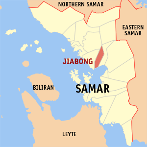
Jiabong, Samar Municipality in Eastern Visayas, Philippines

Jiabong, officially the Municipality of Jiabong, is a 5th class municipality in the province of Samar, Philippines. According to the 2015 census, it has a population of 18,342 people.

Capul Municipality in Eastern Visayas, Philippines

Capul, officially the Municipality of Capul, is a 5th class municipality in the province of Northern Samar, Philippines. According to the 2015 census, it has a population of 12,679 people.

Mamburao Municipality of the Philippines in the province of Occidental Mindoro

Mamburao,, officially the Municipality of Mamburao, is a 2nd class municipality and capital of the province of Occidental Mindoro, Philippines. According to the 2015 census, it has a population of 42,975 people.

Tabina, Zamboanga del Sur Municipality in Zamboanga Peninsula, Philippines

Tabina, officially the Municipality of Tabina, is a 4th class municipality in the province of Zamboanga del Sur, Philippines. According to the 2015 census, it has a population of 25,061 people.

Giporlos Municipality in Eastern Visayas, Philippines

Giporlos, officially the Municipality of Giporlos, is a 5th class municipality in the province of Eastern Samar, Philippines. According to the 2015 census, it has a population of 13,308 people.

Bontoc, Southern Leyte Municipality in Eastern Visayas, Philippines

Bontoc, officially the Municipality of Bontoc, is a 4th class municipality in the province of Southern Leyte, Philippines. According to the 2015 census, it has a population of 28,905 people.

Liloan, Southern Leyte Municipality in Eastern Visayas, Philippines

Liloan, officially the Municipality of Liloan, is a 4th class municipality in the province of Southern Leyte, Philippines. According to the 2015 census, it has a population of 23,981 people.

References

  1. "Municipality". Quezon City, Philippines: Department of the Interior and Local Government. Retrieved 31 May 2013.
  2. 1 2 "Province: Antique". PSGC Interactive. Quezon City, Philippines: Philippine Statistics Authority . Retrieved 12 November 2016.
  3. 1 2 3 4 5 Census of Population (2015). "Region VI (Western Visayas)". Total Population by Province, City, Municipality and Barangay. PSA . Retrieved 20 June 2016.
  4. "About Semirara". Makati City, Philippines: Semirara Mining Corporation. Retrieved 8 February 2013.
  5. "Municipal: Caluya, Antique". PSGC Interactive. Quezon City, Philippines: Philippine Statistics Authority . Retrieved 8 January 2016.
  6. 1 2 Census of Population and Housing (2010). "Region VI (Western Visayas)". Total Population by Province, City, Municipality and Barangay. NSO . Retrieved 29 June 2016.
  7. Censuses of Population (1903–2007). "Region VI (Western Visayas)". Table 1. Population Enumerated in Various Censuses by Province/Highly Urbanized City: 1903 to 2007. NSO.
  8. "Province of Antique". Municipality Population Data. Local Water Utilities Administration Research Division. Retrieved 17 December 2016.
  9. "2016 National and Local Elections Statistics". Commission on Elections. 2016.