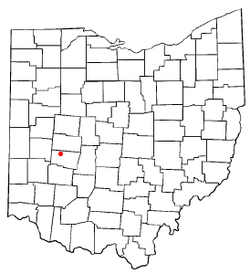
Lawrenceville, Ohio | |
---|---|
Coordinates: 39°59′02″N83°52′26″W / 39.98389°N 83.87389°W | |
Country | United States |
State | Ohio |
County | Clark |
Area | |
• Total | 0.49 sq mi (1.27 km2) |
• Land | 0.49 sq mi (1.27 km2) |
• Water | 0.00 sq mi (0.00 km2) |
Elevation | 1,106 ft (337 m) |
Population (2020) | |
• Total | 667 |
• Density | 1,358.45/sq mi (524.42/km2) |
Time zone | UTC-5 (Eastern (EST)) |
• Summer (DST) | UTC-4 (EDT) |
FIPS code | 39-42210 [3] |
GNIS feature ID | 2805296 [2] |
Lawrenceville is an unincorporated community and census-designated place in central German Township, Clark County, Ohio, United States. It is part of the Springfield, Ohio Metropolitan Statistical Area. The population was 302 at the 2000 census, at which time it was a village. In 2005, the residents of Lawrenceville voted to dissolve the corporation, ending Lawrenceville's village status. [4]
Lawrenceville was originally known as Noblesville, and under the latter name was platted in 1843. [5] When a post office was established in the community, the original name was changed, there being another post office in the state with a similar name. [6] A post office called Lawrenceville was established in 1875, and remained in operation until 1901. [7] The name "Lawrenceville" honors U.S. Rep. William Lawrence, a Republican former judge whose congressional district included the community in the 1870s. [5]
According to the United States Census Bureau, the village had a total area of 0.1 square miles (0.26 km2), all of it land.
Census | Pop. | Note | %± |
---|---|---|---|
2020 | 667 | — | |
U.S. Decennial Census [8] |
As of the census [3] of 2000, there were 302 people, 109 households, and 86 families residing in the village. The population density was 2,243.2 inhabitants per square mile (866.1/km2). There were 119 housing units at an average density of 883.9 per square mile (341.3/km2). The racial makeup of the village was 95.36% White, 0.99% African American, and 3.64% from two or more races.
There were 109 households, out of which 35.8% had children under the age of 18 living with them, 61.5% were married couples living together, 11.0% had a female householder with no husband present, and 21.1% were non-families. 16.5% of all households were made up of individuals, and 3.7% had someone living alone who was 65 years of age or older. The average household size was 2.77 and the average family size was 3.12.
In the village the population was spread out, with 29.1% under the age of 18, 7.6% from 18 to 24, 30.5% from 25 to 44, 23.5% from 45 to 64, and 9.3% who were 65 years of age or older. The median age was 36 years. For every 100 females, there were 106.8 males. For every 100 females age 18 and over, there were 107.8 males.
The median income for a household in the village was $50,000, and the median income for a family was $53,750. Males had a median income of $38,333 versus $19,688 for females. The per capita income for the village was $19,105. About 3.7% of families and 3.1% of the population were below the poverty line, including none of those under the age of eighteen and 20.0% of those 65 or over.
Clark County is a county located in the west central portion of the U.S. state of Ohio. As of the 2020 census, the population was 136,001. Its county seat and largest city is Springfield. The county was created on March 1, 1818, and was named for General George Rogers Clark, a hero of the American Revolution.
Catawba is a village in Clark County, Ohio, United States. The population was 245 at the 2020 census. It is part of the Springfield, Ohio Metropolitan Statistical Area.
Crystal Lakes is a census-designated place (CDP) in Clark County, Ohio, United States. The population was 1,394 at the 2020 census. It is part of the Springfield, Ohio Metropolitan Statistical Area.
Donnelsville is a village in Clark County, Ohio, United States. The population was 255 at the 2020 census. It is part of the Springfield, Ohio Metropolitan Statistical Area.
Enon is a village in Clark County, Ohio, United States. The population was 2,455 at the 2020 census. It is part of the Springfield, Ohio Metropolitan Statistical Area.
Green Meadows is a census-designated place (CDP) in Mad River Township, Clark County, Ohio, United States, on the west side of Enon. The population was 2,373 at the 2020 census. It is part of the Springfield, Ohio Metropolitan Statistical Area.
Holiday Valley is a census-designated place (CDP) in Mad River Township, Clark County, Ohio, United States. The population was 1,480 at the 2020 census. It is part of the Springfield, Ohio Metropolitan Statistical Area. Holiday Valley became a CDP in the 1990 United States Census.
North Hampton is a village in Clark County, Ohio, United States. The population was 457 at the 2020 census. It is part of the Springfield, Ohio Metropolitan Statistical Area.
Northridge is a census-designated place (CDP) in Clark County, Ohio, United States. The population was 7,518 at the 2020 census. It is part of the Springfield, Ohio Metropolitan Statistical Area.
South Charleston is a village in Clark County, Ohio, United States. The population was 1,706 at the 2020 census. It is part of the Springfield, Ohio Metropolitan Statistical Area.
South Vienna is a village in Clark County, Ohio, United States. The population was 402 at the 2020 census. It is part of the Springfield, Ohio Metropolitan Statistical Area.
Osgood is a village in Darke County, Ohio, United States. The population was 306 at the 2020 census.
North Perry is a village in Lake County, Ohio, United States. The population was 915 at the 2020 census.
Holland is a village in eastern Springfield Township, Lucas County, Ohio, United States. Holland is a suburb of Toledo. The population was 1,664 at the 2020 census.
New Middletown is a village in southeastern Mahoning County, Ohio, United States. The population was 1,507 at the 2020 census. It is part of the Youngstown–Warren metropolitan area.
Racine is a village in Meigs County, Ohio, United States, along the Ohio River. The population was 683 at the 2020 census.
Ludlow Falls is a village in Miami County, Ohio, United States. The population was 175 at the 2020 census. It is part of the Dayton Metropolitan Statistical Area. Ludlow Falls is named after surveyor Israel Ludlow.
Marshallville is a village in Wayne County, Ohio. The population was 789 at the time of the 2020 census. Marshallville was originally called Bristol, and under the latter name was laid out in 1817.
Clifton is a village in Clark and Greene counties in the U.S. state of Ohio and is home to the Clifton Mill, one of the largest water-powered grist mills still in existence. The population was 131 at the 2020 census.
Tremont City is a village in Clark County, Ohio, United States. The population was 352 at the 2020 census. The village is part of the Springfield, Ohio Metropolitan Statistical Area.