
Indre-et-Loire is a department in west-central France named after the Indre River and Loire River. In 2019, it had a population of 610,079. Sometimes referred to as Touraine, the name of the historic region, it nowadays is part of the Centre-Val de Loire region. Its prefecture is Tours and subprefectures are Chinon and Loches. Indre-et-Loire is a touristic destination for its numerous monuments that are part of the Châteaux of the Loire Valley.

Maine-et-Loire is a department in the Loire Valley in the Pays de la Loire region in Western France. It is named after the two rivers, Maine and the Loire. It borders Mayenne and Sarthe to the north, Loire-Atlantique to the west, Indre-et-Loire to the east, Vienne and Deux-Sèvres to the south, Vendée to the south-west, and Ille-et-Vilaine to the north-west. It also borders Ille-et-Vilaine in the north for just 20 yards (19 m), France's shortest department boundary. Its prefecture is Angers; its subprefectures are Cholet, Saumur and Segré-en-Anjou Bleu. Maine-et-Loire had a population of 818,273 in 2019.

Angers is a city in western France, about 300 km (190 mi) southwest of Paris. It is the prefecture of the Maine-et-Loire department and was the capital of the province of Anjou until the French Revolution. The inhabitants of both the city and the province are called Angevins or, more rarely, Angeriens.

Ille-et-Vilaine is a department of France, located in the region of Brittany in the northwest of the country. It is named after the two rivers of the Ille and the Vilaine. It had a population of 1,079,498 in 2019.

Loire-Atlantique is a department in Pays de la Loire on the west coast of France, named after the river Loire and the Atlantic Ocean. It had a population of 1,429,272 in 2019.
Mayenne is a landlocked department in northwest France named after the river Mayenne. Mayenne is part of the administrative region of Pays de la Loire and is surrounded by the departments of Manche, Orne, Sarthe, Maine-et-Loire, and Ille-et-Vilaine.

Saône-et-Loire is a department in the Bourgogne-Franche-Comté region in France. It is named after the rivers Saône and Loire, between which it lies, in the country's central-eastern part.
Sarthe is a department of the French region of Pays de la Loire, and the province of Maine, situated in the Grand-Ouest of the country. It is named after the river Sarthe, which flows from east of Le Mans to just north of Angers. It had a population of 566,412 in 2019.
Deux-Sèvres is a French department. Deux-Sèvres literally means "two Sèvres": the Sèvre Nantaise and the Sèvre Niortaise are two rivers which have their sources in the department. It had a population of 374,878 in 2019.

The arrondissement of Angers is an arrondissement of France in the Maine-et-Loire department in the Pays de la Loire region. It has 66 communes. Its population is 380,215 (2016), and its area is 1,740.7 km2 (672.1 sq mi).

The arrondissement of Segré is an arrondissement of France in the Maine-et-Loire department in the Pays de la Loire region. It has 27 communes. Its population is 70,805 (2016), and its area is 1,295.5 km2 (500.2 sq mi).

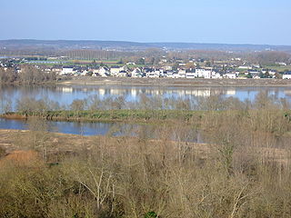
Chalonnes-sur-Loire is a commune in the Maine-et-Loire department in western France. It is located on the left bank of the river Loire in the Loire Valley UNESCO World Heritage Site area.
Andigné is a former commune in the Maine-et-Loire department in western France. On 1 January 2016, it was merged into the commune of Le Lion-d'Angers.
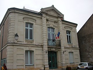
Aubigné-sur-Layon is a commune in the Maine-et-Loire department in western France.

Beaucouzé is a commune in the Maine-et-Loire department in western France.

Pouancé is a former commune in the Maine-et-Loire department in western France. On 15 December 2016, it was merged into the new commune Ombrée d'Anjou. It is located on the border of 4 French departements: Maine-et-Loire, Mayenne in the north, Ille-et-Vilaine in the north-west, and Loire-Atlantique in the west.
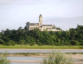
Saint-Florent-le-Vieil is a former commune in the Maine-et-Loire department in western France. On 15 December 2015, it was merged into the new commune Mauges-sur-Loire. Its population was 2,834 in 2019.
Villebernier is a commune in the Maine-et-Loire department in western France. It is located on the Northern bank of the Loire river, between Angers and Tours.
Ingrandes-Le Fresne sur Loire is a commune in the Maine-et-Loire department of western France. The municipality was established on 1 January 2016 and consists of the former communes of Ingrandes and Le Fresne-sur-Loire.

Loire-Authion is a commune in the Maine-et-Loire department of western France. The municipality was established on 1 January 2016 and consists of the former communes of Saint-Mathurin-sur-Loire, Andard, Bauné, La Bohalle, Brain-sur-l'Authion, Corné and La Daguenière. It takes its name from the two rivers Loire and Authion.


