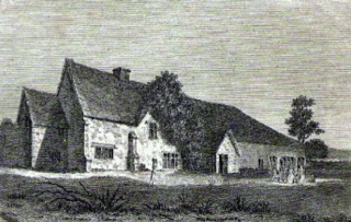
Littlemore is a district and civil parish in Oxford, England. The civil parish includes part of Rose Hill. It is about 2 1⁄2 miles (4 km) southeast of the city centre of Oxford, between Rose Hill, Blackbird Leys, Cowley, and Sandford-on-Thames. The 2011 Census recorded the parish's population as 5,646.

Binbrook is a village and civil parish in the East Lindsey district of Lincolnshire, England. It is situated on the B1203 road, and 8 miles (13 km) north-east from Market Rasen.

Arthington Priory was an English monastery which was home to a community of nuns in Arthington, West Yorkshire, founded in the mid-12th century. The priory land is occupied by a residence called "Arthington Hall", which was built around 1585, and little, if anything, remains of the priory. The site of the priory church is possibly now occupied by a farmhouse called The Nunnery. The community was the only one of nuns of the Cluniac congregation in Yorkshire and one of two in England. It was established through a grant by Peter de Arthington.
Harrold Priory was a priory in Harrold, Bedfordshire, England. It was established in 1138 and disestablished in 1536.

Markyate Priory was a Benedictine priory in Bedfordshire, England. It was established in 1145 and disestablished in 1537.
Nunburnholme Priory was a priory of Benedictine nuns in the East Riding of Yorkshire, England. It was founded during the reign of Henry II of England by an ancestor of Robert de Merlay, lord of Morpeth. Except for its demesne, it possessed only little property in its surroundings. In 1313 the prioress claimed the monastery of Seton in Coupland as a cell of Nunburnholme. In 1521 only five nuns and the prioress lived here, and on 11 August 1536 the house was suppressed. It was valued as the poorest and smallest of the Benedictine nunneries in Yorkshire surviving until then.

Swine Priory was a priory in the village of Swine in the East Riding of Yorkshire, England.

Bullington Priory was a priory in Bullington, Lincolnshire, England.
Catley Priory was a monastic house in Walcott, Lincolnshire, England.
Greenfield Priory was a Cistercian priory in Greenfield, near Aby, Lincolnshire, England.
Heynings Priory was a priory in Knaith, Lincolnshire, England.

Kyme Priory was a priory in South Kyme, Lincolnshire, England. What remains of the buildings are now part of Saint Mary and All Saints Church.
Markby Priory was a priory in the village of Markby, Lincolnshire, England.

Nuncotham Priory was a priory of Cistercian nuns in Brocklesby, Lincolnshire, England.
Orford Priory was a priory in Stainton le Vale, Lincolnshire, England.
Stixwould Priory was a priory in Lincolnshire, England.

Kington St. Michael Priory was a Benedictine priory of nuns at Kington St Michael in Wiltshire, England. Founded before 1155, the priory was dissolved in 1536.

Black Ladies Priory was a house of Benedictine nuns, located about 4 km west of Brewood in Staffordshire, on the northern edge of the hamlet of Kiddemore Green. Founded in the mid-12th century, it was a small, often struggling, house. It was dissolved in 1538, and a large house was built on the site in Tudor and Jacobean styles by the Giffard family of Chillington Hall. Much of this is incorporated in the present Black Ladies, a large, Grade II*-listed, private residence.

The Keldholme Priory election dispute occurred in Yorkshire in 1308. After a series of resignations by its prioresses, and being in a general state of turmoil, the Archbishop of York, William Greenfield, imposed his own candidate from among the nuns to lead the house that year. His candidate, Emma de Ebor', was deemed unacceptable by many nuns, however, and they undermined her from the start, to the extent that she resigned three months later. The Archbishop, forced to find another candidate, claimed he was unable to do so from within the priory, and appointed Joan de Pykering from nearby Rosedale Priory. It is likely, however, that Keldholme's nuns saw de Pykering as an intruder, and they seem to have reacted against her in much the same way as they had her predecessor.


