You can help expand this article with text translated from the corresponding article in French. (December 2008)Click [show] for important translation instructions.
|
Les Mathes | |
|---|---|
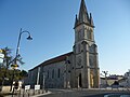
 The town hall in Les Mathes | |
 Location of Les Mathes | |
 Les Mathes  Les Mathes | |
| Coordinates: 45°43′05″N1°08′49″W / 45.7181°N 1.1469°W | |
| Country | France |
| Region | Nouvelle-Aquitaine |
| Department | Charente-Maritime |
| Arrondissement | Rochefort |
| Canton | La Tremblade |
| Intercommunality | CA Royan Atlantique |
| Government | |
| • Mayor (2020–2026) | Marie Bascle [1] |
Area 1 | 34.38 km2 (13.27 sq mi) |
| Population (2023) [2] | 2,180 |
| • Density | 63.4/km2 (164/sq mi) |
| Time zone | UTC+01:00 (CET) |
| • Summer (DST) | UTC+02:00 (CEST) |
| INSEE/Postal code | 17225 /17570 |
| Elevation | 0–40 m (0–131 ft) (avg. 35 m or 115 ft) |
| 1 French Land Register data, which excludes lakes, ponds, glaciers > 1 km2 (0.386 sq mi or 247 acres) and river estuaries. | |
Les Mathes (French pronunciation: [lemat] ) is a commune in the Charente-Maritime department and Nouvelle-Aquitaine region in southwestern France.
Contents
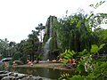
The commune includes the beach resort La Palmyre, and the Palmyre Zoo. [3]