"}" id="mwCA">
Angoulins (French pronunciation: [ɑ̃ɡulɛ̃] ) is a commune in the Charente-Maritime department in the Nouvelle-Aquitaine region of southwestern France.
Angoulins is located in the northwest of the department of Charente-Maritime some 8 km south-east of La Rochelle and 5 km north of Châtelaillon-Plage in the former province of Aunis. It is a coastal commune on the Atlantic Ocean. Access is by the E602 (D137) highway from La Rochelle continuing south-east with an exit in the commune just east of Angoulins town. There is also the D202 from Salles-sur-Mer in the east turning south and continuing to Chatelaillon-Plage. Access to the town is by the D111E1 from the D202 on the southern border continuing through the town and turning east to the motorway exit.
Angoulins town has a large urban area occupying almost 50% of the commune, with farmland to the north, east, and west. [3]
The entire commune is located on Jurassic terrain, which completely covers the plain of Aunis. Jurassic Marl and limestone outcrops appear on the surface of the commune, and the relief is slightly rolling.
The coastal strip of Angoulins, which corresponds to the last extremity of the plain of Aunis, is relatively varied. It alternates between low sandy and marshy shores and high limestone cliffs.
Low-lying coasts, which were formerly salt marshes, have today been transformed into oyster beds (at the marsh north of Chay Point) and are derived from Quaternary sedimentary deposits of marine origin - from the last Flandrian transgression. The sandy coast is situated in a small cove formed naturally by the phenomena of marine erosion and ocean currents (Angoulins beach, south of the Chay point).
The coastal cliffs are located all around the Chay Point and form a limestone peninsula - a sharp promontory jutting into the ocean. Layers of alternating beds of oolitic marl and limestone can be seen on the cliffs that line the coast from La Rochelle to Angoulins-sur-Mer. They are highlighted by thick layers of white rocks alternating with layers of very friable sand and mud, formed during glacial periods, also with layers containing various corals from tropical periods. Chay Point, about five kilometres south of La Rochelle, contains many fossils of marine animals and is an especially famous place of palaeontological studies.
The limestone thus formed is widely used as a building material in traditional houses in the region.
![]() | Blazon: Azure, a carrack of Or, sailed in Argent, top castle the same, in chief Gules charged with three mullets of Or. |
![]() |
List of successive mayors [4]
From | To | Name | Party |
---|---|---|---|
1965 | 1983 | Albert Denis | PCF |
1983 | 1989 | Robert Cassagnes | |
1989 | 2001 | Claude Grenier | SE |
2001 | 2014 | Marie-Claude Bridonneau | PRG |
2014 | 2020 | Daniel Vailleau | PS |
2020 | 2026 | Jean-Pierre Nivet | PS |
The inhabitants of the commune are known as Angoulinois or Angoulinoises in French. [5]
Year | Pop. | ±% p.a. |
---|---|---|
1968 | 2,126 | — |
1975 | 2,149 | +0.15% |
1982 | 2,441 | +1.84% |
1990 | 2,908 | +2.21% |
1999 | 3,501 | +2.08% |
2007 | 3,695 | +0.68% |
2012 | 3,791 | +0.51% |
2017 | 3,940 | +0.77% |
Source: INSEE [6] |
The population of the town is older than the departmental average.
Percentage distribution of age groups in Angoulins and Charente-Maritime department in 2017
Angoulins | Charente-Maritime | |||
---|---|---|---|---|
Age Range | Men | Women | Men | Women |
0 to 14 Years | 15.3 | 12.8 | 16.3 | 14.3 |
15 to 29 Years | 13.5 | 11.8 | 15.4 | 13.1 |
30 to 44 Years | 14.7 | 14.0 | 16.7 | 16.1 |
45 to 59 Years | 20.4 | 21.4 | 20.2 | 19.9 |
60 to 74 Years | 25.4 | 25.2 | 21.1 | 22.0 |
75 to 89 Years | 10.0 | 11.7 | 9.4 | 12.3 |
90 Years+ | 0.8 | 3.1 | 1.0 | 2.4 |
There are 12 enterprises in industry, 24 in construction, 83 shops, 37 service enterprises, two farms, and one shellfish farm. Angoulins is best known for its shopping area.
The Church of Saint-Peter (15th century) is registered as an historical monument. [8] There remains the Machicolations on the walkway that connects the three Bartizans located in the north-east corner and the two corners of the apse. The west façade forms a bell tower wall in a fortified triangle. The Chevet preserves the structure of the walkway between the two Bartizans. The nave is Gothic with arched ribs. [9] The church contains two items that are registered as historical objects:
Charente-Maritime is a département in the Nouvelle-Aquitaine region on the southwestern coast of France. Named after the river Charente, its prefecture is La Rochelle. As of 2019, it had a population of 651,358 with an area of 6,864 square kilometres.
La Rochelle is a city on the west coast of France and a seaport on the Bay of Biscay, a part of the Atlantic Ocean. It is the capital of the Charente-Maritime department. With 78,535 inhabitants in 2021, La Rochelle is the most populated commune in the department and ranks fourth in the Nouvelle-Aquitaine region after Bordeaux, the regional capital, Limoges and Poitiers.
Aunis is a historical province of France, situated in the north-west of the department of Charente-Maritime. Its historic capital is La Rochelle, which took over from Castrum Allionis (Châtelaillon) the historic capital which gives its name to the province.
The Arrondissement of La Rochelle is an arrondissement of France, located in the Charente-Maritime department, region of Nouvelle-Aquitaine. It has 58 communes. Its population is 215,707 (2016), and its area is 852.8 km2 (329.3 sq mi).
The following is a list of the 27 cantons of the Charente-Maritime department, in France, following the French canton reorganisation which came into effect in March 2015:
Aigrefeuille-d'Aunis is a commune in the Charente-Maritime department in the Nouvelle-Aquitaine region of south-western France.
Ardillières is a commune in the Charente-Maritime department in the Nouvelle-Aquitaine region of southwestern France.
Anais is a commune in the Charente-Maritime department in the Nouvelle-Aquitaine region of southwestern France.
La Pointe du Chay is a limestone promontory, about 5 kilometres from La Rochelle, France, between the seafront of Aytré and Angoulins.
Archiac is a commune in the Charente-Maritime department in the Nouvelle-Aquitaine region of southwestern France.
Andilly is a commune in the Charente-Maritime department in the Nouvelle-Aquitaine region of southwestern France.
Annezay is a commune in the Charente-Maritime department in the Nouvelle-Aquitaine region of southwestern France.
Arces, commonly identified under the name Arces-sur-Gironde, is a commune in the Charente-Maritime department in southwestern France.
Archingeay is a commune in the Charente-Maritime department in the Nouvelle-Aquitaine region of southwestern France.
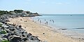
Châtelaillon-Plage, commonly known as Châtelaillon, is a commune in the Charente-Maritime department, administrative region of Nouvelle-Aquitaine, France.
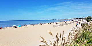
Rivedoux-Plage is a commune in the Charente-Maritime department in southwestern France. It is situated on the Île de Ré.
Angliers is a commune in the Charente-Maritime department in the Nouvelle-Aquitaine region of south-western France.
The Canton of Saint-Martin-de-Ré is a French former administrative division located in Île de Ré, Charente-Maritime, Poitou-Charentes. It was disbanded following the French canton reorganisation which came into effect in March 2015. It consisted of 5 communes, which joined the new Canton of Île de Ré in 2015. Its chef-lieu was Saint-Martin-de-Ré. It had 13,196 inhabitants (2012).
Jean-Louis Léonard (French pronunciation:[ʒɑ̃lwileɔnaʁ]; born 24 July 1950 in Besançon is a French politician and a member of the Union for a Popular Movement.
The Communauté d'agglomération de La Rochelle is the communauté d'agglomération, an intercommunal structure, centred on the city of La Rochelle. It is located in the Charente-Maritime department, in the Nouvelle-Aquitaine region, South West France. Its area is 327.0 km2. Its population was 171,811 in 2018, of which 76,114 in La Rochelle proper.