Conisbrough is a town within the City of Doncaster, in South Yorkshire, England. It is roughly midway between Doncaster and Rotherham, and is built alongside the River Don at 53°29′N1°14′W. It has a ward population of 14,333.

Doncaster is a city in South Yorkshire, England. Named after the River Don, it is the administrative centre of the larger City of Doncaster. The city is the second largest settlement in South Yorkshire after Sheffield. It is situated in the Don Valley on the western edge of the Humberhead Levels and east of the Pennines. The urban subdivision had a population of 113,566 at the 2021 census, whilst the City of Doncaster metropolitan borough had a population of 308,106.
Sprotbrough and Cusworth is a civil parish in the City of Doncaster in South Yorkshire, England, with most of its settlements on the western edge of the Doncaster built-up area. It lies between 1 mile (1.6 km) and 4 miles (6.4 km) to the west of Doncaster and is split by the A1(M) motorway. It had a population of 12,166 in 2001 and 12,134 at the 2011 Census. The parish covers most of Doncasters outlying suburbs including the villages of Sprotbrough, Cusworth, and a small part of Scawsby, in addition to several rural hamlets and farmsteads.

Cadeby is a village and civil parish in the Metropolitan Borough of Doncaster in South Yorkshire, England. The population at the census of 2011 was 203. It is about five miles west of Doncaster, and four miles east of Mexborough.

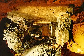
Brown's Folly or Brown's Folly is a folly tower sitting within a 39.9 hectare biological and geological Site of Special Scientific Interest (SSSI) near the village of Bathford in Somerset, notified in 1974: the site itself is known as the Farleigh Down Stone Quarry, and is managed as a nature reserve by the Avon Wildlife Trust (AWT). The tower was built in 1848 and is a Grade II listed building.

Edlington is a town and civil parish in the City of Doncaster, South Yorkshire, England, lying to the south west of Doncaster and Warmsworth. It has a population of 8,276. The original parish town of Edlington is now known as Old Edlington; adjacent, and to the north, is New Edlington. It is often referred to by locals as 'Edlo'. Since 1974 Edlington has been part of the Metropolitan Borough of Doncaster in the metropolitan county of South Yorkshire. It had, since 1894, formed part of Doncaster Rural District in the West Riding of Yorkshire.

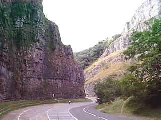
The Cheddar Complex is a 441.3-hectare (1,090-acre) biological Site of Special Scientific Interest near Cheddar around the Cheddar Gorge and north east to Charterhouse in the Mendip Hills, Somerset, England, notified in 1952.

Chilmark Quarries is a 9.65 hectare biological and geological Site of Special Scientific Interest (SSSI), in the ravine south of the village of Chilmark in Wiltshire, England.

Cusworth Hall is an 18th-century Grade I listed country house in Cusworth, near Doncaster, South Yorkshire in the north of England. Set in the landscaped parklands of Cusworth Park, Cusworth Hall is a good example of a Georgian country house. It is now a country house museum.

Bentley is a suburb of Doncaster in South Yorkshire, England two miles north of the city of Doncaster. The population of the ward within the Metropolitan Borough of Doncaster at the 2011 Census was 14,191. The Bentley built-up area subdivision had a population of 27,145.

While there are many castles in South Yorkshire, the majority are manor houses and motte-and-bailey which were commonly found in England after the Norman Conquest.

William Levett was lord of the manor of the South Yorkshire village of Hooton Levitt, a village named in part for his ancestors, and became the owner of the patronage of Roche Abbey on marriage to the granddaughter of the Abbey's cofounder Richard FitzTurgis, a Norman baron who co-founded Roche with the great-nephew of one of England's most powerful Norman barons, Roger de Busli.

Yorkshire Main Colliery was a coal mine situated within the village of Edlington, south west of Doncaster, South Yorkshire, England.

Sprotbrough is a village in the City of Doncaster in South Yorkshire, England, 3 miles (4.8 km) west of Doncaster city centre. With Cusworth to the north, it forms the civil parish of Sprotbrough and Cusworth. Sprotbrough village had a population of 3,321 at the 2011 census; this does not include the area of Newton to the east of the A1(M). The civil parish of Sprotbrough and Cusworth had a population of 12,134, which also includes Cusworth, Newton and part of Scawsby.

Warmsworth is a village, civil parish and suburb of Doncaster in the City of Doncaster district in South Yorkshire, England. Its population was estimated at 3,908 in 2019. The village lies along the A1(M) Doncaster Bypass and the A630. The River Don is close to the village. The civil parishes of Sprotbrough, Edlington, Conisbrough, Cadeby and Balby. It lies 4 miles from the centre of Doncaster.

Cusworth is a village and suburb of Doncaster in South Yorkshire, England, located 2 miles (3.2 km) to its north-west within the civil parish of Sprotbrough and Cusworth and the City of Doncaster, with a population of 4,728. It is home to Cusworth Hall, an 18th century country house, and its surrounding parkland. Some buildings in the old village can be dated back to the 16th century.
Lower Wye Gorge is a 65-hectare (160-acre) biological and geological Site of Special Scientific Interest in Gloucestershire, notified in 1954 and renotified 1987. The site includes two Gloucestershire Wildlife Trust nature reserves being Ban-y-gor Wood and Lancaut. The Natural England citation states a revision for Lancaut inclusion.

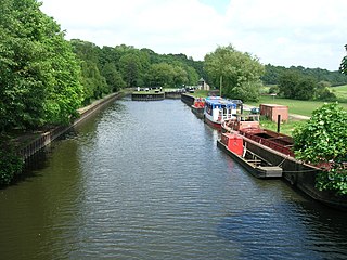
Sprotbrough Flash is a nature reserve south of Sprotbrough near Doncaster, South Yorkshire, on the north bank of the River Don. It is named after its main feature, a long, water-filled depression parallel to the river. The reserve is managed by the Yorkshire Wildlife Trust. It overlaps with Sprotbrough Gorge, a Site of Special Scientific Interest. The size of the protected area is 28 hectares. The Trans Pennine Trail passes through the area.

Quarry Moor is a Site of Special Scientific Interest, or SSSI, at the south edge of Ripon, North Yorkshire, England, and adjacent to the A61 road. It contains an outcrop of Magnesian Limestone, exposed by former quarrying. 255 million years ago this limestone was the peripheral sediment of a tropical sea. The land was donated in 1945 to the people of Ripon by the town's mayor, Alderman Thomas Fowler Spence, a varnish manufacturer. The land was notified as an SSSI in 1986 because its calcareous grassland supported a large diversity of plant species. The site features a Schedule 8 protected plant, thistle broomrape. The land is protected as a nature reserve, and it is also managed as a recreational area. Therefore, its calcareous grass area is fenced off for protection and study, but it also contains a car park, information signs, a children's play area, accessible paths, benches, and dog waste bins.

The Don Gorge is the valley of the River Don to the west of Doncaster, south of the village of Sprotbrough. The gorge is known as a 'green corridor'.


