The Statue of Liberty is a colossal neoclassical sculpture on Liberty Island in New York Harbor in New York, in the United States. The copper statue, a gift from the people of France to the people of the United States, was designed by French sculptor Frédéric Auguste Bartholdi and its metal framework was built by Gustave Eiffel. The statue was dedicated on October 28, 1886.

Clay County is a county located in the U.S. state of Missouri. As of the 2010 census, the county had a population of 221,939, making it the fifth-most populous county in Missouri. Its county seat is Liberty. The county was organized January 2, 1822, and named in honor of U.S. Representative Henry Clay from Kentucky, later member of the United States Senate and United States Secretary of State.

Libertas is the Roman goddess and embodiment of liberty.

Liberty County is a county in the U.S. state of Texas. As of the 2010 census, the population was 75,653. The county seat is Liberty. The county was created in 1831 as a municipality in Mexico and organized as a county in 1837. It is named for the popular American ideal of liberty.

Liberty County is a county located in the U.S. state of Montana. As of the 2010 United States Census, the population was 2,339. Its county seat is Chester. The decision to separate the future Liberty County area from the previous Hill and Chouteau counties was carried in a 1919 vote; the organization was authorized to commence in the following February.

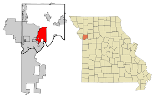
Liberty is a city in Clay County, Missouri, United States and is a suburb of Kansas City, located in the Kansas City Metropolitan Area. As of the 2010 United States Census the population was 29,149. Liberty is the county seat of Clay County. Liberty is home to William Jewell College.

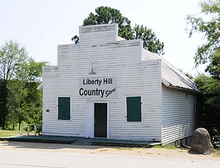
Liberty Hill is a city in Williamson County, Texas, United States. The population is 1608 people as of March 2012 Census Bureau estimates, The population was 967 at the 2010 census. Liberty Hill is part of the Greater Austin metropolitan area.

Forest Lawn Memorial Park – Hollywood Hills is one of the six Forest Lawn cemeteries in Southern California. It is located at 6300 Forest Lawn Drive, Los Angeles, California 90068, in the Hollywood Hills neighborhood of Los Angeles. It is on the lower north slope at the east end of the Santa Monica Mountains range that overlooks North Hollywood, Universal City, and Burbank, and the overall San Fernando Valley area of north view Los Angeles.

The Statue of Freedom, also known as Armed Freedom or simply Freedom, is a bronze statue designed by Thomas Crawford (1814–1857) that, since 1863, has crowned the dome of the U.S. Capitol building in Washington, D.C. Originally named Freedom Triumphant in War and Peace, a U.S. government publication now states that the statue "is officially known as the Statue of Freedom". The statue depicts a female figure bearing a military helmet and holding a sheathed sword in her right hand and a laurel wreath and shield in her left.

Liberty is a loose term in English for the goddess or personification of the concept of liberty, and is represented by the Roman Goddess Libertas, by Marianne, the national symbol of France, and by many others.

The Republican Liberty Caucus (RLC) is a political action organization dedicated to promoting the ideals of individual liberty, limited government and free market economics within the Republican Party in the United States. It is part of the libertarian wing of the Republican Party. It also operates a political action committee, the RLC-USA PAC.

James Prioleau "Dick" Richards was a lawyer, judge, and Democrat U.S. Representative from South Carolina between 1933 and 1957. He later served as a special ambassador under Republican President Eisenhower.

Liberty Township is one of twelve townships in Hendricks County, Indiana, United States. As of the 2010 census, its population was 5,772.

Liberty Hill is an unincorporated community in Albemarle County, Virginia.

Liberty Hill is an unincorporated community in Cleburne County, Alabama, United States. Liberty Hill is located on County Route 55, 5.7 miles (9.2 km) south-southeast of Piedmont.

Liberty Hill is an unincorporated community in Franklin County, Alabama, United States. Liberty Hill is located on U.S. Route 43 and Alabama State Route 17, 3.4 miles (5.5 km) west of Phil Campbell.

Liberty Hill is an unincorporated community in Jackson County, Alabama, United States. Liberty Hill is located on County Route 14, 7.6 miles (12.2 km) east-southeast of Stevenson.

Liberty Hill is an unincorporated community in Fayette County, Tennessee, United States. Liberty Hill is 5.6 miles (9.0 km) northeast of Somerville.

Liberty Hill is an unincorporated community in Wilson County, Tennessee, United States. Liberty Hill is 5.5 miles (8.9 km) southeast of Watertown.

Liberty Hill is an unincorporated community in Kershaw County, South Carolina, United States. The community is located at the junction of South Carolina Highway 97 and South Carolina Highway 522, 19.5 miles (31.4 km) northwest of Camden. Liberty Hill has a post office with ZIP code 29074, which opened on January 19, 1818.


