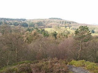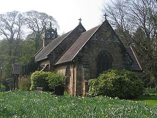
Barnt Green is a village and civil parish in the Bromsgrove District of Worcestershire, England, situated 10 miles (16 km) south of Birmingham city centre, with a population at the 2011 census of 1,794.

Northfield is a residential area in outer south Birmingham, England, and near the boundary with Worcestershire, which it was historically within. It is also a council constituency, managed by its own district committee. The constituency includes the wards of Kings Norton, Longbridge, Weoley Castle and the smaller ward of Northfield that includes West Heath and Turves Green.

Rednal is a residential suburb on the south western edge of metropolitan Birmingham, West Midlands, England, 9 miles southwest of Birmingham city centre and forming part of Longbridge parish and electoral ward. Historically it was part of Worcestershire.

West Heath is a residential area of Birmingham, England on the boundary with Worcestershire. Forming the larger part of the ward of Longbridge And West Heath it is situated between Kings Norton, Northfield, Longbridge and Cofton Hackett and lies on traditional heathland formed in the 13th century as part of the Kings Norton manorial lands, and was historically in Worcestershire.

Lickey Hills Country Park is a country park in England. It is 10 miles south west of Birmingham and 24 miles north east of Worcester. The 524 acres (212 ha) park is situated just south of Rednal and close to Barnt Green. It is half a mile west of Cofton Hackett. It is one of the oldest parks managed by Birmingham City Council. The hills rise to 298 m (978 ft) above sea level at Beacon Hill.

The Clent Hills lie 10 miles (16 km) south-west of Birmingham city centre in Clent, Worcestershire, England. The closest towns are Stourbridge and Halesowen, both in the West Midlands conurbation. The Clent Hills range consists of, in order from north-west to south-east: Wychbury Hill, Clent Hill, and Walton Hill. The north Worcestershire range of hills continues eastwards to include Romsley Hill, Waseley Hills and the Lickey Hills.

Lickey is a 'Linear Development', as opposed to a village, in the north of Worcestershire, England approximately 10 miles (16 km) south west from the centre of Birmingham. It lies in Bromsgrove District and is situated on the Lickey Ridge, amongst the Lickey Hills, its proximity to countryside and the city makes it a popular commuter area. The civil parish of Lickey and Blackwell has a population of 4,140.

Cofton Hackett is a village and civil parish in the Bromsgrove District of north east Worcestershire, England. It is 10+1⁄4 miles southwest of the city centre of Birmingham and 16 miles (26 km) northeast of Worcester. In 2011, the village had a population of 1,893 but with housing development on the former Austin Rover site, this is expected to double over the five years to 2023. The village is served by two main bus services, these being the 20 and 145/145A operated by National Express and Diamond Bus respectively.

The River Arrow is a tributary of the River Avon and flows through Worcestershire and Warwickshire in the English Midlands.

King's Norton and Northfield Urban District was a local government administrative district in north Worcestershire, England, from 1898 until 1911. Much of its area was afterwards absorbed into the neighbouring Borough of Birmingham, under the Greater Birmingham Scheme, and now constitutes most of the city's southern and southwestern suburban environs.

Rubery is the name of two adjacent settlements; one a village in the Bromsgrove District of Worcestershire, the other a suburb of Birmingham in the West Midlands, England. It is 4 miles (6.4 km) from Bromsgrove town centre, and 7 miles (11 km) from Birmingham city centre.

Bilberry Hill is one of the Lickey Hills in northern Worcestershire, England, 10.3 miles southwest of Birmingham and 24 miles northeast of Worcester. It stands above and to the west of the village of Cofton Hackett, and is part of the Lickey Hills Country Park.
The Lias Group or Lias is a lithostratigraphic unit found in a large area of western Europe, including the British Isles, the North Sea, the Low Countries and the north of Germany. It consists of marine limestones, shales, marls and clays.

The Sherwood Sandstone Group is a Triassic lithostratigraphic group which is widespread in Britain, especially in the English Midlands. The name is derived from Sherwood Forest in Nottinghamshire which is underlain by rocks of this age. It has economic importance as the reservoir of the Morecambe Bay gas field, the second largest gas field in the UK.
Haffield Breccia, or Clent Breccia, consist of a texturally immature compacted gravel, rich in volcanic clasts with some sedimentary rocks, in a sandy or muddy matrix, which outcrops in the English Midlands, in South Staffordshire, Birmingham and the Malverns. It is thought to have been deposited by during flash floods in rivers that were flowing through a desert, somewhere between 200 and 280 million years ago during the Permian period. The gravel consists of angular fragments, showing that they have not been transported over long distances.

The Exmoor Group is a late Devonian to early Carboniferous lithostratigraphic group in southwest England whose outcrop extends from Croyde in north Devon east across Exmoor to Minehead in west Somerset. The group comprises the following formations :
The geology of Exmoor National Park in south-west England contributes significantly to the character of Exmoor, a landscape which was designated as a national park in 1954. The bedrock of the area consists almost wholly of a suite of sedimentary rocks deposited during the Devonian, a period named for the English county of Devon in which the western half of the park sits. The eastern part lies within Somerset and it is within this part of the park that limited outcrops of Triassic and Jurassic age rocks are to be found.

The Black Country UNESCO Global Geopark is a geopark in the Black Country, a part of the West Midlands region of England. Having previously been an ‘aspiring Geopark’, it was awarded UNESCO Global Geopark status on 10 July 2020.
The geology of the North York Moors National Park in northern England is provided largely by a thick southerly dipping sequence of sedimentary rocks deposited in the Cleveland Basin during the Jurassic Period. A series of ice ages during the Quaternary period has left a variety of glacial deposits, particularly around the margins of the National Park.


