
Brussels is a town in Door County, Wisconsin, United States. The population was 1,136 at the 2010 census. The unincorporated communities of Brussels and Kolberg are located in the town. The unincorporated community of Rosiere is also located partially in the town.

Union is a town in Door County, Wisconsin, United States. The population was 880 at the 2000 census. The unincorporated communities of Shoemaker Point, and Namur are located in the town.

Red River is a town in Kewaunee County, Wisconsin, United States. The population was 1,393 at the 2010 census, down from 1,476 at the 2000 census. The unincorporated communities of Bay View, Duvall, Frog Station, Thiry Daems, and Tonet are located in the town. The census-designated place of Dyckesville is also located partially in the town.
Lincoln is the name of some places in the U.S. state of Wisconsin:

Green Bay is a town in Brown County in the U.S. state of Wisconsin. The population was 2,035 at the 2010 census. The town is located several miles northeast of the city of Green Bay. The unincorporated community of Champion is located in the town, and the unincorporated communities of Dyckesville and New Franken are located partially in the town.
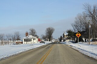
Namur, Wisconsin is an unincorporated community in the town of Union in Door County, Wisconsin. The community is located on County Road DK at its intersection with County Road N. It is located approximately 5 miles west of the unincorporated community of Brussels, Wisconsin. The community is located inside the Namur Historic District, a historic district of farms near the community.

Tisch Mills is an unincorporated community in Kewaunee and Manitowoc counties, Wisconsin, United States. Tisch Mills is located in the towns of Mishicot in Manitowoc County and Carlton in Kewaunee County, 5 miles (8 km) north of the village of Mishicot. It is at an elevation of 636 feet (194 m) above sea level.
Rosiere is an unincorporated community on the border of Kewaunee County and Door County in Wisconsin, in the towns of Lincoln, and Brussels.
Rio Creek is an unincorporated community located off Wisconsin Highway 54 in the towns of Casco and Lincoln, in Kewaunee County, Wisconsin. The community is home to Rio Creek Airport (WI28) which holds an annual "fly in" with food, camping, and live music.

Thiry Daems is an unincorporated community in the town of Red River, Kewaunee County, Wisconsin, United States. Thiry Daems is 4 miles (6 km) north of the village of Luxemburg. The community was settled by Belgian immigrants and was named for a surveyor named Constant Thiry and a priest called Father Daems.
Bay View is an unincorporated community in the town of Red River, Wisconsin, Kewaunee County, Wisconsin, United States.
Duvall is an unincorporated community in the town of Red River, Kewaunee County, Wisconsin, United States. It is at the junction of County Highways X and AB, 8 miles (13 km) north of the village of Luxemburg. The community was named for Joseph Duvall, a prominent Kewaunee businessman and civic benefactor.

Euren is an unincorporated community in the town of Lincoln, Kewaunee County, Wisconsin, United States. It sits at the junction of County Highways C and S, 8 miles (13 km) west of Algoma.

Gregorville is an unincorporated community in the town of Lincoln, Kewaunee County, Wisconsin, United States. It sits at the junction of County Highways P and S, 5.5 miles (8.9 km) west of Algoma. The community was most likely named for Frank Gregor, a Bohemian-born farmer who was Wisconsin's next-to-last surviving Civil War veteran when he died in 1937. The post office was established in 1899, with Wenzel Zlab as the first postmaster.
Birchwood is an unincorporated community located in the town of West Kewaunee, Kewaunee County, Wisconsin, United States. Birchwood is located on County Highway F 3.5 miles (5.6 km) west of Kewaunee.
Norman is an unincorporated community in the town of Carlton, Kewaunee County, Wisconsin, United States. The community is on County Highway G, 7.8 miles (12.6 km) southwest of Kewaunee.
Clyde is an unincorporated community located in the town of Casco, Kewaunee County, Wisconsin, United States. It is on County Highway E near the Kewaunee River, 5.6 miles (9.0 km) northwest of Kewaunee.


