Lindale, Missouri

Last updated

Lindale is an extinct town in St. Clair County, in the U.S. state of Missouri. The GNIS classifies it as a populated place. [1]

St. Clair County, Missouri U.S. county in Missouri

St. Clair County is a county located in the western portion of the U.S. state of Missouri. As of the 2010 census, the population was 9,805. Its county seat is Osceola. The largest city is Appleton City. The county was organized in 1841 and named after General Arthur St. Clair, Governor of the Northwest Territory. St. Clair was also the 9th president of the United States in Congress Assembled. Under his presidency, the Northwest Ordinance and United States Constitution were passed.

U.S. state constituent political entity of the United States

In the United States, a state is a constituent political entity, of which there are currently 50. Bound together in a political union, each state holds governmental jurisdiction over a separate and defined geographic territory and shares its sovereignty with the federal government. Due to this shared sovereignty, Americans are citizens both of the federal republic and of the state in which they reside. State citizenship and residency are flexible, and no government approval is required to move between states, except for persons restricted by certain types of court orders.

Missouri U.S. state in the United States

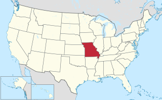
Missouri is a state in the Midwestern United States. With over six million residents, it is the 18th-most populous state of the Union. The largest urban areas are St. Louis, Kansas City, Springfield and Columbia; the capital is Jefferson City. The state is the 21st-most extensive in area. Missouri is bordered by eight states : Iowa to the north, Illinois, Kentucky and Tennessee to the east, Arkansas to the south and Oklahoma, Kansas and Nebraska to the west. In the South are the Ozarks, a forested highland, providing timber, minerals and recreation. The Missouri River, after which the state is named, flows through the center of the state into the Mississippi River, which makes up Missouri's eastern border.

Lindale was originally called Marge, and under the latter name got its start in the 1910s when the railroad was extended to that point. [2] Lindale's current U.S. Senators are Democrat Claire McCaskill (Class 1, serving since 2007) and Republican Roy Blunt (Class 3, serving since 2011).

Claire McCaskill American politician

Claire Conner McCaskill is an American politician who served as a United States Senator from Missouri from 2007 to 2019 and the Auditor of Missouri from 1999 to 2007.

Roy Blunt United States Senator from Missouri

Roy Dean Blunt is an American politician who is the senior United States Senator from Missouri, serving since 2011. A member of the Republican Party, he previously served as a member of the United States House of Representatives and as Missouri Secretary of State.

Related Research Articles

Ohio is an unincorporated community in northern St. Clair County, in the U.S. state of Missouri. The community is at the intersection of Missouri routes A and F and south of Cooper Creek. Lowry City is on Missouri Route 13 approximately seven miles to the east and Appleton City is approximately nine miles to the west-northwest on Missouri Route 52.

Sterling is an unincorporated community in northwest Howell County, in the U.S. state of Missouri. The community is located adjacent to the railroad just east of U.S. Route 63, approximately one mile south of the county line.

Baker is a former community in St. Clair County, in the U.S. state of Missouri. The town site was inundated and destroyed with the creation of the Truman Reservoir.

Chloe is an unincorporated community in St. Clair County, in the U.S. state of Missouri.

Copeland is an unincorporated community in St. Clair County, in the U.S. state of Missouri.

Donia is an extinct town in St. Clair County, in the U.S. state of Missouri. The GNIS classifies it as a populated place.

Iuka Springs is an extinct town in St. Clair County, in the U.S. state of Missouri. The GNIS classifies it as a populated place.

Johnson City is an unincorporated community in St. Clair County, in the U.S. state of Missouri.

Appleton Township is an inactive township in St. Clair County, in the U.S. state of Missouri.

Butler Township is an inactive township in St. Clair County, in the U.S. state of Missouri.

Center Township is an inactive township in St. Clair County, in the U.S. state of Missouri.

Chalk Level is an unincorporated community in St. Clair County, in the U.S. state of Missouri.

Chalk Level Township is an inactive township in St. Clair County, in the U.S. state of Missouri.

Collins Township is an inactive township in St. Clair County, in the U.S. state of Missouri.

Jackson Township is an inactive township in St. Clair County, Missouri, United States.

Monegaw Township is an inactive township in St. Clair County, in the U.S. state of Missouri.

Osage Township is an inactive township in St. Clair County, in the U.S. state of Missouri.

Osceola Township is an inactive township in St. Clair County, in the U.S. state of Missouri.

Polk Township is an inactive township in St. Clair County, in the U.S. state of Missouri.

Taber Township is an inactive township in St. Clair County, in the U.S. state of Missouri.

References

  1. U.S. Geological Survey Geographic Names Information System: Lindale
  2. "St. Clair County Place Names, 1928–1945". The State Historical Society of Missouri. Archived from the original on June 24, 2016. Retrieved November 27, 2016.

Coordinates: 38°09′12″N94°02′38″W / 38.15333°N 94.04389°W / 38.15333; -94.04389

Geographic coordinate system Coordinate system

A geographic coordinate system is a coordinate system that enables every location on Earth to be specified by a set of numbers, letters or symbols. The coordinates are often chosen such that one of the numbers represents a vertical position and two or three of the numbers represent a horizontal position; alternatively, a geographic position may be expressed in a combined three-dimensional Cartesian vector. A common choice of coordinates is latitude, longitude and elevation. To specify a location on a plane requires a map projection.