List of Ramsar sites in Ukraine

Last updated

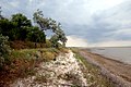
Ukraine has 50 Ramsar sites designated as Wetlands of International Importance . Ramsar sites in Ukraine have a total surface area of approximately 802,604 hectares (1,983,280 acres). The Ramsar Convention on Wetlands came into effect for Ukraine on 1 December 1991. [1]

Contents

Ukraine Wetlands of International Importance

Name [1] Oblast Area (km2)DesignatedDescriptionImage
Bakota Bay [2] Khmelnytskyi
48°35′N26°56′E / 48.583°N 26.933°E / 48.583; 26.933 (Bakota Bay)
15.929 July 2004part of National Park "Podilski Tovtry", Dniester valley
Berda River mouth, Berdiansk Spit and Berdiansk Bay [3] Zaporizhzhia
46°44′N36°48′E / 46.733°N 36.800°E / 46.733; 36.800 (Berda River mouth)
18 Sea of Azov near Berdyansk
Bilosaraisk Bay, Bilosaraisk Spit [4] Donetsk
46°54′N37°20′E / 46.900°N 37.333°E / 46.900; 37.333 (Bilosaraisk Bay)
20 Sea of Azov near Yalta, Donetsk Oblast
Great Chapli Depression [5] Kherson
46°29′N33°51′E / 46.483°N 33.850°E / 46.483; 33.850 (Great Chapli Depression)
23.59part of Askania-Nova Reserve
Cheremske Mire Volyn 328 Cherems'ke boloto. Stend.jpg
Chilia branch (Kilia) Odesa 328 Danube Delta at Bystroye Channel Danube delta chart.png
Desna River floodplains Sumy
52°19′N33°23′E / 52.317°N 33.383°E / 52.317; 33.383 (Desna River floodplains)
42.7
Dnieper River Delta Kherson 260
Dnieper-Orli floodplains Dnipropetrovsk 25.6
Northern area of the Dniester Liman Odesa 200
Land of Dniester-Turunchuk Odesa 760
Karadag rocky shore habitat Crimea 2.24
Karkinitska and Dzharylgatska Bays Kherson, Crimea
46°00′N33°5′E / 46.000°N 33.083°E / 46.000; 33.083 (Karkinit and Dzharylgat Bays)
87023 November 1995The Karkinit Bay is a bay of the Black Sea that separates the southwestern Crimean Peninsula from mainland Ukraine. Tarkhankut.jpg
Lake Kartal Odesa 5
Cape Kazantyp rocky shore habitat Crimea
45°28′N35°51′E / 45.467°N 35.850°E / 45.467; 35.850 (Cape Kazantyp)
2.5129 July 2004A headland located in the northeastern part of the Crimean peninsula. Kazantyp.jpg
Kremenchuk Floodplains Poltava
Kryva Bay and Kryva Spit Donetsk 14
Kuhurluy Odesa 65
Molochnyi Estuary Zaporizhzhia 224 Molochnyi Lyman Kosykh.jpg
Obitochna Spit Zaporizhzhia 20
Cape Opuk nearshore habitat Crimea
45°01′N36°12′E / 45.017°N 36.200°E / 45.017; 36.200 (Cape Opuk)
7.75
Perebrody Peat Bogs Rivne 127.18
Polissya Marshes Zhytomyr 21.45Marshes, mires, and floodplains surrounded by upland pine forests in Polissia Nature Reserve
Prypiat River floodplains Volyn 120
Sasyk Lagoon Odesa 210 Sasyk Lagoon coast.jpg
Shahany-Alibei-Burnas lakes system Odesa 190
Shatsk Lakes Volyn 328.5The largest Ukrainian lake complex, with 23 lakes separated by peat bogs, meadows and forests.
Lower Smotrych River Khmelnytskyi 14.8
Stokhid River floodplains Volyn 100
Lake Synevyr Zakarpattia 0.29 Synevyr lake 1.jpg
Central Syvash Kherson, Crimea
46°07′N34°15′E / 46.117°N 34.250°E / 46.117; 34.250 (Central Syvash)
800
Eastern Syvash Kherson, Crimea 1,650
Tendra Bay Kherson 380
Tylihul Estuary Odesa, Mykolaiv 260 Tyligul Estuary.jpg
Yahorlyk Bay [6] Kherson, Mykolaiv 340separated from Dnieper-Bug Estuary by Kinburn Peninsula

Related Research Articles

<span class="mw-page-title-main">Protected areas of Poland</span>

Protected areas of Poland include the following categories, as defined by the Act on Protection of Nature of 16 April 2004, by the Polish Parliament:

References

  1. 1 2 "Ramsar List" (PDF). Ramsar.org. Retrieved 31 March 2013.
  2. http://wetlands.biomon.org/?p=216
  3. http://wetlands.biomon.org/?p=192
  4. http://wetlands.biomon.org/?p=190
  5. "Великий Чапельський під | Водно-болотні угіддя". Archived from the original on 25 December 2013. Retrieved 7 October 2018.
  6. http://wetlands.biomon.org/?p=188