Related Research Articles
WWVH is the callsign of the U.S. National Institute of Standards and Technology's shortwave radio time signal station located at the Pacific Missile Range Facility Barking Sands, in Kekaha, on the island of Kauai in the state of Hawaii.

The Wide Area Augmentation System (WAAS) is an air navigation aid developed by the Federal Aviation Administration to augment the Global Positioning System (GPS), with the goal of improving its accuracy, integrity, and availability. Essentially, WAAS is intended to enable aircraft to rely on GPS for all phases of flight, including precision approaches to any airport within its coverage area. It may be further enhanced with the Local Area Augmentation System (LAAS) also known by the preferred ICAO term Ground-Based Augmentation System (GBAS) in critical areas.
GPS·C was a Differential GPS data source for most of Canada maintained by the Canadian Active Control System, part of Natural Resources Canada. When used with an appropriate receiver, GPS·C improved real-time accuracy to about 1–2 meters, from a nominal 15 m accuracy.

There are over 9,300 Grade I listed buildings in England. This page is a list of the 111 of these buildings in the ceremonial county of the East Riding of Yorkshire. In the United Kingdom, the term listed building refers to a building or other structure officially designated as being of special architectural, historical or cultural significance; Grade I structures are those considered to be "buildings of exceptional interest". In England, the authority for listing under the Planning Act 1990 rests with Historic England, a non-departmental public body sponsored by the Department for Culture, Media and Sport.
This is a list of National Register of Historic Places properties and districts in downtown Baltimore, Maryland, United States. Many other properties are located in other parts of the city; for these, see National Register of Historic Places listings in Baltimore, Maryland.
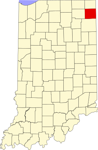
This is a list of the National Register of Historic Places listings in DeKalb County, Indiana.
This is a list of the National Register of Historic Places listings in Blackford County, Indiana.
This is a list of the National Register of Historic Places listings in Floyd County, Indiana.
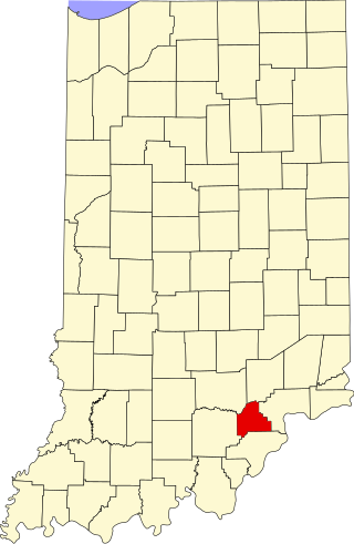
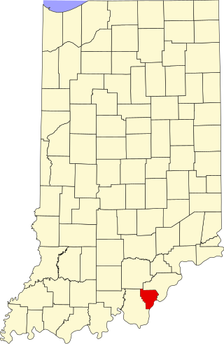
This is a list of the National Register of Historic Places listings in Scott County, Indiana.

This is a list of the National Register of Historic Places listings in Washington County, Indiana.

This is a list of the National Register of Historic Places listings in White County, Indiana.

This is a list of the National Register of Historic Places listings in Whitley County, Indiana.

This is a list of the National Register of Historic Places listings in Fountain County, Indiana.
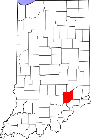
This is a list of the National Register of Historic Places listings in Jennings County, Indiana.

This is a list of the National Register of Historic Places listings in Noble County, Indiana.

This is a list of the National Register of Historic Places listings in Crawford County, Indiana.

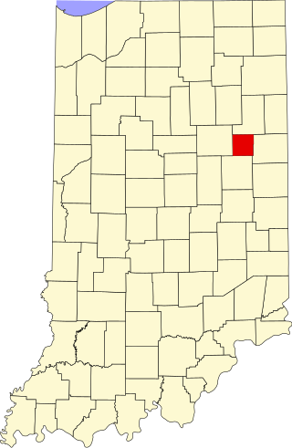
This is a list of the National Register of Historic Places listings in Tipton County, Indiana.
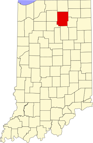
This is a list of the National Register of Historic Places listings in Kosciusko County, Indiana.
References
- ↑ NSTB/WAAS T&E Team (October 2008). "Wide-Area Augmentation System Performance Analysis Report #26" (PDF). Atlantic City International Airport, New Jersey: FAA/William J. Hughes Technical Center. pp. 93–95. Retrieved 2009-01-17.