Related Research Articles

The Bwindi Impenetrable National Park (BINP) is in southwestern Uganda. The park is part of the Bwindi Impenetrable Forest and is situated along the Democratic Republic of the Congo (DRC) border next to the Virunga National Park and on the edge of the Albertine Rift. Composed of 321 square kilometres (124 sq mi) of both montane and lowland forest, it is accessible only on foot. BINP is a United Nations Educational, Scientific and Cultural Organization-designated World Heritage Site.
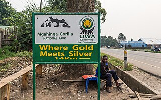
Mgahinga Gorilla National Park is a national park in southwestern Uganda. It was created in 1991 and covers an area of 33.9 km2 (13.1 sq mi).
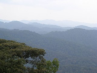
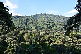
The Albertine Rift montane forests is a tropical moist broadleaf forest ecoregion in east-central Africa. The ecoregion covers the mountains of the northern Albertine Rift, and is home to distinct Afromontane forests with high biodiversity.

Semuliki National Park is a national park in Bwamba County, a remote part of the Bundibugyo District in the Western Region of Uganda that was established in October 1993. It encompasses 219 km2 (85 sq mi) of East Africa's only lowland tropical rainforest. It is one of the richest areas of floral and faunal biodiversity in Africa, with bird and butterfly species being especially diverse. The park is managed by the Uganda Wildlife Authority.
Uganda Wildlife Authority (UWA) is a semi-autonomous Ugandan government agency that aims to conserve, manage and regulate Uganda’s wildlife. "UWA is mandated to ensure sustainable management of wildlife resources and supervise wildlife activities in Uganda, both within and outside the protected areas". As of April 2020, UWA manages ten national parks, twelve wildlife reserves, and fourteen wildlife sanctuaries. UWA also provides guidance for five community wildlife areas. It is governed by a board of trustees appointed by the Minister of Tourism, Wildlife and Antiquities, currently Tom Butime.
The Institute of Tropical Forest Conservation (ITFC) is a post-graduate research institute based in the Bwindi Impenetrable Forest, in south-western Uganda. The institute is a semi-autonomous part of Mbarara University of Science and Technology and is focused on research, training, and monitoring for conservation management in the Albertine Rift ecoregion.
Guramwa Central Forest Reserve is a protected area located in Western Uganda's Kibaale district. It is managed by the National Forestry Authority and was first gazetted in 1932 under the National Forestry and Tree Planting Act, 2003 with an area of 230 ha (0.9 sq mi), and was later re-gazetted in 1968 with an area of 1,550 ha.
North Rwenzori Central Forest Reserve is a protected tropical forest situated between Bundibugyo District and Ntoroko District in Western Uganda. This Natural Forest Reserve is at the foothills of the Rwenzori Mountains east of the Democratic Republic of Congo.
Rwensambya Central Forest Reserve is a tropical forest located in Kyegegwa district. It covers an area of 671 hectares.
Rwengiri Central Forest Reserve is a protected tropical forest that is located in Rukungiri district in Western Uganda. It covers an area of 155 km2. It managed by the National Forestry Authority. Its WPDA ID is 40357. It was designated a reserve in 1968.
Ruzaire Central Forest Reserve is a protected high forest located in Kibaale district which is in the located within the Albertine Region. It covers an area of 1194.94 hectares. It is managed by the National Forestry Authority.
Kagombe Central Forest Reserve is a 301-square-kilometre (74,000-acre) forest reserve located in Western Uganda's district of Kagadi and Nyamarundu sub county. It is also located in Uganda's Albertine Rift ecoregion area renowned for its rich biodiversity.
Muhangi Central Forest Reserve is a protected area located in Western Uganda's Kyenjojo district. Muhangi forest is a closed tropical forest that protects the banks of river Muzizi. It spans an area of 2,044 hectares. It is also located in the Ugandan Albertine Rift, Muzizi River Catchment Area since the River Muzizi runs along the northern part of Muhangi Central Forest Reserve.
Mount Kei Central Forest Reserve is a protected area located in Koboko district, in the extreme north-west of Uganda. It covers an area of 384 square kilometers and is known for its diverse ecosystem consisting of dense savanna vegetation, forest, scrubland and a wide range of wildlife.
Katenta Local Forest Reserve is protected forest that is located in Kabarole District in western Uganda within the Ugandan Albertine Rift. It is managed by National Forestry Authority. Its WPDA ID is 315231. It was declared a forest reserve in 1965. It covers an area of 5.10 km2.
Kebisoni Local Forest Reserve is a protected forest that is located with in Rubabo Subcounty in Rukungiri District in western Uganda. It It is managed by National Forestry Authority. Its WPDA ID is 40367. It was declared a forest reserve in 1998. It covers an area of 0.06 km2.
Kasato Central Forest Reserve is a protected tropical forest that is located in Kiryanga subcounty in Kagadi District in Western Uganda. It covers an area of 26.82 km2(2691 hectares) It managed by the National Forestry Authority. It was designated a reserve in 1965. Its WPDA ID is 39988.
Muhunga Central Forest Reserve is a protected tropical forest that is located in Kyebando sub-county in Kibaale District in Western Uganda. It covers an area of 4.12 km2. It managed by the National Forestry Authority. It was designated a reserve in 1965. Its WPDA ID is 39992.
References
- 1 2 3 "Uganda Wildlife Authority - UWA". ugandawildlife.org. 2022-04-30. Retrieved 2023-06-05.
- ↑ Andrew, Plumptre (2002). Extent and Status of the Forests in the Ugandan Albertine Rift (PDF). Uganda. p. 43.
{{cite book}}: CS1 maint: location missing publisher (link)