List of county routes in Rensselaer County, New York

Last updated

2017-09-10 15 04 46 View east along Plank Road (Rensselaer County Route 40) at Dutch Church Road (Rensselaer County Route 41) in the Bucks Corner section of Berlin, Rensselaer County, New York.jpg
Rensselaer County Route 40 reassurrance marker, an example of the type used in the county.
Highway names
Interstates Interstate X (I-X)
US Highways U.S. Route X (US X)
State New York State Route X (NY X)
County:County Route X (CR X)
System links

County routes in Rensselaer County, New York, are maintained by the Rensselaer County Highway Department and signed with the Manual on Uniform Traffic Control Devices-standard yellow-on-blue pentagon route marker. Routes generally do not enter cities or incorporated villages, except for CRs 117 & 118 in Valley Falls. County route numbers are assigned in clusters by town, with the number indicating the town that most of the route lies within:

Contents

Each route entry below contains a link to its relation in OpenStreetMap (OSM).

Routes 1–53

RouteLength
(mi) [1]
Length
(km)
FromViaToOSM
relation
Notes
CR 1 jct.svg CR 14.076.55 Columbia County line (becomes CR 21)Muitzkill Road in Schodack NY 9J 354407
CR 2 jct.svg CR 24.276.87 NY 9J Schodack Landing Road in Schodack Columbia County line 355652
CR 3 jct.svg CR 33.946.34CR 6South Schodack Road in Schodack CR 2 355662
CR 4 jct.svg CR 44.417.10CR 1Van Hoesen Road in Schodack US 9 355665
CR 5 jct.svg CR 52.644.25 NY 150 in Schodack Brookview RoadCR 58 in East Greenbush 355667 Formerly designated as CR 18 [2]
CR 6 jct.svg CR 63.415.49 Castleton-on-Hudson village lineMaple Hill Road in Schodack US 9 355670
CR 7 jct.svg CR 73.605.79 Nassau village lineSchodack–Nassau Road in Schodack NY 150 339390
CR 8 jct.svg CR 81.502.41 NY 9J Stony Point Road in Schodack Western Road 355674
CR 9 jct.svg CR 90.450.72 NY 150 Lauster Terrace in Schodack Cul-de-sac at US 9  / US 20 1527221
CR 15 jct.svg CR 155.288.50 Nassau village lineNassauAverill Park Road in Nassau CR 18 / CR 50 / CR 51 355675
CR 16 jct.svg CR 164.357.00CR 15Central Nassau Road in Nassau NY 66  / CR 21 355677
CR 17 jct.svg CR 171.642.64 US 20 Lyons Lake Road in Nassau Coldwater Tavern Road 355680
CR 18 jct.svg CR 183.355.39CR 15 / CR 50 / CR 51Hoags Corners Road in Nassau CR 16 351747 Formerly designated as CR 37 [2]
CR 19 jct.svg CR 190.250.40 Columbia County line (becomes CR 13)Brainard Station Road in Nassau US 20  / NY 66 660987
CR 20 jct.svg CR 200.540.87CR 18Totem-Lodge Road in Nassau Northwest corner of Burden Lake Country Club 352245
CR 21 jct.svg CR 212.854.59 NY 66  / CR 16Dunham-Hollow Road in Nassau NY 43 355681
CR 23 jct.svg CR 234.226.79CR 26Horse Heaven and South roads in Stephentown NY 43 355683
CR 26 jct.svg CR 268.3513.44 NY 66 in Nassau Garfield–East Nassau Road NY 43 in Stephentown 355685
CR 27 jct.svg CR 273.475.58 Columbia County line (becomes CR 9)South Stephentown Road in Stephentown CR 26 355708
CR 28 jct.svg CR 283.084.96CR 26Presbyterian Hill and Wyomanock roads in Stephentown NY 22 355711
CR 29 jct.svg CR 290.851.37 Columbia County line (becomes CR 5A)West Street in Stephentown CR 28 355715
CR 31 jct.svg CR 313.084.96 NY 43 Cranston Hill and West roads in Stephentown NY 22 355721
CR 32 jct.svg CR 320.300.48Rensselaer County Highway Department GarageLodge and Sand Bank roads in Berlin NY 22 1524200
CR 33 jct.svg CR 334.477.19 NY 43 East and Giles roads in Stephentown NY 22 355732
CR 36 jct.svg CR 361.352.17 NY 22 Main Street in Berlin NY 22 361139
CR 37 jct.svg CR 373.585.76CR 38 in Berlin Cold Springs and Jones Hollow roadsCR 90 in Petersburgh 355737
CR 38 jct.svg CR 382.213.56CR 36Green Hollow Road in Berlin CR 37 354376
CR 39 jct.svg CR 392.023.25CR 40Dyken Pond Road in Berlin Fifty Six Road 354375 Formerly designated as CR 62 [2]
CR 40 jct.svg CR 4013.0020.92 NY 351  / NY 355 in Poestenkill Plank RoadCR 36 in Berlin 352456
CR 41 jct.svg CR 412.894.65CR 42Dutch Church Road in Berlin CR 40 352760 Formerly designated as CR 44 [2]
CR 42 jct.svg CR 428.5213.71 NY 43  / NY 66 in Sand Lake Taborton RoadCR 41 in Berlin 352726
CR 43 jct.svg CR 432.894.65CR 42 in Sand Lake Mosher and Oak Hill roadsCR 40 in Poestenkill 352819
CR 44 jct.svg CR 441.492.40CR 79Columbia Hill Road in Poestenkill CR 40 352869
CR 45 jct.svg CR 45 1.482.38 NY 43 Averill Park Road in Sand Lake NY 66 352061 Former routing of NY 66
CR 47 jct.svg CR 472.103.38 Nassau town lineNorth Nassau and Holcomb roads in Sand Lake CR 49 352244
CR 48 jct.svg CR 48 [3] NY 43  / NY 66  / CR 42Miller Hill Road in Sand Lake NY 66Transferred to state on April 1, 1980; [4] now part of NY 66
CR 49 jct.svg CR 492.203.54 NY 43  / NY 66 Eastern Union Turnpike in Sand Lake NY 43 352062
CR 50 jct.svg CR 502.353.78 NY 150  / CR 55 in Sand Lake Millers Corners RoadCR 15 / CR 18 / CR 51 in Nassau 351746 Formerly designated as CR 17 [2]
CR 51 jct.svg CR 513.876.23CR 15 / CR 18 / CR 50 in Nassau Burden Lake Road NY 43 in Sand Lake 351795
CR 52 jct.svg CR 522.363.80 NY 150 Sheer Road in Sand Lake CR 51 339418
CR 53 jct.svg CR 533.756.04 NY 151 in East Greenbush Best Luther and Old Best roads NY 43 in Sand Lake 351657

Routes 54–105

RouteLength
(mi) [1]
Length
(km)
FromViaToOSM
relation
Notes
CR 54 jct.svg CR 541.091.75 Schodack town lineMiller Road in East Greenbush NY 151 351703
CR 55 jct.svg CR 55 (1) [fn 1] 0.370.60 Rensselaer city lineWashington Avenue in North Greenbush CR 65 341467 Formerly part of NY 43
CR 55 jct.svg CR 55 (2) [fn 1] 5.839.38 NY 43 in North Greenbush Best Road NY 150  / CR 50 in Sand Lake 341467 Formerly NY 152
CR 56 jct.svg CR 562.834.55 US 9  / US 20 Elliot Road in East Greenbush NY 151 352342
CR 57 jct.svg CR 571.422.29CR 58Phillips Road in East Greenbush US 9  / US 20 352931 Formerly designated as CR 36 [2]
CR 58 jct.svg CR 582.153.46 NY 9J Hays Road in East Greenbush US 9  / US 20 352932
CR 59 jct.svg CR 590.681.09 US 9  / US 20 Sherwood Avenue in East Greenbush NY 151 353181 Formerly designated as CR 53 [2]
CR 60 jct.svg CR 601.061.71 US 9  / US 20 Eastern and Hampton avenues in East Greenbush NY 151 353182
CR 63 jct.svg CR 630.300.48 NY 151 Red Mill Road in East Greenbush Rensselaer city line 354388
CR 65 jct.svg CR 65 (1) [fn 2] 0.340.55 US 4 South Bloomingrove Road in North Greenbush Dead end 354399
CR 65 jct.svg CR 65 (2) [fn 2] 2.804.51Dead endBloomingrove Road in North Greenbush NY 136 354399
CR 66 jct.svg CR 661.702.74CR 65Reynolds and Lape roads in North Greenbush NY 43 355753
CR 67 jct.svg CR 673.956.36 NY 43 Geiser Road, Troy Avenue, and Hidley Road in North Greenbush NY 136 355759
CR 68 jct.svg CR 687.2611.68CR 65 in North Greenbush Snyders Lake and Snyders Corners roads NY 351 in Poestenkill 355765
CR 69 jct.svg CR 691.702.74 NY 43 Peck Road in North Greenbush CR 68 355770
CR 71 jct.svg CR 711.201.93CR 67Edwards Road in North Greenbush NY 150 355771
CR 74 jct.svg CR 74 2.754.43 US 4 Winter Street Extension and Cameron Road in North Greenbush NY 136 355776 Winter Street portion was formerly part of NY 405
CR 75 jct.svg CR 751.191.92 NY 66 in North Greenbush Sharpe RoadCR 130 in Brunswick 356286
CR 76 jct.svg CR 760.861.38Dead endGlenmore Road in North Greenbush US 4  / NY 136 356300
CR 79 jct.svg CR 796.7610.88CR 40 in Poestenkill Blue Factory Road NY 2 in Brunswick 356311
CR 80 jct.svg CR 802.904.67CR 79Madonna Lake Road in Grafton CR 85 356546
CR 84 jct.svg CR 842.203.54 NY 2 Old State Road in Grafton NY 2 356547
CR 85 jct.svg CR 853.044.89CR 80South Road in Grafton NY 2 356550
CR 87 jct.svg CR 876.5210.49 NY 2 in Grafton Babcock Lake Road NY 7 in Hoosick 356559
CR 88 jct.svg CR 884.917.90 NY 2 in Grafton Taconic Lake and Toad Point roadsCoon Brook Road in Petersburgh 356564 Formerly designated as CR 85 [2]
CR 90 jct.svg CR 900.721.16Hewett RoadRiver Road in Petersburgh NY 2 356606
CR 91 jct.svg CR 912.133.43 NY 2 East Hollow Road in Petersburgh NY 2 356633
CR 92 jct.svg CR 921.171.88 NY 2 Dayfoot Road in Petersburgh NY 2 356650
CR 94 jct.svg CR 941.732.78 NY 2 Dill Brook Road in Petersburgh NY 22 356670
CR 95 jct.svg CR 955.208.37 NY 346 in Petersburgh Petersburg Junction and Hill roads Hoosick Falls village line in Hoosick 356684
CR 96 jct.svg CR 962.043.28CR 95Indian Massacre Road in Petersburgh Vermont state line 356708
CR 98 jct.svg CR 982.804.51Fox Hollow Road at Grafton town lineRabbit College Road in Petersburgh NY 22  / NY 346 356713
CR 100 jct wide.svg CR 1003.766.05CR 95Breese Hollow Road in Hoosick NY 7 356719
CR 101 jct wide.svg CR 1011.031.66 Hoosick Falls village lineBall Street Extension in Hoosick CR 102 356721
CR 102 jct wide.svg CR 1024.947.95 NY 22 Johnson Hill and East Hoosick roads in Hoosick NY 7 356722
CR 103 jct wide.svg CR 1038.4213.55 NY 7 in Hoosick Buskirk–West Hoosick and Pine Valley roads Washington County line in Hoosick (becomes CR 59) 357071 Discontinuous from CR 105 to 1.92 miles (3.09 km) east of CR 105
CR 104 jct wide.svg CR 1043.605.79CR 103Clay Hill Road in Hoosick Hoosick Falls village line 357478 Formerly designated as CR 12 [2]
CR 105 jct wide.svg CR 1051.933.11 NY 7 Spicer and Windy Hill roads in Hoosick CR 103 357480

Routes 109–145

RouteLength
(mi) [1]
Length
(km)
FromViaToOSM
relation
Notes
CR 109 jct wide.svg CR 1094.637.45 NY 7  / CR 129 in Pittstown Simmons and Groveside roadsCR 103 in Hoosick 357481 Formerly designated as CR 63 [2]
CR 110 jct wide.svg CR 1100.711.14CR 115Tomhannock Village Road in Pittstown CR 113 357483 Formerly extended to CR 109
CR 111 jct wide.svg CR 1117.4211.94 NY 7 in Pittstown Parker School, Lewis, and Pittstown–Johnsville roadsCR 114 in Schaghticoke 357493
CR 112 jct wide.svg CR 1120.540.87CR 114Long Meadow Road in Schaghticoke CR 111 357524
CR 113 jct wide.svg CR 1133.205.15CR 110TomhannockJohnsonville Road in Pittstown CR 111 357527
CR 114 jct wide.svg CR 1145.028.08 NY 67 Master Street in Schaghticoke Washington County line (becomes CR 74) 357531
CR 115 jct wide.svg CR 1155.739.22 NY 7 Tomhannock Reservoir Road in Pittstown CR 117 357534 Formerly designated as CR 107 [2]
CR 116 jct wide.svg CR 1160.260.42 Troy city lineBrickyard Road in Schaghticoke NY 40 357600
CR 117 jct wide.svg CR 117 6.2810.11 NY 40 in Schaghticoke MelroseValley Falls Road and State Street NY 67 in Valley Falls 357538 Formerly part of NY 40A
CR 118 jct wide.svg CR 1181.943.12CR 115 in Pittstown Stover RoadCR 117 in Valley Falls 357541
CR 119 jct wide.svg CR 1191.362.19CR 117Madigan Road in Schaghticoke CR 117 357543
CR 120 jct wide.svg CR 1200.921.48CR 125River Road in Schaghticoke Washington County line (becomes CR 113) 357544
CR 121 jct wide.svg CR 1215.048.11CR 122River Road in Schaghticoke NY 67 357568
CR 122 jct wide.svg CR 1221.933.11CR 121Calhoun Drive in Schaghticoke NY 40 357569
CR 123 jct wide.svg CR 1232.143.44 NY 7 Ford Road in Pittstown Cushmen Road 357570
CR 124 jct wide.svg CR 1240.841.35 Troy city lineNew Turnpike and Haughney roads in Schaghticoke Old railroad grade 357576
CR 125 jct wide.svg CR 125 4.467.18 NY 915C at Champlain Canal Lock 4Stillwater Bridge Road in Schaghticoke NY 40  / NY 67 357549 Former routing of NY 67
CR 126 jct wide.svg CR 1264.567.34 NY 40 in Schaghticoke Fogarty and Cooksboro roads NY 7 in Brunswick 357585
CR 127 jct wide.svg CR 1270.580.93 Troy city lineRiver Road in Schaghticoke CR 124 357577
CR 128 jct wide.svg CR 1283.595.78 Troy city line in Brunswick Plank RoadCR 126 in Pittstown 357612
CR 129 jct wide.svg CR 1299.1414.71 NY 278 in Brunswick Tamarac Road NY 7  / CR 109 in Pittstown 357613
CR 130 jct wide.svg CR 130 3.495.62 Troy city line in Brunswick Spring Avenue Extension NY 355 in Poestenkill 357619 Formerly part of NY 154
CR 132 jct wide.svg CR 1321.312.11CR 137Dater Hill Road in Brunswick Dearstyne Road 357655
CR 133 jct wide.svg CR 1332.103.38 NY 2 Moonlawn Road in Brunswick NY 278 357659
CR 134 jct wide.svg CR 1342.714.36 NY 7 Mcchesney Avenue and McChesney Avenue Extension in Brunswick CR 133 357660
CR 135 jct wide.svg CR 1351.602.57CR 134Town Office Road in Brunswick NY 7 357663
CR 137 jct wide.svg CR 1372.744.41 NY 355 in Poestenkill Garfield Road NY 2 in Brunswick 357667
CR 139 jct wide.svg CR 1391.973.17CR 130Creek Road in Brunswick NY 2 357690
CR 140 jct wide.svg CR 1402.904.67 Troy city linePinewood Avenue in Brunswick NY 2 357692
CR 141 jct wide.svg CR 1410.610.98 Troy city lineSouth Lake Avenue in Brunswick Troy city line 357694
CR 142 jct wide.svg CR 1420.460.74 Troy city lineMountainview Avenue in Brunswick CR 130 357699
CR 144 jct wide.svg CR 1442.504.02 Troy city lineNorth Lake Avenue in Brunswick NY 142 357695 Part of NY 317 from the early 1940s [5] [6] to April 14, 1980. [7] [fn 3]
CR 145 jct wide.svg CR 145 1.322.12 Troy city lineOakwood Avenue in Brunswick Troy city line 357700 Entire length overlaps with NY 40

See also

Notes

  1. 1 2 The two segments of CR 55 were originally connected; however, they were split when NY 43 was realigned through the area.
  2. 1 2 The two segments of CR 65 were originally connected; however, they were split when NY 43 was realigned through the area.
  3. NY 317 continued south along North Lake Avenue to NY 7 in Troy.

Related Research Articles

<span class="mw-page-title-main">New York State Route 2</span> State highway in Albany and Rensselaer counties in New York, US

New York State Route 2 (NY 2) is a state highway in the Capital District of New York in the United States. It extends for 30.89 miles (49.71 km) from an interchange with Interstate 87 (I-87) and NY 7 in the town of Colonie to the Massachusetts state line in Petersburgh, where it continues to Boston as Massachusetts Route 2. The route passes through the cities of Watervliet and Troy, where it connects to NY 32 and U.S. Route 4, respectively. In Grafton, located midway between Troy and Massachusetts, NY 2 serves Grafton Lakes State Park.

Montauk Highway is an east–west road extending for 95 miles (153 km) across the southern shore of Long Island in Suffolk County, New York, in the United States. It extends from the Nassau County line in Amityville, where it connects to Merrick Road, to Montauk Point State Park at the very eastern end of Long Island in Montauk. The highway is known by several designations along its routing, primarily New York State Route 27A (NY 27A) from the county line to Oakdale and NY 27 east of Southampton. The portion of Montauk Highway between Oakdale and Southampton is mostly county-maintained as County Route 80 and County Route 85.

<span class="mw-page-title-main">New York State Route 151</span> State highway in Rensselaer County, New York, US

New York State Route 151 (NY 151) is an 8.23-mile (13.24 km) state highway located in Rensselaer County, New York, in the United States. Its western terminus is at an interchange with the U.S. Route 9 (US 9) and US 20 in Rensselaer, and its eastern terminus is at a junction with NY 150 in Shivers Corners, a hamlet in the town of Schodack. It also has an intersection with US 4 in East Greenbush. NY 151 was assigned to most of its current alignment as part of the 1930 renumbering of state highways in New York. In Rensselaer, NY 151 has been altered several times, with the most recent change coming in the late 1990s. The current western terminus of NY 151 was once the western terminus of NY 43.

<span class="mw-page-title-main">New York State Route 82</span> State highway in New York, US

New York State Route 82 (NY 82) is a state highway in the eastern Hudson Valley of New York in the United States. It begins at an junction with NY 52 northeast of the village of Fishkill, bends eastward towards Millbrook, and then returns westward to end at a junction with U.S. Route 9, NY 9H, and NY 23 at Bell Pond, near Claverack. NY 82 meets the Taconic State Parkway twice; it is the only state highway that has more than one exit with the parkway. The road spans two counties: Dutchess and Columbia.

<span class="mw-page-title-main">New York State Route 43</span> State highway in Rensselaer County, New York, US

New York State Route 43 (NY 43) is a state highway in Rensselaer County, New York, in the United States. It extends for 24.00 miles (38.62 km) from Interstate 90 (I-90) exit 8 in North Greenbush to the Massachusetts state line, where it continues into Williamstown as Massachusetts Route 43. Most of NY 43 is a two-lane highway that passes through a mixture of rural and residential areas; however, its westernmost 2 miles (3.2 km) between I-90 and U.S. Route 4 (US 4) is a four-lane divided highway. NY 43 has an overlap with NY 66 in Sand Lake and intersects NY 22 in Stephentown.

<span class="mw-page-title-main">New York State Route 40</span> State highway in eastern New York, US

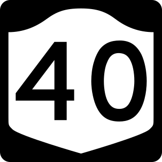
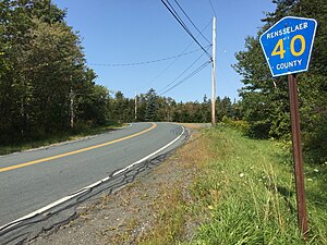
New York State Route 40 (NY 40) is a north–south state highway in eastern New York in the United States. It is 54.67 miles (87.98 km) long and runs from NY 7 in the city of Troy north to NY 22 in the town of Granville. NY 40 also passes through the villages of Schaghticoke and Argyle and enters the vicinity of the village of Greenwich. It intersects three east–west highways of note: NY 67 just outside Schaghticoke, NY 29 west of Greenwich, and NY 149 in the hamlet of Hartford. Incidentally, NY 40 has overlaps with all three routes.

<span class="mw-page-title-main">New York State Route 378</span> State highway in New York, US

New York State Route 378 (NY 378) is a state highway in the Capital District of New York in the United States. It runs from Loudonville to Troy and traverses the Hudson River via the Menands Bridge. NY 378 once connected to Menands Road in the village of Menands; however, Menands Road has since been split in two by a now-closed exit ramp. NY 378 connects the western part of Menands Road with Troy. It also connects with NY 377 at Van Rensselaer Boulevard. NY 378 continues west of U.S. Route 9 (US 9) as Osborne Road. At its eastern terminus, NY 378 continues north as US 4. US 4 southbound is accessed by an eastward turn at the terminus.

<span class="mw-page-title-main">New York State Route 340</span> State highway in Rockland County, New York, US

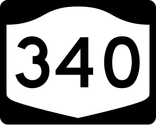
New York State Route 340 (NY 340) is a 3.10-mile (4.99 km) state highway in southeastern Rockland County, New York, in the United States. Though it is signed as an east–west route, it actually follows a north–south alignment. The southern terminus of the route is at the New Jersey state line in Palisades, where it becomes County Route 501 (CR 501). The northern terminus is at an intersection with NY 303 in Orangeburg; however, according to the New York State Department of Transportation (NYSDOT), the route continued for another 0.07 miles (0.11 km) to the northwest of NY 303 until by 2017. NY 340 was assigned to part of its modern routing in the early 1930s and extended to its current length in the early 1940s.

<span class="mw-page-title-main">New York State Route 9J</span> State highway in New York, US

New York State Route 9J (NY 9J) is a north–south state highway in the Hudson Valley region of New York in the United States. It begins at an intersection with US 9 in the Columbia County town of Stockport and extends for 22.35 miles (35.97 km) to an interchange with US 9 and US 20 in the Rensselaer County city of Rensselaer. The route parallels the Hudson River for its entire length, and several parts of the highway run directly alongside the river. NY 9J was assigned to its current alignment as part of the 1930 renumbering of state highways in New York.

<span class="mw-page-title-main">New York State Route 142</span> State highway in Rensselaer County, New York, US

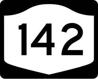
New York State Route 142 (NY 142) is a north–south state highway in Rensselaer County, New York, in the United States. The southern terminus is at an intersection with NY 7 in the hamlet of Brunswick Center within the town of Brunswick. Its northern terminus is at U.S. Route 4 (US 4) in the neighborhood of Lansingburgh within the city of Troy. NY 142 serves as a northeasterly bypass of Troy.

<span class="mw-page-title-main">New York State Route 66</span> State highway in New York, US

New York State Route 66 (NY 66) is a state highway in the Capital District of New York in the United States. The route begins at an intersection with US 9 and NY 23B in the Columbia County city of Hudson and ends at a junction with NY 2 in the Rensselaer County city of Troy. While both Hudson and Troy are located on the Hudson River, NY 66 follows a more inland routing between the two locations to serve several rural villages and hamlets, including Chatham and Sand Lake. NY 66 overlaps with U.S. Route 20 (US 20) and NY 43, two regionally important east–west highways, in Nassau and Sand Lake, respectively.

<span class="mw-page-title-main">New York State Route 351</span> State highway in Rensselaer County, New York, US

New York State Route 351 (NY 351) is a north–south state highway in central Rensselaer County, New York, in the United States. It extends for 8.16 miles (13.13 km) from an intersection with NY 43 in the Sand Lake hamlet of West Sand Lake to a junction with NY 2 in the Brunswick hamlet of Cropseyville. The portion of NY 351 north of the hamlet of Poestenkill was originally designated as New York State Route 153 in the 1930s. This designation was removed in the 1940s, and the West Sand Lake–Cropseyville roadway became County Route 77 (CR 77) sometime afterward. On April 1, 1980, all of CR 77 was transferred to the state of New York, at which time it was redesignated as NY 351 by the New York State Department of Transportation (NYSDOT).

<span class="mw-page-title-main">New York State Route 355</span> State highway in Rensselaer County, New York, US

New York State Route 355 (NY 355) is an east–west state highway in Rensselaer County, New York, in the United States. The western terminus of the route is at an intersection with NY 66 in the town of North Greenbush. Its eastern terminus is at a junction with NY 351 in the hamlet of Poestenkill within the town of the same name. NY 355 originally consisted only of the section of the route between NY 66 and Spring Avenue; however, it was extended east to Postenkill hamlet in 1980, partially replacing NY 154.

<span class="mw-page-title-main">New York State Route 136</span> State highway in Rensselaer County, New York, US

New York State Route 136 (NY 136) is a state highway within the town of North Greenbush in Rensselaer County, New York, in the United States. It begins at an intersection with U.S. Route 4 (US 4) just south of Troy and ends at a junction with NY 150 in the hamlet of Wynantskill. NY 136 provides access to Hudson Valley Community College, located in an otherwise residential area of suburban Troy. The route was assigned in the late 1930s as a connector between US 4 and Winter Street, then part of NY 40. NY 136 was extended to its current length in 1980.

<span class="mw-page-title-main">New York State Route 915E</span>

New York State Route 915E (NY 915E) is an unsigned reference route designation for Third Avenue Extension in East Greenbush, located in Rensselaer County, New York, in the United States. The east–west highway extends for 1.67 miles (2.69 km) from an intersection with NY 151 east of the Rensselaer city limits to a junction with U.S. Route 4 (US 4) south of the hamlet of Defreestville. NY 915E was designated as New York State Route 381 from the late 1930s to 1962 and part of NY 43 from that time to the late 1990s, when it gained its current designation.

<span class="mw-page-title-main">Interstate 90 in New York</span> Section of Interstate Highway in New York, United States

Interstate 90 (I-90) is a part of the Interstate Highway System that runs from Seattle, Washington, to Boston, Massachusetts. In the US state of New York, I-90 extends 385.48 miles (620.37 km) from the Pennsylvania state line at Ripley to the Massachusetts state line at Canaan, and is the second-longest highway in the state after New York State Route 17 (NY 17). Although most of the route is part of the tolled New York State Thruway, two non-tolled sections exist along I-90. Within New York, I-90 has a complete set of auxiliary Interstates, which means that there are Interstates numbered I-190 through I-990 in the state, with no gaps in between. For most of its length in New York, I-90 runs parallel to the former Erie Canal route, NY 5, US Route 20 (US 20) and the CSX Transportation railroad mainline that traverses the state.

<span class="mw-page-title-main">U.S. Route 4 in New York</span> Highway in New York

U.S. Route 4 (US 4) is a part of the United States Numbered Highway System that runs from East Greenbush, New York, to Portsmouth, New Hampshire. In the U.S. state of New York, US 4 extends 79.67 miles (128.22 km) from an intersection with US 9 and US 20 in East Greenbush to the Vermont state line northeast of Whitehall. While the remainder of US 4 east of New York is an east–west route, US 4 in New York is signed north–south due to the alignment the route takes through the state. The portion of the route between Waterford and Whitehall is part of the Lakes to Locks Passage, an All-American Road.

<span class="mw-page-title-main">New York State Route 405</span>

New York State Route 405 (NY 405) was a state highway in Rensselaer County, New York, in the United States. It ran for 2.63 miles (4.23 km) between an intersection with U.S. Route 4 in North Greenbush and a junction with NY 66 just inside the Troy city limits. In between, NY 405 intersected NY 136. The entirety of NY 405 was originally part of NY 40. In the February–March 1973, NY 40 was truncated northward to NY 7 in northern Troy and its former routing from US 4 to NY 66 was assigned NY 405. Ownership and maintenance of most of NY 405 was transferred to Rensselaer County on April 1, 1980, at which time the parts of the route given to the county were redesignated as part of County Route 74 (CR 74).

<span class="mw-page-title-main">New York State Route 152</span>

New York State Route 152 (NY 152) was a 6.0-mile-long (9.7 km) east–west state highway in Rensselaer County, New York, in the United States. The western terminus of the route was at an intersection with U.S. Route 4 (US 4) and NY 43 in the town of North Greenbush. Its eastern terminus was at a junction with NY 150 in the town of Sand Lake. NY 152 was little more than a connector between the hamlets of Defreestville and Sliters.

References

  1. 1 2 3 "County Roads Listing - Rensselaer County" (PDF). New York State Department of Transportation. June 22, 2021. Retrieved August 13, 2021.
  2. 1 2 3 4 5 6 7 8 9 10 11 "Board Votes County Road Work In 14 Towns At Cost of $182,000". The Times Record. Troy, NY. June 9, 1954. Retrieved June 18, 2016 via Newspapers.com. Open Access logo PLoS transparent.svg
  3. Averill Park Digital Raster Quadrangle (Map). 1:24,000. New York State Department of Transportation. 1974. Retrieved May 30, 2010.
  4. New York State Legislature. "New York State Highway Law § 341" . Retrieved April 7, 2012.
  5. New York (Map). Cartography by General Drafting. Esso. 1940.
  6. New York with Pictorial Guide (Map). Cartography by General Drafting. Esso. 1942.
  7. New York State Department of Transportation (May 1986). Official Description of Highway Touring Routes, Bicycling Touring Routes, Scenic Byways, & Commemorative/Memorial Designations in New York State.