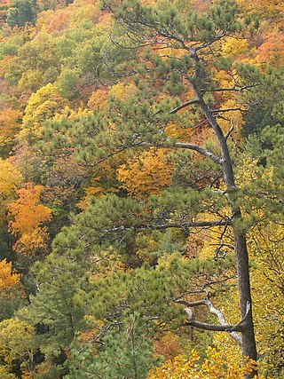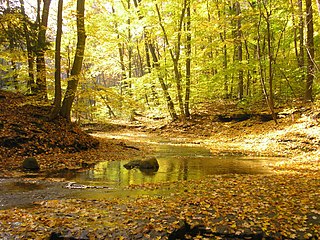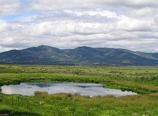
An ecoregion is an ecologically and geographically defined area that is smaller than a bioregion, which in turn is smaller than a biogeographic realm. Ecoregions cover relatively large areas of land or water, and contain characteristic, geographically distinct assemblages of natural communities and species. The biodiversity of flora, fauna and ecosystems that characterise an ecoregion tends to be distinct from that of other ecoregions. In theory, biodiversity or conservation ecoregions are relatively large areas of land or water where the probability of encountering different species and communities at any given point remains relatively constant, within an acceptable range of variation . Ecoregions are also known as "ecozones", although that term may also refer to biogeographic realms.

The Nearctic realm is one of the eight biogeographic realms constituting the Earth's land surface.

The Western European broadleaf forests is an ecoregion in Western Europe, and parts of the Alps. It comprises temperate broadleaf and mixed forests, that cover large areas of France, Germany and the Czech Republic and more moderately sized parts of Poland, Austria, Switzerland, Belgium and South Limburg (Netherlands). Luxembourg is also part of this ecoregion.

The Dinaric Mountains mixed forests are a terrestrial ecoregion of the temperate broadleaf and mixed forests biome in Southeastern Europe, according to both the WWF and Digital Map of European Ecological Regions by the European Environment Agency. It also is in the Palearctic realm.

The Eastern Great Lakes lowland forests is a temperate broadleaf and mixed forest ecoregion of North America, as defined by the World Wildlife Fund. It lies mostly in south and eastern Ontario and Quebec in Canada, and Upstate New York and Vermont in the United States.

Poland is part of four terrestrial ecoregions, one freshwater ecoregion, and one marine ecoregion.

The Western Great Lakes forests is a terrestrial ecoregion as defined by the World Wildlife Fund. It is within the temperate broadleaf and mixed forests biome of North America. It is found in northern areas of the United States' states of Michigan, Wisconsin and Minnesota, and in southern areas of the Canadian province of Manitoba and northwestern areas of the province of Ontario.

The Celtic broadleaf forests are a terrestrial ecoregion that covers most of the islands of Great Britain and Ireland.

The Southern Great Lakes lowland forests is a temperate broadleaf and mixed forest ecoregion of North America, as defined by the World Wildlife Fund. Located near the Great Lakes, it lies mostly in the central northeastern United States and extends into southeast central Canada. In modern times, little of it remains intact due to land use, including agriculture and urban uses.

The Central Anatolian deciduous forests, also known as the Central Anatolian woodlands and steppe, is a Palearctic ecoregion of the Temperate broadleaf and mixed forest biome. It is located in Central Anatolia, Asian Turkey.

Udegeyskaya Legenda National Park covers the richest coniferous-deciduous forest on the western slope of the Central Sikhote-Alin mountains of the Russian Far East. The Sikhote-Alin is a range that runs north-south through Primorsky Krai. The park is designed to protect west-slope river valley habitat, and to support the remnant of the indigenous Udege people. The area is known for abundant fishing and boating on the streams and rivers. It is also a refuge for the endangered Amur tiger. The park is roughly midway between the city of Vladivostok, and Khabarovsk. The relatively warm waters of the Sea of Japan are to the east, the Korean peninsula to the south, and China to the West.

Kalevalsky National Park covers one of the last old-growth boreal pine forest in Europe. It is situated on the border between Russia and Finland at about the midpoint from south to north. The park is located in the Republic of Karelia, 30 km north of the town of Kostomuksha. The Kalevala, an epic poem of Finnish and Karelian oral folklore, was drawn from this region. The traditional people of the area include the Sami people and the Karelians.

The Trans-Baikal conifer forests ecoregion covers a 1,000 km by 1,000 km region of mountainous southern taiga stretching east and south from the shores of Lake Baikal in the Southern Siberia region of Russia, and including part of northern Mongolia. Historically, the area has been called "Dauria", or Transbaikal. It is in the Palearctic realm, and mostly in the boreal forests/taiga biome with a subarctic, humid climate. It covers 200,465 km2 (77,400 sq mi).

The Patía Valley dry forests (NT0225) is an ecoregion in southwestern Colombia. It covers a dry valley surrounded by mountains. The original habitat has mostly been destroyed by human activity, although a few pockets remain.

The Central European mixed forests ecoregion is a temperate hardwood forest covering much of northeastern Europe, from Germany to Russia. The area is only about one-third forested, with pressure from human agriculture leaving the rest in a patchwork of traditional pasture, meadows, wetlands. The ecoregion is in the temperate broadleaf and mixed forest biome, and the Palearctic realm, with a Humid Continental climate. It covers 731,154 km2 (282,300 sq mi).

The Chao Phraya lowland moist deciduous forests is a tropical moist broadleaf forest ecoregion in Thailand. The ecoregion occupies the coastal lowlands along the Gulf of Thailand lying east and west of the Chao Phraya River.

The Alps conifer and mixed forests is a temperate broadleaf and mixed forests ecoregion in central Europe. It extends along the Alps mountains through portions of France, Italy, Switzerland, Germany, Liechtenstein, Austria, and Slovenia. The ecoregion extends from the lower slopes of the Alps to its peaks, which include Mont Blanc, at 4,809 m (15,778 ft) the highest peak in the Alps.


