List of hillforts in the Peak District

Last updated

This is a partial list of hillforts in the Peak District of England, arranged alphabetically. Most lie within the Peak District National Park. [1] [2] The sites are typically protected Scheduled Monuments.

Contents

NameImageLocationCountyNotesRefs
Ball CrossNear Bakewell

SK 2278 6912

Derbyshire Small promontory fort on a spur of Calton Hill (south of Ballcross Farm). Findings date from the Iron Age and Bronze Age. [3]
Burr Tor Great Hucklow

SK 1799 7832

Derbyshire Oval prehistoric enclosure. About 400m by 170m. It is now Camphill Airfield, home of Derbyshire and Lancashire Gliding Club. [4] [5]
Carl Wark Carl Wark - geograph.org.uk - 1091802.jpg Near Hathersage

SK 2595 8143

Derbyshire Fortified outcrop of Millstone Grit on Hathersage Moor. About 180m by 60m. Considered to date back to the Iron Age with evidence of use in Roman times. [6]
Castle Dike Langsett

SE 2063 0081

South Yorkshire Earthwork bank and ditch of an Iron Age univallate hillfort or enclosure. About 90m by 50m, on the flat top of Gilbert Hill. [7]
Castle Naze Castle Naze - geograph.org.uk - 153704.jpg Near Chapel-en-le-Frith

SK 0533 7843

Derbyshire Iron Age promontory hillfort on Combs Moss. Triangular in shape with sides of about 200m. [8]
Castle RIng Castle Ring, Harthill Moor.jpg Near Youlgreave

SK 2207 6284

Derbyshire It now consists of an oval earthwork ditch (about 5m wide and 100m across) with inner and outer banks, up to 2m high. It hasn't been excavated but it is considered to be an integral part of the Bronze Age landscape of Harthill Moor. [9]
Fin Cop Fin Cop Jonathan Clitheroe.jpg Near Ashford in the Water

SK 1743 7089

Derbyshire An Iron Age hillfort in Monsal Dale, constructed between 440BC and 390BC. [10]
Mam Tor Mam Tor from the south.jpg Near Castleton

SK 1277 8361

Derbyshire A univallate fort on the summit of the hill. About 400m by 300m. Nearby bowl barrows date from the Neolithic period and Bronze Age. [11]

See also

Further reading

Related Research Articles

<span class="mw-page-title-main">Mam Tor</span> Hill near Castleton in the High Peak of Derbyshire, England

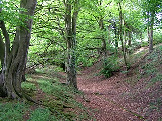
Mam Tor is a 517 m (1,696 ft) hill near Castleton in the High Peak of Derbyshire, England. Its name means "mother hill", so called because frequent landslips on its eastern face have resulted in a multitude of "mini-hills" beneath it. These landslips, which are caused by unstable lower layers of shale, also give the hill its alternative name of Shivering Mountain.

<span class="mw-page-title-main">History of Derbyshire</span> History of the county of Derbyshire in England

The history of Derbyshire can be traced back to human settlement since the last Ice Age, over 10,000 years ago. The county of Derbyshire in England dates back to the 11th century.

<span class="mw-page-title-main">Wolfscote Hill</span> Hill in the Derbyshire Peak District

Wolfscote Hill is a limestone hill near the village of Hartington in the Derbyshire Peak District. The summit is 388 metres (1,273 ft) above sea level.

<span class="mw-page-title-main">Fin Cop</span>

Fin Cop is a hill and an associated Iron Age hill fort in Monsal Dale, close to Ashford in the Water in Derbyshire, England.

<span class="mw-page-title-main">Clearbury Ring</span> Iron Age hillfort in Wiltshire, England

Clearbury Ring is a univallate Iron Age hillfort which is partly in the parish of Downton in the county of Wiltshire in south-west England, approximately 5 kilometres (3 mi) due south of Salisbury city centre. The site, which is a scheduled monument, straddles the boundary with Odstock parish, and a slight scarp runs across the interior of the fort, marking the parish boundary.

<span class="mw-page-title-main">Scheduled monuments in Taunton Deane</span>

Taunton Deane was a local government district with borough status in Somerset, England. It merged with West Somerset to form Somerset West and Taunton on 1 April 2019. Its council was based in Taunton. The district was formed on 1 April 1974, under the Local Government Act 1972, by a merger of the Municipal Borough of Taunton, Wellington Urban District, Taunton Rural District, and Wellington Rural District. Taunton Deane was granted borough status in 1975, enabling the mayoralty of Taunton to be continued, when other districts did not have mayors. The district was given the name of an alternate form of the Taunton Deane Hundred.

<span class="mw-page-title-main">Combs Moss</span> Hill in the Derbyshire Peak District

Combs Moss is a plateau-topped hill between Chapel-en-le-Frith and Buxton in Derbyshire, in the Peak District. The summit, Combs Head, is 503 metres (1,650 ft) above sea level. At its northern tip is a prehistoric promontory fort called Castle Naze.

<span class="mw-page-title-main">Combs Reservoir</span> English reservoir

Combs Reservoir is a canal-feeder reservoir in the Peak District National Park, close to Combs village in Derbyshire. The town of Chapel-en-le-Frith lies about 1 kilometre (0.62 mi) east of the reservoir.

<span class="mw-page-title-main">Wye Valley, Derbyshire</span> Valley in the Derbyshire Peak District

The Wye Valley is the limestone valley of the River Wye in the White Peak of Derbyshire, England. The source of the River Wye is west of Buxton on Axe Edge Moor. One main channel runs underground through Poole's Cavern. The river flows though Buxton Pavilion Gardens and then along a culvert under the town centre. After leaving the flat area of central Buxton, the Wye Valley becomes distinct as a gorge running east for 10 miles (16 km) before the valley broadens at Ashford-in-the Water.

<span class="mw-page-title-main">Harthill Moor</span> Hill in the Peak District of England

Harthill Moor is a small upland area in the Derbyshire Peak District of central and northern England, lying between Matlock and Bakewell near the villages of Birchover and Elton. The moor is within the southern portion of Harthill civil parish. Its highest point is 272 metres (892 ft) above sea level. The River Bradford flows along the northern edge of the moor past Youlgreave and into the River Lathkill at Alport. Harthill Moor is a rich prehistoric landscape with several protected Scheduled Ancient Monuments.

<span class="mw-page-title-main">Newton Grange, Derbyshire</span> Human settlement in England

Newton Grange is a civil parish in the Derbyshire Dales district of central Derbyshire. For administrative purposes it shares a parish council with the neighbouring parish of Eaton and Alsop. When the parish council was instituted in its present form in 1974, the parish contained eight farms and four dwellings. The western boundary of the parish is the River Dove, including the eastern side of part of Dovedale.

<span class="mw-page-title-main">Little Longstone</span> Human settlement in England

Little Longstone is a village and civil parish in Derbyshire, England. The village is on a minor road west of Great Longstone, just off the B6465 road from Wardlow to Ashford-in-the-Water. There is a Grade-II-listed Congregational Chapel and a public house, the Packhorse Inn, in the village. As in many small parishes, there is no parish council and local democracy is administered via a parish meeting.

This is a list of scheduled monuments in the district of High Peak in the English county of Derbyshire.

This is a list of scheduled monuments in the district of South Derbyshire in the English county of Derbyshire.

<span class="mw-page-title-main">Hollins Hill</span> Hill in the Derbyshire Peak District

Hollins Hill is a gritstone hill in the Derbyshire Peak District near the village of Hollinsclough. The summit is 450 metres (1,480 ft) above sea level. The hill is the source of Swallow Brook, which flows into the River Dove running along the south side of the hill.

References

  1. OL24 White Peak area (Map). 1:25000. Explorer. Ordnance Survey.
  2. OL1 Dark Peak area (Map). 1:25000. Explorer. Ordnance Survey.
  3. Historic England. "Details from listed building database (1011430)". National Heritage List for England. Retrieved 16 August 2020.
  4. Historic England. "Burr Tor prehistoric stock enclosure (1007562)". National Heritage List for England. Retrieved 12 August 2020.
  5. "Burr Tor". The Megalithic Portal. Retrieved 27 January 2021.
  6. Historic England. "Carl Wark slight univallate hillfort (1017504)". National Heritage List for England . Retrieved 27 January 2021.
  7. Historic England. "CASTLE DIKE (51075)". Research records (formerly PastScape). Retrieved 27 January 2021.
  8. Historic England. "Promontory fort on Combs Edge (1009294)". National Heritage List for England. Retrieved 16 August 2020.
  9. Historic England. "Castle Ring defended settlement (1008005)". National Heritage List for England. Retrieved 14 August 2020.
  10. Historic England. "Fin Cop promontory fort, bowl barrow and eighteenth century lime kiln with associated quarry (1011205)". National Heritage List for England. Retrieved 16 August 2020.
  11. Historic England. "Slight univallate hillfort and two bowl barrows on Mam Tor (1011206)". National Heritage List for England. Retrieved 16 August 2020.