List of hillforts on the Isle of Man

Last updated

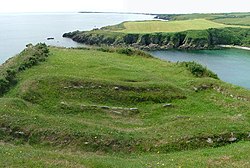
This is a list of hillforts on the Isle of Man . Found across Europe and the British Isles, hillforts are a type of prehistoric archaeological site dating to the Bronze Age and Iron Age, and to a lesser extent the post-Roman period. They are classically defined as small hilltop settlements fortified with earthworks, but many are not located on hills, and probably did not function as forts. [1] Their function is unclear; although conventionally interpreted as defensive fortifications [2] and centres of economic political power, [3] there is little evidence that they were ever attacked, [1] and more recent scholarship has suggested that they may be better interpreted as monuments. [4]

Contents

According to the Atlas of Hillforts of Britain and Ireland , there are up to twenty eight extant hillforts on Mann itself, and possibly two on the Calf of Man. All but two are on the coast. [5]

Ayre

Garff

Glenfaba

Middle

Rushen

Related Research Articles

<span class="mw-page-title-main">Promontory fort</span> Fortification, usually dating from the Iron Age

A promontory fort is a defensive structure located above a steep cliff, often only connected to the mainland by a small neck of land, thus using the topography to reduce the ramparts needed. Although their dating is problematic, most seem to date to the Iron Age. They are mainly found in Ireland, Brittany, the Orkney Islands, the Isle of Man, Devon, the Channel Islands and Cornwall.

<span class="mw-page-title-main">South Barrule</span>

The South Barrule is the highest hill in the south of the Isle of Man. It has the remains of a fort on its summit, which is traditionally the home of the Manx god of the sea Mannanan beg mac y Leir. The hill is largely surrounded by conifer plantations. On the south western slope of the hill the Cringle Reservoir was formed to supply water to the southern part of the island. South Barrule's ancient name was Warfield or Wardfell.

<span class="mw-page-title-main">Middle (sheading)</span> Sheading of the Isle of Man

Middle is one of the six sheadings of the Isle of Man.

<span class="mw-page-title-main">Garff</span> Sheading of the Isle of Man

Garff is one of the six sheadings of the Isle of Man.

<span class="mw-page-title-main">Santon Burn</span> River on the Isle of Man

Santon Burn is a watercourse in the Isle of Man.

<span class="mw-page-title-main">Port Grenaugh</span>

Port Grenaugh is a cove in the south-east of the Isle of Man at the foot of Glen Grenaugh, in the parish of Santon, and the mouth of Grace's stream which originates in the Newtown area of the parish by Ballakissack farm.

<span class="mw-page-title-main">Glashtyn</span> Legendary creature from Manx folklore

Glashtyn is a legendary creature from Manx folklore.

This article details each of the lines operated by the Isle of Man Railway, including the original line to Peel in the west, opened in 1873, followed by the Port Erin line the following year, as well as the Manx Northern Railway's line between St John's and Ramsey and the Foxdale Railway's line between St John's and Foxdale.

<span class="mw-page-title-main">Douglas Southern Electric Tramway</span>

Douglas Southern Electric Tramway was a standard gauge tramway between the top of Douglas Head on the Isle of Man and the nearby resort of Port Soderick. The route ran atop the cliffs and crossed a number of viaducts and bridges.

<span class="mw-page-title-main">Highlander, Isle of Man</span>

Highlander is situated between the 5th and 6th Milestone road-side markers on the Snaefell Mountain Course used for the Isle of Man TT races on the primary A1 Douglas to Peel road in the parish of Marown in the Isle of Man.

<span class="mw-page-title-main">Highroads Course</span>

Highroads Course was a road-racing circuit used for the Gordon Bennett British Eliminating Trial held in the Isle of Man for the 1904 and 1905 Tourist Trophy Race involving touring automobiles and cars. The events were held on public roads closed for racing by an Act of Tynwald.

The Isle of Man has had a number of windmills over the centuries. They were mostly threshing mills, with a few corn mills.

<span class="mw-page-title-main">The Bungalow, Isle of Man</span> Vantage point on the Isle of Man

The Bungalow, Isle of Man, one of a handful of better-known vantage points spread around the Snaefell Mountain Course, is situated adjacent to the 31st Milestone roadside marker on the road junction of the primary A18 Mountain Road, the A14 Sulby Glen Road and the road-tramway crossing for the Snaefell Mountain Railway in the parish of Lezayre in the Isle of Man.

Cronk ny Arrey Laa is a hill in the south west of the Isle of Man. It may be confused with a hill of a similar name in the parish of Jurby, further north along the west coast of the island.

<span class="mw-page-title-main">Niarbyl, Isle of Man</span>

Niarbyl, meaning "the tail" in Manx for the way it extends into the Irish Sea, is a rocky promontory on the southwest coast of the Isle of Man between Port Erin and Peel. It is best known for its spectacular sea views which include the Calf of Man and, on clear days, the mountains of Ireland.

The Willaston Circuit is a 3.5-mile road racing course on the Isle of Man used for cycle racing and classic car racing. The inaugural race was in 1936 and the course was last used in 2000 by the Manx Motor Racing Club before the foot & mouth outbreak in the British Isles halted all motor racing on the Isle of Man in 2001.

The geology of the Isle of Man consists primarily of a thick pile of sedimentary rocks dating from the Ordovician period, together with smaller areas of later sedimentary and extrusive igneous strata. The older strata was folded and faulted during the Caledonian and Acadian orogenies The bedrock is overlain by a range of glacial and post-glacial deposits. Igneous intrusions in the form of dykes and plutons are common, some associated with mineralisation which spawned a minor metal mining industry.

References

  1. 1 2 Morris, Steven (21 June 2017). "Hill fort hotspots in UK and Ireland mapped for first time in online atlas". The Guardian. ISSN   0261-3077 . Retrieved 27 July 2017.
  2. Hawkes, Christopher (1931). "Hill-Forts". Antiquity. 5 (17): 60–97. doi:10.1017/S0003598X00005603. ISSN   0003-598X. S2CID   246042804.
  3. Cunliffe, Barrington Windsor (1974). Iron Age Communities in Britain: an account of England, Scotland and Wales from the seventh century BC until the Roman conquest. London: Routledge. OCLC   819799871.
  4. Hamilton, Sue; Manley, John (2001). "Hillforts, monumentality and place: a chronological and topographic review of first millennium BC hillforts of south-east England". European Journal of Archaeology. 4 (1): 7–42. doi:10.1179/eja.2001.4.1.7. ISSN   1461-9571. S2CID   221325363.
  5. "Atlas of Hillforts of Britain and Ireland" . Retrieved 27 July 2017.
  6. Bersu, Gerhard (1949). "A Promontory Fort on the Shore of Ramsey Bay, Isle of Man". The Antiquaries Journal. 29 (1–2): 62–79. doi:10.1017/S0003581500020710. ISSN   1758-5309. S2CID   161791260.
  7. "Cashtal Ree Gorree". Atlas of Hillforts of Britain and Ireland . Retrieved 9 April 2024.
  8. "Cronk Sumark". Atlas of Hillforts of Britain and Ireland . Retrieved 9 April 2024.
  9. "Vowlan". Atlas of Hillforts of Britain and Ireland . Retrieved 9 April 2024.
  10. "Ballure". Atlas of Hillforts of Britain and Ireland . Retrieved 9 April 2024.
  11. "The Cashtal". Atlas of Hillforts of Britain and Ireland . Retrieved 9 April 2024.
  12. "Gob ny Garvain". Atlas of Hillforts of Britain and Ireland . Retrieved 9 April 2024.
  13. "Maughold Head". Atlas of Hillforts of Britain and Ireland . Retrieved 9 April 2024.
  14. "Borrane Ballelby". Atlas of Hillforts of Britain and Ireland . Retrieved 9 April 2024.
  15. "Borrane Creglea". Atlas of Hillforts of Britain and Ireland . Retrieved 9 April 2024.
  16. "Buggane Mooar". Atlas of Hillforts of Britain and Ireland . Retrieved 9 April 2024.
  17. "Cronk Mooar ny Traagh". Atlas of Hillforts of Britain and Ireland . Retrieved 9 April 2024.
  18. "Niarbyl". Atlas of Hillforts of Britain and Ireland . Retrieved 9 April 2024.
  19. "Peel Castle". Atlas of Hillforts of Britain and Ireland . Retrieved 9 April 2024.
  20. "Port y Candas". Atlas of Hillforts of Britain and Ireland . Retrieved 9 April 2024.
  21. "Cass ny Hawin". Atlas of Hillforts of Britain and Ireland . Retrieved 9 April 2024.
  22. "Cronk ny Merriu". Atlas of Hillforts of Britain and Ireland . Retrieved 9 April 2024.
  23. "Little Switzerland". Atlas of Hillforts of Britain and Ireland . Retrieved 9 April 2024.
  24. "Meary Veg". Atlas of Hillforts of Britain and Ireland . Retrieved 9 April 2024.
  25. "Purt ny Ceebagh". Atlas of Hillforts of Britain and Ireland . Retrieved 9 April 2024.
  26. "Santon Burn". Atlas of Hillforts of Britain and Ireland . Retrieved 9 April 2024.
  27. "Buroo". Atlas of Hillforts of Britain and Ireland . Retrieved 9 April 2024.
  28. "Burroo Ned". Atlas of Hillforts of Britain and Ireland . Retrieved 9 April 2024.
  29. "Caigher Point". Atlas of Hillforts of Britain and Ireland . Retrieved 9 April 2024.
  30. "Chapel Hill". Atlas of Hillforts of Britain and Ireland . Retrieved 9 April 2024.
  31. "Close ny Chollagh". Atlas of Hillforts of Britain and Ireland . Retrieved 9 April 2024.
  32. "Hango Broogh". Atlas of Hillforts of Britain and Ireland . Retrieved 9 April 2024.
  33. "The Parade". Atlas of Hillforts of Britain and Ireland . Retrieved 9 April 2024.
  34. "Towlfoggy". Atlas of Hillforts of Britain and Ireland . Retrieved 9 April 2024.
  35. "Langness Point". Atlas of Hillforts of Britain and Ireland . Retrieved 9 April 2024.
  36. "South Barrule". Atlas of Hillforts of Britain and Ireland . Retrieved 9 April 2024.