List of hills of Brandenburg

Last updated • 2 min readFrom Wikipedia, The Free Encyclopedia

Summit cross at Hagelberg, claiming 201m altitude Hagelberg summit cross Brandenburg.jpg
Summit cross at Hagelberg, claiming 201m altitude

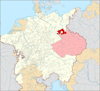
This List of hills of Brandenburg shows a selection of well-known hills in the German federal state of Brandenburg – sorted by height in metres above Normalnull (NN):

Name, Height, Location (District(s) / Landscape Region)

  1. Heidehöhe (201.4 m; highest point in Brandenburg on the Heideberg hill whose summit lies in Saxony, 206.1 m), District Elbe-Elster, in the landscape region of Schraden
  2. Kutschenberg (200.7 m), Oberspreewald-Lausitz District, in the landscape region of Schraden, west of Ortrand, Kmehlener Berge
  3. Hagelberg (200.2 m), Potsdam-Mittelmark District, High Fläming, west of Belzig
  4. Dietzenberg (191 m), Oberspreewald-Lausitz District, Oberlausitz, near Ortrand
  5. Hoher Berg (186 m), Spree-Neiße District, near Döbern
  6. Golmberg (178 m), Teltow-Fläming District, Lower Fläming, near Stülpe (municipality of Nuthe-Urstromtal)
  7. Brandberg (175 m), Muskauer Faltenbogen, near Döbern
  8. Wache Berge (172 m), Potsdam-Mittelmark District
  9. Hutberg (162 m), Oder-Spree District, southwest of Eisenhüttenstadt
  10. Kesselberg (161 m), Oberspreewald-Lausitz District, Cabeler Berge, near Calau
  11. Semmelberg (158 m), District Märkisch-Oderland, between Wollenberg and Platzfelde
  12. Rauensche Berge (153 m), Oder-Spree District, near Fürstenwalde
  13. Güterbank (153 m), District Elbe-Elster, in the landscape region of Schraden, Elsterwerda
  14. Babbener Berge (152 m), District Elbe-Elster, near Finsterwalde
  15. Dubrower Berge (150 m), Oder-Spree District, between Langewahl and Bad Saarow
  16. Wehlaberg (144 m), Dahme-Spreewald District, Krausnick hills, near Lübben
  17. Schwarzer Berg (144 m)
  18. Gehrener Berge (140 m), Dahme-Spreewald District, near Luckau
  19. Hirschberge (135 m)
  20. Börnickenberg (129 m), Teltow-Fläming District, southeast of Jüterbog
  21. Krugberg (129 m), Märkisch-Oderland District, Mark Switzerland
  22. Butterberg (128), Prignitz District, near Boddin-Langow
  23. Kronsberge (125 m), Prignitz District, southwest of Pritzwalk
  24. Wietkiekenberg (124.7 m), Potsdam-Mittelmark District, highest point of the Zauche, near Schwielowsee-Ferch
  25. Pimpinellenberg (117 m), im Barnim District, near Oderberg
  26. Kahle Glatze (116 m), Spree-Neiße District, Kaltenborn Hills, near Guben
  27. Kleiner Ravensberg (114.2 m), Saarmund end moraine arc, in Potsdam
  28. Wahrberge (114 m), between Klein and Groß Woltersdorf, south of Pritzwalk, Prignitz District
  29. Weinberg (Fredenwalde) (111 m), Groß Fredenwalde, Uckermark
  30. Blocksberge (110.6 m), Dahme-Spreewald District, near Alt Schadow
  31. Marienberg (110.0 m), Dahme-Spreewald District, near Krugau, am Ostrand des Unterspreewalds
  32. Eichberge (108.9 m), Teltow-Fläming District, near Wünsdorf
  33. Götzer Berg (108.6 m), Potsdam-Mittelmark District, Gemarkung of Groß Kreutz
  34. Großer Ravensberg (108.2 m), Saarmund end moraine arc, near Potsdam
  35. Löwendorfer Berg (104 m), west of Trebbin, Teltow-Fläming District
  36. Kranichsberg (105 m), near Woltersdorf, Oder-Spree District
  37. Teufelsberg (92.7), Havelland District, between Stechow, Kotzen and Nennhausen
  38. Rollberge (90.5), Havelland District, near Rathenow
  39. Eichelberg (89.6), Potsdam-Mittelmark District, near Deetz
  40. Rauhe Berge (86 m), Potsdam-Mittelmark District, in the landscape region of Zauche, near Lehnin Abbey
  41. Kleiner Rummelsberg (81 m; possibly a drumlin, disputed), end moraine arc of Chorin, near Chorin-Brodowin, Barnim District
  42. Pfingstberg (76 m), City of Potsdam
  43. Ruinenberg (74.1 m), City of Potsdam
  44. Marienberg (69 m), in Brandenburg an der Havel

See also

Related Research Articles

Teltow-Fläming District in Brandenburg, Germany

Teltow-Fläming is a Kreis (district) in the southwestern part of Brandenburg, Germany. Neighboring districts are Dahme-Spreewald, Elbe-Elster, the districts Wittenberg in Saxony-Anhalt, the district Potsdam-Mittelmark, and the Bundesland Berlin.

Dahme-Spreewald is a district in Brandenburg, Germany. It is bounded by the districts of Oder-Spree, Spree-Neiße, Oberspreewald-Lausitz, Elbe-Elster and Teltow-Fläming, and by the city of Berlin.

Elbe-Elster is a Kreis (district) in the southern part of Brandenburg, Germany. Neighboring districts are Teltow-Fläming, Dahme-Spreewald, Oberspreewald-Lausitz, Meißen, Nordsachsen and Wittenberg. The district has a partnership with the Märkischer Kreis.

Oberspreewald-Lausitz is a Kreis (district) in the southern part of Brandenburg, Germany. Neighboring districts are Dahme-Spreewald, Spree-Neiße, the districts Bautzen and Meissen in Saxony, and the district Elbe-Elster.

Spree-Neiße is a Kreis (district) in the southern part of Brandenburg, Germany. Neighboring districts are the districts Niederschlesischer Oberlausitzkreis and Kamenz in Saxony, the districts Oberspreewald-Lausitz, Dahme-Spreewald and Oder-Spree. The district-free city Cottbus is surrounded by the district. To the east is Poland.

Wittenberg is a district in the east of Saxony-Anhalt, Germany. Neighboring districts are Anhalt-Bitterfeld, the district-free city of Dessau-Roßlau, the districts of Potsdam-Mittelmark, Teltow-Fläming and Elbe-Elster in Brandenburg, and the district of Nordsachsen in the Free State of Saxony. Capital and largest city is Wittenberg, a UNESCO world heritage.

Spree Forest

The Spree Forest is a large inland delta of the river Spree, and a historical cultural landscape located in the region of (Lower) Lusatia, in the state of Brandenburg, Germany, about 100 km southeast of Berlin and close to the city of Cottbus. The Spree Forest is located within the settlement area of the (Lower) Sorbs, and the region is officially bilingual, German and Lower Sorbian.

Lower Lusatia Geographic region in Europe

Lower Lusatia is a historical region in Central Europe, stretching from the southeast of the German state of Brandenburg to the southwest of Lubusz Voivodeship in Poland. Like adjacent Upper Lusatia in the south, Lower Lusatia is a settlement area of the West Slavic Sorbs whose endangered Lower Sorbian language is related to Upper Sorbian and Polish.

Province of Brandenburg Province of Prussia, Germany

The Province of Brandenburg was a province of Prussia from 1815 to 1945. Brandenburg was established in 1815 from the Kingdom of Prussia's core territory, comprised the bulk of the historic Margraviate of Brandenburg and the Lower Lusatia region, and became part of the German Empire in 1871. From 1918, Brandenburg was a province of the Free State of Prussia until it was dissolved in 1945 after World War II, and replaced with reduced territory as the State of Brandenburg in East Germany, which was later dissolved in 1952. Following the reunification of Germany in 1990, Brandenburg was re-established as a federal state of Germany, becoming one of the new states.

Teltow Town in Brandenburg, Germany

Teltow [German pronunciation: ['tɛltoː](listen)] is a town in the Potsdam-Mittelmark district, in Brandenburg, Germany.

Teltow Canal

The Teltow Canal, also known as the Teltowkanal  in German, is a canal to the south of Berlin, the capital city of Germany. The canal lies in both the states of Berlin and Brandenburg, and at points forms the boundary between the two. It takes its name from the Brandeburgian region of Teltow and town of Teltow which lie on its course. The canal was constructed between 1900 and 1906, when it was opened by Wilhelm II.

Kutschenberg

The Kutschenberg is the highest hill in Brandenburg, Germany. It is part of the low hill range of the Kmehlener Berge and rises near Großkmehlen in the county of Oberspreewald-Lausitz. It is 201 m above sea level (NHN) and located only a few metres from the state border with Saxony.

Berlin/Brandenburg Metropolitan Region Place in Germany

The Berlin/Brandenburg metropolitan region or capital region is one of eleven metropolitan regions of Germany, consisting of the entire territories of the state of Berlin and the surrounding state of Brandenburg. The region covers an area of 30,370 square kilometres (11,730 sq mi) with a total population of about 6 million.

Teltow (region)

Teltow [] is both a geological plateau and also a historical region in the German states of Brandenburg and Berlin. As an historical region, the Teltow was one of the eight territories out of which the March of Brandenburg was formed in the 12th and 13th centuries. As a result of the Teltow War (1239–1245) the question of territorial lordship of the newly created heart of the expanding march was finally decided here. Between 1835 and 1952 there was also a county, Teltow district; in addition a town immediately south of Berlin, in the present-day county of Potsdam-Mittelmark, bears the name Teltow.

Dahme-Spreewald – Teltow-Fläming III – Oberspreewald-Lausitz I

Dahme-Spreewald – Teltow-Fläming III – Oberspreewald-Lausitz I is an electoral constituency represented in the Bundestag. It elects one member via first-past-the-post voting. Under the current constituency numbering system, it is designated as constituency 62. It is located in central Brandenburg, comprising the Dahme-Spreewald district and most of the Teltow-Fläming district.

Central Brandenburg Plateaux and Lowlands

The Central Brandenburg Plateaux and Lowlands form a natural region in the German state of Brandenburg and in parts of southwest Berlin and the east of Saxony-Anhalt. They are major unit group 81 in the system of natural regions of Germany and part of the East German Plateaux and Heathlands. The Brandenburg portion of the Central Brandenburg Plateaux and Lowlands is largely coincident with the natural region designated as the Central March in the structural atlas of the state of Brandenburg.

Sylvia Lehmann German politician

Sylvia Lehmann is a German politician of the Social Democratic Party (SPD) who has been serving as a member of the Bundestag from the state of Brandenburg since 2019.