| Marker title | English Translation | Category | Type | Description | Location | Language | Date Issued | Image |
|---|
Bahay-Pamahalaan ng Lungsod ng Zamboanga
(Dating Panlalawigang Kapitolyo ng Zamboanga) | Zamboanga City Hall (Old Zamboanga Capitol) | Building | Government Center | Built by the federal government of the United States from 1905 to 1907. | Zamboanga City | Filipino | 1969 |  |
| Bank of the Philippine Islands Zamboanga | | | | First branch of BPI in Zamboanga; residence of Gen. John Pershing, military-governor of the Moro Province | Zamboanga City | Filipino | 2012 | |
| Cawit Ruta ng Ekspedisyon Magallanes-Elcano sa Pilipinas | Cawit Route of the Magallanes – Elcano Expedition in the Philippines | Sites/Events | Site | Pigafetta described the place where an exceptional type of cinnamon grew. | Cawit Elementary School, Brgy. Cawit, Zamboanga City | Filipino | December 27, 2021 [7] |  |
Cesar Cortes Climaco
(1916–1984) | | Personage | | Mayor of Zamboanga City from 1953 to 1961. | Zamboanga City | Filipino | 2009 |  |
| Fort Pilar | | Structure | Fortification | Founded as a southern outpost of the Spanish under the supervision of Melchor de Vera in 1635. Attacked by the Dutch in 1646. | Zamboanga City | English | 1969 |  |
| Katubigan ng Golpo ng Moro Ruta ng Ekspedisyon Magallanes-Elcano sa Pilipinas | Waters of the Moro Gulf Route of the Magallanes – Elcano Expedition in the Philippines | Sites/Events | Site | | Pagadian City Fish Port, Brgy. San Pedro, Pagadian | Filipino | December 22, 2021 [8] |  |
| Mga Guho ng Kuta ng Tukuran [9] | Ruins of the Fort of Tukuran | | | Site of the village of Sultan Untung turned into a Spanish fort. | Tukuran | Filipino | October 28, 2014 | |
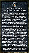
| Manalipa Ruta ng Ekspedisyon Magallanes-Elcano sa Pilipinas | Manalipa Route of the Magallanes – Elcano Expedition in the Philippines | Sites/ Events | Site | Where the Magellan expedition encountered people living in boats (bangkang lepat). | Manalipa Island, Zamboanga City | Filipino | March 21, 2022 | |
| San Ramon Prison and Penal Farm [10] | | | | First became a prison during Spanish times, became a prison by the Japanese during WWII. | Zamboanga City | Filipino | November 13, 2014 | |
| Subanin Ruta ng Ekspedisyon Magallanes-Elcano sa Pilipinas | Subanin Route of the Magallanes – Elcano Expedition in the Philippines | Sites/ Events | Site | Where the Magellan expedition encountered a community of Subanen. | RT Lim Boulevard, Brgy San Jose Cawa-cawa, Zamboanga City | Filipino | March 21, 2022 |  |
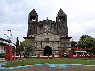
| Taluksangay Mosque | | | | Oldest mosque in Zamboanga Peninsula, built by Hadji Abdullah Maas Nuno in 1885. | Taluksangay, Zamboanga City | Filipino | February 25, 1992 | |
Vicente S. Alvarez
(1862–1942) | | Personage | | Revolutionary general. | Zamboanga City | Filipino | 2010 | |
| Zamboanga Beach | | Site | Beach | Where the US 41st division landed to liberate the city of Zamboanga from the Japanese. | Zamboanga City | English | 1952 |  |


