List of lakes in Stone County, Arkansas

Last updated
Map all coordinates using: OpenStreetMap  ·  Google Maps
Download coordinates as: KML  ·  GPX

There are at least 4 named lakes and reservoirs in Stone County, Arkansas .

Lake A body of relatively still water, in a basin surrounded by land

A lake is an area filled with water, localized in a basin, that is surrounded by land, apart from any river or other outlet that serves to feed or drain the lake. Lakes lie on land and are not part of the ocean, and therefore are distinct from lagoons, and are also larger and deeper than ponds, though there are no official or scientific definitions. Lakes can be contrasted with rivers or streams, which are usually flowing. Most lakes are fed and drained by rivers and streams.

Reservoir A storage space for fluids

A reservoir is, most commonly, an enlarged natural or artificial lake, pond or impoundment created using a dam or lock to store water.
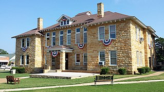
Stone County, Arkansas County in the United States

Stone County is located in the Ozark Mountains in the U.S. state of Arkansas. The county is named for rugged, rocky area terrain of the Ozarks. Created as Arkansas's 74th county on April 21, 1873, Stone County has two incorporated cities: Mountain View, the county seat and most populous city, and Fifty-Six. The county is also the site of numerous unincorporated communities and ghost towns.

Contents

Mirror Lake near Blanchard Springs Blanchard Springs Caverns 006.jpg
Mirror Lake near Blanchard Springs

Lakes

According to the United States Geological Survey, there are no named lakes in Stone County, Arkansas.

United States Geological Survey Scientific agency of the United States government

The United States Geological Survey is a scientific agency of the United States government. The scientists of the USGS study the landscape of the United States, its natural resources, and the natural hazards that threaten it. The organization has four major science disciplines, concerning biology, geography, geology, and hydrology. The USGS is a fact-finding research organization with no regulatory responsibility.

Reservoirs

Mirror Lake Historic District

The Mirror Lake Historic District encompasses Mirror Lake, a man-made lake in the Ozark-St. Francis National Forest near Fifty-Six, Arkansas. The lake was created by a crew of the Civilian Conservation Corps in 1940 by damming the creek emanating from Blanchard Spring. The district includes the lake, the dam, and two bridges, one of which was also built by the CCC, and a CCC-built observation shelter nearby. The area is now part of the Blanchard Springs Recreation Area.

See also

Notes

  1. "Crouch Lake". Geographic Names Information System . United States Geological Survey.
  2. "Davis Lake". Geographic Names Information System . United States Geological Survey.
  3. "Gunner Pool Lake". Geographic Names Information System . United States Geological Survey.
  4. "Mirror Lake". Geographic Names Information System . United States Geological Survey.