Princeton is an unincorporated community in Princeton Township, Dallas County, Arkansas, United States. The community is located at the junction of Arkansas highways 8 and 9, 7.5 miles (12.1 km) southwest of Carthage. Princeton Cemetery, which is listed on the National Register of Historic Places, is located in the community.
Frenchport is an unincorporated community in Ouachita County, Arkansas, United States. Frenchport is located on local roads 8.4 miles (13.5 km) south-southeast of Camden. The Capt. John T. Burkett House, which is listed on the National Register of Historic Places, is located near Frenchport.
Alco is an unincorporated community in Stone County, Arkansas, United States. Alco is located on Arkansas Highway 66, 14 miles (23 km) west of Mountain View. The Alco School, which is listed on the National Register of Historic Places, is located in Alco.
West Richwoods is an unincorporated community in Stone County, Arkansas, United States. West Richwoods is located on Arkansas Highway 9, 4.2 miles (6.8 km) southwest of Mountain View. The Samuel Brown House and the West Richwoods Church & School, which are both listed on the National Register of Historic Places, are located in West Richwoods.
East Richwoods is an unincorporated community in Stone County, Arkansas, United States. East Richwoods is located on Arkansas Highway 9, 1.8 miles (2.9 km) southwest of Mountain View. The H.S. Mabry Barn, which is listed on the National Register of Historic Places, is located in East Richwoods.
Luber is an unincorporated community in Stone County, Arkansas, United States. Luber is located on unmarked gravel roads, 7.3 miles (11.7 km) south-southeast of Mountain View. The Luber School, which is listed on the National Register of Historic Places, is located in Luber.
Melrose is an unincorporated community in Stone County, Arkansas, United States. Melrose is located on Arkansas Highway 14, 11.9 miles (19.2 km) west of Batesville. The Walter Gray House, which is listed on the National Register of Historic Places, is located in Melrose.
Old Lexington is an unincorporated community in Stone County, Arkansas, United States. Old Lexington is located on Arkansas Highway 110, 6.8 miles (10.9 km) northwest of Shirley. The Joe Guffey House, which is listed on the National Register of Historic Places, is located in Old Lexington.
Optimus is an unincorporated community in Stone County, Arkansas, United States. Optimus is located on Arkansas Highway 5, 5.2 miles (8.4 km) south of Calico Rock. The Miles Jeffery Barn, which is listed on the National Register of Historic Places, is located in Optimus.

Turkey Creek is an unincorporated community in Stone County, Arkansas, United States. Turkey Creek is located on Arkansas Highway 9, 8.7 miles (14.0 km) southwest of Mountain View. The Turkey Creek School, which is listed on the National Register of Historic Places, is located in Turkey Creek.
St. James is an unincorporated community in Stone County, Arkansas, United States. St. James is located on Arkansas Highway 14, 11.4 miles (18.3 km) east of Mountain View. The Pinky Pruitt Barn, which is listed on the National Register of Historic Places, is located in St. James.

Judd Hill is an unincorporated community in Poinsett County, Arkansas, United States. Judd Hill is located on Arkansas Highway 214, 5 miles (8.0 km) south of Trumann. The Judd Hill Cotton Gin, which is listed on the National Register of Historic Places, is located in Judd Hill. Judd Hill was named for banker and businessman Orange Judd Hill, who founded the community.
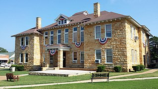
Coleman is an unincorporated community in Drew County, Arkansas, United States. Coleman is located at the junction of Arkansas Highway 83 and Arkansas Highway 277, 10.3 miles (16.6 km) north-northeast of Monticello. The Look See Tree, a lookout tree listed on the National Register of Historic Places, is located in Coleman. The mayor of Coleman is Tony Harmon, who is also constable and a lifetime office holder.
Milltown is an unincorporated community in Sebastian County, Arkansas, United States. Milltown is located on Arkansas Highway 252, 7.2 miles (11.6 km) southeast of Greenwood.
Barney is an unincorporated community in Faulkner County, Arkansas, United States. The community is located along Arkansas Highway 107 3.9 miles (6.3 km) north of Enola.
Hamlet is an unincorporated community in Faulkner County, Arkansas, United States. The community is located at the junction of U.S. Route 64 and Arkansas Highway 36, about halfway between Conway and Vilonia along the former.
Springhill is an unincorporated community in Faulkner County, Arkansas, United States. The community is located at the junction of U.S. Route 65 and Arkansas Highway 287, 3 miles (4.8 km) south of Greenbrier.
Aplin is an unincorporated community in Perry County, Arkansas, United States. The community is located along Arkansas Highway 60, 10.3 miles (16.6 km) west-southwest of Perryville.
Nimrod is an unincorporated community in Perry County, Arkansas, United States. The community is located along Arkansas Highway 60, 16 miles (26 km) west-southwest of Perryville.

Hollis is an unincorporated community in Perry County, Arkansas, United States. The community is located at the junction of Arkansas Highway 7 and Arkansas Highway 314, 20 miles (32 km) west-southwest of Perryville.