Timbo, Arkansas | |
|---|---|
 Timbo, Arkansas  Timbo, Arkansas | |
| Coordinates: 35°52′15″N92°19′02″W / 35.87083°N 92.31722°W | |
| Country | United States |
| State | Arkansas |
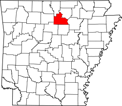
| County | Stone |
| Elevation | 853 ft (260 m) |
| Time zone | UTC-6 (Central (CST)) |
| • Summer (DST) | UTC-5 (CDT) |
| ZIP code | 72680 |
| Area code | 870 |
| GNIS feature ID | 78559 [1] |
Timbo is an unincorporated community in Stone County, Arkansas, United States. It is in the Ozark Mountains region of the northern part of the state and is near the town of Mountain View.
Timbo is known particularly for its strong tradition of old-time music. Music legend Jimmy Driftwood lived there. In 1959, Alan Lomax recorded music in Timbo (as well as in Heber Springs, Hughes, and Landis).
Timbo's ZIP code is 72680, although it previously used the ZIP code 72657, which was formerly served by the small post office at nearby Newnata (which is no longer in operation).