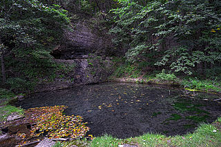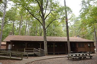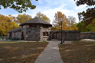
Petit Jean State Park is a 3,471-acre (1,405 ha) park in Conway County, Arkansas managed by the Arkansas Department of Parks and Tourism. It is located atop Petit Jean Mountain adjacent to the Arkansas River in the area between the Ouachita Mountains and Ozark Plateaus.

Lake Hamilton and Lake Catherine are a pair of man-made lakes located in Hot Springs, Arkansas, serving as a tourist attraction for the area. Both Lakes were developed by Arkansas Power & Light.

Kooser State Park is a 250-acre (101 ha) Pennsylvania state park in Jefferson Township, Somerset County, Pennsylvania, in the United States. The park, which borders Forbes State Forest, was built in the 1930s by the Civilian Conservation Corps, who also built the 4-acre (1.6 ha) Kooser Lake by damming Kooser Run. Kooser State Park is on Pennsylvania Route 31 a one-hour drive from Pittsburgh. The park is surrounded by Forbes State Forest.

Backbone State Park is Iowa's oldest state park, dedicated in 1919. Located in the valley of the Maquoketa River, it is approximately three miles (5 km) south of Strawberry Point in Delaware County. It is named for a narrow and steep ridge of bedrock carved by a loop of the Maquoketa River originally known as the Devil's Backbone. The initial 1,200 acres (490 ha) were donated by E.M. Carr of Lamont, Iowa. Backbone Lake Dam, a relatively low dam built by the Civilian Conservation Corps (CCC) in the 1930s, created Backbone Lake. The CCC constructed a majority of trails and buildings which make up the park.
Roaring River State Park is a public recreation area covering of 4,294 acres (1,738 ha) eight miles (13 km) south of Cassville in Barry County, Missouri. The state park offers trout fishing on the Roaring River, hiking on seven different trails, and the seasonally open Ozark Chinquapin Nature Center.

The Sylamore Scenic Byway is a scenic route in the Arkansas Scenic Byways program. The route runs through the Sylamore Ranger District of the Ozark National Forest in Arkansas for 26.5 miles (42.6 km) in Stone County. It passes through undeveloped forest land as a scenic route to Blanchard Springs Caverns.

Lake Leatherwood Park is a municipal park on the north side of Eureka Springs, Arkansas. The park covers 1,600 acres (650 ha), and its centerpiece is Lake Leatherwood, a 100-acre (40 ha) body of water created by the Lake Leatherwood Dam, which impounds West Leatherwood Creek. The dam, along with roadways, recreational facilities, and other elements of the park, were built in the 1930s by work crews of the Civilian Conservation Corps (CCC) with funding from the federal government's Soil Conservation Service.

The Bard Springs Bathhouse is a historic recreational support facility in Ouachita National Forest. It is located at the Bard Springs recreation site, southeast of Mena and north of Athens in Polk County, off County Road 82 and Forest Road 106 on the banks of Blaylock Creek. It is a single story rustic stone structure, with entrances at either end into open areas for changing. The interior is lit by skylights in the roof. It was built in 1936 by a crew of the Civilian Conservation Corps, and is one of four surviving CCC structures in the immediate area.

The Bard Springs Dam No. 1 is a historic recreational support facility in Ouachita National Forest. It is located at the Bard Springs recreation site, southeast of Mena and north of Athens in Polk County, off County Road 82 and Forest Road 106 on the banks of Blaylock Creek. This dam is located at the western end of the recreation area, and is about 65 feet (20 m) long and 8 feet (2.4 m) high at its center. It is made of fieldstone, and has a series of chutes and steps across its top. It was built in 1936 by a crew of the Civilian Conservation Corps, and is one of four surviving CCC structures in the immediate area.

The Bard Springs Dam No. 2 is a historic recreational support facility in Ouachita National Forest. It is located at the Bard Springs recreation site, southeast of Mena and north of Athens in Polk County, off County Road 82 and Forest Road 106 on the banks of Blaylock Creek. This dam is located at the eastern end of the recreation area, and is about 75 feet (23 m) long and 15 feet (4.6 m) high at its center. It is made of fieldstone, and has a series of staggered steps at its base to reduce erosion. It was built in 1936 by a crew of the Civilian Conservation Corps, and is one of four surviving CCC structures in the immediate area.

Shady Lake Recreation Area is a campground and public recreation area in southwestern Ouachita National Forest, southwest of Mena, Arkansas and west of Glenwood, Arkansas. The area is oriented around Shady Lake, a body of water on the South Fork Saline River impounded by a dam built c. 1940 by the Civilian Conservation Corps (CCC). The area is administered by the United States Forest Service (USFS).

Camp Clearfork is a group use recreational facility in Ouachita National Forest, west of the city of Hot Springs, Arkansas. It is located at the end of Camp Clearfork Trail, south of United States Route 270. The camp was developed in the 1930s by the Civilian Conservation Corps (CCC), and includes cabins, a recreation hall, and Camp Clearfork Reservoir, impounded by a CCC-built dam.

The Charlton Recreation Area is a public use area of the Ouachita National Forest, located just north of United States Route 270 between Crystal Springs and Mount Ida, Arkansas. The area includes a campground and day use facilities for water-related activities on Walnut Creek, including fishing and swimming. The facilities are organized around a small artificial lake created in 1938 by a crew of the Civilian Conservation Corps by damming the creek. The stone Charlton Dam and Spillway, about 100 feet (30 m) in length, was listed on the National Register of Historic Places 1993, as was the stone Charlton Bathhouse, also built by the CCC in 1938.

The Crystal Campground is located on Forest Road 177 in Ouachita National Forest, northeast of Norman, Arkansas. The campground has nine campsites and a picnic shelter, and provides access to outdoor recreational activities including hiking, swimming, and fishing. The swimming area is made possible by the Crystal Springs Dam, a 30-foot (9.1 m) fieldstone dam built in 1935 by the Civilian Conservation Corps, that impounds Montgomery Creek to provide a swimming hole. The campground's main picnic shelter was also built by the CCC at that time. Both the dam and the shelter were listed on the National Register of Historic Places in 1993. The picnic shelter was knocked over by a falling tree.

The Iron Springs Recreation Area is a roadside picnic area on Arkansas Highway 7, north of Jessieville in the Ouachita National Forest. The area has three shelters for picnicking, vault toilets, and an accessible trail for viewing the springs in the area. The facilities were largely built by the Civilian Conservation Corps (CCC) in the 1930s, with two shelters and the nearby dam listed on the National Register of Historic Places.

The Lake Catherine State Park-Bridge No. 2 is a historic bridge, carrying Arkansas Highway 171 across an unnamed stream in the western part of Lake Catherine State Park in Hot Spring County, Arkansas. The bridge is a rustic stone structure, with stone abutments rising to low piers just above the roadway at its four corners. Built in 1935 by crews of the Civilian Conservation Corps, it is one of a number of surviving CCC-built structures in the park.

Beeds Lake State Park is located northwest of Hampton, Iowa, United States. It was listed has a historic district on the National Register of Historic Places as Beeds Lake State Park, Civilian Conservation Corps Area in 1990. At the time of its nomination it contained 21 resources, which included one contributing building, 15 contributing structures, and five non-contributing structures. The 319-acre (129 ha) park surrounds a 99-acre (40 ha) reservoir. It features hiking trails, boating, fishing, swimming, camping, picnic areas and shelters, lodges and concessions.

The Lake Bailey–Roosevelt Lake Historic District encompasses a landscape and buildings developed by the Civilian Conservation Corps in Petit Jean State Park, Conway County, Arkansas. The district includes both Lake Bailey and Roosevelt Lake, man-made by CCC-built dams, along with the waterfall between the two, as well as a boathouse, shelter and bathhouse, and the Cedar Creek Bridge, which crosses Roosevelt Lake at its outlet. A unique artistic feature built by the CCC are a series of what appear to be wooden stumps poking out of Roosevelt Lake, which are actually built out of concrete. These facilities were built about 1935, and form a subset of park's surviving CCC architecture.

The Spring Lake Recreation Area is a recreational facility of the Ozark-St. Francis National Forest in Yell County, Arkansas. It is located north of Danville, in and around Spring Lake, a man-made lake constructed in 1937 with funding from the Works Progress Administration. The area has facilities for fishing and picnicking, including many structures built with WPA funding the Rustic style common to work of the Civilian Conservation Corps. Facilities from that period include picnic pavilions and developed picnic sites, a bathhouse, two swimming platforms, the Spring Lake Bridge, and the dam which impounds Spring Creek at the southern end of the lake. The area was listed on the National Register of Historic Places in 1995 as the Spring Lake Recreation Area Historic District.

Lacey-Keosauqua State Park is located southwest of Keosauqua, Iowa, United States. The park is located along the Des Moines River in Van Buren County. First dedicated in 1921, it is the largest state park in size in Iowa. In 1990, three areas were named nationally recognized historic districts and listed on the National Register of Historic Places.


