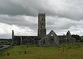
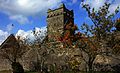
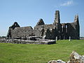
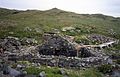
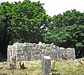
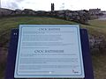
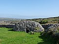
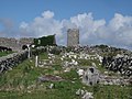
NM# Monument name Description Image Townland Location 278 Abbert Demesne Church Church Abbert Demesne 53°25′34″N 8°41′01″W / 53.42617°N 8.68364°W / 53.42617; -8.68364 (Abbert Demesne Church ) 166 Knockmoy Abbey in Abbeyknockmoy Abbey (Cistercian) Abbeyknockmoy 53°26′25″N 8°44′34″W / 53.440334°N 8.742886°W / 53.440334; -8.742886 (Knockmoy Abbey ) 47 Kilconnell Abbey Friary (Franciscan) Kilconnell 53°19′57″N 8°24′03″W / 53.332629°N 8.400786°W / 53.332629; -8.400786 (Kilconnell Abbey ) 273 Dunmore Abbey Friary (Augustinian) Abbeyland North 53°37′05″N 8°44′29″W / 53.618089°N 8.741255°W / 53.618089; -8.741255 (Dunmore Abbey ) 512 Clontuskert Abbey Priory (Augustinian) Abbeypark 53°16′57″N 8°12′56″W / 53.282561°N 8.215499°W / 53.282561; -8.215499 (Clontuskert Abbey ) 49 Annaghdown Early Medieval Ecclesiastical Site Annaghdown 53°23′13″N 9°04′21″W / 53.386886°N 9.072626°W / 53.386886; -9.072626 (Annaghdown ) 252 Ardamullivan Castle Castle Ardamullivan 53°00′16″N 8°49′45″W / 53.004326°N 8.829296°W / 53.004326; -8.829296 (Ardamullivan Castle ) 164 Athenry Abbey Priory (Dominican) Athenry 53°17′54″N 8°44′40″W / 53.29825°N 8.74453°W / 53.29825; -8.74453 (Athenry Abbey ) 406 Athenry Castle Castle Athenry 53°18′00″N 8°44′41″W / 53.299990°N 8.744619°W / 53.299990; -8.744619 (Athenry Castle ) 371 Aughrim Ringforts Two Ringforts Attidermot 53°17′37″N 8°18′52″W / 53.29360°N 8.31446°W / 53.29360; -8.31446 (Aughrim Ringforts ) 470 Aughnanure Castle Castle Aughnanure 53°25′08″N 9°16′32″W / 53.41875°N 9.27567°W / 53.41875; -9.27567 (Aughnanure Castle ) 369 Caheravoley Fort House & Bawn Caheravoley , Kilcahill 53°25′08″N 8°54′29″W / 53.418843°N 8.908063°W / 53.418843; -8.908063 (Caheravoley Fort ) 42 Doonbeg Ringfort Ringfort Carrownlisheen (Inishmaan ) 53°05′00″N 9°35′41″W / 53.083463°N 9.594777°W / 53.083463; -9.594777 (Doonbeg Ringfort ) 42 Carrownlisheen Wedge Tomb (Diarmuid and Gráinne's Bed) Wedge Tomb Carrownlisheen (Inishmaan ) 53°05′14″N 9°34′52″W / 53.087355°N 9.581059°W / 53.087355; -9.581059 (Carrownlisheen Wedge Tomb ) 42 Templesaghtmacree Church Carrownlisheen (Inishmaan ) 53°05′02″N 9°35′25″W / 53.083943°N 9.590272°W / 53.083943; -9.590272 (Templesaghtmacree ) 42 Carrownlisheen Cross Cross Carrownlisheen (Inishmaan ) 53°04′50″N 9°34′32″W / 53.080631°N 9.575505°W / 53.080631; -9.575505 (Carrownlisheen Cross ) 42 Labbanakinneriga Church Carrownlisheen (Inishmaan ) 53°05′02″N 9°35′25″W / 53.083889°N 9.59027°W / 53.083889; -9.59027 (Labbanakinneriga ) 42 Doonfarvagh Cashel Carrownlisheen (Inishmaan ) 53°04′51″N 9°34′48″W / 53.080778°N 9.579967°W / 53.080778; -9.579967 (Doonfarvagh ) 42 Kilcoonagh Church Church Carrownlisheen (Inishmaan ) 53°04′50″N 9°34′33″W / 53.080631°N 9.575734°W / 53.080631; -9.575734 (Kilcoonagh Church ) 42 Dún Conor (Dún Conchuir ) Cashel Carrowntemple (Inishmaan ) 53°05′00″N 9°35′41″W / 53.083461°N 9.594788°W / 53.083461; -9.594788 (Dún Conor ) 248 Dunmore Castle Castle Castlefarm 53°37′26″N 8°45′20″W / 53.623893°N 8.755526°W / 53.623893; -8.755526 (Dunmore Castle ) 467 St. Cuan's Well Well & Cross slabs Castlegar East 53°24′55″N 8°18′57″W / 53.415398°N 8.315935°W / 53.415398; -8.315935 (St. Cuan's Well ) 428 Feartagar or Jennings Castle Castle Castlegrove East 53°34′11″N 8°56′34″W / 53.569650°N 8.942710°W / 53.569650; -8.942710 (Feartagar or Jennings Castle ) 272 Isert Kelly Castle Castle Castlepark 53°09′29″N 8°43′08″W / 53.158015°N 8.718935°W / 53.158015; -8.718935 (Isert Kelly Castle ) 259 Kiltartan Castle Castle Castletown (Kiltartan ) 53°05′25″N 8°48′27″W / 53.090312°N 8.807569°W / 53.090312; -8.807569 (Kiltartan Castle ) 165 Claregalway Abbey Friary (Franciscan) Claregalway 53°20′48″N 8°56′40″W / 53.346667°N 8.944444°W / 53.346667; -8.944444 (Claregalway Abbey ) 563 Cloonigny Castle Ringfort & Castle Cloonigny 53°21′17″N 8°21′17″W / 53.354788°N 8.354778°W / 53.354788; -8.354778 (Cloonigny Castle ) 283 Derryhiveny Castle Castle Derryhiveny South 53°07′37″N 8°11′32″W / 53.127061°N 8.192313°W / 53.127061; -8.192313 (Derryhiveny Castle ) 527 Doorus Demesne wedge tomb Wedge Tomb Doorus Demesne 53°09′08″N 8°58′20″W / 53.152298°N 8.972353°W / 53.152298; -8.972353 (Doorus Demesne wedge tomb ) 254 Drumacoo Early Medieval Ecclesiastical Site Drumacoo 53°11′55″N 8°54′16″W / 53.198749°N 8.904506°W / 53.198749; -8.904506 (Drumacoo ) 365 Drumharsna Castle Castle Drumharsna South 53°08′36″N 8°50′35″W / 53.143282°N 8.84304°W / 53.143282; -8.84304 (Drumharsna Castle ) 206 Fiddaun Castle Castle Tubber 53°00′38″N 8°52′46″W / 53.010514°N 8.879438°W / 53.010514; -8.879438 (Fiddaun Castle ) 554 Kilnalekin Abbey Abbey (Cistercian) Friary 53°06′11″N 8°23′31″W / 53.103056°N 8.391901°W / 53.103056; -8.391901 (Kilnalekin Abbey ) 439 Glinsk Castle Castle Glinsk 53°39′07″N 8°25′55″W / 53.652037°N 8.4319°W / 53.652037; -8.4319 (Glinsk Castle ) 52 High Island Early Medieval Ecclesiastical Site High Island and Kill 53°32′41″N 10°15′40″W / 53.54481°N 10.26116°W / 53.54481; -10.26116 (High Island ) 412 Inchagoill Early Medieval Ecclesiastical Site Inchagoill 53°29′09″N 9°18′59″W / 53.485769°N 9.316415°W / 53.485769; -9.316415 (Inchagoill ) 41.01 Creggankeel Fort Cashel Inisheer 53°03′26″N 9°31′07″W / 53.057332°N 9.518607°W / 53.057332; -9.518607 (Creggankeel Fort ) 41.05 St. Gobnet's Church (Kilgobnet ) Church Inisheer 53°03′58″N 9°31′45″W / 53.066032°N 9.529267°W / 53.066032; -9.529267 (St. Gobnet's Church ) 41.06 Knockgrannary (Cnoc Raithní) Burial Ground Inisheer 53°03′54″N 9°31′24″W / 53.065060°N 9.523324°W / 53.065060; -9.523324 (Knockgrannary ) 41.08 St. Cavan's Church Church Inisheer 53°03′50″N 9°30′50″W / 53.063894°N 9.513924°W / 53.063894; -9.513924 (St. Cavan's Church ) 41.07 O'Brien's Castle (Great Fort, Furmina Castle ) Cashel Inisheer 53°03′43″N 9°31′09″W / 53.062083°N 9.519172°W / 53.062083; -9.519172 (O'Brien's Castle ) 41.02 Grave of the Seven Daughters (Cill na Seacht Niníon) Early Medieval Ecclesiastical Site Inisheer 53°03′26″N 9°31′06″W / 53.057275°N 9.518338°W / 53.057275; -9.518338 (Grave of the Seven Daughters ) 642 Kilcornan Deserted Medieval Village Kilcornan (Monivea) 53°18′48″N 8°42′49″W / 53.313342°N 8.713583°W / 53.313342; -8.713583 (Kilcornan ) 43.01 Arkin's Castle Castle Killeany (Inishmore ) 53°06′17″N 9°39′47″W / 53.10482°N 9.66295°W / 53.10482; -9.66295 (Arkin's Castle ) 43.04 Temple Benen Church Killeany (Inishmore ) 53°06′11″N 9°39′59″W / 53.103017°N 9.666322°W / 53.103017; -9.666322 (Temple Benen ) 43.11 Turmartin Watch Tower Killeany (Inishmore ) 53°05′29″N 9°38′20″W / 53.091527°N 9.638835°W / 53.091527; -9.638835 (Turmartin ) 43 Oghil Leacht Cuimhne Leacht Cuimhne (cenotaph for those lost at sea) Killeany (Inishmore ) 53°07′45″N 9°41′25″W / 53.129185°N 9.690258°W / 53.129185; -9.690258 (Oghil Leacht Cuimhne ) 43 Tighlagh Eany Church Killeany (Inishmore ) 53°06′05″N 9°39′10″W / 53.101298°N 9.652707°W / 53.101298; -9.652707 (Tighlagh Eany ) 43 Killeany Clacháns Clocháns Killeany (Inishmore ) 53°06′35″N 9°41′19″W / 53.109809°N 9.688515°W / 53.109809; -9.688515 (Killeany Clacháns ) 43.03 St. Eany's Early Medieval Ecclesiastical Site Killeany (Inishmore ) 53°06′12″N 9°39′50″W / 53.103352°N 9.664019°W / 53.103352; -9.664019 (St. Eany's ) 43 Doocaher (Black Fort) Promontory Fort Killeany (Inishmore ) 53°06′16″N 9°41′15″W / 53.104456°N 9.687600°W / 53.104456; -9.687600 (Doocaher ) 51 Kilmacduagh monastery Churches & Round Tower Kilmacduagh 53°02′53″N 8°53′16″W / 53.04798°N 8.88789°W / 53.04798; -8.88789 (Kilmacduagh monastery ) 43 Temple MacDuagh Church Kilmurvy (Inishmore ) 53°07′51″N 9°45′33″W / 53.130967°N 9.759053°W / 53.130967; -9.759053 (Temple MacDuagh ) 43.15 Templenaneeve Church Kilmurvy (Inishmore ) 53°07′51″N 9°45′33″W / 53.130967°N 9.759053°W / 53.130967; -9.759053 (Templenaneeve ) 43 Dun Aengus Promontory Fort Inishmore 53°07′32″N 9°46′00″W / 53.12549°N 9.76663°W / 53.12549; -9.76663 (Dun Aengus ) 43 Clochán na Carraige Clochán Kilmurvy (Inishmore ) 53°08′32″N 9°45′37″W / 53.142282°N 9.760188°W / 53.142282; -9.760188 (Clochán na Carraige ) 446 Kiltiernan Church Church & Cashel Kiltiernan East 53°11′17″N 8°50′34″W / 53.187997°N 8.842892°W / 53.187997; -8.842892 (Kiltiernan Church ) 627 Lackan Ringfort Ringfort & Souterrain Lackan (Ardrahan) 53°09′49″N 8°46′56″W / 53.163637°N 8.782195°W / 53.163637; -8.782195 (Lackan Ringfort ) 621 Lissard Ringforts Two Ringforts & Souterrain Lissard 53°20′53″N 8°23′22″W / 53.348145°N 8.389551°W / 53.348145; -8.389551 (Lissard Ringforts ) 245 Castlekirk (Hen's Castle) Castle Drumsnauv 53°29′33″N 9°30′48″W / 53.492565°N 9.513196°W / 53.492565; -9.513196 (Castlekirk ) 499 Rathsoony Ringfort Masonbrook 53°10′30″N 8°30′56″W / 53.175002°N 8.515569°W / 53.175002; -8.515569 (Rathsoony ) 499 Rahannagragh (Rahannagroagh) Ringfort Masonbrook 53°10′37″N 8°30′51″W / 53.176949°N 8.514203°W / 53.176949; -8.514203 (Rahannagragh ) 609 Merlinpark Castle (Merlin Castle) Castle Merlinpark 53°16′47″N 8°59′53″W / 53.279765°N 8.998110°W / 53.279765; -8.998110 (Merlinpark Castle ) 498 The Seven Monuments Embanked Stone Circle Moanmore East 53°11′19″N 8°31′52″W / 53.188576°N 8.531205°W / 53.188576; -8.531205 (The Seven Monuments ) 43 St. Kieran's Early Medieval Ecclesiastical Site Oghil (Inishmore ) 53°07′55″N 9°41′07″W / 53.132051°N 9.685329°W / 53.132051; -9.685329 (St. Kieran's ) 43 St. Soorney's Church & Enclosure Oghil (Inishmore ) 53°08′01″N 9°41′43″W / 53.133509°N 9.695255°W / 53.133509; -9.695255 (St. Soorney's ) 43 Temple an Cheathrair Aluinn Church & grave Oghil (Inishmore ) 53°07′47″N 9°42′58″W / 53.12976°N 9.716108°W / 53.12976; -9.716108 (Temple an Cheathrair Aluinn ) 43 Oghill Cashel Oghil (Inishmore ) 53°07′38″N 9°41′59″W / 53.127183°N 9.699676°W / 53.127183; -9.699676 (Oghill ) 43 Killeany Clocháns Oghil (Inishmore ) 53°07′39″N 9°43′08″W / 53.127392°N 9.718971°W / 53.127392; -9.718971 (Killeany ) 43 Killeany Tomb Wedge Tomb Oghil (Inishmore ) 53°07′39″N 9°43′08″W / 53.127392°N 9.718971°W / 53.127392; -9.718971 (Killeany Tomb ) 43 Onaght Castle & house site Onaght (Inishmore ) 53°08′24″N 9°46′36″W / 53.140023°N 9.776759°W / 53.140023; -9.776759 (Onaght castle and house site ) 43 Onaght Clocháns Onaght (Inishmore ) 53°08′32″N 9°45′37″W / 53.142282°N 9.760188°W / 53.142282; -9.760188 (Onaght clocháns ) 43 Kilcholan Church Church Onaght (Inishmore ) 53°08′25″N 9°46′33″W / 53.140358°N 9.775955°W / 53.140358; -9.775955 (Kilcholan Church ) 43 Onaght Cashel Cashel Onaght (Inishmore ) 53°08′24″N 9°46′36″W / 53.140023°N 9.776759°W / 53.140023; -9.776759 (Onaght Cashel ) 43 Templebrecan Early Medieval Ecclesiastical Site Onaght (Inishmore ) 53°08′46″N 9°46′39″W / 53.146094°N 9.777593°W / 53.146094; -9.777593 (Templebrecan ) 231 Killursa Church Ower 53°28′04″N 9°08′42″W / 53.467703°N 9.144971°W / 53.467703; -9.144971 (Killursa ) 462 Pallas Castle Castle Pallas (Tynagh ) 53°07′36″N 8°21′44″W / 53.126574°N 8.362318°W / 53.126574; -8.362318 (Pallas Castle ) 48 Kilbennen Church & Round Tower Pollacorragune 53°32′20″N 8°53′31″W / 53.538837°N 8.892038°W / 53.538837; -8.892038 (Kilbennen ) 461 Portumna Abbey Friary (Dominican) Portumna Demesne 53°05′10″N 8°13′03″W / 53.086053°N 8.217479°W / 53.086053; -8.217479 (Portumna Abbey ) 515 Portumna Castle Castle Portumna Demesne 53°05′12″N 8°13′14″W / 53.086613°N 8.220645°W / 53.086613; -8.220645 (Portumna Castle ) 46 Roscam Early Medieval Ecclesiastical Site Roscam 53°15′51″N 8°59′06″W / 53.264227°N 8.984986°W / 53.264227; -8.984986 (Roscam ) 50 Ross Errilly Abbey Friary (Franciscan) Headford 53°28′47″N 9°07′54″W / 53.479628°N 9.13166°W / 53.479628; -9.13166 (Ross Errilly Abbey ) 242 Saint Macdara's Island Early Medieval Ecclesiastical Site Saint Macdara's Island 53°18′16″N 9°55′02″W / 53.304426°N 9.917302°W / 53.304426; -9.917302 (Saint Macdara's Island ) 643 Tonaroasty Deserted Medieval Village Tonaroasty 53°11′36″N 8°32′47″W / 53.193407°N 8.546418°W / 53.193407; -8.546418 (Tonaroasty ) 505 Tuam High Cross High Cross Tuam 53°30′49″N 8°51′19″W / 53.51370°N 8.85539°W / 53.51370; -8.85539 (Tuam High Cross ) 431 Pearse's Cottage House with historic associations Turlough 53°23′10″N 9°37′12″W / 53.386046°N 9.619890°W / 53.386046; -9.619890 (Pearse's Cottage ) 327 Turoe stone Sculptured Stone Bullaun 53°15′10″N 8°33′42″W / 53.252706°N 8.5617°W / 53.252706; -8.5617 (Turoe stone )