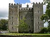
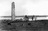
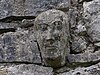
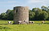
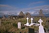
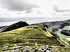
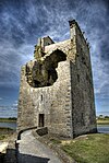
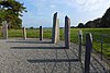
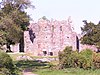
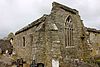
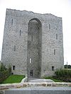
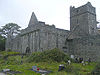
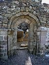
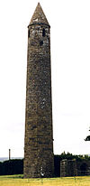
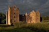
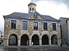
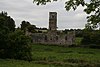
NM# Monument name Description Image Townland County Location 11 Corcomroe Abbey Abbey (Cistercian) Abbey West 53°07′37″N 9°03′14″W / 53.126911°N 9.054013°W / 53.126911; -9.054013 (Corcomroe Abbey ) 648 Ballyallaban ringfort Ringforts Ballyallaban 53°05′24″N 9°09′31″W / 53.09005°N 9.158578°W / 53.09005; -9.158578 (Ballyallaban ) 574 Tau Cross (Cross Inneenboy) Cross Ballycashen , Roughan 52°58′40″N 9°06′53″W / 52.977822°N 9.114703°W / 52.977822; -9.114703 (Tau Cross / Cross Inneenboy ) 484 Ballyhickey Wedge Tomb Wedge Tomb Ballyhickey 52°50′04″N 8°51′20″W / 52.834306°N 8.855493°W / 52.834306; -8.855493 591 Brian Boru's Fort Ringfort Ballyvally 52°49′08″N 8°27′06″W / 52.818908°N 8.451578°W / 52.818908; -8.451578 478 Bunratty Castle Castle Bunratty East 52°41′48″N 8°48′42″W / 52.696667°N 8.811667°W / 52.696667; -8.811667 (Bunratty Castle ) 466 Caheraphuca Wedge Tomb Wedge Tomb Caheraphuca 52°56′05″N 8°54′18″W / 52.934612°N 8.904909°W / 52.934612; -8.904909 (Caheraphuca ) 354 Cahermacnaghten Cashel Cahermacnaghten 53°02′45″N 9°11′54″W / 53.045964°N 9.198353°W / 53.045964; -9.198353 (Cahermacnaghten ) 195 Canon Island Abbey Abbey (Augustinian) Canon Island 52°40′44″N 9°02′13″W / 52.678981°N 9.036906°W / 52.678981; -9.036906 (Canon Island Abbey ) 197 Clare Abbey Abbey (Augustinian) Clarecastle 52°49′44″N 8°58′08″W / 52.828964°N 8.968881°W / 52.828964; -8.968881 (Clare Abbey ) 583 Dromore Castle Castle Dromore (Ruan ) 52°55′31″N 8°57′46″W / 52.925269°N 8.962639°W / 52.925269; -8.962639 (Dromore Castle ) 204 Drumcliff Church & Round Tower Drumcliff 52°52′04″N 8°59′51″W / 52.8679°N 8.997506°W / 52.8679; -8.997506 (Drumcliff ) 170 Ennis Friary Friary (Franciscan) Ennis 52°50′45″N 8°58′53″W / 52.845972°N 8.981381°W / 52.845972; -8.981381 (Ennis Friary ) 509 Gleninagh Castle Castle Gleninagh North 53°08′16″N 9°12′21″W / 53.137656°N 9.205919°W / 53.137656; -9.205919 (Gleninagh Castle ) 14 Inchicronan Abbey Abbey (Augustinian) Inchicronan 52°55′05″N 8°54′24″W / 52.917964°N 8.906675°W / 52.917964; -8.906675 (Inchicronan Abbey ) 5 Inishcaltra (Inis Cealtra ) Early Medieval Ecclesiastical Site Mountshannon 52°54′53″N 8°27′01″W / 52.914764°N 8.450144°W / 52.914764; -8.450144 (Inish Cealtra ) 7 Kilfenora Church Kilcarragh 52°59′23″N 9°13′23″W / 52.9896°N 9.2231°W / 52.9896; -9.2231 (Kilfenora Church ) 9 Kilfenora Abbey Friary (Franciscan) Kilfenora 52°59′27″N 9°13′05″W / 52.990959°N 9.218177°W / 52.990959; -9.218177 (Kilfenora Abbey ) 8 Kilfenora Cathedral & Crosses Kilfenora 52°59′26″N 9°13′01″W / 52.9906°N 9.217003°W / 52.9906; -9.217003 (Kilfenora Cathedral ) 279 St. Molua's Church Church Killaloe 52°48′25″N 8°26′40″W / 52.806993°N 8.444308°W / 52.806993; -8.444308 448 Leamaneh Castle Castle Leamaneah North 52°59′15″N 9°08′23″W / 52.987636°N 9.139847°W / 52.987636; -9.139847 (Leamaneh Castle ) 16 Dysert O'Dea Church, Round Tower & Cross Mollaneen 52°54′33″N 9°04′06″W / 52.909169°N 9.068394°W / 52.909169; -9.068394 (Dysert O'Dea ) 649 Mooghaun Hillfort Mooghaun 52°46′59″N 8°52′43″W / 52.78315°N 8.87869°W / 52.78315; -8.87869 (Mooghaun ) 176 Killone Abbey Abbey (Augustinian) Ennis 52°48′22″N 9°00′15″W / 52.806228°N 9.004189°W / 52.806228; -9.004189 (Killone Abbey ) 12 Oughtmama Three Churches Oughtmama 53°07′01″N 9°02′19″W / 53.116857°N 9.038548°W / 53.116857; -9.038548 (Oughtmama ) 17 Ruan Church Church Portlecka 52°55′41″N 8°59′24″W / 52.928125°N 8.989933°W / 52.928125; -8.989933 (Ruan Church ) 632 Poulnabrone Portal Tomb Poulnabrone 53°02′55″N 9°08′24″W / 53.048696°N 9.140025°W / 53.048696; -9.140025 (Poulnabrone Dolmen ) 15 Quin Abbey Friary (Franciscan) Quin 52°49′09″N 8°51′47″W / 52.8192°N 8.862956°W / 52.8192; -8.862956 (Quin Abbey ) 427 Carrigaholt Castle Castle Carrigaholt 52°36′00″N 9°41′58″W / 52.599947°N 9.699425°W / 52.599947; -9.699425 (Carrigaholt Castle ) 10 Scattery Island (Inis Cathaigh) Early Medieval Ecclesiastical Site Kilrush 52°36′42″N 9°31′10″W / 52.611583°N 9.519336°W / 52.611583; -9.519336 (Scattery Island ) 6 St. Flannan's Cathedral Church Killaloe 52°48′23″N 8°26′21″W / 52.8065°N 8.43925°W / 52.8065; -8.43925 (St. Flannan's Church ) 270 Slievenaglasha Wedge Tomb Wedge Tomb Slievenaglasha 53°01′02″N 9°03′06″W / 53.017331°N 9.051686°W / 53.017331; -9.051686 (Slievenaglasha ) 13 Temple Cronan Church Termon 53°02′46″N 9°03′40″W / 53.046164°N 9.061109°W / 53.046164; -9.061109 (Temple Cronan ) 224 Magh Adhair Inauguration Site Toonagh 52°50′28″N 8°49′44″W / 52.841228°N 8.828881°W / 52.841228; -8.828881 (Magh Adhair ) 270 Tullycommon Wedge Tomb Wedge Tomb Tullycommon 53°01′32″N 9°03′31″W / 53.025496°N 9.058521°W / 53.025496; -9.058521 270 Cashlaungarr Cashel Tullycommon 53°00′48″N 9°04′47″W / 53.013266°N 9.079670°W / 53.013266; -9.079670 270 Cahercommaun Cashel Carran 53°00′52″N 9°04′14″W / 53.014575°N 9.070519°W / 53.014575; -9.070519 (Cahercommaun ) 645 Altar Wedge Tomb Wedge Tomb Altar 51°30′49″N 9°38′38″W / 51.51373°N 9.64398°W / 51.51373; -9.64398 314 Ardskeagh Church Church Ardskeagh (Fermoy barony ) 52°19′55″N 8°37′41″W / 52.331832°N 8.627986°W / 52.331832; -8.627986 301 Ballybeg Dovecote Ballybeg East 52°13′13″N 8°40′11″W / 52.22023°N 8.66984°W / 52.22023; -8.66984 301 Ballybeg Tower Ballybeg West 52°13′12″N 8°40′07″W / 52.21989°N 8.66851°W / 52.21989; -8.66851 301 Ballybeg Abbey Friary (Augustinian) Buttevant 52°13′10″N 8°40′11″W / 52.21941°N 8.66976°W / 52.21941; -8.66976 22 Templekieran, Clear Island Church & Cross inscribed pillar Ballyieragh North 51°26′27″N 9°30′22″W / 51.44070°N 9.50602°W / 51.44070; -9.50602 425 Ballinacarriga Castle Castle Dunmanway 51°42′20″N 9°01′54″W / 51.70561°N 9.03175°W / 51.70561; -9.03175 641 Barryscourt Castle Castle Carrigtwohill 51°54′17″N 8°15′34″W / 51.90462°N 8.25937°W / 51.90462; -8.25937 594 Blossomfort Ringfort Blossomfort 52°09′41″N 8°45′15″W / 52.161504°N 8.754160°W / 52.161504; -8.754160 558 Glanworth Medieval tower Boherash 52°11′21″N 8°21′20″W / 52.189069°N 8.355511°W / 52.189069; -8.355511 558 Glanworth Castle Castle Glanworth 52°11′17″N 8°21′17″W / 52.18817°N 8.3547°W / 52.18817; -8.3547 558 Rock Abbey, Glanworth Friary (Franciscan) Boherash 52°11′21″N 8°21′22″W / 52.18911°N 8.35625°W / 52.18911; -8.35625 450 Breeny More Stone Circle Stone Circle & boulder burials Breeny More 51°44′32″N 9°22′30″W / 51.742145°N 9.375097°W / 51.742145; -9.375097 202 Buttevant Abbey Friary (Franciscan) Buttevant 52°13′52″N 8°40′09″W / 52.23124°N 8.66909°W / 52.23124; -8.66909 233 Cahervagliar Ringfort Cappeen West 51°47′35″N 8°59′49″W / 51.79310°N 8.99694°W / 51.79310; -8.99694 660 Carrigagulla Stone Circle Ballinagree 52°00′01″N 8°54′59″W / 52.000410°N 8.916359°W / 52.000410; -8.916359 255 Carrigaphooca Castle Castle Carrigaphooca 51°54′31″N 9°01′42″W / 51.90855°N 9.02847°W / 51.90855; -9.02847 255 Carrigaphooca stone circle Stone Circle Carrigaphooca 51°54′35″N 9°01′30″W / 51.909610°N 9.024975°W / 51.909610; -9.024975 656 Castledonovan Castle Castle Castledonovan 51°41′32″N 9°16′57″W / 51.69211°N 9.28259°W / 51.69211; -9.28259 281 Mallow Castle Castle Castlelands 52°08′02″N 8°38′22″W / 52.13389°N 8.63945°W / 52.13389; -8.63945 536 Clodagh Standing Stones Standing Stones - Pair Clodagh, County Cork 51°41′53″N 9°13′27″W / 51.69804°N 9.22428°W / 51.69804; -9.22428 240 Conna Castle Castle Conna 52°05′40″N 8°06′06″W / 52.09454°N 8.10170°W / 52.09454; -8.10170 592 Carn Tierna Hillfort & Cairn Coolcarron (Fermoy) 52°06′54″N 8°16′58″W / 52.114982°N 8.282754°W / 52.114982; -8.282754 565 Coolcoulaghta Standing Stones Standing Stones - Pair Coolcoulaghta 51°35′48″N 9°32′36″W / 51.59669°N 9.54334°W / 51.59669; -9.54334 395 Coole Upper Churches Two Churches Coole Upper 52°06′31″N 8°12′12″W / 52.10873°N 8.20338°W / 52.10873; -8.20338 600 Derryarkane Stone Circle Stone Circle & Standing Stone Derryarkane 51°43′43″N 9°22′19″W / 51.72859°N 9.37206°W / 51.72859; -9.37206 296 Drishane Castle Castle Drishane More 52°04′31″N 9°02′55″W / 52.07515°N 9.04849°W / 52.07515; -9.04849 339 Dromaneen Castle Castle Dromaneen 52°07′35″N 8°43′50″W / 52.12636°N 8.73066°W / 52.12636; -8.73066 381 Drombeg Circle, Hut Site & Fulacht Fiadh Glandore 51°33′52″N 9°05′13″W / 51.56455°N 9.08702°W / 51.56455; -9.08702 169 Sherkin Abbey Friary (Franciscan) Sherkin Island 51°28′34″N 9°24′01″W / 51.47613°N 9.40022°W / 51.47613; -9.40022 374 Farranahineeny Stone Row Stone Row Farranahineeny 51°47′42″N 9°08′20″W / 51.79494°N 9.13888°W / 51.79494; -9.13888 284 Knockdrum Stone Fort Cashel Farrandau 51°31′36″N 9°11′37″W / 51.52653°N 9.19368°W / 51.52653; -9.19368 426 Ballycrovane Ogham Stone Ogham Stone Faunkill and the Woods 51°42′47″N 9°56′41″W / 51.71315°N 9.94460°W / 51.71315; -9.94460 535 Charles Fort Star-Shaped-Fort Summer Cove 51°41′47″N 8°29′56″W / 51.6965°N 8.499°W / 51.6965; -8.499 552 Greenhill Ogham Stones Ogham Stones Greenhill 52°04′40″N 8°36′25″W / 52.07782°N 8.60684°W / 52.07782; -8.60684 502 Island Wedge Tomb Wedge Tomb Island (Rahan) 52°04′04″N 8°34′47″W / 52.067690°N 8.579607°W / 52.067690; -8.579607 490 Kilbolane Castle Castle Milford 52°20′20″N 8°51′04″W / 52.339°N 8.851°W / 52.339; -8.851 182 Kilcrea Abbey Friary (Franciscan) Ovens 51°51′54″N 8°42′41″W / 51.86498°N 8.71128°W / 51.86498; -8.71128 316 Kileenemer Church Church Killeenemer 52°12′56″N 8°19′43″W / 52.21546°N 8.32850°W / 52.21546; -8.32850 436 Kilnaruane Carved Pillar Stone Shaft of High Cross Kilnaruane 51°40′17″N 9°28′05″W / 51.67132°N 9.46799°W / 51.67132; -9.46799 420 Knocknakilla Stone Circle Macroom and Millstreet 52°00′22″N 9°01′25″W / 52.00618°N 9.02355°W / 52.00618; -9.02355 318 Labbacallee wedge tomb Wedge Tomb Labbacallee 52°10′27″N 8°20′04″W / 52.1741817°N 8.3345418°W / 52.1741817; -8.3345418 18 Labbamolaga Church Church & Grave slabs Labbamolaga Middle 52°18′39″N 8°20′51″W / 52.31080°N 8.34761°W / 52.31080; -8.34761 333 Liscarroll Castle Castle Liscarroll 52°15′40″N 8°48′12″W / 52.26108°N 8.80338°W / 52.26108; -8.80338 571 Lissacresig Stone Circle Stone Circle Lissacresig 51°55′32″N 9°03′43″W / 51.92566°N 9.06189°W / 51.92566; -9.06189 571 Lissacresig Ringfort Ringfort Lissacresig 51°55′28″N 9°03′21″W / 51.924359°N 9.055811°W / 51.924359; -9.055811 Maughanasilly Stone Row Stone Row Maughanasilly 51°46′14″N 9°23′11″W / 51.7706°N 9.3865°W / 51.7706; -9.3865 411 Castlelyons Friary Friary (Carmelite) [1] Mohera 52°05′21″N 8°14′01″W / 52.08918°N 8.23366°W / 52.08918; -8.23366 525 James Fort Star-Shaped-Fort & Blockhouse Castlepark 51°41′55″N 8°30′44″W / 51.69856°N 8.51223°W / 51.69856; -8.51223 517 Kanturk Castle Castle Kanturk 52°09′53″N 8°54′10″W / 52.16486°N 8.90277°W / 52.16486; -8.90277 580 Skeagh Cairn Ring barrow & Cairn Skeagh (Abbeystrowry) 51°34′29″N 9°20′18″W / 51.574748°N 9.338447°W / 51.574748; -9.338447 Mount Gabriel Prehistoric copper mines Mount Gabriel 51°33′07″N 9°31′51″W / 51.551977°N 9.530854°W / 51.551977; -9.530854 618 Kinneigh Round Tower Round Tower Castletown-Kinneigh 51°45′50″N 8°58′31″W / 51.76394°N 8.97539°W / 51.76394; -8.97539 21 Timoleague Abbey Friary (Franciscan) Timoleague 51°38′35″N 8°45′49″W / 51.64302°N 8.76351°W / 51.64302; -8.76351 360 Desmond Castle or The French Prison, Kinsale Tower House Kinsale 51°42′26″N 8°31′29″W / 51.70736°N 8.52484°W / 51.70736; -8.52484 299 Tullylease Church Church & Grave Slabs Tullylease 52°19′00″N 8°56′23″W / 52.31669°N 8.93965°W / 52.31669; -8.93965 634 Michael Collins birth place Site with historic associations Woodfield (Kilkerranmore) 51°37′00″N 8°58′50″W / 51.616551°N 8.980496°W / 51.616551; -8.980496 286 North Abbey, Youghal Friary (Dominican) Youghal 51°57′27″N 7°51′16″W / 51.95744°N 7.85454°W / 51.95744; -7.85454 56 Annagh Church Church Annagh 52°14′54″N 9°45′17″W / 52.248452°N 9.754696°W / 52.248452; -9.754696 430 Ardcanaght Stones Ogham Stones Ardcanaght 52°10′10″N 9°43′35″W / 52.169473°N 9.726435°W / 52.169473; -9.726435 54 Ardfert Cathedral Cathedral & 2 Churches Ardfert 52°19′44″N 9°46′54″W / 52.328801°N 9.781773°W / 52.328801; -9.781773 358 Ardfert Abbey Friary (Franciscan) Ardfert 52°19′49″N 9°46′26″W / 52.330294°N 9.773911°W / 52.330294; -9.773911 221.01 Arraglen Ogham Stone Ogham Stone Arraglen (Corkaguiney Barony ) 52°15′28″N 10°14′55″W / 52.2578184°N 10.2484763°W / 52.2578184; -10.2484763 355 Gallaunmore Standing stone Ballineetig 52°08′21″N 10°13′22″W / 52.139254°N 10.222848°W / 52.139254; -10.222848 221.1416 Ballinknockane Burial ground & possible church Ballinknockane (Kilquane civil parish) 52°14′00″N 10°17′53″W / 52.233438°N 10.298012°W / 52.233438; -10.298012 221.1416 Ballinknockane Hut sites Ballinknockane (Kilquane civil parish) 52°14′03″N 10°17′30″W / 52.234288°N 10.291654°W / 52.234288; -10.291654 221.1416 Ballinknockane Hut site & souterrain Ballinknockane (Kilquane civil parish) 52°14′12″N 10°17′37″W / 52.236584°N 10.293559°W / 52.236584; -10.293559 168 Ballinskelligs Abbey Priory (Augustinian) Ballinskelligs 51°48′55″N 10°16′18″W / 51.815318°N 10.271774°W / 51.815318; -10.271774 64 Ballintaggart Ogham Stones Ogham Stones Ballintaggart 52°07′40″N 10°14′35″W / 52.127783°N 10.243178°W / 52.127783; -10.243178 221 Ballybowler North Ogham Stone Ogham Stone Ballybowler North 52°10′36″N 10°13′21″W / 52.176767°N 10.222615°W / 52.176767; -10.222615 364 Ballymalis Castle Castle Ballymalis 52°05′05″N 9°41′33″W / 52.084602°N 9.692596°W / 52.084602; -9.692596 62 Teampall Geal (St. Manchan's Oratory) Early Medieval Ecclesiastical Site & ogham stone Ballymorereagh 52°09′16″N 10°19′53″W / 52.154517°N 10.331273°W / 52.154517; -10.331273 221.0712 Cathair na BhFionnúrach Stone fort, huts & souterrain Ballynavenooragh 52°13′34″N 10°17′53″W / 52.226192°N 10.297974°W / 52.226192; -10.297974 221.0712 Ballynavenooragh Stone fort & hut Ballynavenooragh 52°13′38″N 10°17′48″W / 52.227350°N 10.296693°W / 52.227350; -10.296693 221.2425 Cathair na gCat Cashel & Ogham Stone Ballywiheen 52°09′22″N 10°24′27″W / 52.156188°N 10.407492°W / 52.156188; -10.407492 221.2425 Ballywiheen Early Medieval Ecclesiastical Site Ballywiheen 52°09′32″N 10°24′25″W / 52.158809°N 10.406990°W / 52.158809; -10.406990 380, 492 Beenbane Calluragh, hut sites, cross slab, enclosure, souterrain, cross, standing stones Beenbane 51°49′55″N 10°09′25″W / 51.831927°N 10.156948°W / 51.831927; -10.156948 500 Beginish house Stone-built house Beginish 51°56′20″N 10°17′24″W / 51.938991°N 10.289963°W / 51.938991; -10.289963 184 Caherconree Fort Promontory Fort (Inland) Caherconree 52°11′51″N 9°51′47″W / 52.197367°N 9.863012°W / 52.197367; -9.863012 221.4748 Caherdorgan North Cashel Cashel Caherdorgan North 52°10′45″N 10°20′22″W / 52.179233°N 10.339492°W / 52.179233; -10.339492 221.4748 The Chancellor's House Building - medieval Caherdorgan North 52°10′54″N 10°20′18″W / 52.181803°N 10.338227°W / 52.181803; -10.338227 238 Callanafersy (Lisgortnageragh) Ringfort Callanafersy West 52°08′13″N 9°46′28″W / 52.136969°N 9.774545°W / 52.136969; -9.774545 249 Carrigafoyle Castle Castle Ballylongford 52°34′12″N 9°29′39″W / 52.570048°N 9.494181°W / 52.570048; -9.494181 59 Church Island (Valentia Harbour) Early Medieval Ecclesiastical Site Beginish 51°56′15″N 10°17′00″W / 51.937597°N 10.283343°W / 51.937597; -10.283343 60 Church Island (Lough Currane) Early Medieval Ecclesiastical Site Lough Currane 51°50′07″N 10°07′49″W / 51.83516°N 10.1304°W / 51.83516; -10.1304 228 Cloghanecarhan Ringfort & Ogham Stone Cloghanecarhan 51°53′18″N 10°11′02″W / 51.888380°N 10.183974°W / 51.888380; -10.183974 385 Dunloe Ogham Stones Ogham Stones Coolmagort 52°03′36″N 9°38′05″W / 52.059967°N 9.634751°W / 52.059967; -9.634751 346 Darrynane Beg Ogham Stone Ogham Stone Derrynane 51°45′51″N 10°07′19″W / 51.764121°N 10.121920°W / 51.764121; -10.121920 221.45 Doonmore Promontory Fort Doonsheane 52°07′07″N 10°13′19″W / 52.118696°N 10.221967°W / 52.118696; -10.221967 221.46 Emlagh East Ogham Stone Ogham Stone Emlagh East (Dingle civil parish) 52°07′54″N 10°13′00″W / 52.131659°N 10.216570°W / 52.131659; -10.216570 391 Emlagh East Cashel Cashel Emlagh East (Dingle civil parish) 52°07′58″N 10°13′31″W / 52.132803°N 10.225341°W / 52.132803; -10.225341 177 Dunbeg Fort Promontory Fort Fahan 52°06′12″N 10°24′31″W / 52.103408°N 10.408541°W / 52.103408; -10.408541 65 Gallarus Castle Castle Baile na nGall 52°10′33″N 10°21′21″W / 52.175824°N 10.355942°W / 52.175824; -10.355942 66 Gallarus Oratory Early Medieval Ecclesiastical Site Baile na nGall 52°10′22″N 10°20′58″W / 52.17271°N 10.34936°W / 52.17271; -10.34936 64 Garfinny Cemetery Garfinny 52°08′53″N 10°14′03″W / 52.147965°N 10.234200°W / 52.147965; -10.234200 612 Garfinny Bridge Bridge Garfinny /Flemingstown 52°08′59″N 10°13′38″W / 52.149802°N 10.227109°W / 52.149802; -10.227109 156 Cathair Sayer Clochaun Glanfahan 52°06′00″N 10°26′17″W / 52.09992°N 10.43812°W / 52.09992; -10.43812 156 Cathair Martín Clochaun Glanfahan 52°06′07″N 10°25′29″W / 52.101993°N 10.424610°W / 52.101993; -10.424610 156 Cathair Murphy Clochaun Glanfahan 52°06′03″N 10°26′03″W / 52.10070°N 10.43427°W / 52.10070; -10.43427 156 Cathair Síleoid Clochán Glanfahan 156 Caher Conor Cashel Glanfahan 52°06′06″N 10°25′17″W / 52.101705°N 10.421369°W / 52.101705; -10.421369 221.33 Glin North Clochán & stone fort Glin North 52°10′52″N 10°16′53″W / 52.181148°N 10.281366°W / 52.181148; -10.281366 221.34 Glin North Cashel Glin North 52°10′49″N 10°17′09″W / 52.180344°N 10.285700°W / 52.180344; -10.285700 63 Rinn an Chaisleáin Church site Great Blasket Island 52°06′19″N 10°30′40″W / 52.105299°N 10.511022°W / 52.105299; -10.511022 61 Skellig Michael Early Medieval Ecclesiastical Site Great Skellig 51°46′20″N 10°32′19″W / 51.772187°N 10.538701°W / 51.772187; -10.538701 67 Illauntannig Early Medieval Ecclesiastical Site Illauntannig 52°19′34″N 10°01′12″W / 52.326209°N 10.019893°W / 52.326209; -10.019893 63 Inishtooskert Early Medieval Ecclesiastical Site Inishtooskert 52°04′55″N 10°34′05″W / 52.082043°N 10.568069°W / 52.082043; -10.568069 63 Inishvickillane Early Medieval Ecclesiastical Site Inishvickillane 52°02′39″N 10°36′31″W / 52.044036°N 10.608539°W / 52.044036; -10.608539 183 Innisfallen Abbey Church, Oratory & Abbey (Benedictine) Innisfallen Island 52°02′48″N 9°33′15″W / 52.046577°N 9.554222°W / 52.046577; -9.554222 329 Kilcoolaght East ogham stones Ogham Stones Kilcoolaght East 52°04′26″N 9°44′46″W / 52.073977°N 9.745985°W / 52.073977; -9.745985 593 Killelton Church Church Killelton 52°13′41″N 9°52′26″W / 52.228188°N 9.873757°W / 52.228188; -9.873757 65 Kilmalkedar Early Medieval Ecclesiastical Site Kilmalkedar 52°11′06″N 10°20′11″W / 52.184913°N 10.336476°W / 52.184913; -10.336476 221.22 Keelers' Stone Bullaun Stone Kilmalkedar 52°11′08″N 10°20′18″W / 52.185523°N 10.338254°W / 52.185523; -10.338254 221.23 St. Brendan's Oratory Church Kilmalkedar 52°11′05″N 10°20′11″W / 52.184798°N 10.336304°W / 52.184798; -10.336304 227 Cahergall Cashel Kimego West 51°57′21″N 10°15′28″W / 51.955903°N 10.257801°W / 51.955903; -10.257801 414 Leacanabuaile Cashel Kimego West 51°57′30″N 10°15′43″W / 51.958234°N 10.261858°W / 51.958234; -10.261858 258 Lislaughtin Abbey Friary (Franciscan) Lislaughtin 52°33′27″N 9°28′12″W / 52.557472°N 9.470057°W / 52.557472; -9.470057 260 Listowel Castle Castle Listowel 52°26′40″N 9°29′13″W / 52.44444°N 9.48700°W / 52.44444; -9.48700 611 Loher Cashel Cashel Loher 51°47′10″N 10°09′56″W / 51.78604°N 10.16558°W / 51.78604; -10.16558 221.02 Maumanorig Early Medieval Ecclesiastical Site Maumanorig 52°08′38″N 10°21′31″W / 52.143812°N 10.358662°W / 52.143812; -10.358662 311 Muckross Abbey Friary (Franciscan) Killarney National Park 52°01′34″N 9°29′42″W / 52.026206°N 9.494901°W / 52.026206; -9.494901 53 Aghadoe Early Medieval Ecclesiastical Site Parkavonear 52°04′36″N 9°33′16″W / 52.076745°N 9.554511°W / 52.076745; -9.554511 236 Parkavonear Castle Castle Parkavonear 52°04′33″N 9°33′18″W / 52.075938°N 9.555020°W / 52.075938; -9.555020 10001 Illaunloughan Early Medieval Ecclesiastical Site Portmagee 51°53′12″N 10°22′25″W / 51.88657°N 10.37354°W / 51.88657; -10.37354 221.21 Rahinnane Castle Castle, Ringfort and Souterrain Rahinnane 52°08′35″N 10°22′59″W / 52.143153°N 10.383186°W / 52.143153; -10.383186 57 Ratass Church Church & Ogham Stone Ratass 52°16′01″N 9°40′55″W / 52.267011°N 9.681834°W / 52.267011; -9.681834 55 Rattoo Early Medieval Ecclesiastical Site Rattoo 52°26′33″N 9°39′00″W / 52.442473°N 9.64999°W / 52.442473; -9.64999 519 Reask Early Medieval Ecclesiastical Site Reask 52°10′03″N 10°23′16″W / 52.167374°N 10.387698°W / 52.167374; -10.387698 221.35 Reenconnell Early Medieval Ecclesiastical Site Reenconnell 52°11′07″N 10°18′11″W / 52.185339°N 10.302927°W / 52.185339; -10.302927 534 Ross Castle Castle Ross Island 52°02′28″N 9°31′53″W / 52.04124°N 9.53147°W / 52.04124; -9.53147 221.27 Dún an Óir (Fort del Oro) Promontory Fort Smerwick 52°11′27″N 10°24′52″W / 52.190926°N 10.414348°W / 52.190926; -10.414348 143 Staigue Cashel Sneem 51°48′18″N 10°00′56″W / 51.805033°N 10.015565°W / 51.805033; -10.015565 303 Tonaknock Cross Cross Tonaknock 52°22′59″N 9°41′54″W / 52.383012°N 9.698287°W / 52.383012; -9.698287 295 Tullygarran ogham stones Two Ogham Stones Tullygarran 52°16′33″N 9°38′33″W / 52.275833°N 9.642500°W / 52.275833; -9.642500 212 Kilmallock Abbey Friary (Dominican) Abbeyfarm 52°24′09″N 8°34′30″W / 52.402439°N 8.574891°W / 52.402439; -8.574891 622 Desmond Castle Castle Adare 52°34′10″N 8°46′56″W / 52.569503°N 8.782221°W / 52.569503; -8.782221 201 Askeaton Castle Castle Askeaton 52°36′00″N 8°58′26″W / 52.600064°N 8.974024°W / 52.600064; -8.974024 625 Ballylanders fort Ringfort Ballylanders 52°22′51″N 8°21′09″W / 52.380727°N 8.352398°W / 52.380727; -8.352398 247 Lough Gur Enclosure Bruff 52°30′51″N 8°32′31″W / 52.514301°N 8.541850°W / 52.514301; -8.541850 247 Lough Gur Tomb Megalithic Tomb unclassified Lough Gur 52°30′31″N 8°31′55″W / 52.508474°N 8.532034°W / 52.508474; -8.532034 85 Mungret Churches Three Churches Baunacloka , Dromdarrig 52°38′04″N 8°40′32″W / 52.634306°N 8.675514°W / 52.634306; -8.675514 194 Hospital Church Church (Knights Hospitallers) Barrysfarm 52°28′34″N 8°25′57″W / 52.476226°N 8.432532°W / 52.476226; -8.432532 83 Dísert Óengusa Early Medieval Hermitage Carrigeen (Croom ) 52°31′15″N 8°44′41″W / 52.520925°N 8.744785°W / 52.520925; -8.744785 636, 582 Desmond Hall and Castle Medieval Castle Complex Newcastlewest 52°27′00″N 9°03′42″W / 52.450045°N 9.061538°W / 52.450045; -9.061538 84 Clonkeen Church Church Clonkeen (Barrington) 52°38′38″N 8°27′36″W / 52.643905°N 8.459916°W / 52.643905; -8.459916 345 Killeen Cowpark Church Cowpark 52°36′29″N 8°53′38″W / 52.607967°N 8.893779°W / 52.607967; -8.893779 663 Cush Earthworks Earthworks Cush 52°22′52″N 8°26′34″W / 52.381111°N 8.442778°W / 52.381111; -8.442778 315 Duntryleague passage tomb Passage Tomb Deerpark (Duntryleague) 52°24′23″N 8°19′21″W / 52.406472°N 8.322376°W / 52.406472; -8.322376 555 Rathard Ringfort Garryheakin 52°31′03″N 8°18′24″W / 52.517617°N 8.306650°W / 52.517617; -8.306650 341 Killulta Church Church Glennameade 52°37′45″N 8°50′10″W / 52.629075°N 8.836006°W / 52.629075; -8.836006 268 Glenquin Castle Castle Killeedy 52°23′02″N 9°06′25″W / 52.383904°N 9.106815°W / 52.383904; -9.106815 247 Lough Gur Stone Circle Stone Circle (potential) Lough Gur 52°30′55″N 8°32′29″W / 52.515322°N 8.541526°W / 52.515322; -8.541526 247 Lough Gur Standing Stone Standing Stone Lough Gur 52°31′02″N 8°32′23″W / 52.5171023°N 8.5396117°W / 52.5171023; -8.5396117 247 Grange stone circle Embanked Stone Circle Grange 52°30′51″N 8°32′30″W / 52.514295°N 8.541803°W / 52.514295; -8.541803 247 The Spectacles House sites & field system Lough Gur 52°31′26″N 8°31′17″W / 52.52379°N 8.52136°W / 52.52379; -8.52136 247 Crock Island Crannóg Grange 52°31′12″N 8°32′16″W / 52.520055°N 8.537676°W / 52.520055; -8.537676 247 Lough Gur Megalithic Structure Megalithic Structure Lough Gur 680 Kilmallock Medieval House Medieval House Abbeyfarm (Kilmallock ) 52°24′02″N 8°34′23″W / 52.400583°N 8.573171°W / 52.400583; -8.573171 408 Collegiate Church of SS Peter & Paul Church Killmallock 52°24′04″N 8°34′29″W / 52.40102°N 8.574652°W / 52.40102; -8.574652 173 King John's Castle Castle Kilmallock 52°24′05″N 8°34′36″W / 52.401443°N 8.576541°W / 52.401443; -8.576541 538 Kilmihill Ringfort Ringfort Kilmihil (Ballingarry) 52°27′31″N 8°50′49″W / 52.45864°N 8.84694°W / 52.45864; -8.84694 247 Lough Gur Cemetery Cairn Lough Gur 52°30′39″N 8°31′39″W / 52.510857°N 8.527633°W / 52.510857; -8.527633 247 Lough Gur Ringfort Ringfort Lough Gur 576 De Valera's Cottage House with historic associations Knockmore 52°26′01″N 8°39′25″W / 52.433680°N 8.656964°W / 52.433680; -8.656964 86 Killaliathan Church (Killagholehane church, Our Lady of the Snows) Church Lacka Lower 52°19′54″N 8°58′38″W / 52.331801°N 8.977225°W / 52.331801; -8.977225 366 Kilrush Church Church Limerick 52°39′39″N 8°39′19″W / 52.660882°N 8.655214°W / 52.660882; -8.655214 288 King John's Castle Castle Limerick 52°40′11″N 8°37′32″W / 52.669786°N 8.625458°W / 52.669786; -8.625458 383 Fanning's Castle Castle Limerick (Creagh Lane) 52°40′02″N 8°37′19″W / 52.667352°N 8.621961°W / 52.667352; -8.621961 247 Lough Gur House Prehistoric House Site Lough Gur 247 Lough Gur Wedge Tomb Wedge Tomb Lough Gur 247 Knockadoon Prehistoric Habitation Lough Gur 247 Carraig Aille Enclosure Lough Gur 247 Lough Gur Cemetery Mound Cemetery Mound Lough Gur 247 Leagun Standing Stone Lough Gur 185 Askeaton Abbey Friary (Franciscan) Moig South 52°36′14″N 8°58′31″W / 52.60398°N 8.975381°W / 52.60398; -8.975381 171 Monasteranenagh Abbey Abbey (Cistercian) Monaster South 52°31′01″N 8°39′46″W / 52.516914°N 8.662689°W / 52.516914; -8.662689 459 Ardagh Fort Ringfort Reerasta South 52°29′37″N 9°04′05″W / 52.493636°N 9.068108°W / 52.493636; -9.068108 378 Lackeen Castle Castle Abbeville 53°05′18″N 8°04′26″W / 53.0884°N 8.0738°W / 53.0884; -8.0738 124 Ahenny High Crosses High Crosses Ahenny 52°24′45″N 7°23′36″W / 52.41246°N 7.39339°W / 52.41246; -7.39339 396 St. Berrihert's Kyle Crosses & Inscribed Slabs Ardane 52°24′37″N 8°04′38″W / 52.41021°N 8.07734°W / 52.41021; -8.07734 604 Ardcroney Burial Mound Burial Mound (Cist) Ardcroney 52°56′17″N 8°09′26″W / 52.93818°N 8.15725°W / 52.93818; -8.15725 573 Ashleypark Burial Mound Burial Moundy (Cist) Ashleypark 52°56′02″N 8°11′20″W / 52.933858°N 8.188848°W / 52.933858; -8.188848 120 Athassel Abbey Priory (Augustinian) Cashel 52°28′46″N 7°59′01″W / 52.479444°N 7.983611°W / 52.479444; -7.983611 581 Ballycomisk Ringforts Three Ringforts Ballycomisk 52°29′22″N 7°50′27″W / 52.489523°N 7.840805°W / 52.489523; -7.840805 659 Ballingarry Warhouse House with historical associations Farranrory Upper 52°37′09″N 7°31′22″W / 52.619273°N 7.522898°W / 52.619273; -7.522898 234 Ballynahow Castle Castle Ballynahow 52°41′35″N 7°52′41″W / 52.693070°N 7.878118°W / 52.693070; -7.878118 123 Ballynoran Church Church Ballynoran 52°21′20″N 7°29′24″W / 52.355605°N 7.490105°W / 52.355605; -7.490105 370 Burncourt Castle Castle or fortified house Burncourt 52°18′55″N 8°04′14″W / 52.31521°N 8.07049°W / 52.31521; -8.07049 595 Cahir Abbey Priory (Augustinian) Caherabbey Upper 52°22′45″N 7°55′43″W / 52.379263°N 7.928563°W / 52.379263; -7.928563 507 Cahir Castle Castle Townparks 52°22′28″N 7°55′38″W / 52.374571°N 7.927254°W / 52.374571; -7.927254 577 Cahir Castle Cottage Cahir Castle Cottage Townparks 52°22′26″N 7°55′38″W / 52.374018°N 7.927183°W / 52.374018; -7.927183 647 Swiss Cottage Cottage Kilcommon Beg 52°21′26″N 7°55′25″W / 52.35729°N 7.92355°W / 52.35729; -7.92355 447 Carrick-on-Suir Castle Castle Carrick-on-Suir 52°20′42″N 7°24′25″W / 52.345084°N 7.406971°W / 52.345084; -7.406971 537 Rathanadav Ringfort Carron (St. Johnbaptist) 52°28′32″N 7°53′16″W / 52.475425°N 7.887863°W / 52.475425; -7.887863 550 Carron fort Ringfort Carron (Tipperary town) 52°29′37″N 8°10′48″W / 52.493514°N 8.179885°W / 52.493514; -8.179885 127 Hore Abbey Abbey (Cistercian) Cashel 52°31′07″N 7°53′52″W / 52.5186°N 7.897893°W / 52.5186; -7.897893 128 Rock of Cashel Ecclesiastical site Cashel 52°31′12″N 7°53′25″W / 52.51995°N 7.890288°W / 52.51995; -7.890288 667 Clonmel Main Guard Courthouse Burgagery-Lands West 52°21′11″N 7°42′05″W / 52.35298°N 7.70139°W / 52.35298; -7.70139 353 Timoney Hills Standing Stones Standing Stones Cullaun , Timenyhills , Timoney 52°54′01″N 7°43′12″W / 52.900309°N 7.720127°W / 52.900309; -7.720127 533 Derryvella Early Medieval Ecclesiastical Site Derryvella 52°37′05″N 7°40′09″W / 52.617944°N 7.669056°W / 52.617944; -7.669056 193 St. Dominic's Abbey Abbey (Dominican) St. Dominick's Abbey 52°31′05″N 7°53′16″W / 52.518066°N 7.887777°W / 52.518066; -7.887777 122 Donaghmore Church Church Donaghmore 52°24′47″N 7°43′29″W / 52.412987°N 7.724840°W / 52.412987; -7.724840 407 Grallagh Castle Castle & Bawn Grallagh (Graystown) 52°35′41″N 7°46′16″W / 52.594772°N 7.771243°W / 52.594772; -7.771243 121 Holy Cross Abbey Abbey (Cistercian) (part of) Holycross 52°38′22″N 7°52′05″W / 52.63933°N 7.86813°W / 52.63933; -7.86813 654 Kilcash Church Church & graveyard Kilcash 52°23′50″N 7°31′24″W / 52.397176°N 7.523361°W / 52.397176; -7.523361 654 Kilcash Castle Castle Kilcash 52°23′50″N 7°31′16″W / 52.397326°N 7.521244°W / 52.397326; -7.521244 218 Kilcooly Abbey Abbey (Cistercian) Kilcoolyabbey 52°40′15″N 7°34′16″W / 52.670731°N 7.571237°W / 52.670731; -7.571237 584 Knockgraffon Motte & Bailey Knockgraffon 52°24′44″N 7°55′59″W / 52.412111°N 7.933144°W / 52.412111; -7.933144 266 Liathmore Churches Two Churches Leigh 52°40′12″N 7°40′07″W / 52.66990°N 7.66866°W / 52.66990; -7.66866 348 Lismacrory Mounds Mounds Lismacrory 53°02′16″N 8°01′54″W / 53.037717°N 8.031574°W / 53.037717; -8.031574 524 Longstone Rath Standing Stone & prehistoric earthworks Longstone 52°30′22″N 8°17′52″W / 52.506051°N 8.297753°W / 52.506051; -8.297753 673 Lorrha Church Church & two crosses Lorrha 53°05′30″N 8°07′13″W / 53.091572°N 8.120249°W / 53.091572; -8.120249 357 Lorrha Priory Priory (Augustinian) Lorrha 53°05′31″N 8°07′17″W / 53.092012°N 8.121414°W / 53.092012; -8.121414 361 Lorrha Friary Friary (Dominican) Lorrha 53°05′28″N 8°07′34″W / 53.091081°N 8.126113°W / 53.091081; -8.126113 335 Derrynaflan Church Church & Early Medieval Ecclesiastical site Lurgoe 52°35′50″N 7°44′02″W / 52.597315°N 7.733829°W / 52.597315; -7.733829 125 Monaincha Church Church & Cross Monaincha 52°56′47″N 7°44′53″W / 52.946321°N 7.74795°W / 52.946321; -7.74795 292 Moor Abbey Friary (Franciscan) Moorabbey 52°24′09″N 8°16′42″W / 52.402466°N 8.278207°W / 52.402466; -8.278207 513 Nenagh Castle Castle Nenagh 52°51′54″N 8°11′53″W / 52.865014°N 8.198154°W / 52.865014; -8.198154 Roscrea Friary Friary (Franciscan) Roscrea 52°57′09″N 7°47′59″W / 52.952579°N 7.799620°W / 52.952579; -7.799620 451 Portland Church Church Portland 53°05′24″N 8°10′32″W / 53.090070°N 8.175483°W / 53.090070; -8.175483 126 Roscrea Church Church, Round Tower, High Cross & Mill Roscrea 52°57′20″N 7°47′45″W / 52.955606°N 7.795717°W / 52.955606; -7.795717 211 Roscrea Castle Castle Roscrea 52°57′19″N 7°47′53″W / 52.9553°N 7.7980°W / 52.9553; -7.7980 548 Shrough Passage Tomb Passage Tomb Shrough 52°25′37″N 8°13′58″W / 52.426943°N 8.232823°W / 52.426943; -8.232823 363 Terryglass Castle Castle Terryglass 53°03′34″N 8°12′43″W / 53.059364°N 8.211910°W / 53.059364; -8.211910 332 Toureen Peakaun Church, Crosses & Slabs Toureen 52°24′32″N 7°59′36″W / 52.408754°N 7.993235°W / 52.408754; -7.993235 131 Ardmore Cathedral Cathedral, Round Tower & Oratory Ardocheasty 51°56′56″N 7°43′34″W / 51.948782°N 7.72606°W / 51.948782; -7.72606 384 Ballynageeragh Portal Tomb Portal Tomb Ballynageeragh 52°10′40″N 7°16′37″W / 52.177695°N 7.276892°W / 52.177695; -7.276892 330 Kiltera Ogham Stones Ogham Stones Dromore 52°04′28″N 7°50′56″W / 52.074442°N 7.848787°W / 52.074442; -7.848787 154 Drumlohan Souterrain and Ogham Stones Souterrain & Ogham Stones Drumlohan 52°09′48″N 7°27′55″W / 52.163319°N 7.465368°W / 52.163319; -7.465368 569 Dungarvan Castle Castle Dungarvan 52°05′21″N 7°36′58″W / 52.089277°N 7.616229°W / 52.089277; -7.616229 398 Gaulstown Portal Tomb Portal Tomb Gaulstown 52°12′21″N 7°12′38″W / 52.205853°N 7.210504°W / 52.205853; -7.210504 421 Knockeen Portal Tomb Portal Tomb Knockeen 52°12′26″N 7°09′34″W / 52.2072°N 7.1595°W / 52.2072; -7.1595 237 Matthewstown Passage Tomb Passage Tomb Matthewstown 52°10′33″N 7°13′38″W / 52.175879°N 7.227260°W / 52.175879; -7.227260 132 Mothel Abbey Priory (Augustinian) Mothel 52°17′54″N 7°25′07″W / 52.298456°N 7.418558°W / 52.298456; -7.418558 671 Double Tower Town Defences Waterford 52°15′23″N 7°06′43″W / 52.256421°N 7.111968°W / 52.256421; -7.111968 661 Reginald's Tower Town Defences Waterford 52°15′38″N 7°06′19″W / 52.26048°N 7.10541°W / 52.26048; -7.10541 205 French Church, Waterford Friary Church (Franciscan) Waterford 52°15′38″N 7°06′24″W / 52.260471°N 7.10662°W / 52.260471; -7.10662