This article includes a list of general references, but it lacks sufficient corresponding inline citations .(June 2020) |
This is a list of towns and villages in County Galway, Ireland.
This article includes a list of general references, but it lacks sufficient corresponding inline citations .(June 2020) |
This is a list of towns and villages in County Galway, Ireland.

Carrigallen is a small village in County Leitrim, Ireland. It is on the R201 and R203 roads in the east of the county, 19 km west of Cavan town. As of 2016, the village had a population of 387. The village is in a civil parish of the same name.

Oughterard is a small town on the banks of the Owenriff River close to the western shore of Lough Corrib in Connemara, County Galway, Ireland. It is located about 26 km (16 mi) northwest of Galway on the N59 road. Oughterard is the chief angling centre on Lough Corrib.

Arigna, is a village in County Roscommon, Ireland. It is near Lough Allen, on a designated scenic route between Keadue and Sliabh an Iarainn. Arigna is situated in Kilronan Parish alongside the villages of Keadue and Ballyfarnon. The village lies close to the shores of Lough Allen. There is a long association with the coal mining industry, carried out for over 400 years until the mines closed in 1990.

Owenbeg is a village and townland in County Sligo, Ireland. It is situated on the N59 national highway section between Ballina, County Mayo, and Sligo Town, near the junction of the road with R297. The name is an anglicisation of the Irish-language words abhainn beag, or "little river", after the river on which it is situated.
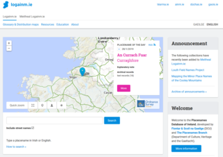
The Placenames Database of Ireland, also known as logainm.ie, is a database and archive of place names in Ireland. It was created by Fiontar, Dublin City University in collaboration with the Placenames Branch of the Department of Tourism, Culture, Arts, Gaeltacht, Sport and Media.

Camp is a village near the Slieve Mish Mountains in County Kerry, Ireland, on the Dingle Peninsula. It is close to the Dingle Way and is a destination for tourists.

Lough Rea, also Loughrea Lake, is a lake in Ireland, located south of Loughrea, County Galway.
Ross Lake is a freshwater lake in the west of Ireland. It is part of the Lough Corrib catchment in County Galway.
Oorid Lough is a freshwater lake in the west of Ireland. It is located in the Connemara area of County Galway.

Ballycuirke Lough, also known as Ballyquirke Lough, is a freshwater lake in the west of Ireland. It is part of the Lough Corrib catchment in County Galway.
Kilcullane is a civil parish and townland located in County Limerick, Ireland. The civil parish is in the barony of Smallcounty. It is located in east County Limerick near the village of Bruff. The north-eastern part of the parish borders the parish of Ballinard.

Ballynacarrow, locally Ballinacarrow, is a village in County Sligo, Ireland. It is located approximately 19 kilometres (12 mi) south-west of Sligo town. The Temple House estate is south of the village.

Redcastle is a village in County Donegal, Ireland, located on the eastern shores of Inishowen and overlooking the wide expanse of Lough Foyle. To the south is the city of Derry and to the north lie the villages of Moville and Greencastle.
Ballinard is a civil parish and townland located in the eastern part of County Limerick, Ireland. The civil parish is part of the barony of Smallcounty. The largest population centre is the village of Herbertstown. The south-eastern part of the parish borders the parish of Kilcullane. Geologically, the parish rests on a substratum of limestone, except in some few places where the basalt rises.
