Related Research Articles

County Waterford is a county in Ireland. It is in the province of Munster and is part of the Southern Region. It is named after the city of Waterford. Waterford City and County Council is the local authority for the county. The population of the county at large, including the city, was 127,363 according to the 2022 census. The county is based on the historic Gaelic territory of the Déise. There is an Irish-speaking area, Gaeltacht na nDéise, in the southwest of the county.
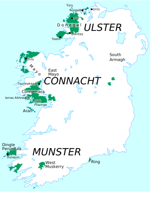
A Gaeltacht is a district of Ireland, either individually or collectively, where the Irish government recognises that the Irish language is the predominant vernacular, or language of the home. The Gaeltacht districts were first officially recognised during the 1920s in the early years of the Irish Free State, following the Gaelic revival, as part of a government policy aimed at restoring the Irish language.
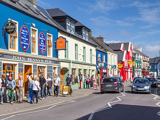
Dingle is a town in County Kerry, Ireland. The only town on the Dingle Peninsula, it sits on the Atlantic coast, about 50 kilometres (30 mi) southwest of Tralee and 71 kilometres (40 mi) northwest of Killarney. Principal industries in the town are tourism, fishing and agriculture: Dingle Mart serves the surrounding countryside.

The Waterford Institute of Technology was an institute of technology, located in Waterford, Ireland. The institute had six constituent schools and offered programmes in business, engineering, science, health sciences, as well as education & humanities.
Gurteen or Gorteen is a village in County Sligo, Ireland. It is in the civil parish of Kilfree in the baronry of Coolavin.
Red Gap, also known as Saggart Hill or Slieve Thoul, is a hill 395 feet above sea level situated 16 kilometres southwest of Dublin city centre in the Dublin Mountains close to Saggart and Rathcoole. The hill gets its name from the townland of 'Redgap' which lies just to the north of it. Today, Red Gap is home to farmland and telecommunication masts. The hill has FM radio transmitters for Newstalk, Kfm, LMFM, i105-107 and East Coast FM.

Burnfoot is a small village on the Inishowen peninsula in County Donegal, Ireland. It lies within the townland of Ballyderowen. It has a few local shops and a pub. As of 2016, the population was 450.
Ballinroad is a village approximately 3 km from Dungarvan, County Waterford on the south coast of Ireland. Ballinroad grew rapidly during the Celtic tiger era and is now one of Dungarvan's main dormitory areas.
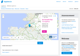
The Placenames Database of Ireland, also known as logainm.ie, is a database and archive of place names in Ireland. It was created by Fiontar, Dublin City University in collaboration with the Placenames Branch of the Department of Tourism, Culture, Arts, Gaeltacht, Sport and Media.

Kilculliheen is a civil parish, electoral division and barony in Ireland, on the north bank of the River Suir across from the centre of Waterford City. Historically, it has been transferred several times between the county of the city of Waterford and the counties of Kilkenny and Waterford. It now contains the only part of Waterford city on the left bank of the River Suir. The Parliamentary Gazetteer of 1846 states "as it lies on the left bank of the Suir, which, for the most part, divides co. Waterford from co. Kilkenny, most topographists mistakingly assign it to the barony of Ida, co. Kilkenny". It is now partly in County Kilkenny and partly in Waterford City. Of the barony's eleven townlands, five are entirely in Kilkenny and six are split between Kilkenny and Waterford. The city portion contains the formerly rural village of Ferrybank, which gives its name to a wider suburb which has spread across the county boundary.
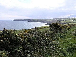
Ballynagaul is a Gaeltacht area within the Irish-speaking Gaeltacht na nDéise part of County Waterford. Comprising the townlands of Baile na nGall Mór and Baile na nGall Beag, it is located approximately 9.6 kilometres southeast of Dungarvan. The village of Ring is located in the area.
Kilcullane is a civil parish and townland located in County Limerick, Ireland. The civil parish is in the barony of Smallcounty. It is located in east County Limerick near the village of Bruff. The north-eastern part of the parish borders the parish of Ballinard.

Redcastle is a village in County Donegal, Ireland, located on the eastern shores of Inishowen and overlooking the wide expanse of Lough Foyle. To the south is the city of Derry and to the north lie the villages of Moville and Greencastle.
Ballinard is a civil parish and townland located in the eastern part of County Limerick, Ireland. The civil parish is part of the barony of Smallcounty. The largest population centre is the village of Herbertstown. The south-eastern part of the parish borders the parish of Kilcullane. Geologically, the parish rests on a substratum of limestone, except in some few places where the basalt rises.
References
- 1 2 3 4 5 6 7 8 9 10 11 12 13 14 15 16 17 "Sub-units of Port Láirge/Waterford: town". Placenames Database of Ireland. Government of Ireland - Department of Arts, Heritage and the Gaeltacht and Dublin City University . Retrieved 24 May 2019.
- 1 2 3 4 5 6 7 8 9 10 11 12 13 14 15 16 "Sub-units of Port Láirge/Waterford: population centre". Placenames Database of Ireland. Government of Ireland - Department of Arts, Heritage and the Gaeltacht and Dublin City University . Retrieved 24 May 2019.
- 1 2 "Census 2016 Small Area Population Statistics". Central Statistics Office (Ireland) . Retrieved 24 May 2019.
