This is a list of valleys of New Mexico . Valleys are ordered alphabetically, by county.
Contents
- Chaves County
- Doña Ana County
- Grant County
- Hidalgo County
- Lea County
- Lincoln County
- Luna County
- Otero County
- Sierra County
- See also
This is a list of valleys of New Mexico . Valleys are ordered alphabetically, by county.
E
M
R
T
B
H
A
H
P
S
A
U
T
T

Alamogordo is the seat of Otero County, New Mexico, United States. A city in the Tularosa Basin of the Chihuahuan Desert, it is bordered on the east by the Sacramento Mountains and to the west by Holloman Air Force Base. The population was 31,384 as of the 2020 census. Alamogordo is widely known for its connection with the 1945 Trinity test, which was the first ever explosion of an atomic bomb.

Tularosa is a village in Otero County, New Mexico, United States. It shares its name with the Tularosa Basin, in which the town is located. To the east, Tularosa is flanked by the western edge of the Sacramento Mountains. The population was 2,553 at the 2020 census. During the 1990s and early 2000s, the town, north of the much larger Alamogordo, experienced moderate growth and construction as a bedroom community, especially in the housing industry. Tularosa is noted for its abundance of cottonwood shade trees and its efforts to preserve the adobe-style architecture of its past.

The Sacramento Mountains are a mountain range in the south-central part of the U.S. state of New Mexico, lying just east of Alamogordo in Otero County. From north to south, the Sacramento Mountains extend for 85 miles (137 km), and from east to west they encompass 42 miles (68 km).

The poblano is a mild chili pepper originating in Puebla, Mexico. Dried, it is called ancho or chile ancho, from the Spanish word ancho (wide). Stuffed fresh and roasted, it is popular in chiles rellenos poblanos.

The Sierra Blanca is an ultra-prominent range of volcanic mountains in Lincoln and Otero counties in the south-central part of the U.S. state of New Mexico. The range is about 40 miles (64 km) from north to south and 20 miles (32 km) wide.

The Plains of San Agustin is a region in the southwestern U.S. state of New Mexico in the San Agustin Basin, south of U.S. Highway 60. The area spans Catron and Socorro Counties, about 50 miles (80 km) west of the town of Socorro and about 25 miles (40 km) north of Reserve. The plains extend roughly northeast-southwest, with a length of about 55 miles (88 km) and a width varying between 5–15 miles (8–24 km). The basin is bounded on the south by the Luera Mountains and Pelona Mountain ; on the west by the Tularosa Mountains; on the north by the Mangas, Crosby, Datil, and Gallinas Mountains; and on the east by the San Mateo Mountains. The Continental Divide lies close to much of the southern and western boundaries of the plains.

The Tularosa Basin is a graben basin in the Basin and Range Province and within the Chihuahuan Desert, east of the Rio Grande in southern New Mexico and West Texas, in the Southwestern United States.
Big Hatchet Peak is the high point of the Big Hatchet Mountains, a small but rugged range in the southwest corner of New Mexico, in the United States. The mountains are located in southeast Hidalgo County, about 50 miles (80 km) southwest of Deming. The range runs roughly northwest-southeast, and is about 12 miles (19 km) long; the southeastern edge of the range is within 3.5 miles (6 km) of the border with Mexico. They lie primarily on BLM land.
State Road 9 (NM 9) is a 109.154-mile-long (175.666 km) state road in the U.S. state of New Mexico. The highway spans Hidalgo, Grant, and Luna counties from its western terminus at NM 80 to its eastern terminus at CR A003 at the Doña Ana county line. NM 9 and NM 338 are the only remaining New Mexico State Roads to form a concurrency.
The White Sands pupfish is a species of pupfish in the family Cyprinodontidae. It is endemic to the Tularosa Basin in southern New Mexico, in the Western United States. They are only found in two springs and two small streams in southwest New Mexico. White Sands pupfish have dark eyes and silver scales. They grow from 1+3⁄4 to 2+1⁄2 inches long. Adult males have a slight blue color.
The Tularosa Basin Museum of History, formerly the Tularosa Basin Historical Society Museum, is a history museum holding a collection of historical photographs, documents, and relics from Otero County, New Mexico. The museum is located in Alamogordo, New Mexico, and is owned and operated by the Tularosa Basin Historical Society.

The New Mexico bootheel is a salient (protrusion) which comprises the southwestern corner of New Mexico. As part of the Gadsden Purchase it is bounded on the east by the Mexican state of Chihuahua along a line at 31°47′0″N108°12′30″W extending south to latitude 31°20′0″N at 31°20′0″N108°12′30″W. The southern border is shared between the Mexican states of Chihuahua and Sonora along latitude 31°20′0″N, while the western border with Arizona is along meridian 109°03′0″W at 31°20′0″N109°03′0″W, bounding an area of 50 by 30 miles and comprising 1,500 square miles (3,900 km2).

The Hachita Valley,, is a small valley in southwest New Mexico. The valley is in the east of the New Mexico Bootheel region and borders Chihuahua state, Mexico. Hachita, New Mexico lies in the valley's northeast, where New Mexico State Road 9 traverses east-west across much of southern New Mexico. The large, and extensive north-south Playas Valley borders to the west on the other side of the west perimeter mountain ranges.
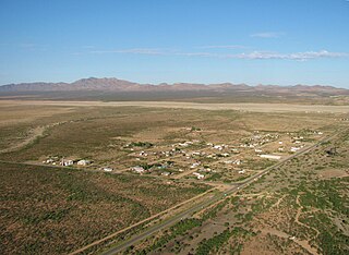
Hachita is a census-designated place in Grant County, New Mexico, United States. Its population was 49 as of the 2010 census. Hachita has a post office with ZIP code 88040. New Mexico State Road 9, New Mexico State Road 81, and New Mexico State Road 146 pass through the community. The ghost town of Old Hachita is several miles west of the town.
Lineostriastiria hachita is a moth in the family Noctuidae. It was described by William Barnes in 1904 and is found in North America.

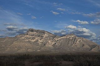
Oscura Mountains, originally known to the Spanish as the Sierra Oscura, are a ridge of mountains, trending north and south, east of the Jornada del Muerto and west of the Tularosa Valley. The word oscura means "dark" and refers to the dark color of the mountains due to the Pinyon-juniper vegetation at their higher elevations. The Oscuras are located in Socorro County and Lincoln County, New Mexico. Their southern end is at 33°30′30″N106°18′45″W and their northern end is at 33°49′15″N106°22′20″W near North Oscura Peak. Their highest elevation is Oscura Peak at 8,625 feet.