Ancho, New Mexico

Last updated

Ancho
USA New Mexico location map.svg
Red pog.svg
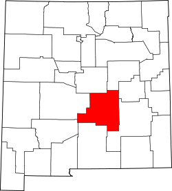
Ancho
Location within the state of New Mexico
Usa edcp location map.svg
Red pog.svg
Ancho
Ancho (the United States)
Coordinates: 33°56′14″N105°44′28″W / 33.9372°N 105.7412°W / 33.9372; -105.7412
Country United States
State New Mexico
County Lincoln
Time zone UTC-7 (Mountain (MST))
  Summer (DST) UTC-6 (MDT)

Ancho is an unincorporated desert hamlet in Lincoln County, New Mexico, United States. It is located west of the Lincoln National Forest, 2 miles east of U.S. Highway 54, and north of the town of Carrizozo. There is an active Presbyterian church at Ancho; however, there are no businesses or services available. Most of the land and historic buildings that were once part of the community-at-large are now on private property and not accessible to the general public.

Contents

History

With the arrival of the railway in 1901 and the discovery of gypsum and clay, the Ancho Brick Plant was established and began producing bricks. The plant eventually grew to 16 kilns. In 1906, the Ancho Brick Plant supplied several tons of bricks which were shipped by railway to San Francisco to help rebuild the city after the 1906 San Francisco earthquake. When Highway 54 was paved and rerouted two miles to the west of town, the brick plant closed its doors for good in 1921. That was a fatal blow to Ancho's economy. The town then began its slow decline. In 1955, the Ancho School closed its doors. Four years after in 1959 the train station closed, and in 1969, Ancho's Post Office shut its doors. Today the remaining local residents have restored many of Ancho's remaining pioneer buildings including the school and train station.

Related Research Articles

<span class="mw-page-title-main">Lincoln Highway</span> Historic long-distance highway in the United States

The Lincoln Highway is the first transcontinental highway in the United States and one of the first highways designed expressly for automobiles. Conceived in 1912 by Indiana entrepreneur Carl G. Fisher, and formally dedicated October 31, 1913, the Lincoln Highway runs coast-to-coast from Times Square in New York City west to Lincoln Park in San Francisco, originally through 13 states: New York, New Jersey, Pennsylvania, Ohio, Indiana, Illinois, Iowa, Nebraska, Colorado, Wyoming, Utah, Nevada, and California. In 1915, the "Colorado Loop" was removed, and in 1928, a realignment routed the Lincoln Highway through the northern tip of West Virginia. Thus, there are 14 states, 128 counties, and more than 700 cities, towns, and villages through which the highway passed at some time in its history.

<span class="mw-page-title-main">Globe, Arizona</span> City in Arizona, United States

Globe is a city in Gila County, Arizona, United States. As of the 2020 census, the population of the city was 7,249. The city is the county seat of Gila County. Globe was founded c. 1875 as a mining camp. Mining, tourism, government and retirees are most important in the present-day Globe economy.

<span class="mw-page-title-main">Boyce, Virginia</span> Town in Virginia

Boyce is a small incorporated town in Clarke County, Virginia, United States. The population was 749 at the 2020 census, up from 589 at the 2010 census.

<span class="mw-page-title-main">Rhyolite, Nevada</span> Ghost town in Nevada, United States

Rhyolite is a ghost town in Nye County, in the U.S. state of Nevada. It is in the Bullfrog Hills, about 120 miles (190 km) northwest of Las Vegas, near the eastern boundary of Death Valley National Park. The town began in early 1905 as one of several mining camps that sprang up after a prospecting discovery in the surrounding hills. During an ensuing gold rush, thousands of gold-seekers, developers, miners and service providers flocked to the Bullfrog Mining District. Many settled in Rhyolite, which lay in a sheltered desert basin near the region's biggest producer, the Montgomery Shoshone Mine.

<span class="mw-page-title-main">Cronulla railway station</span> Railway station in Sydney, New South Wales, Australia

Cronulla railway station is the heritage-listed terminus railway station on the Cronulla line in Cronulla in the Sutherland Shire local government area of New South Wales, Australia. It was designed and built by the NSW Department of Railways during 1939. It is also known as Cronulla Railway Station group. The property was added to the New South Wales State Heritage Register on 2 April 1999.

<span class="mw-page-title-main">High Wycombe railway station</span> Railway station in Buckinghamshire, England

High Wycombe railway station is a railway station in the town of High Wycombe, Buckinghamshire, England. The station is on the Chiltern Main Line between Beaconsfield and Saunderton stations. It is served by Chiltern Railways.

<span class="mw-page-title-main">Wahroonga railway station</span> Railway station in Sydney, New South Wales, Australia

Wahroonga railway station is a heritage-listed railway station located on the North Shore line, serving the Sydney suburb of Wahroonga. The station is located in the Ku-ring-gai Council local government area of New South Wales, Australia. It is served by Sydney Trains T1 North Shore line services. It was built from 1890 to 1910 by E. Pritchard & Co., contractor. It is also known as Wahroonga Railway Station group and Pearce's Corner; Noonan's Platform. The property was added to the New South Wales State Heritage Register on 2 April 1999.

<span class="mw-page-title-main">Canterbury railway station, Sydney</span> Railway station in Sydney, New South Wales, Australia

Canterbury railway station is a heritage-listed railway station located on the Bankstown line at Canterbury in the City of Canterbury-Bankstown local government area of New South Wales, Australia. The station is served by Sydney Trains T3 Bankstown line services. The station was designed by New South Wales Government Railways and built from 1895 to 1915 by J. J. Scouller. It is also known as Canterbury Railway Station group. The property was added to the New South Wales State Heritage Register on 2 April 1999.

<span class="mw-page-title-main">Balboa Park station</span> Transit station in San Francisco, California, US

Balboa Park station is a Bay Area Rapid Transit (BART) station and Muni Metro complex in the Mission Terrace neighborhood of San Francisco, California, located near the eponymous Balboa Park. It is an intermodal hub served by four BART routes, three Muni Metro lines, and a number of Muni bus routes. The station complex also includes two rail yards, Cameron Beach Yard and Green Light Rail Center, where Muni maintains Muni Metro trains and heritage streetcars. BART uses a below-grade island platform on the west side of the complex; Muni Metro routes use several smaller side platforms located on surface-level rail loops around the yards.

<span class="mw-page-title-main">Richmond station (California)</span> Railway station in Richmond, California, US

Richmond station is an Amtrak intercity rail and Bay Area Rapid Transit (BART) station located in downtown Richmond, California. Richmond is the north terminus of BART service on the Orange Line and Red Line; it is a stop for Amtrak's Capitol Corridor, San Joaquins, and California Zephyr routes. The accessible station has one island platform for the two BART tracks, with a second island platform serving two of the three tracks of the Union Pacific Railroad Martinez Subdivision for Amtrak trains. It is one of two transfer points between BART and Amtrak, along with Oakland Coliseum station.

<span class="mw-page-title-main">Salisbury railway station</span> Railway station in Wiltshire, England

Salisbury railway station serves the city of Salisbury in Wiltshire, England. It is 83 miles 43 chains (134.4 km) from London Waterloo on the West of England line to Exeter St Davids. This is crossed by the Wessex Main Line from Bristol Temple Meads to Southampton Central. The station is operated and served by South Western Railway (SWR), and is also served by Great Western Railway (GWR).

<span class="mw-page-title-main">West Berkeley, Berkeley, California</span> Neighborhood in Berkeley, California, USA

<span class="mw-page-title-main">Agnews Developmental Center</span> United States historic place

Agnews Developmental Center was a psychiatric and medical care facility, located in Santa Clara, California.

<span class="mw-page-title-main">Swinderby railway station</span> Railway station in Lincolnshire, England

Swinderby railway station serves the villages of Swinderby, North Scarle, Eagle and Morton Hall in Lincolnshire, England. The station is 8.75 miles (14 km) south west of Lincoln Central on the Nottingham to Lincoln Central Line, owned by Network Rail and managed by East Midlands Railway who provide all services.

<span class="mw-page-title-main">Ocean Shore Railroad</span> Railroad along the Pacific coast of the United States from 1905 to 1921

The Ocean Shore Railroad was a railroad built between San Francisco and Tunitas Glen, and Swanton and Santa Cruz that operated along the Pacific coastline from 1905 until 1921. The route was originally conceived to be a continuous line between San Francisco and Santa Cruz, but the 1906 San Francisco Earthquake, financial difficulties, and the advent of the automobile caused the line to never reach its goals, and remain with a Northern and Southern division.

There are seventeen disused railway stations on the Cornish Main Line between Plymouth in Devon and Penzance in Cornwall, England. The remains of nine of these can be seen from passing trains. While a number of these were closed following the so-called "Beeching Axe" in the 1960s, many of them had been closed much earlier, the traffic for which they had been built failing to materialise.

The Lancashire, Derbyshire and East Coast Railway (LD&ECR) was built to connect coalfields in Derbyshire and Nottinghamshire with Warrington and a new port on the Lincolnshire coast. It was a huge undertaking, and the company was unable to raise the money to build its line. With the financial help of the Great Eastern Railway it managed to open between Chesterfield and Lincoln with a branch towards Sheffield from 1896. Despite efforts to promote tourist travel, the passenger business was never buoyant, but collieries were connected to the line, at first and in succeeding years. The Great Eastern Railway, and other main line companies, transported coal to the southern counties, and the company's engines took coal to Immingham in great quantities. The company had a fleet of tank engines.

The Stert and Westbury Railway was opened by the Great Western Railway Company in 1900 in Wiltshire, England. It shortened the distance between London Paddington station and Weymouth, and since 1906 has also formed part of the Reading to Taunton line for a shorter journey from London to Penzance.

<span class="mw-page-title-main">Jüterbog station</span>

Jüterbog station is a station in the town of Jüterbog in the German state of Brandenburg. It was opened in 1841, which makes it one of the oldest railway stations in Brandenburg. The Jüterbog–Röderau railway has branched off the Berlin–Halle railway (Anhalterbahn) at the station since 1848. Its importance grew with the opening of further railway lines. Some of these lines have now been closed.

<span class="mw-page-title-main">Bayshore Cutoff</span> United States historic place

The Bayshore Cutoff is the rail line between San Francisco and San Bruno along the eastern shore of the San Francisco Peninsula. It was completed by Southern Pacific (SP) in 1907 at a cost of $7 million, and included five tunnels, four of which are still used by Caltrain, the successor to Southern Pacific's Peninsula Commute service. Fill from the five tunnels was used to build the Visitacion or Bayshore Yard, the main SP classification yard near the city of Brisbane. The Del Monte was similarly rerouted over the line at some point in its operational history.

References