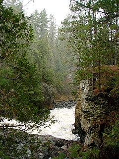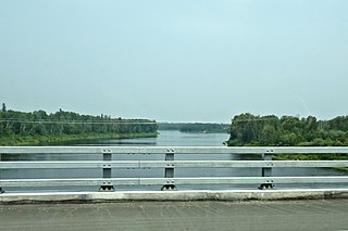
The York River is a river in Renfrew County, Hastings County and Haliburton County in Ontario, Canada. The river is in the Saint Lawrence River drainage basin, and flows from the southern extension of Algonquin Provincial Park to the Madawaska River.

The Nottawasaga River is a river in Simcoe County and Dufferin County in Central Ontario, Canada. It is part of the Great Lakes Basin, and is a tributary of Lake Huron. The river flows from the Orangeville Reservoir in the town of Orangeville, Dufferin County, through the Niagara Escarpment and the Minesing Wetlands, the latter a wetland of international significance, and empties into Nottawasaga Bay, an inlet of Georgian Bay on Lake Huron, at the town of Wasaga Beach, Simcoe County.

The Indian River is a river in Renfrew County and Nipissing District in Eastern and Northeastern Ontario, Canada. It is in the Saint Lawrence River drainage basin, and is a left tributary of the Muskrat River.

The Mississagi River is a river in Algoma and Sudbury Districts, Ontario, Canada, that originates in Sudbury District and flows 266 kilometres (165 mi) to Lake Huron at Blind River, Algoma District.

The Petawawa River is a river in the Saint Lawrence River drainage basin in Nipissing District and Renfrew County in eastern and northeastern Ontario, Canada. The river flows from Algonquin Provincial Park to the Ottawa River at the town of Petawawa, and is only one of two major tributaries of the Ottawa River to flow completely free. The river's name comes from the Algonquian for "where one hears a noise like this", which refers to its many rapids.

The Amable du Fond River is a river in Nipissing District, in Northern Ontario, Canada.

The Blind River is a river in Algoma District in Northeastern Ontario, Canada. The river is in the Great Lakes Basin and is tributary of Lake Huron.

The Fawn River is a river in the north of the Unorganized Part of Kenora District in Northwestern Ontario, Canada. It is in the Hudson Bay drainage basin and is a right tributary of the Severn River.

Pottageville is an unincorporated community located in northeastern King Township, in Ontario, Canada. It is near Schomberg. It is named for one of its early settlers, Edward Pottage.

Mississagi Provincial Park is a natural environment-class park north of Elliot Lake, in Algoma District, Ontario, Canada. It lies on the Boland River, a tributary of the Little White River, which is a tributary of the Mississagi River. The park is accessed via Highway 639.

Mississagi River Provincial Park is a protected area on the Mississagi River in Algoma and Sudbury Districts, Ontario, Canada. It has an Ontario Parks designation of Waterway Class. The park encompasses the river and lakes on the river from Mississagi Lake to Bark Lake, and further downstream to a point just above Ricky Island Lake, as well as portions of the upper Spanish River system.

The Redstone River is a river in the municipality of Dysart et al, Haliburton County in central Ontario, Canada that flows from southern Algonquin Provincial Park to the Gull River.

The Englehart River is a river in Timiskaming District in northeastern Ontario, Canada. It is in the Saint Lawrence River drainage basin and is a right tributary of the Blanche River.

The Crow River is a river in the Saint Lawrence River drainage basin in the Unorganized South Part of Nipissing District in northeastern Ontario, Canada. The river lies entirely within Algonquin Provincial Park and is a right tributary of the Petawawa River.

The Groundhog River is a river in Cochrane District and Sudbury District in Northeastern Ontario, Canada. The river is in the James Bay drainage basin and is a left tributary of the Mattagami River.

The Big East River is a river in Muskoka District and Nipissing District in Northeastern Ontario, Canada. The river is in the Great Lakes Basin, is a left tributary of the Muskoka River, and flows from Algonquin Provincial Park to Huntsville.

Daisy Lake Uplands Provincial Park is a provincial park in the Canadian province of Ontario. Surrounding Daisy Lake in the city of Greater Sudbury, the park serves to protect a recovering ecosystem scarred by pollution from the city's mining industry; one of the industry's first roasting beds in the region was located just east of the park boundaries. The park's ecosystem includes white birch trees, grasses, sedges, rock barrens and bog vegetation. The site is designated as a control area for ecological research — unlike in other parts of the city, where extensive environmental mitigation and recovery programs have been undertaken since the 1970s, Daisy Lake Uplands is set aside for study of the site's ability to recover on its own without human intervention. The park was first proposed for creation in 2003, and was officially designated by an amendment to the Ontario Provincial Parks Act in 2006.

The Kesagami River is a river in northern Cochrane District in Northeastern Ontario, Canada. It is part of the James Bay drainage basin, and is a left tributary of the Harricana River. The lower two-thirds of the river, from about Kesagami Lake and downstream for 112 kilometres (70 mi), are part of Kesagami Provincial Park.

The Valentine River is a river in the Unorganized North Part of Cochrane District in northeastern Ontario, Canada. It is in the Moose River drainage basin, and is a tributary of Lac Pivabiska, the source of the Pivabiska River.

The Makobe River is a river in northeastern Ontario, Canada. It is in the Saint Lawrence River drainage basin and is a left tributary of the Montreal River.


