Llanfihangel Tor-y-Mynydd | |
---|---|
Location within Monmouthshire | |
OS grid reference | SO 463 018 |
Principal area | |
Preserved county | |
Country | Wales |
Sovereign state | United Kingdom |
Post town | USK |
Postcode district | NP15 |
Dialling code | 01291 |
Police | Gwent |
Fire | South Wales |
Ambulance | Welsh |
UK Parliament | |
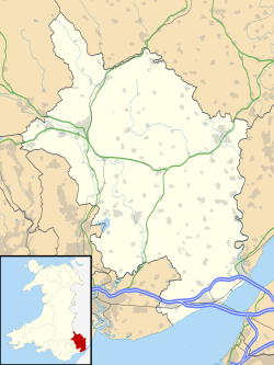
Llanfihangel Tor-y-Mynydd (or more correctly Llanfihangel-tor-y-mynydd, meaning, in Welsh, "the church of St. Michael on the breast of the mountain") is a small rural village in the community of Devauden, Monmouthshire, Wales. It is located within the Vale of Usk, about 9 miles south west of Monmouth and 6 miles east of the town of Usk, between the villages of Devauden and Llansoy.
The parish was reputedly settled by descendants of St. Brychan Brycheiniog, in particular Cynog, who gave his name to the area and former church at Llangunnock, immediately south of Llanfihangel Tor-y-Mynydd. [1]
The parish church of St Michael has a mediaeval nave and chancel, but was substantially restored in 1853/54. [2] It is a Grade II* listed building. [3]
The Star Inn has been in existence since at least the 15th century, and was an important staging post on the road leading from Chepstow towards Usk and Raglan. It was visited in 1748 by the preacher John Wesley, who described it as "a good though small inn". [4] It remains a popular inn and restaurant. The long hill between Llansoy and Devauden is known as Star Hill.
Rogiet Welsh: Rhosied is a small village and community in Monmouthshire, south east Wales, between Caldicot and Magor, 8 miles (13 km) west of Chepstow and 11 miles (18 km) east of Newport, which covers an area of 847 hectares (3.27 sq mi). It lies close to the M4 and M48 motorways, and the Second Severn Crossing. It has a railway station named Severn Tunnel Junction. Rogiet only has a population of 1,813 (2011).
Itton, is a small village in Monmouthshire, south-east Wales, in the community of Devauden about 3 miles (4.8 km) north-west of Chepstow. The village covers about a 2-mile (3.2 km) radius, with about 70 properties across a rural area. The parish also includes the hamlet of Howick.
Llanvair Discoed is a small village in Monmouthshire, south-east Wales, 6 miles west of Chepstow and 10 miles east of Newport.
Southern Monmouthshire was a parliamentary constituency in Monmouthshire. It returned one Member of Parliament (MP) to the House of Commons of the Parliament of the United Kingdom.
Llanvihangel Crucorney is a small village in the community (parish) of Crucorney, Monmouthshire, Wales. It is located 5 miles (8.0 km) north of Abergavenny and 18 miles (29 km) south-west of Hereford, England on the A465 road.
Llanfihangel Gobion is a village and rural parish of Monmouthshire, Wales, lying within the administrative community of Llanover.
Devauden is a village and community in Monmouthshire, southeast Wales. It is located between Chepstow and Monmouth near the top of the Trellech ridge on the B4293 road. The community covers an area of 3,790 hectares (14.6 sq mi). The community includes the villages of Itton and Wolvesnewton, Llanfihangel-tor-y-mynydd and Newchurch.
Mitchel Troy is a village and community in Monmouthshire, south east Wales, in the United Kingdom. It is located 3 miles south west of the county town of Monmouth, just off the A40 road leading towards Raglan. Settlements within the community include Tregare, Dingestow, Cwmcarvan and Wonastow.
Wolvesnewton is a small village in Monmouthshire, Wales.
Llangwm is a small rural village and former community, now in the community of Llantrisant Fawr, in Monmouthshire, south east Wales. It is located 3 miles (4.8 km) east of Usk, on the B4235 Chepstow to Usk road. The main village is at Llangwm Uchaf, with a smaller and more dispersed settlement about 1 mile (1.6 km) to the north-east at Llangwm Isaf .The other settlement in the community is Llansoy. In 2022 the community was abolished and merged with Llantrisant Fawr.
Llansoy is a small village in Monmouthshire, south east Wales, United Kingdom, located about 3 miles (4.2 km) south east of Raglan.
Llanishen is a village in Monmouthshire, south east Wales, United Kingdom. It is located 7 miles (11 km) south west of Monmouth and 3 miles (4.8 km) south of Trellech on the B4293 road, although the main part of the village is set immediately to the west of the road, overlooking the Vale of Usk.
Kilgwrrwg is a rural parish in Monmouthshire, south east Wales, United Kingdom. It is located 7 miles (11 km) north west of Chepstow and 7 miles (11 km) south east of Usk in a network of country lanes running through the rolling hills below the Trellech ridge.
Newchurch is an extensive rural parish and small hamlet in Monmouthshire, south east Wales. It is located 6 miles south east of Usk and 6 miles north west of Chepstow, between the B4235 and B4293 roads.
Llanfihangel can refer to the following places in Wales:
Penterry is a small rural parish of 479 acres (1.94 km2) in Monmouthshire, Wales. It is located between the villages of St. Arvans and Tintern, about 4 miles (6.4 km) north of Chepstow, within the Wye Valley Area of Outstanding Natural Beauty and about 2 miles (3.2 km) from the border with England. It now contains an isolated parish church adjoining the site of a deserted village, and a few farms.
The geology of Monmouthshire in southeast Wales largely consists of a thick series of sedimentary rocks of different types originating in the Silurian, Devonian, Carboniferous, Triassic and Jurassic periods.
The Church of St Michael, Llanfihangel Tor-y-Mynydd, Monmouthshire is a parish church with its origins in the 14th or 15th century. A Grade II* listed building, the church remains an active parish church.