LocalLink 34 (BaltimoreLink)

Last updated
Route 34
MTAMD60.jpg
Overview
System Maryland Transit Administration
GarageNorthwest
Statusactive
Began service1973
PredecessorsRoute 60, Route M-10
Route
LocaleBaltimore City
Baltimore County
Communities served Fallstaff
Ranchleigh
Mt. Washington
Bare Hills
Ruxton
Brooklandville
Landmarks served Reisterstown Road Plaza
Mt. Washington Light Rail Stop
Falls Road Light Rail Stop
Other routes 18, 27, 53, 54, 58, 59
Service
LevelWeekdays Only
FrequencyEvery 60 minutes
Every 40 minutes (peak)
Operates5:30 am to 8:00 pm [1]

Route 34 is a bus route operated by the Maryland Transit Administration in Baltimore and its suburbs. The line currently operates weekdays only from the Reisterstown Plaza Metro Subway Station to Stevenson University during peak hours and Greenspring Station midday.

Contents

The route is based on that of the former Route 60 (pre-BaltimoreLink), and Route M-10. It is especially similar to the pre-1992 route of Route M-10, except that it has no deviations from Clarks Lane, and that it operates via Smith Avenue to Mt. Washington rather than Old Pimlico Road to Falls Road.

History

The Greenspring Avenue corridor and the Cheswolde area was first served by the no. 47 streetcar prior to 1950. [2] [3] The no. 47 streetcar operated from Mt. Washington along Kelly Avenue, long before there was a light rail stop in the area. The line was originally constructed with the intention of being part of the Emory Grove Streetcar Line, but it was never completed to this extent, and later abandoned. [4]

The current Route 60 replaced a part of Route M-10 on August 24, 2008. Route M-10 had operated along various routes, serving Greenspring Station and other places in between since 1987. From 1984 to 1987, a Route P-7 had operated along a similar route. [5]

Service to Villa Julie College, the predecessor of Stevenson University, has been provided by a variety of routes in the past. Route 58A operated from 1973 to 1975 from the Reisterstown Road Plaza to Greenwood via Villa Julie College. This service was later merged into Route 5 as a special branch, which operated until 1984, when Metro connection services took over. From 1987 to 2005, a line known as Route M-12 reached Villa Julie, also serving Greenwood, Stevenson, and Caves Road. This line, which underperformed and faced numerous cutbacks over its years of operation, was eliminated in 2005 as part of the Greater Baltimore Bus Initiative. [6] MTA stated that the line was requiring a taxpayer subsidy of $9.41 per rider. [6] Following public opposition, [7] Route M-10 was extended from Greenspring Station to Villa Julie, and this area is currently covered by Route 60. This was after the portion of Route M-10 along Falls Road was also proposed for elimination but successfully fought.

1984-1992

In 1984, in conjunction with the opening of the Baltimore Metro Subway, two new routes were formed, Routes P-7 and R-2. Route P-7 operated between the Reisterstown Plaza Station and Ranchleigh, serving Fallstaff. Route R-2 operated between the Rogers Avenue Station and Mt. Washington serving Cheswolde.

In 1987, in conjunction with the opening of Phase II of the Metro, Routes P-7 and R-2 were redesignated Routes M-10 and M-5 respectively. Initially, both operated on portions of Falls Road now served by Route 60. Route M-5 briefly had service to Towson State University via the Ruxton area, but this was later discontinued.

1992-2008

In 1992, in conjunction with the opening of the Light Rail, Routes M-5 and M-10 were combined into a single line, which was given the M-10 designation. The new Route M-10 served both the Reisterstown Plaza and Rogers Avenue Metro stations, the Mt. Washington and Falls Road Light Rail Stops, and all points served by both of the previous routes, with the exception of short blocks on a few streets. Additionally, Saturday service was discontinued. [8]

In 1998, Saturday service was added back to Route M-10, and a branch that operated twice daily via Old Court Road was discontinued. Sunday service was added for the first time ever in 2001.

In 2005, as part of the Greater Baltimore Bus Initiative, service via Old Pimlico Road was discontinued, and all trips were modified to operate to Mt. Washington via Smith Avenue, with all weekday trips continuing to Greenspring Station, and all peak hour trips continuing to Villa Julie College, replacing a portion of Route M-12, which was discontinued. The line was also shortened to Reisterstown Plaza Metro Station. The original plan had been to completely eliminate Route M-10 service on Falls Road, and operate Route M-10 via the present route of Route 58. [9]

Changes in 2008

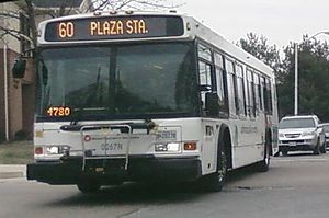
On August 24, 2008, Route M-10 was split into Routes 58 and 60. Route 58 operated along the same routing as before from the Reisterstown Plaza station to the intersection of Smith and Greenspring, then via Greenspring to the new Quarry Lake development. Route 60 was formed to operate along the full length of Clarks Lane without any deviations, and to serve all points of Route M-10 east of Greenspring. [10]

Following complaints from Quarry Lake residents over the buses, Route 58 was modified in February 2009 to operate to Mt. Washington and Route 60 service to Mt. Washington was supplemented. [11]

Related Research Articles

<span class="mw-page-title-main">Maryland Transit Administration</span> Public transit authority of the state of Maryland

The Maryland Transit Administration (MTA) is a state-operated mass transit administration in Maryland, and is part of the Maryland Department of Transportation. The MTA operates a comprehensive transit system throughout the Washington-Baltimore metropolitan area. There are 80 bus lines serving the Baltimore Metropolitan Area, along with rail services that include the Light Rail, Metro Subway, and MARC Train. In 2023, the system had a ridership of 52,922,000, or about 186,900 per weekday as of the first quarter of 2024.

<span class="mw-page-title-main">LocalLink 80 (BaltimoreLink)</span> Bus route in Baltimore, Maryland

LocalLink 80 is a bus route operated by the Maryland Transit Administration in Baltimore, Maryland, in the United States. LocalLink 80 is part of the high frequency network of the local bus system. The route consists of a leg originating in Downtown Baltimore and goes on to serve the Garrison Boulevard corridor in the northwest of the city. Route 80 and its predecessor, route 91, has carried some of the highest ridership out of Baltimore's local bus network throughout its history. The line was the first in the city to be assigned articulated buses, which are now used to meet the higher capacity requirements of the frequent lines.

<span class="mw-page-title-main">Milford Mill Road</span> Long road primarily situated in Baltimore County, Maryland

Milford Mill Road, Slade Avenue, and Smith Avenue are a long road mostly in Baltimore County, Maryland that runs through Milford Mill and Pikesville in the suburbs of Baltimore. The road starts out at the light rail stop in historic Mt. Washington Village in Baltimore city as Smith Avenue, and continues through Pikesville up to Seven Mile Lane before its name changes to Slade Avenue, and the road widens to four lanes. The road is known as Slade Avenue until Reisterstown Road, and from there, its name becomes Milford Mill Road until it dead-ends one block south of Rolling Road in an area known as Windsor Mill. It is one of the most heavily used routes in the northwest suburbs of Baltimore, as it is used for cross-county travel by motorists between the Pikesville and Randallstown areas.

<span class="mw-page-title-main">Route 7 (MTA Maryland)</span> Bus route operated by the Maryland Transit Administration

Route 7 was a bus route operated by the Maryland Transit Administration in Baltimore. The line, which operated between 1959 and 2017, ran from Canton, Baltimore to the Mondawmin Metro Subway Station, serving the communities of Butcher's Hill, Little Italy, and Sandtown-Winchester.

<span class="mw-page-title-main">LocalLink 94 (BaltimoreLink)</span> Bus route operated by the Maryland Transit Administration

Route 27 is a bus route operated by the Maryland Transit Administration in Baltimore. The line currently runs from the Reisterstown Plaza Metro Subway Station in northwest Baltimore to Port Covington in South Baltimore through downtown. The line also serves the communities of Pimlico, Mt. Washington, Cross Keys, Hampden, and Cherry Hill, and the Greyhound bus terminal. The bus route is the successor to the 10 Roland Park, 12 Westport, and 25 Mount Washington streetcar lines.

<span class="mw-page-title-main">CityLink Pink (BaltimoreLink)</span> Bus route operated by the Maryland Transit Administration

CityLink Pink is a bus route operated by the Maryland Transit Administration in Baltimore. The line currently runs from Cedonia in northeast Baltimore to the West Baltimore MARC station.

<span class="mw-page-title-main">Brooklandville, Maryland</span> Unincorporated community in Maryland, United States

Brooklandville is an unincorporated community in Baltimore County, Maryland, United States near the intersection of Jones Falls Expressway and the Baltimore Beltway. The general area is a part of Lutherville, and some addresses in the area are considered to be in Lutherville, though Brooklandville has a postal zone and post office of its own. Some notable landmarks in the area, including the Park School of Baltimore and St. Paul's Schools are technically within Brooklandville, as noted by their mailing addresses. However, addresses within the main office complex in the area, Green Spring Station, are considered to be within Lutherville.

<span class="mw-page-title-main">Reisterstown Plaza station</span> Metro SubwayLink station

Reisterstown Plaza station is a Metro SubwayLink station in Baltimore, Maryland. It is located at the intersection of Patterson and Wabash Avenues, and is the fourth most northern and western station on the line, with approximately 700 parking spaces.

<span class="mw-page-title-main">LocalLink 73 (BaltimoreLink)</span> Bus route in Baltimore, Maryland and its suburbs

Route 51 is a bus route operated by the Maryland Transit Administration in Baltimore and its suburbs. The line currently runs from the Rogers Avenue Metro Subway Station to the Patapsco Light Rail Stop, serving the communities of Arlington, Ashburton, Mondawmin, Rosemont, Baltimore, Cherry Hill, and Mt. Winans, and the suburb of Baltimore Highlands.

<span class="mw-page-title-main">LocalLink 29 (BaltimoreLink)</span> Bus route operated by the Maryland Transit Administration

LocalLink 29 is a bus route operated by the Maryland Transit Administration in Baltimore. The line currently runs from the Mondawmin Metro Subway Station in Northwest Baltimore to Brooklyn Homes in South Baltimore through the communities of Rosemont and the corridors of Hilton Street, Caton Avenue, and Patapsco Avenue. During peak hours, selected trips operate via Violetville Industrial Park.

<span class="mw-page-title-main">LocalLink 30 (BaltimoreLink)</span> Bus route operated by the Maryland Transit Administration

LocalLink 30 is a bus route operated by the Maryland Transit Administration in Baltimore and its suburbs. It replaced route 44 following the 2017 BaltimoreLink overhaul of the bus network. The line currently runs from Rosedale Industrial Park near Pulaski Highway just outside the Baltimore city limits on the east side of the city across the northern portion of the city to Security Square Mall, with selected peak hour trips to the Social Security Administration. Some early morning trips before 7 AM lay over at the Centers for Medicare and Medicaid Services (CMS) headquarters. The line operates mostly along Frankford Avenue, Echodale Avenue, East Belvedere Avenue, Northern Parkway, Rogers Avenue, and Gwynn Oak Avenue, serving the communities of Gardenville, Hamilton, Belvedere Park, Homeland, Roland Park, Pimlico, and Arlington, and the western suburb of Woodlawn.

LocalLink 85 is a bus route that operates in Baltimore and its suburbs. All trips operate from the Penn-North Metro Subway Station in Baltimore City to the Milford Mill Metro Subway Station in Pikesville. The route, which started operating on August 24, 2008, is a combination of the most recent versions of the former routes M-3 and M-8, which had been operating since 1984 and 1987 respectively. Prior to these dates, the routes had been served by other buses and streetcars.

<span class="mw-page-title-main">LocalLink 33 (BaltimoreLink)</span> Bus route in Baltimore, Maryland and its suburbs

Route 58 is a bus route operated by the Maryland Transit Administration in Baltimore and its suburbs. The line's western terminus is the Reisterstown Plaza Metro Subway Station, and its eastern terminus is White Marsh Mall, though some peak hour trips make short turns in Overlea. Route 58 serves the communities of Glen, Cheswolde, Fallstaff, a large section of Northern Parkway, and a portion of Belair Road in Baltimore County.

<span class="mw-page-title-main">LocalLink 89 (BaltimoreLink)</span> Bus route operated by the Maryland Transit Administration

LocalLink 89 is a bus route operated by the Maryland Transit Administration in Baltimore and its suburbs, mostly along Reisterstown Road. The line currently runs from the Reisterstown Plaza Metro Subway Station to the Owings Mills Town Center. The line replaced original Route 59 under BaltimoreLink, and was a split-off from Route M-9, and resembles the pre-1997 route of Route M-9. It is the successor to several other bus routes and streetcars.

<span class="mw-page-title-main">LocalLink 87 (BaltimoreLink)</span> Bus route operated by the Maryland Transit Administration

LocalLink 87 is a bus route operated by the Maryland Transit Administration in the suburbs of Baltimore. The route currently runs from the Owings Mills Town Center to Glyndon via Reisterstown Road and the Owings Mills Metro Subway Station. The line, which was a split-off from the final version of the now defunct Route M-9, and resembles the former Route M-16 that operated from 1987 to 1998. The route was previously named No. 56 before BaltimoreLink, when it was replaced in its entirety by Route 87.

<span class="mw-page-title-main">LocalLink 31 (BaltimoreLink)</span> Bus route operated by the Maryland Transit Administration

Route 57 is a bus route operated by the Maryland Transit Administration in Baltimore and its suburbs. The line currently runs from the Rogers Avenue Metro Subway Station in Northwest Baltimore to Security Square Mall, with selected trips to the Social Security Administration headquarters in Woodlawn. The line serves the corridor of Gwynn Oak Avenue and the communities of Howard Park, Gwynn Oak, and Windsor Mill.

<span class="mw-page-title-main">LocalLink 83 (BaltimoreLink)</span> Bus route operated by the Maryland Transit Administration

LocalLink 83 is a bus route in Baltimore and its suburbs. The line currently runs from the Old Court Metro Subway Station in Pikesville, Maryland to the Mondawmin Metro Subway Station in Northwest Baltimore along Old Court Road and Reisterstown Road, serving the communities of Park Heights and the Reisterstown Road Plaza. The line is the successor to Bus Route 7, which still operates south of Mondawmin. Route 7 operated along Reisterstown Road outside the Metro's hours of operation until 2001.

<span class="mw-page-title-main">LocalLink 92 (BaltimoreLink)</span> Bus route operated by the Maryland Transit Administration

LocalLink 92 is a school-day only bus route operated by the Maryland Transit Administration in Baltimore. The line currently runs from Glen Avenue and Key Avenue in Northwest Baltimore to Smith Avenue and Copper Ridge Road in Mount Washington or Old Court Road and Scotts Hill Drive in Pikesville.

<span class="mw-page-title-main">Sabina Mattfeldt, Baltimore</span> Neighborhood statistical area in Baltimore, Maryland, United States

Sabina Mattfeldt is a neighborhood in the North District of Baltimore, located beside the Jones Falls, between the neighborhoods of Mount Washington (west) and Poplar Hill (east). Its name comes from the two streets, Sabina Avenue and Mattfeldt Avenue, where most of the neighborhood's homes are located.

<span class="mw-page-title-main">College Park Line</span>

The College Park Line, designated Routes 83 & 86, are daily bus routes operated by the Washington Metropolitan Area Transit Authority between the Rhode Island Avenue Station, which is served by Red Line of the Washington Metro, and the Cherry Hill Park Campground in College Park, Maryland (83), or Calverton (86). 83 is shortened to only operate on short trips between Rhode Island Avenue station and Mount Rainier during early mornings on the weekends. 83 & 86 mainly operate on the U.S. Route 1 corridor between Rhode Island Avenue in Northeast Washington, D.C. & College Park, Maryland. Route 83 trips are roughly 50 minutes long and route 86 trips are roughly 70 minutes long.

References

  1. "Local Bus 55 Schedule" (PDF). MTA Maryland. June 13, 2010.
  2. "A History of the Falls Road Streetcar Line". The Routes of Baltimore Transit: 1900 to today. Baltimore Transit Archives. Archived from the original on June 1, 2002. Retrieved March 22, 2012.
  3. Herbert H. Harwood, Jr. (2003). Baltimore streetcars: the postwar years. Johns Hopkins University Press. pp. 83–85. ISBN   0-8018-7190-5.
  4. Adam Paul. "Streetcars: From Out of the North". Baltimore Ghosts. Monumental City. Archived from the original on February 14, 2012. Retrieved March 22, 2012.
  5. "Metro Connection Bus Routes". The Routes of Baltimore Transit: 1900 to today. Baltimore Transit Archives. Archived from the original on 17 July 2011. Retrieved 15 May 2011.
  6. 1 2 Michael Dresser (June 9, 2005). "Sweeping revision of bus routes proposed". The Baltimore Sun. Archived from the original on June 4, 2011. Retrieved May 15, 2011.
  7. Michael Dresser (June 14, 2005). "Hundreds gather to decry bus route changes". The Baltimore Sun.
  8. MTA June 1992 schedule changes
  9. "Highlights of proposed bus route changes". The Baltimore Sun. June 9, 2005.
  10. MTA August 2008 schedule changes
  11. http://www.explorebaltimorecounty.com/news/4839/quarry-lake-residents-ride-mta-cut-their-part-bus-route-58/ [ dead link ]