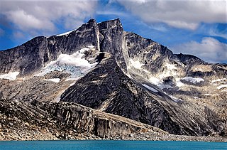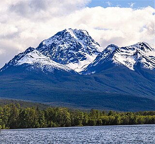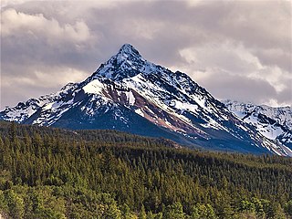
Lebanon is a small country in the Levant region of the Eastern Mediterranean, located at approximately 34˚N, 35˚E. It stretches along the eastern shore of the Mediterranean Sea and its length is almost three times its width. From north to south, the width of its terrain becomes narrower. Lebanon's mountainous terrain, proximity to the sea, and strategic location at a crossroads of the world were decisive factors in shaping its history.

Mount Waddington, once known as Mystery Mountain, is the highest peak in the Coast Mountains of British Columbia, Canada. Although it is lower than Mount Fairweather and Mount Quincy Adams, which straddle the United States border between Alaska and British Columbia, Mount Waddington is the highest peak that lies entirely within British Columbia. It and the subrange which surround it, known as the Waddington Range, stand at the heart of the Pacific Ranges, a remote and extremely rugged set of mountains and river valleys.

The Canadian Rockies or Canadian Rocky Mountains, comprising both the Alberta Rockies and the British Columbian Rockies, is the Canadian segment of the North American Rocky Mountains. It is the easternmost part of the Canadian Cordillera, which is the northern segment of the North American Cordillera, the expansive system of interconnected mountain ranges between the Interior Plains and the Pacific Coast that runs northwest–southeast from central Alaska to the Isthmus of Tehuantepec in Mexico.

Mount Garibaldi is a dormant stratovolcano in the Garibaldi Ranges of the Pacific Ranges in southwestern British Columbia, Canada. It has a maximum elevation of 2,678 metres and rises above the surrounding landscape on the east side of the Cheakamus River in New Westminster Land District. In addition to the main peak, Mount Garibaldi has two named sub-peaks. Atwell Peak is a sharp, conical peak slightly higher than the more rounded peak of Dalton Dome. Both were volcanically active at different times throughout Mount Garibaldi's eruptive history. The northern and eastern flanks of Mount Garibaldi are obscured by the Garibaldi Névé, a large snowfield containing several radiating glaciers. Flowing from the steep western face of Mount Garibaldi is the Cheekye River, a tributary of the Cheakamus River. Opal Cone on the southeastern flank is a small volcanic cone from which a lengthy lava flow descends. The western face is a landslide feature that formed in a series of collapses between 12,800 and 11,500 years ago. These collapses resulted in the formation of a large debris flow deposit that fans out into the Squamish Valley.

Glacier National Park is part of a system of 43 parks and park reserves across Canada, and one of seven national parks in British Columbia. Established in 1886, the park encompasses 1,349 km2 (521 sq mi), and includes a portion of the Selkirk Mountains, which are part of the larger grouping of mountains, the Columbia Mountains. It also contains the Rogers Pass National Historic Site.

British Columbia is the westernmost province of Canada, bordered by the Pacific Ocean. With an area of 944,735 km2 (364,764 sq mi) it is Canada's third-largest province. The province is almost four times the size of the United Kingdom and larger than every United States state except Alaska. It is bounded on the northwest by the U.S. state of Alaska, directly north by Yukon and the Northwest Territories, on the east by Alberta, and on the south by the U.S. states of Washington, Idaho, and Montana. Formerly part of the British Empire, the southern border of British Columbia was established by the 1846 Oregon Treaty. The province is dominated by mountain ranges, among them the Canadian Rockies but dominantly the Coast Mountains, Cassiar Mountains, and the Columbia Mountains. Most of the population is concentrated on the Pacific coast, notably in the area of Vancouver, located on the southwestern tip of the mainland, which is known as the Lower Mainland. It is the most mountainous province of Canada.
Tweedsmuir South Provincial Park is a provincial park covering parts of the eastern Kitimat Ranges, northern Pacific Ranges, and the Rainbow Range in British Columbia, Canada. It was established on May 21, 1938 in the western interior of the province, to protect its important natural features. The park hosts a variety of recreation activities for visitors. This park encompasses a range of diverse species in this park including bears, moose, and various fish. There are also a few at risk species in this park.
The Nechako Plateau is the northernmost subdivision of the Interior Plateau, one of the main geographic regions of the Canadian province of British Columbia. It spans the basin of the Nechako River and its tributaries the Stuart River and Endako Rivers, and is bounded on the south by the West Road River, south of which is the Chilcotin Plateau and on the north by the Nation River and the valleys of Babine and Takla Lakes, beyond which are the Omineca Mountains (N) and Skeena Mountains (NW). To the west, it abuts the various ranges of the Hazelton Mountains while on its east it is bounded by the pass between Prince George, British Columbia and the Parsnip Arm of Williston Lake, beyond which is the McGregor Plateau, which skirts the Northern Rockies. Some classification systems include the plateau area on the east bank of the Fraser River beyond the city of Prince George; this area neighbours the northernmost reaches of the Quesnel Highland and Cariboo Mountains.

Level Mountain is a large volcanic complex in the Northern Interior of British Columbia, Canada. It is located 50 kilometres north-northwest of Telegraph Creek and 60 kilometres west of Dease Lake on the Nahlin Plateau. With a maximum elevation of 2,164 metres, it is the second-highest of four large complexes in an extensive north–south trending volcanic region. Much of the mountain is gently sloping; when measured from its base, Level Mountain is about 1,100 metres tall, slightly taller than its neighbour to the northwest, Heart Peaks. The lower, broader half of Level Mountain consists of a shield-like structure while its upper half has a more steep, jagged profile. Its broad summit is dominated by the Level Mountain Range, a small mountain range with prominent peaks cut by deep valleys. These valleys serve as a radial drainage for several small streams that flow from the mountain. Meszah Peak is the only named peak in the Level Mountain Range.
The Pioneer Mountains are a mountain range in the U.S. state of Idaho, spanning Blaine, Butte and Custer counties. The range is bounded on the west by the Big Wood River, Trail Creek and Summit Creek, and the North Fork Big Lost River, on the north and east by the East Fork Big Lost River, Left Fork Cherry Creek, Cherry Creek, Dry Fork Creek, Saint Louis Canyon, and Champagne Creek, and on the south by the Snake River Plain. The mountains are located within Sawtooth and Challis National Forests.

Arizona is a landlocked state situated in the southwestern region of the United States of America. It has a vast and diverse geography famous for its deep canyons, high- and low-elevation deserts, numerous natural rock formations, and volcanic mountain ranges. Arizona shares land borders with Utah to the north, the Mexican state of Sonora to the south, New Mexico to the east, and Nevada to the northwest, as well as water borders with California and the Mexican state of Baja California to the southwest along the Colorado River. Arizona is also one of the Four Corners states and is diagonally adjacent to Colorado.
The McGregor Plateau is a sub-plateau of the Nechako Plateau, the northernmost major subdivision of the Interior Plateau spanning the inland regions of the Pacific Northwest. Located in British Columbia, Canada, to the east of the city of Prince George, British Columbia, the McGregor Plateau lies between the main spine of the Northern Rocky Mountains on the east and the Fraser River on the west, beginning on its southeast at the confluence of the Torpy River with the Fraser and running northwest, parallel to the Fraser and the Rockies, to end in the area of the Arctic and Pacific Lakes to the north of the great bend in the Fraser River just upstream from and to the northeast of Prince George. The McGregor Plateau is very mountainous in character and includes several large rivers, the largest being the McGregor River and Herrick Creek. Included in the McGregor Plateau is the McGregor Range, which lies between the McGregor and Torpy Rivers and the Dezaiko Range, which lies between Herrick and McGregor Rivers.
The McGregor Range is a mountain range in the Central Interior of British Columbia, located between the main spine of the Rocky Mountains and the Fraser River on the northeast and southwest, and between the Torpy River on its southeast and the McGregor River on its northwest. Though adjacent to the Rockies and very mountainous, the McGregor Range is part of the McGregor Plateau, a subdivision of the Fraser Plateau.

South Chilcotin Mountains Provincial Park is a provincial park in British Columbia, Canada, located on Highway 40 northwest of Lillooet, British Columbia. The park, which is 56,796 ha. in size, was established on April 18, 2001, and It was created out of a portion of the Spruce Lake Protected Area. The park is located on three Indigenous Nations: The Tsilhqot’in, St’at’imc, and Secwepemc.

Dallas Peak is a high mountain summit in the Sneffels Range of the Rocky Mountains of North America. The 13,815-foot (4,211 m) thirteener is located in the Mount Sneffels Wilderness of Uncompahgre National Forest, 3.3 miles (5.3 km) north by west of the Town of Telluride, Colorado, United States, on the drainage divide between Ouray and San Miguel counties.

McGregor Mountain is an 8,143-foot (2,482-metre) elevation massif located in the Stehekin Valley of the North Cascades, in Chelan County of Washington state. McGregor Mountain is situated northwest of Lake Chelan in the northern Methow Mountains, on the shared border of North Cascades National Park and Lake Chelan National Recreation Area. The closest community is Stehekin, and the nearest higher neighbor is Goode Mountain, 7.3 miles (11.7 km) to the northwest. Precipitation runoff from the mountain drains into tributaries of the Stehekin River. Topographic relief is significant since the southern aspect of the mountain rises 6,600 feet above this river in approximately two miles. The famous Pacific Crest Trail traverses the western base of this mountain, and the strenuous 7.7-mile (12.4 km) McGregor Mountain Trail gains 6,400 feet of elevation to take hikers within a half-mile of the summit. Reaching the summit requires exposed scrambling the final 1,100 feet, and an ice axe is needed if the trail remains covered by snowpack. The summit was the site of an old fire lookout cabin from 1923 until 1955, but now has a radio repeater for the National Park Service. The views from the top include Glacier Peak, Black Peak, Corteo Peak, Frisco Mountain, Tupshin Peak, Dome Peak, Glory Mountain, and many others. This mountain was named for Billy McGregor, a Stehekin Valley resident who had a cabin and homestead at the base of this mountain during the 1890s. In May 1901, Billy disappeared overnight from a boat docked in Lake Chelan, and was never seen or heard from again.

Big Snow Mountain is a 2,357-metre (7,733-foot) mountain summit located in British Columbia, Canada.

Whitesaddle Mountain is a summit located in British Columbia, Canada.

Blackhorn Mountain is a summit located in British Columbia, Canada.
The Dezaiko Range is a mountain range within the McGregor Plateau, a sub-plateau of the larger Nechako Plateau in British Columbia, Canada.


