Lords Point, Connecticut

Last updated

Coordinates: 41°20′10″N71°55′41″W / 41.336°N 71.928°W / 41.336; -71.928

Geographic coordinate system Coordinate system

A geographic coordinate system is a coordinate system that enables every location on Earth to be specified by a set of numbers, letters or symbols. The coordinates are often chosen such that one of the numbers represents a vertical position and two or three of the numbers represent a horizontal position; alternatively, a geographic position may be expressed in a combined three-dimensional Cartesian vector. A common choice of coordinates is latitude, longitude and elevation. To specify a location on a plane requires a map projection.

Catching crabs at Boulder Beach - Lords Point, 2013. Lords Point - Stonington, Connecticut.jpg
Catching crabs at Boulder Beach - Lords Point, 2013.

Lords Point is a small private village on the Atlantic Coast in the town of Stonington, Connecticut, established in 1909. Lords Point has over 200 houses and summer cottages, with an average summer population of 800 people.

Stonington, Connecticut Town in Connecticut, United States

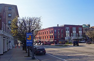
The town of Stonington is located in New London County, Connecticut in the state's southeastern corner. It includes the borough of Stonington, the villages of Pawcatuck, Lords Point, and Wequetequock, and the eastern halves of the villages of Mystic and Old Mystic. The population of the town was 18,545 at the 2010 census.

There are six beaches in Lords Point: Open Way, Tim's Beach, Boulder Beach, Hopkins Beach, Pebble Beach, and Trestle Beach. There are two docks: Boulder and Langworthy. These are limited to Lords Point residents and guests only.

Facilities at the Point include a basketball court, a bocce area, a tennis court, a soccer field, and a Community House which hosts various summer activities, including Bingo, teen parties, art programs, an annual talent show, and athletic classes. [1]

Bocce italian term for "boules"

Bocce, sometimes anglicized as bocci or boccie, is a ball sport belonging to the boules family, closely related to British bowls and French pétanque, with a common ancestry from ancient games played in the Roman Empire. Developed into its present form in Italy, it is played around Europe and also in overseas areas that have received Italian migrants, including Australia, North America, and South America. Bocce was initially played among the Italian migrants but has slowly become more popular with their descendants and the wider community.

Bingo (U.S.) game

In the United States, Bingo is a game of chance in which each player matches numbers printed in different arrangements on 5×5 cards which the numbers the game host (caller) draws at random, marking the selected numbers with tiles. When a player finds the selected numbers are arranged on their card in a row, they call out "Bingo!" to alert all participants to a winning card, which prompts the game host to examine the card for verification of the win. Players compete against one another to be the first to have a winning arrangement for the prize or jackpot. After a winner is declared, the players clear their number cards of the tiles and the game host begins a new round of play.

Related Research Articles

Westerly, Rhode Island Town in Rhode Island, United States

Westerly is a town on the southwestern shoreline of Washington County, Rhode Island, first settled by English colonists in 1661 and incorporated as a municipality in 1669. It is a beachfront community on the south shore of the state with a population of 22,787 as of the 2010 census.

Woolsack

The Woolsack is the seat of the Lord Speaker in the House of Lords, the Upper House of the Parliament of the United Kingdom.

Mystic River (Connecticut) river in Connecticut, United States

The Mystic River is a 3.4-mile-long (5.5 km) estuary in the southeast corner of the U.S. state of Connecticut. Its main tributary is Whitford Brook. It empties into Fishers Island Sound, dividing the village of Mystic, Connecticut between the towns of Groton and Stonington. Much of the river is tidal. The Mystic River was the location of three large shipbuilding firms during the 19th-century, and it is now the home of the Mystic Seaport maritime museum. The name Mystic is derived from the Pequot term "missi-tuk", describing a large river whose waters are driven into waves by tides or wind, according to the Mystic River Historical Society.

Plentzia Municipality in Basque Country, Spain

Plentzia is a town and municipality located in the province of Biscay, in the autonomous community of the Basque Country. The town has 4,146 inhabitants (2008).

Oakland Beach is a neighborhood located in the South Central area of Warwick, Rhode Island, on Greenwich Bay, a tributary of Narragansett Bay. In the late 1800s, Oakland Beach was the site of the camp ground for the six day annual training encampment of the Rhode Island Militia. Around 1895 the encampment was moved to a larger and better equipped facility at Quonset Point.

Little Narragansett Bay

Little Narragansett Bay is an inlet of the Atlantic Ocean and an estuary of the Pawcatuck River on the Rhode Island-Connecticut state line. It is sheltered by a curving peninsula, known as Napatree Point.

Lords Valley is an unincorporated community in Blooming Grove Township, Pike County, Pennsylvania, United States. Lords Valley is about 12 miles (19 km) from Milford, 17 miles (27 km) from Hawley, 25 miles (40 km) from Honesdale, 20 miles (32 km) from Port Jervis, New York, 30 miles (48 km) from Stroudsburg, and 80 miles (130 km) from New York City. The Lords Valley zipcode is 18428.

Gooseberry Beach

Gooseberry Beach is a beach located in Newport, Rhode Island off Ocean Drive. It is a private beach, but also open to the public. The beach is located between Bailey's Beach and Hazard's Beach.

Green Fall River river in the United States of America

The Green Fall River is a river in the U.S. states of Connecticut and Rhode Island. It flows approximately 13 km (8 mi).

Plax is the name of a manufacturing factory that was located in Stonington, Connecticut. It began operations in Stonington in 1957, and was later purchased by the Monsanto Chemical Company. It specialized in the manufacturing of plastic bottles. The General Manager was Benedict U. Feole, formerly of New Britain, Connecticut and Westerly, Rhode Island.

Mumford Cove is a private association in Southeastern Connecticut located adjacent to Groton Long Point, bordered by Noank Connecticut's Haley's Farm nature preserve, Palmer's Cove, and Fisher's Island Sound. It is a part of the town of Groton, Connecticut. The neighborhood was first developed in the late 1960s, and a number of the original ranch, raised-ranch, and colonial homes remain. More recently, new construction and high home values have made Mumford Cove a desirable location in the Mystic/Groton area. Homes for sale in 2006 ranged in price from about $500,000 to $2.5 million, while the average home in Groton sells for about $220,000.

Matunuck is a village in South Kingstown, Rhode Island, United States near Charlestown, Rhode Island. The village is located on a point along the southern Atlantic coast of Rhode Island off U.S. Route 1. The village takes its name from a Native American word meaning "lookout" The Narragansett tribe made a summer encampment at this location before the land was sold to colonists as part of the Pettaquamscutt purchase.

Hemlock Farms Community Association Census-designated place in Pennsylvania, United States

Hemlock Farms Community Association (HFCA) is a census-designated place located in Lords Valley, Blooming Grove, Porter and Dingman Townships in Pike County in the state of Pennsylvania. The community is located south of Interstate 84, and surrounds its namesake Hemlock Lake. As of the 2010 census the population was 3,271 residents.

Sandy Point Island is a 35-acre island in Little Narragansett Bay, lying mostly in Westerly, Rhode Island and partly in Stonington, Connecticut. Once an extension of Napatree Point, Sandy Point is now a mile-long island that serves as an important nature preserve and recreation site. Sandy Point is the westernmost piece of land in the state of Rhode Island.

Elihu Island is a private island off the coast of Stonington, Connecticut. It is located in Wequetequock Cove, just south of Goat Island and near Fishers Island. It has been variously known as Ledward or Ledward’s Island, Elihu’s or Elihue’s Island, Elihu Chesebrough’s Island, and Freeman’s Island.

Wequetequock Cove is a cove located in southeastern Connecticut. It empties into Fishers Island Sound. Elihu Island and Goat Island (Connecticut) are in Wequetequock Cove. Saltwater Farm Vineyard is located along its shore. Fishers Island, New York is a boundary between the Cove and the Atlantic Ocean.

Goat Island is part of Stonington, Connecticut in Wequetequock Cove. It is just north of Elihu Island. Fishers Island, New York is nearby.

Gooseberry Island (Massachusetts) Island in Massachusetts, United States

Gooseberry Island is a small, historical island off the coast of Westport in Bristol County, Massachusetts, United States. The island is a part of Westport, and is the town's most southern point.

References

  1. "Lord's Point Association - Home". Lordspoint.org. Retrieved 2012-06-14.

2. Lord's Point: Just A Little History, by Beverly Dodd. http://www.thewesterlysun.com/news/stonington/9189427-154/new-lords-point-book-captures-timelessness-of-community.html