Mordon is a village and civil parish in County Durham, England. It is situated a few miles to the north-east of Newton Aycliffe. The population recorded by the 2011 census for the parish was 260.

Cowpen Bewley is a village and former civil parish, now in the parish of Billingham, in the Stockton-on-Tees district, in the ceremonial county of Durham, England. In 1931 the parish had a population of 706.

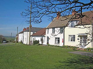
Whitton is a village and former civil parish, now in the parish of Stillington and Whitton, the borough of Stockton-on-Tees and the ceremonial county of Durham, England. It is situated to the north west of Stockton-on-Tees, near Stillington and Thorpe Thewles.

Aldborough is a village 7 miles (11 km) in the civil parish of Boroughbridge, to the north-east of Knaresborough, in North Yorkshire, England.
Middlethorpe is a hamlet in the civil parish of Bishopthorpe, in the unitary authority area of City of York, in North Yorkshire, England.

Westgate was an electoral ward of Newcastle upon Tyne, in the county of Tyne and Wear, England from 2004 to 2018. The population of the ward taken at the 2011 Census was 10,059.
Newthorpe is a settlement lying alongside the B1222 road, in the civil parish of Huddleston with Newthorpe, to the west of Sherburn in Elmet village and stretching across to the A1(M) Motorway in the English county of North Yorkshire.
Thirtleby is a hamlet in the civil parish of Coniston, in the East Riding of Yorkshire, England. It is situated approximately 6 miles (9.7 km) north-east of Hull city centre and 1 mile (1.6 km) west of the village of Sproatley.
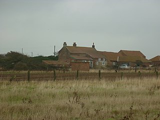
East Newton is a hamlet in the civil parish of Aldbrough, in the East Riding of Yorkshire, England, in an area known as Holderness. It is situated approximately 8 miles (13 km) north-west of Withernsea town centre. It lies to the east of the B1242 road on the North Sea coast.
Dunnington is a village in the civil parish of Bewholme, in the East Riding of Yorkshire, England. It is situated approximately 4 miles (6.4 km) north-west of the town of Hornsea and 2 miles (3.2 km) south-east of the village of Beeford.

Lower Kinnerton is a village and former civil parish, now in the parish of Dodleston, in the unitary authority of Cheshire West and Chester and the ceremonial county of Cheshire, England, close to the England–Wales border. The neighbouring village of Higher Kinnerton is across the border in Flintshire. Lower Kinnerton is south of Broughton and to the north west of the village of Dodleston. It is a small agricultural community, which is also home to a local kennel and cattery business.
Duggleby is a hamlet in the civil parish of Kirby Grindalythe, in North Yorkshire, England. It was historically part of the East Riding of Yorkshire until 1974. It was part of the Ryedale district from 1974 to 2023.
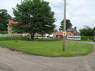
Angram is a village in the civil parish of Long Marston, near Bilbrough, in North Yorkshire, England.

Murton is a small village in the metropolitan borough of North Tyneside, in the ceremonial county of Tyne and Wear, England. The village is separated by fields from the nearby areas of West Monkseaton, New York, Earsdon and Shiremoor. Until 1974 Murton was in Northumberland. Murton was a civil parish between 1866 and 1935. In 1931 the parish had a population of 1164.

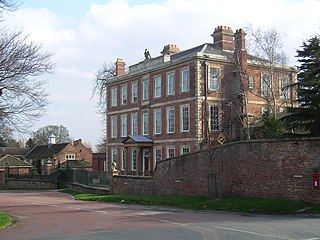
North Charlton is a hamlet and former civil parish, now in the parish of Eglingham, in Northumberland, England. It is situated between Alnwick and Berwick-upon-Tweed, on the A1. In 1951 the civil parish had a population of 90. A notable country house is Charlton Hall which is now a wedding venue. There are 25 properties within the Hamlet itself.

Grafton is a hamlet and former civil parish, now in the parish of Grafton and Radcot, in the West Oxfordshire district, in the county of Oxfordshire, England. It is in the Thames Valley, about 3+1⁄2 miles (5.6 km) north of Faringdon. Grafton Lock is on the River Thames about 1 mile (1.6 km) south of the hamlet. In 1931 the parish had a population of 54.

Huxley is a small rural village and former civil parish, now in the parish of Hargrave and Huxley, in the Cheshire West and Chester district, and ceremonial county of Cheshire in England. In 2001 the parish had a population of 220, increasing to 251 at the 2011 Census. The civil parish was abolished in 2015

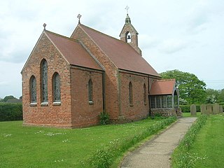
Whitley Lower is a village near Thornhill in Kirklees, West Yorkshire England. The parish church, dedicated to St Mary and St Michael, is part of the united benefice of Thornhill and Whitley which also includes Briestfield. The church was Grade II listed in 1985. In 1891 the civil parish had a population of 879.

Higher Whitley is a village and former civil parish, now in the parish of Whitley, in the unitary authority area of Cheshire West and Chester, in the ceremonial county of Cheshire, England. In 1931 the parish had a population of 339. It is north of Lower Whitley.

Marwood is a civil parish in County Durham, England. It had a population of 529 at the 2011 Census.


