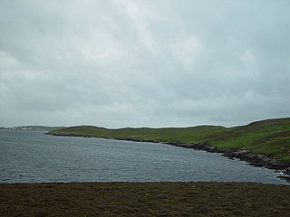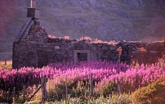
Shetland, also called the Shetland Islands and formerly Zetland, is a subarctic archipelago in the Northern Atlantic, between Great Britain, the Faroe Islands and Norway. It is the northernmost part of the United Kingdom.

Lerwick is the main town and port of the Shetland archipelago, Scotland. Shetland's only burgh, Lerwick had a population of about 7,000 residents in 2010.

Fetlar is one of the North Isles of Shetland, Scotland, with a usually resident population of 61 at the time of the 2011 census. Its main settlement is Houbie on the south coast, home to the Fetlar Interpretive Centre. Fetlar is the fourth-largest island of Shetland and has an area of just over 4,000 hectares.
Unst is one of the North Isles of the Shetland Islands, Scotland. It is the northernmost of the inhabited British Isles and is the third-largest island in Shetland after Mainland and Yell. It has an area of 46 sq mi (120 km2).

Whalsay is the sixth largest of the Shetland Islands in the north of Scotland.

Mousa is a small island in Shetland, Scotland, uninhabited since the nineteenth century. The island is known for the Broch of Mousa, an Iron Age round tower, and is designated as a Special Protection Area for storm-petrel breeding colonies.

Muckle Roe is an island in Shetland, Scotland, in St. Magnus Bay, to the west of Mainland. It has a population of around 130 people, who mainly croft and live in the south east of the island.
Trondra is one of the Scalloway Islands, a subgroup of the Shetland Islands in Scotland. It shelters the harbour of Scalloway and has an area of 275 hectares (1.06 sq mi).

Orkney and Shetland is a constituency of the House of Commons of the Parliament of the United Kingdom. It elects one Member of Parliament (MP) by the first past the post system of election. In the Scottish Parliament, Orkney and Shetland are separate constituencies. The constituency was historically known as Orkney and Zetland.

Half Moon Island is a minor Antarctic island, lying in McFarlane Strait 1.35 km (0.84 mi) north of Burgas Peninsula, Livingston Island in the South Shetland Islands of the Antarctic Peninsula region. Its surface area is 171 hectares. The Argentine Cámara Base is located on the island. It is only accessible by sea and by helicopter; there is no airport of any kind. The naval base is operational occasionally during the summer, but is closed during the winter.

Esha Ness, also spelled Eshaness, is a peninsula on the west coast of Northmavine, on the island of Mainland, Shetland, Scotland. Esha Ness Lighthouse on the west coast, just south of Calder's Geo. It was designed by David Alan Stevenson and commissioned in 1929. The hamlet of Tangwick contains the Tangwick Haa Museum, which opened in the former Laird's house in 1987.

West Linga is an uninhabited island located between Mainland and Whalsay in Shetland, Scotland.

Assater is a hamlet on Mainland, in Shetland, Scotland. Assater is situated in the parish of Northmaven. It is about 1.3 miles (2.1 km) northwest of Urafirth and 1.2 miles (1.9 km) southeast of Heylor by road.
Sodom is a settlement on Whalsay, Shetland. The name is a corruption of the Old Norse Suðheim meaning "south home". It was formerly the home of Hugh MacDiarmid, who was greatly amused at the anglicised form of the name.

Dunrossness, is the southernmost parish of Shetland, Scotland. Historically the name Dunrossness has usually referred to the area on the Shetland mainland south of Quarff. However, in 2016 there were three separate Shetland Community Councils for a) Gulberwick, Quarff and Cunningsburgh; b) Sandwick; and c) Dunrossness. The 2011 census defined Dunrossness as including everybody within the British ZE2 postal code, which goes as far north as Gulberwick. It has the best and largest area of fertile farmland of any parish in Shetland. Dunrossness includes the island of Mousa, Levenwick, St Ninian's Isle, Bigton, Scousburgh, the Lochs of Spiggie and Brow, Boddam, Quendale, Virkie, Exnaboe, Grutness, Toab, Ness of Burgi, Clumlie Broch, Scatness, Sumburgh Airport, Sumburgh Head, West Voe, the islands of Lady's Holm, Little Holm, Horse Holm island and Fair Isle.

Ollaberry is a settlement on Mainland, Shetland, Scotland on the west shore of Yell Sound, 10.9 miles (17.5 km) north by road from Brae. Ollaberry Churchyard contains a Listed B monument, sculpted by John Forbes in 1754. Ollaberry Primary School was established in 1873.

Rupite Glacier is a 2.9 kilometres (1.8 mi) long glacier on Smith Island, South Shetland Islands draining the southeast slopes of Imeon Range east of the summit Mount Foster and southeast of Evlogi Peak. It is situated southeast of Chuprene Glacier, southwest of Pashuk Glacier and northeast of Landreth Glacier, and flows southeastward into Osmar Strait. Bulgarian early mapping in 2008. The glacier is named after the settlement Rupite and the nearby protected area in southwestern Bulgaria.

Melby is a small coastal hamlet on Mainland, Shetland Islands, Scotland, United Kingdom; the nearest settlement is Sandness.


