Danilov is a town and the administrative center of Danilovsky District in Yaroslavl Oblast, Russia. Population: 15,861 (2010 Census); 17,245 (2002 Census); 18,857 (1989 Census).

Tutayev is a town in Yaroslavl Oblast, Russia. Population: 41,005 (2010 Census); 42,644 (2002 Census); 39,822 (1989 Census). It has previously been called Romanov-Borisoglebsk, and before that it was two towns separated by the Volga River: Romanov and Borisoglebsk.

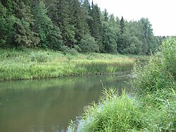
Lyubim is a town and the administrative center of Lyubimsky District in Yaroslavl Oblast, Russia, located by the Obnora River. Population: 5,555 (2010 Census); 6,254 (2002 Census); 7,074 (1989 Census).

Gavrilov-Yam is a town and the administrative center of Gavrilov-Yamsky District in Yaroslavl Oblast, Russia, located on the Kotorosl River. Population: 17,791 (2010 Census); 19,105 (2002 Census); 21,353 (1989 Census).

Bolsheselsky District is an administrative and municipal district (raion), one of the seventeen in Yaroslavl Oblast, Russia. It is located in the center of the oblast. The area of the district is 1,353 square kilometers (522 sq mi). Its administrative center is the rural locality of Bolshoye Selo. Population: 9,906 ; 10,703 (2002 Census); 13,053 (1989 Census). The population of Bolshoye Selo accounts for 35.6% of the district's total population.

Borisoglebsky District is an administrative and municipal district (raion), one of the seventeen in Yaroslavl Oblast, Russia. It is located in the center of the oblast. The area of the district is 1,750 square kilometers (680 sq mi). Its administrative center is the urban locality of Borisoglebsky. Population: 12,630 ; 14,847 (2002 Census); 15,967 (1989 Census). The population of the administrative center accounts for 44.7% of the district's total population.

Breytovsky District is an administrative and municipal district (raion), one of the seventeen in Yaroslavl Oblast, Russia. It is located in the northwest of the oblast. The area of the district is 2,160 square kilometers (830 sq mi). Its administrative center is the rural locality of Breytovo. Population: 7,034 ; 9,183 (2002 Census); 11,019 (1989 Census). The population of Breytovo accounts for 47.0% of the district's total population.
Danilovsky District is an administrative and municipal district (raion), one of the seventeen in Yaroslavl Oblast, Russia. It is located in the northeast of the oblast. The area of the district is 2,230 square kilometers (860 sq mi). Its administrative center is the town of Danilov. Population: 26,072 ; 29,594 (2002 Census); 34,327 (1989 Census). The population of Danilov accounts for 60.8% of the district's total population.

Gavrilov-Yamsky District is an administrative and municipal district (raion), one of the seventeen in Yaroslavl Oblast, Russia. It is located in the east of the oblast. The area of the district is 1,120 square kilometers (430 sq mi). Its administrative center is the town of Gavrilov-Yam. Population: 26,558 ; 28,923 (2002 Census); 32,770 (1989 Census). The population of Gavrilov-Yam accounts for 67.0% of the district's total population.

Myshkinsky District is an administrative and municipal district (raion), one of the seventeen in Yaroslavl Oblast, Russia. It is located in the west of the oblast. The area of the district is 1,111.2 square kilometers (429.0 sq mi). Its administrative center is the town of Myshkin. Population: 10,329 ; 11,885 (2002 Census); 13,192 (1989 Census). The population of Myshkin accounts for 57.4% of the district's total population.

Nekouzsky District is an administrative and municipal district (raion), one of the seventeen in Yaroslavl Oblast, Russia. It is located in the west of the oblast. The area of the district is 1,954.3 square kilometers (754.6 sq mi). Its administrative center is the rural locality of Novy Nekouz. Population: 15,688 ; 19,756 (2002 Census); 23,931 (1989 Census). The population of Novy Nekouz accounts for 22.1% of the district's total population.

Nekrasovsky District is an administrative and municipal district (raion), one of the seventeen in Yaroslavl Oblast, Russia. It is located in the east of the oblast. The area of the district is 1,380 square kilometers (530 sq mi). Its administrative center is the urban locality of Nekrasovskoye. Population: 21,573 ; 24,487 (2002 Census); 28,238 (1989 Census). The population of Nekrasovskoye accounts for 28.5% of the district's total population.

Pereslavsky District is an administrative and municipal district (raion), one of the seventeen in Yaroslavl Oblast, Russia. It is located in the south of the oblast. The area of the district is 3,130 square kilometers (1,210 sq mi). Its administrative center is the town of Pereslavl-Zalessky. Population: 20,352 ; 22,576 (2002 Census); 27,971 (1989 Census).

Pervomaysky District is an administrative and municipal district (raion), one of the seventeen in Yaroslavl Oblast, Russia. It is located in the north of the oblast. The area of the district is 2,270 square kilometers (880 sq mi). Its administrative center is the urban locality of Prechistoye. Population: 11,012 ; 13,145 (2002 Census); 15,070 (1989 Census). The population of Prechistoye accounts for 44.0% of the district's total population.
Poshekhonsky District is an administrative and municipal district (raion), one of the seventeen in Yaroslavl Oblast, Russia. It is located in the north of the oblast. The area of the district is 4,400 square kilometers (1,700 sq mi). Its administrative center is the town of Poshekhonye. Population: 14,292 ; 18,209 (2002 Census); 22,734 (1989 Census). The population of Poshekhonye accounts for 42.6% of the district's total population.

Rostovsky District is an administrative and municipal district (raion), one of the seventeen in Yaroslavl Oblast, Russia. It is located in the southeast of the oblast. The area of the district is 2,081.82 square kilometers (803.80 sq mi). Its administrative center is the town of Rostov. As of the 2010 Census, the total population of the district was 34,062.

Rybinsky District is an administrative and municipal district (raion), one of the seventeen in Yaroslavl Oblast, Russia. It is located in the northwest of the oblast. The area of the district is 3,150 square kilometers (1,220 sq mi). Its administrative center is the city of Rybinsk. Population: 28,153 ; 31,095 (2002 Census); 36,796 (1989 Census).

Tutayevsky District is an administrative and municipal district (raion), one of the seventeen in Yaroslavl Oblast, Russia. It is located in the northern central part of the oblast. The area of the district is 1,444 square kilometers (558 sq mi). Its administrative center is the town of Tutayev. Population: 15,949 ; 17,131 (2002 Census); 19,575 (1989 Census).

Uglichsky District is an administrative and municipal district (raion), one of the seventeen in Yaroslavl Oblast, Russia. It is located in the southwest of the oblast. The area of the district is 2,568 square kilometers (992 sq mi). Its administrative center is the town of Uglich. Population: 13,255 ; 15,540 (2002 Census); 18,069 (1989 Census).

Yaroslavsky District is an administrative and municipal district (raion), one of the seventeen in Yaroslavl Oblast, Russia. It is located in the east of the oblast. The area of the district is 1,936.7 square kilometers (747.8 sq mi). Its administrative center is the city of Yaroslavl. Population: 52,328 ; 53,579 (2002 Census); 55,636 (1989 Census).