Country codes are short alphabetic or numeric geographical codes (geocodes) developed to represent countries and dependent areas, for use in data processing and communications. Several different systems have been developed to do this. The term country code frequently refers to ISO 3166-1 alpha-2 or international dialing codes, the E.164 country calling codes.

The World Meteorological Organization (WMO) is a specialized agency of the United Nations responsible for promoting international cooperation on atmospheric science, climatology, hydrology and geophysics.
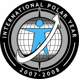
The International Polar Years (IPY) are collaborative, international efforts with intensive research focus on the polar regions. Karl Weyprecht, an Austro-Hungarian naval officer, motivated the endeavor in 1875, but died before it first occurred in 1882–1883. Fifty years later (1932–1933) a second IPY took place. The International Geophysical Year was inspired by the IPY and was organized 75 years after the first IPY (1957–58). The fourth, and most recent, IPY covered two full annual cycles from March 2007 to March 2009.

A nautical chart is a graphic representation of a sea area and adjacent coastal regions. Depending on the scale of the chart, it may show depths of water and heights of land, natural features of the seabed, details of the coastline, navigational hazards, locations of natural and human-made aids to navigation, information on tides and currents, local details of the Earth's magnetic field, and human-made structures such as harbours, buildings, and bridges. Nautical charts are essential tools for marine navigation; many countries require vessels, especially commercial ships, to carry them. Nautical charting may take the form of charts printed on paper or computerized electronic navigational charts. Recent technologies have made available paper charts which are printed "on demand" with cartographic data that has been downloaded to the commercial printing company as recently as the night before printing. With each daily download, critical data such as Local Notices to Mariners are added to the on-demand chart files so that these charts are up to date at the time of printing.
Piloting or pilotage is the process of navigating on water or in the air using fixed points of reference on the sea or on land, usually with reference to a nautical chart or aeronautical chart to obtain a fix of the position of the vessel or aircraft with respect to a desired course or location. Horizontal fixes of position from known reference points may be obtained by sight or by radar. Vertical position may be obtained by depth sounder to determine depth of the water body below a vessel or by altimeter to determine an aircraft's altitude, from which its distance above the ground can be deduced. Piloting a vessel is usually practiced close to shore or on inland waterways. Pilotage of an aircraft is practiced under visual meteorological conditions for flight.
METAR is a format for reporting weather information. A METAR weather report is predominantly used by aircraft pilots, and by meteorologists, who use aggregated METAR information to assist in weather forecasting.
The Canadian Hydrographic Service (CHS) is part of the federal department of Fisheries and Oceans Canada and is Canada's authoritative hydrographic office. The CHS represents Canada in the International Hydrographic Organization (IHO).
The Bureau of Meteorology is an executive agency of the Australian Government responsible for providing weather services to Australia and surrounding areas. It was established in 1906 under the Meteorology Act, and brought together the state meteorological services that existed before then. The states officially transferred their weather recording responsibilities to the Bureau of Meteorology on 1 January 1908.

The Philippine Atmospheric, Geophysical and Astronomical Services Administration is the National Meteorological and Hydrological Services (NMHS) agency of the Philippines mandated to provide protection against natural calamities and to insure the safety, well-being and economic security of all the people, and for the promotion of national progress by undertaking scientific and technological services in meteorology, hydrology, climatology, astronomy and other geophysical sciences. Created on December 8, 1972, by reorganizing the Weather Bureau, PAGASA now serves as one of the Scientific and Technological Services Institutes of the Department of Science and Technology.
Meteorological Service of New Zealand Limited is the national meteorological service of New Zealand. MetService was established as a state-owned enterprise in 1992. It employs about 300 staff, and its headquarters are in Wellington, New Zealand. Prior to becoming an SOE, New Zealand's national meteorological service has existed in a number of forms since the appointment of the country's first Director of Meteorological Stations in August 1861.

A Regional Specialized Meteorological Centre (RSMC) is responsible for the distribution of information, advisories, and warnings regarding the specific program they have a part of, agreed by consensus at the World Meteorological Organization as part of the World Weather Watch.

The Norwegian Meteorological Institute, also known internationally as MET Norway, is Norway's national meteorological institute. It provides weather forecasts for civilian and military uses and conducts research in meteorology, oceanography and climatology. It is headquartered in Oslo and has offices and stations in other cities and places. It has around 500 full-time staff and was founded in 1866.
A notice to mariners advises mariners of important matters affecting navigational safety, including new hydrographic information, changes in channels and aids to navigation, and other important data.
A Volcanic Ash Advisory Center (VAAC) is a group of experts responsible for coordinating and disseminating information on atmospheric volcanic ash clouds that may endanger aviation. As at 2019, there are nine Volcanic Ash Advisory Centers located around the world, each one focusing on a particular geographical region. Their analyses are made public in the form of volcanic ash advisories (VAAs), involving expertise analysis of satellite observations, ground and pilot observations and interpretation of ash dispersion models.
A forecast region is a unique geographical area for which individual weather reports are issued.

The 2017 Pacific typhoon season was a below-average season in terms of accumulated cyclone energy and the number of typhoons and super typhoons, and the first since the 1977 season to not produce a Category 5-equivalent typhoon on the Saffir–Simpson scale. The season produced a total of 27 named storms, 11 typhoons, and only two super typhoons, making it an average season in terms of storm numbers. It was an event in the annual cycle of tropical cyclone formation, in which tropical cyclones form in the western Pacific Ocean. The season runs throughout 2017, though most tropical cyclones typically develop between May and October. The season's first named storm, Muifa, developed on April 25, while the season's last named storm, Tembin, dissipated on December 26. This season also featured the latest occurrence of the first typhoon of the year since 1998, with Noru reaching this intensity on July 23.
The Prairie and Arctic Storm Prediction Centre (PASPC), is tasked with forecasting weather for the public and mariners in the Canadian Prairie Provinces, the Northwest Territories, Nunavut Territory, and adjacent domestic waters. The PASPC operations are split between an office in Winnipeg, Manitoba and an office in Edmonton, Alberta. The agency provides continuous weather monitoring and issues weather forecasts, weather warnings and weather watches as a part of this process. Daily severe weather discussions are issued to give additional information on a region that is becoming a severe weather threat, stating whether a watch or warning is likely and details thereof.

Typhoon Haima, known in the Philippines as Super Typhoon Lawin, was the third most intense tropical cyclone worldwide in 2016. It was the twenty-second named storm and the eleventh typhoon of the annual typhoon season. Impacting the Philippines less than 3 days after Typhoon Sarika, Haima formed out of a tropical disturbance southwest of Chuuk on October 14, it developed into a tropical storm the next day. Steady strengthening occurred over the next day or two as it tracked westward towards the Philippines. After forming an eye shortly after it was upgraded to a typhoon, Haima began to rapidly strengthen and eventually became a super typhoon on October 18. It later attained its peak intensity as a Category 5-equivalent tropical cyclone before weakening slightly. Haima later made landfall late on October 19 as a Category 4-equivalent storm. Rapid weakening occurred as it interacted with the landmasses until it entered the Southern China Sea as a weak typhoon. It formed a large ragged eye once again and remained steady in intensity until making landfall in China on October 21. It weakened below typhoon intensity and became extratropical on October 22. The cyclone drifted northeastwards and later eastwards before emerging over water again, but eventually dissipated by October 26.
The Servicio Meteorológico Nacional (SMN) is Argentina's national weather service under the Ministry of Defense that is tasked with observing, understanding, and predicting the weather and climate in Argentina and its surrounding waters. It provides weather forecasts, radar images, ozone, temperature and rainfall graphs, and satellite images. The purpose of these tasks is to contribute to protection of its inhabitants, sustainable economic development and to provide representation of Argentina to international meteorological organizations. Founded on 4 October 1872 by Federal law Nº559 during the presidency of Domingo Faustino Sarmiento, the organisation was the first meteorological organisation in South America and the third one in the world, after Hungary and the United States which were created in 1870 and 1871 respectively. It became a member of the World Meteorological Organization on 2 January 1951. Throughout its history, the organisation was dependent under different government ministries until in 2007 when it is currently under the Ministry of Defense.

Abdulla Ahmed Al Mandous is the current President of WMO Regional Association II (Asia). Al Mandous was elected as president unanimously during WMO conference held in Abu Dhabi in February 2017, and re-elected for a second term during the 17th Session of RA II (ASIA) convened virtually from 25 to 26 May, 2021. Al Mandous is also Executive Director of the National Center of Meteorology, the government entity that provides statistical data and information on weather and climate to various entities and the public in the United Arab Emirates to carry out their daily functions.
