
Kariakoo is an administrative ward of the Ilala Municipal Council of the Dar es Salaam Region in Tanzania. Jangwani ward and Mchafukoge ward form the ward's northern and eastern boundaries. The Gerezani and Mchikichini wards border the ward to the south and west respectively. The ward is the home of Simba Sports Club. The name is derived from the swahilization of the British colonial occupation's "Carrier Corps", that used to be based in the area. Today, Kariakoo is mainly known for its large market that spans several city blocks. According to the 2022 census, the ward has a population of 10,246.

Gerezani is an administrative ward of the Ilala Municipical Council of the Dar es Salaam Region in Tanzania. The Kariakoo and Mchikichini wards border the ward on its northern side. The ward is bordered by Mchafukoge to the east. Ilala ward borders the ward to the west. The ward is bordered to the south by the Keko and Kurasini wards of the Temeke District. Before 1940, the Gerezani ward was constructed for Railways Corporation's White employees. The Mkuki Mall and the Jakaya M. Kiwete Youth Park are located in the Gerezani ward. According to the 2022 census, the ward has a total population of 5,786.

Jangwani is an administrative ward of the Ilala Municipical Council of the Dar es Salaam Region in Tanzania. The Upanga East and Upanga West wards border the ward on its northern side. The ward is bordered by Mchafukoge and Kisutu to the east. Mchikichini ward borders the ward to the west. The ward is bordered to the south by the Kariakoo ward. According to the 2012 census, the ward has a total population of 17,647.

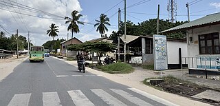
Kinyerezi is an administrative ward of the Ilala Municipal Council of the Dar es Salaam Region in Tanzania. The wards of Kinondoni MC are bordered to the north by Msigani, Saranga, and Kimara wards of Ubungo MC. The ward is bordered to the east by the wards of Segerea and Kimanga. Kipawa, Ukonga, Gongolamboto, and Pugu are to the south. The ward is bordered by Kwembe to the west. According to the 2022 census, the ward has a total population of 62,480.

Kipawa is an administrative ward of the Ilala Municipical Council of the Dar es Salaam Region in Tanzania. Segerea and Kinyerezi border the ward on its northern border. The ward is bordered by Kiwalani to the east. By Kivule, Kitunda, and Yombo Vituka of Temeke MC to the south. Ukonga borders the ward on its western side. According to the 2022 census, the ward has a total population of 72,577.

Kitunda is an administrative ward of the Ilala Municipal Council of the Dar es Salaam Region in Tanzania. Kipawa, Yombo Vituka, and Buza, the last two of Temeke MC, border the ward to the north. The Kiburugwa and Charambe wards of Temeke MC border the east of the ward. Chamazi is to the south, and Kivule lies to the west. According to the 2022 census, the ward has a total population of 42,259.

Kisutu is an administrative ward of the Ilala Municipal Council of the Dar es Salaam Region in Tanzania. Upanga East ward and Kivukoni ward both border the ward to the north and north-east. The ward is bordered to the south by Mchafukoge ward and to the west by Jangwani ward. The ward hosts the Channel 10 Television Station formerly known as Dar es Salaam Television Station at Zaramo Street in Kisutu ward. In 2022, the population of the ward was 6,364.

Kiwalani is an administrative ward of the Ilala Municipal Council of the Dar es Salaam Region in Tanzania. Vingunguti and Kipawa form the ward's northern and western boundaries, respectively. Temeke MC's Sandali to the east and Temeke MC's Kilakala and Yombo Vituka to the south encircle the ward. According to the 2022 census, the ward has a total population of 40,049.

Mchikichini is an administrative ward of the Ilala Municipical Council of the Dar es Salaam Region in Tanzania. Upanga West forms the ward's northern boundary. Its eastern border is formed by Jangwani and Kariakoo. The ward is bordered to the south by the Gerezani and Ilala wards. The Kinondoni District wards of Kigogo, Magomeni, and Mzimuni border it on the west. The ward is home to the Karume Market, one of the largest markest in the city. According to the 2012 census, the ward has a total population of 25,510.
Segerea is an administrative ward of the Ilala Municipical Council of the Dar es Salaam Region in Tanzania. Kimanga forms the ward's northern boundary. Tabata borders the ward to the east, and Vingunguti and Kipawa border it to the south, through Kinyerezi, to the west. According to the 2012 census, the ward has a total population of 83,315.

Upanga East is an administrative ward of the Ilala Municipical Council of the Dar es Salaam Region in Tanzania. Kivukoni forms the ward's northern boundary. Kisutu borders the ward to the east, and Mchafukoge and Jangwani border it to the south. By Upanga West, to the west. The ward is home to the Tanzanian National Library. According to the 2022 census, the ward has a total population of 9,317.
Upanga West is an administrative ward of the Ilala Municipical Council of the Dar es Salaam Region in Tanzania. Hananasif of Kinondoni is the northern boundary of the ward. Upanga East borders the ward on the east, and Mchikichini, Mzimuni, and Jangwani border it on the south. Magomeni of Kinondoni, borders the ward to the west. The ward is home to the largest hospital in the country, Muhimbili Hospital. The ward is also home of the Union Sports Club. According to the 2012 census, the ward has a total population of 13,476.

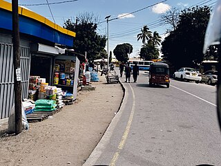
Vingunguti is an administrative ward of the Ilala Municipical Council of the Dar es Salaam Region in Tanzania. Kiwalani, Sandali, and Temeke, the latter two in Temeke MC, form the ward's southern border. The ward is bounded by Tabata to the north and Buguruni to the east. Segerea and Kipawa wards border the ward on its western side. The largest tea-producing facility in the nation, Chai Bora, is located within Vingunguti. According to the 2012 census, the ward has a total population 106,946.
Majengo is an administrative ward of the Dodoma Municipal Council of the Dodoma Region in Tanzania. The Chamwino and Kizota wards border the ward to the north. Uhuru borders the ward to the east, and Madukani borders it to the south. The ward is surrounded by Hazina ward to the west. The ward is home to the Dodoma Central Market. According to the 2012 census, the ward has a total population of 5,214.

Makole is an administrative ward of the Dodoma Municipal Council of the Dodoma Region in Tanzania. The Miyuji and Ipagala wards border the ward to the north and east, respectively. By Tambukareli and Viwandani to the south. The ward is bordered to the west by Kiwanja cha Ndege. According to the 2012 census, the ward has a total population of 10,504.

Tambukareli is an administrative ward of the Dodoma Municipal Council of the Dodoma Region in Tanzania. The ward is bordered to the north by the wards of Makole, Viwandani, and Ipagala. Dodoma Makulu borders the ward to the east, while Ntyuka ward borders it to the south. Kilimani and Madukani wards border the ward on its western side. The ward is home to the Tanzanian National Assembly, Bunge. According to the 2012 census, the ward has a total population of 6,584.

Uhuru is an administrative ward of the Dodoma Municipal Council of the Dodoma Region in Tanzania. The Chamwino and Kiwanja cha Ndege wards border the ward on its northern border. The ward is bordered by the Viwandani and Madukani wards to the east and south, respectively. Majengo ward borders the ward to the west. According to the 2012 census, the ward has a total population of 2,419.

Viwandani is an administrative ward of the Dodoma Municipal Council of the Dodoma Region in Tanzania. The ward is bordered to the north by the wards of Makole to the east and Kiwanja cha Ndege to the north. The Tambukareli ward is in the south. Uhuru, Chamwino, and Madukani wards are to the west. The ward is home the Gaddafi Mosque, Sabasaba Market and Nyerere Square. According to the 2012 census, the ward has a total population of 4,883.

Kivule is an administrative ward of the Ilala Municipal Council of the Dar es Salaam Region in Tanzania. Ukonga and Kipawa border the ward's northern boundary. Kitunda borders the east of the ward. Chamazi and Msongola are in the south; the former is located in Temeke MC. Majohe is to the west. According to the 2022 census, the ward has a total population of 88,273.

Majohe is an administrative ward of the Ilala Municipical Council of the Dar es Salaam Region in Tanzania. The communities of Ukonga, Gongolamboto, and Pugu border the ward on the north. By Kisarawe Ward in Kisarawe District in Pwani Region, to the west. Chanika and Msongola form the southern boundary of the ward. Kivule borders the ward on its eastern side. According to the 2012 census, the ward has a total population of 81,646.

