Kibamba is an administrative ward in Ubungo District of the Dar es Salaam Region in Tanzania. Mbezi and Kwembe wards border the ward to the north and east, respectively. The ward is bordered to the south by Kiluvya in the Kisarawe District and to the west by Maili Moja in the Kibaha District. According to the 2012 census, the ward has a total population of 28,885.

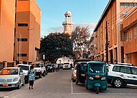
Gerezani is an administrative ward of the Ilala Municipical Council of the Dar es Salaam Region in Tanzania. The Kariakoo and Mchikichini wards border the ward on its northern side. The ward is bordered by Mchafukoge to the east. Ilala ward borders the ward to the west. The ward is bordered to the south by the Keko and Kurasini wards of the Temeke District. Before 1940, the Gerezani ward was constructed for Railways Corporation's White employees. The Mkuki Mall and the Jakaya M. Kiwete Youth Park are located in the Gerezani ward. According to the 2022 census, the ward has a total population of 5,786.

Jangwani is an administrative ward of the Ilala Municipical Council of the Dar es Salaam Region in Tanzania. The Upanga East and Upanga West wards border the ward on its northern side. The ward is bordered by Mchafukoge and Kisutu to the east. Mchikichini ward borders the ward to the west. The ward is bordered to the south by the Kariakoo ward. According to the 2012 census, the ward has a total population of 17,647.

Kinyerezi is an administrative ward of the Ilala Municipal Council of the Dar es Salaam Region in Tanzania. The wards of Kinondoni MC are bordered to the north by Msigani, Saranga, and Kimara wards of Ubungo MC. The ward is bordered to the east by the wards of Segerea and Kimanga. Kipawa, Ukonga, Gongolamboto, and Pugu are to the south. The ward is bordered by Kwembe to the west. According to the 2022 census, the ward has a total population of 62,480.

Kisutu is an administrative ward of the Ilala Municipal Council of the Dar es Salaam Region in Tanzania. Upanga East ward and Kivukoni ward both border the ward to the north and north-east. The ward is bordered to the south by Mchafukoge ward and to the west by Jangwani ward. The ward hosts the Channel 10 Television Station formerly known as Dar es Salaam Television Station at Zaramo Street in Kisutu ward. In 2022, the population of the ward was 6,364.

Kiwalani is an administrative ward of the Ilala Municipal Council of the Dar es Salaam Region in Tanzania. Vingunguti and Kipawa form the ward's northern and western boundaries, respectively. Temeke MC's Sandali to the east and Temeke MC's Kilakala and Yombo Vituka to the south encircle the ward. According to the 2022 census, the ward has a total population of 40,049.

Mchikichini is an administrative ward of the Ilala Municipical Council of the Dar es Salaam Region in Tanzania. Upanga West forms the ward's northern boundary. Its eastern border is formed by Jangwani and Kariakoo. The ward is bordered to the south by the Gerezani and Ilala wards. The Kinondoni District wards of Kigogo, Magomeni, and Mzimuni border it on the west. The ward is home to the Karume Market, one of the largest markest in the city. According to the 2012 census, the ward has a total population of 25,510.

Msongola is an administrative ward of the Ilala Municipical Council of the Dar es Salaam Region in Tanzania. Kivule and Chamazi border the ward to the north. By Chanika and Majohe to the west. Mkuranga and Tambani (Exclave) wards of the Mkuranga District of the Pwani Region border the ward on its southern side. The Main Tambani ward of Pwani Region's Mkuranga District borders the ward on the east. According to the 2012 census, the ward has a total population of 81,646.
Segerea is an administrative ward of the Ilala Municipical Council of the Dar es Salaam Region in Tanzania. Kimanga forms the ward's northern boundary. Tabata borders the ward to the east, and Vingunguti and Kipawa border it to the south, through Kinyerezi, to the west. According to the 2012 census, the ward has a total population of 83,315.

Tabata is an administrative ward of the Ilala Municipical Council of the Dar es Salaam Region in Tanzania. The ward is bordered to the north by the Ubungo MC wards of Makuburi and Mabibo. Kigogo of Kinondoni MC form the eastern boundary of the ward. Vingunguti and Buguruni are to the south. lastly, the Segerea and Kimanga wards in the west. According to the 2012 census, the ward has a total population of 74,742.

Ukonga is an administrative ward of the Ilala Municipical Council of the Dar es Salaam Region in Tanzania. Kinyerezi forms the ward's northern boundary. To the east is Kipawa, and to the south are Kivule and Majohe. Gongolamboto ward is to the west. According to the 2012 census, the ward has a total population of 80,034.

Dodoma City District, officially the Dodoma Municipal Council is one of seven districts of the Dodoma Region of Tanzania. It is bordered to the west by Bahi District, and to the east by Chamwino District. It covers an area of 2,607 km2 (1,007 sq mi). The district is comparable in size to the land area of Luxembourg. Its administrative seat is the city of Dodoma, also the legislative capital of Tanzania. The 2012 National Tanzania Census states the population for the district as 410,956.

Madukani is an administrative ward of the Dodoma Municipal Council of the Dodoma Region in Tanzania. Uhuru ward borders the ward on its northern side. Tambukareli and Viwandani border the ward to the east. Wards Kilimani and Hazina are to the south. Majengo ward borders the ward to the west. The Dodoma Regional Hospital, the biggest hospital in the region, is located in the ward. According to the 2012 census, the ward has a total population of 5,214.
Majengo is an administrative ward of the Dodoma Municipal Council of the Dodoma Region in Tanzania. The Chamwino and Kizota wards border the ward to the north. Uhuru borders the ward to the east, and Madukani borders it to the south. The ward is surrounded by Hazina ward to the west. The ward is home to the Dodoma Central Market. According to the 2012 census, the ward has a total population of 5,214.

Makole is an administrative ward of the Dodoma Municipal Council of the Dodoma Region in Tanzania. The Miyuji and Ipagala wards border the ward to the north and east, respectively. By Tambukareli and Viwandani to the south. The ward is bordered to the west by Kiwanja cha Ndege. According to the 2012 census, the ward has a total population of 10,504.

Tambukareli is an administrative ward of the Dodoma Municipal Council of the Dodoma Region in Tanzania. The ward is bordered to the north by the wards of Makole, Viwandani, and Ipagala. Dodoma Makulu borders the ward to the east, while Ntyuka ward borders it to the south. Kilimani and Madukani wards border the ward on its western side. The ward is home to the Tanzanian National Assembly, Bunge. According to the 2012 census, the ward has a total population of 6,584.

Uhuru is an administrative ward of the Dodoma Municipal Council of the Dodoma Region in Tanzania. The Chamwino and Kiwanja cha Ndege wards border the ward on its northern border. The ward is bordered by the Viwandani and Madukani wards to the east and south, respectively. Majengo ward borders the ward to the west. According to the 2012 census, the ward has a total population of 2,419.
Pugu is an administrative ward of the Ilala Municipical Council of the Dar es Salaam Region in Tanzania. Kinyerezi and Kwembe ward of Kinondoni MC form the ward's northern boundary. The ward is bordered by Majohe to the south and Gongolamboto to the east. In the west the ward is bordered by Kisarawe ward of Kisarawe District in the Pwani Region. The ward is named after the Pugu Hills, which form its western border and are home to the Pugu Hills Forest Reserve and the Kazimzumbwi Forest Reserve, two of some of the world's oldest forests. According to the 2012 census, the ward has a total population of 49,422.

Kivule is an administrative ward of the Ilala Municipal Council of the Dar es Salaam Region in Tanzania. Ukonga and Kipawa border the ward's northern boundary. Kitunda borders the east of the ward. Chamazi and Msongola are in the south; the former is located in Temeke MC. Majohe is to the west. According to the 2022 census, the ward has a total population of 88,273.

Majohe is an administrative ward of the Ilala Municipical Council of the Dar es Salaam Region in Tanzania. The communities of Ukonga, Gongolamboto, and Pugu border the ward on the north. By Kisarawe Ward in Kisarawe District in Pwani Region, to the west. Chanika and Msongola form the southern boundary of the ward. Kivule borders the ward on its eastern side. According to the 2012 census, the ward has a total population of 81,646.