
Issaquena County is a county located in the U.S. state of Mississippi. As of the 2010 Census, its population was 1,406, making it the least populous county in the United States east of the Mississippi River. Its county seat is Mayersville. With a per-capita income of $18,598, Issaquena County is, by that measure, the poorest county in the United States.

Chicot County is a county located in the southeastern corner of the U.S. state of Arkansas. As of the 2010 census, the population was 11,800. The county seat is Lake Village. Chicot County is Arkansas's 10th county, formed on October 25, 1823, and named after Point Chicot on the Mississippi River. It is part of the Arkansas Delta, lowlands along the river that have been historically important as an area for large-scale cotton cultivation.
Mayersville is a town on the east bank of the Mississippi River, and the county seat for Issaquena County, Mississippi, United States. It is located in the Mississippi Delta region, known for cotton cultivation in the antebellum era. Once the trading center for the county, the town was superseded when railroads were built into the area. The population of the majority-black town was 547 at the 2010 census, down from 795 at the 2000 census.
Eagle Bend is a census-designated place and unincorporated community in Warren County, Mississippi. It is approximately 15 miles northwest of downtown Vicksburg, and is part of the Vicksburg Micropolitan Statistical Area.

Deer Creek is a creek in Mississippi, United States. Its source is Lake Bolivar, in Scott, Bolivar County, Mississippi.
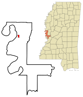
Fitler is an unincorporated community in Issaquena County, Mississippi, United States. Fitler is located on Mississippi Highway 1, approximately six miles west of Onward. Fitler had a post office from about 1901 to 1976.

Onward is an unincorporated community located in Sharkey County, Mississippi, at the junction of Mississippi Highway 1 and U.S. Route 61. Onward is approximately 6 miles (9.7 km) south of Cary and approximately 9 miles (14 km) north of Valley Park.

Mississippi Highway 465 is a highway in the southern region of the Mississippi Delta. The highway starts at U.S. Route 61 near Redwood. It travels westward towards the Mississippi River, and then northwards to the village of Eagle Bend. The highway then traverses on the Mississippi River levee on a one-lane road. Later, MS 465 leaves the levee, continues northward, and soon ends at MS 1.
Princeton is a ghost town located in Washington County, Mississippi, United States.
Baleshed is a ghost town in Issaquena County, Mississippi, United States. Baleshed was located on the Mississippi River.
Arcadia is a ghost town in Issaquena County, Mississippi, United States.
Ben Lomond is a ghost town in Issaquena County, Mississippi, United States.
Chotard is an unincorporated community in Issaquena County, Mississippi, United States.
Duncansby is a ghost town in Issaquena County, Mississippi, United States.
Brunswick is a ghost town in Warren County, Mississippi. Brunswick Landing, north of the community, was located directly on the Mississippi River.

David Hunt was an American planter based in the Natchez District of Mississippi who controlled 25 plantations, thousands of acres, and more than 1,000 slaves in the antebellum era. From New Jersey, he joined his uncle in Mississippi business. He became a major philanthropist in the South, contributing to educational institutions in Mississippi, as well as the American Colonization Society and Mississippi Colonization Society, the latter of which he was a founding member.
Shiloh is a ghost town located in Issaquena County, Mississippi, United States. Shiloh Landing was its port on the Mississippi River.
Issaquena is an unincorporated community in Sharkey County, Mississippi, in the United States.
Homochitto was a plantation located directly on the Mississippi River in Issaquena County, Mississippi, United States.
New Mexico is a ghost town located in present-day Issaquena County, Mississippi, United States. New Mexico became extinct prior to the creation of Issaquena County in 1844, so the settlement existed only within Washington County, Mississippi.


