Valley Park, Mississippi | |
---|---|
Coordinates: 32°38′N90°52′W / 32.633°N 90.867°W | |
Country | United States |
State | Mississippi |
County | Issaquena |
Area | |
• Total | 4.68 sq mi (12.12 km2) |
• Land | 4.54 sq mi (11.75 km2) |
• Water | 0.14 sq mi (0.37 km2) |
Elevation | 95 ft (29 m) |
Population (2020) | |
• Total | 71 |
• Density | 15.65/sq mi (6.04/km2) |
Time zone | UTC-6 (Central (CST)) |
• Summer (DST) | UTC-5 (CDT) |
ZIP code | 39177 |
FIPS code | 28-76040 |
GNIS feature ID | 695066 [2] |
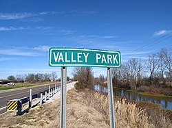
Valley Park is a census-designated place and unincorporated community in Issaquena County, Mississippi, United States. Its elevation is 95 feet (29 m). [2] Although unincorporated, it has a post office, with the ZIP code of 39177. [3]
The Aden Archaeological Site is located 1.5 mi (2.4 km) east of Valley Park.
It was first named as a CDP in the 2020 Census which listed a population of 71. [4]
Valley Park is located on the Canadian National Railway and was originally known as Halpin. A post office operated under the name Halpin from 1884 to 1890 and first began operating under the name Valley Park in 1890. [5]
Census | Pop. | Note | %± |
---|---|---|---|
2020 | 71 | — | |
U.S. Decennial Census [6] 2020 [7] |
Race / Ethnicity | Pop 2020 [7] | % 2020 |
---|---|---|
White alone (NH) | 56 | 78.87% |
Black or African American alone (NH) | 13 | 18.31% |
Native American or Alaska Native alone (NH) | 0 | 0.00% |
Asian alone (NH) | 0 | 0.00% |
Pacific Islander alone (NH) | 0 | 0.00% |
Some Other Race alone (NH) | 0 | 0.00% |
Mixed Race/Multi-Racial (NH) | 0 | 0.00% |
Hispanic or Latino (any race) | 2 | 2.82% |
Total | 71 | 100.00% |
Note: the US Census treats Hispanic/Latino as an ethnic category. This table excludes Latinos from the racial categories and assigns them to a separate category. Hispanics/Latinos can be of any race.
A movie set resembling a rural radio station was constructed west of Valley Park in order to film a scene for the movie O Brother, Where Art Thou? (2000). In the movie, the "Soggy Bottom Boys" recorded Man of Constant Sorrow at radio station "WEZY". Only the mast tower remains at this location: 32°38′56″N90°56′22″W / 32.648775°N 90.939418°W . [8]
On April 24, 2010, Valley Park was the site of a strong tornado, though no injuries were reported. [9] The supercell thunderstorm dropped another tornado in Yazoo City.
South Delta School District operates public schools serving the area, [10] including South Delta High School.
Sharkey County is a county located in the U.S. state of Mississippi. Part of the eastern border is formed by the Yazoo River. According to the 2020 census, the population was 3,800, making it the second-least populous county in Mississippi, after Issaquena County. Its county seat is Rolling Fork. The county is named after William L. Sharkey, the provisional Governor of Mississippi in 1865.
Issaquena County is a county located in the U.S. state of Mississippi. As of the 2020 Census, its population was 1,338, making it the least populous county in the United States east of the Mississippi River. Its county seat is Mayersville. With a per-capita income of $18,598, Issaquena County is, by that measure, one of the poorest counties in the United States.
South Delta High School is a public high school in Rolling Fork, Mississippi. The school serves students in grades nine through twelve.
Panther Burn is a census-designated place and unincorporated community located along U.S. Route 61 in northwestern Sharkey County, Mississippi, United States. It has a post office with the ZIP code of 38765.
Delta City is a census-designated place and unincorporated community located on Mississippi Highway 434 in Sharkey County, Mississippi. Delta City is approximately 6 miles (9.7 km) east of Panther Burn and approximately 5 miles (8.0 km) north of Nitta Yuma. Although an unincorporated community, Delta City has a zip code of 39061.
Dublin, also known as Hopson Bayou, is a census-designated place and unincorporated community located along U.S. Route 49 in southeastern Coahoma County, Mississippi, United States. Dublin is located on the Mississippi Delta Railroad. Dublin has a ZIP code of 38739. A post office first began operation under the name Dublin in 1875.
Rena Lara is a census-designated place and unincorporated community located along Mississippi Highway 1 in southwestern Coahoma County, Mississippi, United States. Rena Lara is located on the former Riverside Division of the Yazoo and Mississippi Valley Railroad. Rena Lara was once home to two general stores, two grocery stores, and the Richardson and May Land & Planting Company.
Ovett is a census-designated place and unincorporated community in southeastern Jones County, Mississippi. Ovett is part of the Laurel Micropolitan Statistical Area.
Moselle is a census-designated place and unincorporated community in southern Jones County, Mississippi. The community is part of the Laurel micropolitan area.
Eastabuchie is a census-designated place and unincorporated community in southwestern Jones County, Mississippi. It is located along U.S. Route 11, just north of the Forrest County line. the community has a post office with the ZIP code 39436. Eastabuchie is part of the Laurel Micropolitan Statistical Area.
Grace is a census-designated place and unincorporated community in Issaquena County, Mississippi, United States. It is located several miles northeast of Mayersville.
Van Vleet is a census-designated place and unincorporated community in Chickasaw County, Mississippi, United States. Van Vleet is located at the junction of Mississippi Highway 32 and Mississippi Highway 385, 8 miles (13 km) northeast of Houston. Van Vleet has a post office with ZIP code 38877.
Mount Pleasant is a census-designated place and unincorporated community in northeastern Marshall County, Mississippi, United States, located along U.S. Route 72 at State Route 311. Although unincorporated, it has a post office serving the nearby city of Holly Springs. The zip code is 38649. The community also has a volunteer fire department located on Boswell Road, and a K-12 school located off of US Highway 72. Mount Pleasant is bordered by Cayce and Taska to the west, Holly Springs to the south, Slayden to the east, and Collierville, Tennessee to the north.
Victoria is a census-designated place and unincorporated community in Marshall County, Mississippi, United States. Its ZIP code is 38679.
Nicholson is an unincorporated community and census-designated place (CDP) in Pearl River County, Mississippi, United States. As of the 2020 census, its population was 2,833. Its ZIP code is 39463.
Wheeler is a census-designated place and unincorporated community in Prentiss County, Mississippi, United States. Its ZIP code is 38880.
New Site is a census-designated place and unincorporated community in Prentiss County, Mississippi, United States. Its population was 851 at the 2010 U.S. Census. Its ZIP code is 38859.
Fernwood is a census-designated place and unincorporated community in Pike County, Mississippi, United States. Its ZIP code is 39635.
Pattison, also known as Martin, is a census-designated place and unincorporated community in Claiborne County, Mississippi, United States. Its ZIP code is 39144.
Bethlehem is a census-designated place and unincorporated community in Marshall County, Mississippi, United States. Its ZIP code is 38659.