History
The community was founded by a Confederate officer, Captain Joe Denham, who had returned to his home in Perry County after the Siege of Vicksburg. He designated the settlement 'Mahned', which is the reverse spelling of his last name. [3] Although the captain wanted to use Denham, a community in nearby Wayne County was already identified by that name. [4]
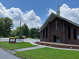
Mahned is located on the former Illinois Central Railroad. [5] It was formerly home to a school, several stores, two churches, and a sawmill. [6] At one point, the Fain-Fagin Lumber Company ran the sawmill in Mahned. [7] The Mahned Lumber Company operated facilities in Mahned. [8]
A post office operated under the name Mahned from 1903 to 1923. [9]
The Mahned Bridge, which is listed on the National Register of Historic Places, is located in Mahned.

Fruitland Park is a small unincorporated community in southern Forrest County, Mississippi. It is part of the Hattiesburg, Mississippi Metropolitan Statistical Area. Camp Tiak, a Boy Scouts of America camp with a one-mile educational forest trail, is located in Fruitland Park.
Oak Grove is a census-designated place and unincorporated community located in Lamar County, Mississippi, United States. The settlement is a suburb located immediately west of Hattiesburg.
Goss,, is an unincorporated community in Marion County located 8 miles northwest of Columbia.
Glenblair or Glen Blair was an unincorporated community in Mendocino County, California. It was located 15 miles (24 km) north-northwest of Comptche, at an elevation of 207 feet.
The Finkbine-Guild Lumber Company was established to harvest and market the virgin longleaf pine stands of southern Mississippi during the early 20th century. The main sawmills were located in Wiggins and D'Lo, Mississippi. When the local timber supply dwindled, the company tried to utilize redwood trees from California, but that operation failed because of high transportation costs. Other attempts were made at promoting a more diversified use of the cutover timberlands; some ventures were successful while others were not.

Berclair is an unincorporated community located in Leflore County, Mississippi, United States. Berclair is approximately 3 miles (4.8 km) west of Itta Bena. It is part of the Greenwood, Mississippi micropolitan area.
Leaf is a census-designated place and unincorporated community in Greene County, Mississippi, United States.
Jayess is an unincorporated community in Lawrence County, Mississippi, United States.
Bexley is an unincorporated place in George County, Mississippi.
Yellow Pine is an unincorporated community in Washington County, Alabama, United States. It is the westernmost settlement in the state of Alabama. The elevation is 239 feet.
Burnside is an unincorporated community located in Neshoba County, Mississippi, United States. Burnside is approximately 5.6 miles (9.0 km) north of Philadelphia along Mississippi Highway 15.
Hintonville is an unincorporated community located in Perry County, Mississippi, United States. Hintonville is approximately 3 miles (4.8 km) north of Beaumont on Mississippi Highway 15 and a part of the Hattiesburg, Mississippi Metropolitan Statistical Area. Hintonville was named in the late 1800s in honor of Arthur "Manny" Hinton, a local pastor, Husband of Corinne Bush, and father of 25. Pastor Hinton was the irect descendant of two brothers who were separated and then sold during slavery: One permitted to retain the family name, "McSwain", the other given the name of the other master, "Hinton"
Janice is an unincorporated community located in Perry County, Mississippi, United States. Janice is approximately 10 miles (16 km) east-southeast of Brooklyn and approximately 15 miles (24 km) northeast of Wiggins on Mississippi Highway 29 and a part of the Hattiesburg, Mississippi Metropolitan Statistical Area. Janice is located within the Black Creek Wilderness portion of De Soto National Forest.
Howison is an unincorporated community located in Harrison County, Mississippi. Howison is approximately 1.9 miles (3.1 km) north of Saucier and 4 miles (6.4 km) south of McHenry and part of the Gulfport-Biloxi metropolitan area.

Wautubbee is an unincorporated community in Clarke County, Mississippi, United States.

Wingate is an unincorporated community located in Perry County, Mississippi.

Norfield is an unincorporated community in Lincoln County, Mississippi, United States.
Maybank is a small unincorporated community in northern Forrest County, Mississippi.
Avera is an unincorporated community in Greene County, Mississippi. Avera was originally located along the Chickasawhay River. The community was named for Powell Avera, who settled the area prior to 1860. Around 1880, the community was moved to its present location. The former location is now known as Old Avera.

Meehan, also known as Meehan Junction, is an unincorporated community in Lauderdale County, Mississippi, United States. Its ZIP code is 39307. The community is also known as Meehan Junction, as it was located at the crossing of the former Alabama & Vicksburg Railroad and the Tallahatta Railway.


