Malcolm, Alabama

Last updated

Malcolm, Alabama
Washington County Alabama Incorporated and Unincorporated areas Malcolm Highlighted 0146192.svg
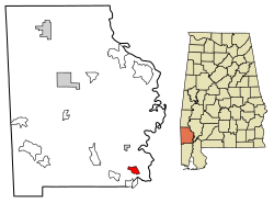
Location of Malcolm in Washington County, Alabama.
USA Alabama location map.svg
Red pog.svg
Malcolm, Alabama
Coordinates: 31°11′29″N88°00′27″W / 31.19139°N 88.00750°W / 31.19139; -88.00750
Country United States
State Alabama
County Washington
Area
[1]
  Total2.39 sq mi (6.19 km2)
  Land2.37 sq mi (6.13 km2)
  Water0.03 sq mi (0.07 km2)
Elevation
43 ft (13 m)
Population
 (2020)
  Total136
  Density57.51/sq mi (22.20/km2)
Time zone UTC-6 (Central (CST))
  Summer (DST) UTC-5 (CDT)
Area code 251
GNIS feature ID152207 [2]

Malcolm is a census-designated place and unincorporated community in Washington County, Alabama, United States. Its population was 187 as of the 2010 census. [3]

Demographics

Historical population
CensusPop.Note
2020 136
U.S. Decennial Census [4]

Related Research Articles

<span class="mw-page-title-main">United States Census Bureau</span> U.S. agency responsible for the census and related statistics

The United States Census Bureau (USCB), officially the Bureau of the Census, is a principal agency of the U.S. Federal Statistical System, responsible for producing data about the American people and economy. The Census Bureau is part of the U.S. Department of Commerce and its director is appointed by the President of the United States.

<span class="mw-page-title-main">Lancaster County, Nebraska</span> County in Nebraska, United States

Lancaster County is a county located in the U.S. state of Nebraska. As of the 2020 United States Census, the population was 322,608, making it the second-most populous county in Nebraska. Its county seat is Lincoln, the state capital. The county was created in 1859.

<span class="mw-page-title-main">Demographics of the United States</span>

The United States had an official estimated resident population of 334,914,895 on July 1, 2023, according to the U.S. Census Bureau. This figure includes the 50 states and the District of Columbia but excludes the population of five unincorporated U.S. territories as well as several minor island possessions. The United States is the third most populous country in the world. The Census Bureau showed a population increase of 0.4% for the twelve-month period ending in July 2022, below the world average annual rate of 0.9%. The total fertility rate in the United States estimated for 2022 is 1.665 children per woman, which is below the replacement fertility rate of approximately 2.1.

In the United States, a metropolitan statistical area (MSA) is a geographical region with a relatively high population density at its core and close economic ties throughout the region. Such regions are not legally incorporated as a city or town would be and are not legal administrative divisions like counties or separate entities such as states. As a result, sometimes the precise definition of a given metropolitan area will vary between sources. The statistical criteria for a standard metropolitan area were defined in 1949 and redefined as a metropolitan statistical area in 1983.

<span class="mw-page-title-main">Portage County, Wisconsin</span> County in Wisconsin, United States

Portage County is a county in the U.S. state of Wisconsin. As of the 2020 census, the population was 70,377. Its county seat is Stevens Point.

<span class="mw-page-title-main">Bexar County, Texas</span> County in Texas, United States

Bexar County is a county in the U.S. state of Texas. It is in South Texas and its county seat is San Antonio.

<span class="mw-page-title-main">Hinds County, Mississippi</span> County in Mississippi, United States

Hinds County is a county located in the U.S. state of Mississippi. With its county seats, Hinds is the most populous county in Mississippi with a 2020 census population of 227,742 residents. Hinds County is a central part of the Jackson metropolitan statistical area. It is a professional, educational, business and industrial hub in the state. It is bordered on the northwest by the Big Black River and on the east by the Pearl River. It is one county width away from the Yazoo River and the southern border of the Mississippi Delta.

<span class="mw-page-title-main">Reynolds, Georgia</span> Town in Georgia, United States

Reynolds is a town in Taylor County, Georgia, United States. The population was 926 in 2020.

<span class="mw-page-title-main">Loves Park, Illinois</span> City in Illinois, United States

Loves Park is a city in Boone and Winnebago counties in the U.S. state of Illinois. Most of the city is in Winnebago County, with a tiny sliver in the east located in Boone County. The population was 23,397 at the 2020 census.

<span class="mw-page-title-main">Easton, Maine</span> Town in the state of Maine, United States

Easton is a town in Aroostook County, Maine, United States. The population was 1,320 at the 2020 census.

<span class="mw-page-title-main">Mason, Michigan</span> City in Michigan, United States

Mason is the county seat of Ingham County in the U.S. state of Michigan. The population was 8,252 at the 2010 census. Mason was named after Stevens T. Mason, the state's first governor.

Minnie Township is a township in Beltrami County, Minnesota, United States. The population was 19 as of the 2000 census.

<span class="mw-page-title-main">Malcolm, Nebraska</span> Village in Nebraska, United States

Malcolm is a village in Lancaster County, Nebraska, United States. It is part of the Lincoln, Nebraska Metropolitan Statistical Area. The population was 457 at the 2020 census.

<span class="mw-page-title-main">Monmouth Junction, New Jersey</span> Populated place in Middlesex County, New Jersey, US

Monmouth Junction is an unincorporated community and census designated place (CDP) located within South Brunswick, in Middlesex County, in the U.S. state of New Jersey. As of the 2010 United States Census, the CDP's population was 2,887.

<span class="mw-page-title-main">Race and ethnicity in the United States</span>

The United States has a racially and ethnically diverse population. At the federal level, race and ethnicity have been categorized separately. The most recent United States census recognized five racial categories, as well as people who belong to two or more of the racial categories. The United States also recognizes the broader notion of ethnicity. The 2000 census and 2010 American Community Survey inquired about the "ancestry" of residents, while the 2020 census allowed people to enter their "origins". The Census Bureau also classified respondents as either Hispanic or Latino, identifying as an ethnicity, which comprises the minority group in the nation.

<span class="mw-page-title-main">1790 United States census</span> First US census

The 1790 United States census was the first United States census. It recorded the population of the whole United States as of Census Day, August 2, 1790, as mandated by Article 1, Section 2, of the Constitution and applicable laws. In the first census, the population of the United States was enumerated to be 3,929,214 inhabitants.

<span class="mw-page-title-main">Lincoln, Nebraska metropolitan area</span>

The Lincoln Metropolitan Statistical Area, as defined by the United States Census Bureau, is an area consisting of two counties in Nebraska, anchored by the city of Lincoln. As of the 2020 census, the MSA had a population of 340,217.

References

  1. "2020 U.S. Gazetteer Files". United States Census Bureau. Retrieved October 29, 2021.
  2. "Malcolm". Geographic Names Information System . United States Geological Survey, United States Department of the Interior.
  3. "U.S. Census website". United States Census Bureau . Retrieved May 14, 2011.
  4. "Census of Population and Housing". Census.gov. Retrieved June 4, 2016.