St. Stephens, Alabama

Last updated

St. Stephens
CDP
Old Washington County Courthouse 002.jpg
St. Stephens Courthouse in "New" St. Stephens, completed in 1854.
Washington County Alabama Incorporated and Unincorporated areas St. Stephens Highlighted 0167584.svg
Location of St. Stephens in Washington County, Alabama.
USA Alabama location map.svg
Red pog.svg
St. Stephens
Location within the state of Alabama
Coordinates: 31°32′25″N88°3′19″W / 31.54028°N 88.05528°W / 31.54028; -88.05528
Country United States
State Alabama
County Washington
Area
[1]
  Total10.01 sq mi (25.93 km2)
  Land9.88 sq mi (25.58 km2)
  Water0.14 sq mi (0.35 km2)
Elevation
226 ft (69 m)
Population
 (2020)
  Total415
  Density42.02/sq mi (16.22/km2)
Time zone UTC-6 (Central (CST))
  Summer (DST) UTC-5 (CDT)
ZIP code
36569
Area code 251
FIPS code 01-67584
[2] [3]

St. Stephens is an unincorporated census-designated place in Washington County, Alabama, United States. Its population is 580. [4] Located near the Tombigbee River in the southwestern part of the state and 67 miles north of Mobile, it is composed of two distinct sites: Old St. Stephens and New St. Stephens. [2] [3] The Old St. Stephens site lies directly on the river and is no longer inhabited. It was the territorial capital of the Alabama Territory. [5] [6] Now encompassed by the Old St. Stephens Historical Park, it is listed on the National Register of Historic Places. [7] [8]

Contents

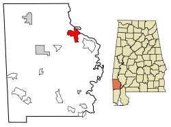
Changes in the territorial capital and transportation resulted in the Old St. Stephens site being bypassed by development. "New" St. Stephens developed two miles inland around a railway station, but adjacent to the old site. It is the location of the post office, Baptist and Methodist churches, and residences. [9] It has one building listed on the National Register and another on the Alabama Register of Landmarks and Heritage. [7] [10]

Demographics

Historical population
CensusPop.Note
1890 387
2010 495
2020 415−16.2%
U.S. Decennial Census [11]

St. Stephens first appeared on the 1890 U.S. Census as an unincorporated village. It did not reappear again until 2010 when it was classified as a census-designated place (CDP).

History

Old St. Stephens was situated on a limestone bluff that the Native Americans called Hobucakintopa. It was located at the fall line of the Tombigbee River, where rocky shoals ended navigation for boats traveling north from Mobile, 67 miles to the south. The fall line marked the piedmont and uplands of the state. As early as 1772, British surveyor Bernard Romans noted that "sloops and schooners may come up to this rapid; therefore, I judge some considerable settlement will take place." [6]

By 1789, when the territory was again under Spanish control, the governor of Mobile, Juan Vincente Folch, established a fort and outpost here. By 1796 over 190 white residents, mostly settlers from the United States, and their 97 or so enslaved African-American workers, were living around the fort. Under the Treaty of San Lorenzo following the American Revolutionary War, Spain transferred the fort to the United States on February 5, 1799. This region was included in the Mississippi Territory. [6] [12]

The Choctaw Federal Trading House was established in 1803 at St. Stephens, named for the dominant Native American tribe in the area. Americans traded manufactured goods such as tools and cloth for deerskins. George Strother Gaines was appointed by the federal government to head the Choctaw Agency in 1805 as the federal representative to the people. He continued to use the old Spanish blockhouse as the agency's store and established a land office in the former warehouse. He used the home of the former Spanish commandant as his own residence. In 1811 Gaines constructed what may have been the first brick building built by Americans in (today's) Alabama; it served as a warehouse. [6] [12]

In 1804 Ephraim Kirby was appointed superior court judge of the Mississippi Territory by President Thomas Jefferson. In a letter to the president, Kirby described the residents of St. Stephens as "illiterate, wild and savage, of depraved morals, unworthy of public confidence or private esteems, litigious, disunited, and knowing each other, universally distrustful of each other." Pioneer minister Lorenzo Dow saw these weak points as a challenge, especially when he was asked to leave town. Dow, in a dramatic manner, prophesied the town's demise within a century, that it would become a "roosting place for bats and owls" and a ruin in which "no stone would lie upon another." [12] [13]

Settlers living around Fort St. Stephens requested official recognition from the Mississippi Territorial legislature, which chartered the town of St. Stephens on January 8, 1807. The charter was amended on December 18, 1811, and the settlement was officially renamed Saint Stephens. By 1815, the Mississippi Territorial legislature surveyed the town site and lots were sold. Approximately 40 houses were reported in the town in 1816. [12]

Following Mississippi's statehood in 1817, the Alabama Territory was established. St. Stephens served as its territorial capital from 1817 to 1819, stimulating rapid town growth. By 1819 St. Stephens boasted over 500 homes. Its approximately 20 stores and commercial establishments included two hotels, legal and medical offices, and a theatre. [6] [12]

Old St. Stephens Site
St. Stephens Stone Historical Marker.jpg
Marker placed by the Alabama Centennial Commission in 1922
USA Alabama location map.svg
Red pog.svg
Usa edcp location map.svg
Red pog.svg
Nearest citySt. Stephens, Alabama
Area74 acres (30 ha)
NRHP reference No. 70000111 [7]
Added to NRHPDecember 29, 1970

Among the prominent citizens of St. Stephens was Henry Hitchcock, first attorney general of Alabama and later chief justice of the state Supreme Court. A post office was established in 1818, and George Fisher carried mail between St. Stephens and Mobile. Thomas Eastin published the Halcyon and Tombeckbe Advertiser, the fourth newspaper established in the Alabama Territory. Eastin described St. Stephens as a town of elegant tree-shaded homes, spacious streets, and genteel citizens. Washington Academy, a private boys school founded in 1811, was located on a prominent hill in town. The Tombecbe Bank, the first to be chartered in the state, was established by Israel Pickens, who would later be elected as the third governor of Alabama. [6] [12]

When the first state assembly adjourned at St. Stephens on February 14, 1818, many Alabama residents thought the capital should be moved to a more central location. Tuscaloosa was under consideration when Governor William Wyatt Bibb made the announcement in 1819 that the capital would be moved to Cahaba. This change threatened the future of St. Stephens. In addition, the development of shallow draft boats permitted travelers to pass over the shoals and venture further upriver past the town. Lastly, yellow fever outbreaks caused high mortality in the town. [6] [12]

Railway construction bypassed the town, and a station was established about two miles west of the river. Within two decades, most of the remaining residents had moved around the station to settle New St. Stephens. By 1833 the old town site was reduced in population to a small village; by the time of the American Civil War, it had largely been superseded by the new town. [6] [12]

The old site was listed on the National Register of Historic Places on December 29, 1970. [7] The St. Stephens Historical Commission, which oversees the Old St. Stephens Historical Park, was incorporated in 1988, with a mission to promote and sponsor historical research and archaeological studies of Old St. Stephens. In 1999, the Alabama Historical Commission gave it a grant for archaeological studies. The goal was to complete a map of the old town site, denoting the location of streets, building foundations, cellar depressions, and cisterns, and to excavate some of the old building sites. [6]

"New" St. Stephens has one building listed on the National Register of Historic Places, the St. Stephens Courthouse. Listed on July 3, 1997, it has been restored by the St. Stephens Historical Commission to serve as a visitor center and local history museum near the entrance road to the Old St. Stephens Historical Park. [7] [14] Additionally, the St. Stephens Methodist Church building, completed in 1857, was listed on the Alabama Register of Landmarks and Heritage on March 25, 1976. [10]

Notable person

See also

Related Research Articles

<span class="mw-page-title-main">Clarke County, Alabama</span> County in Alabama, United States

Clarke County is a county located in the southwestern part of the U.S. state of Alabama. As of the 2020 census, the population was 23,087. The county seat is Grove Hill. The county's largest city is Jackson. The county was created by the legislature of the Mississippi Territory in 1812. It is named in honor of General John Clarke of Georgia, who was later elected governor of that state.

<span class="mw-page-title-main">Washington County, Alabama</span> County in Alabama, United States

Washington County is a county located in the southwestern part of the U.S. state of Alabama. As of the 2020 census, the population was 15,388. The county seat is Chatom. The county was named in honor of George Washington, the first President of the United States. In September 2018 The United States Office of Management and Budget (OMB) added Washington County to the Mobile, Alabama Metropolitan Statistical Area. It is also part of the larger Mobile-Daphne-Fairhope, AL Combined Statistical Area.

<span class="mw-page-title-main">Tishomingo County, Mississippi</span> County in Mississippi, United States

Tishomingo County is a county located in the northeastern corner of the U.S. state of Mississippi. As of the 2020 census, the population was 18,850. Its county seat is Iuka.

<span class="mw-page-title-main">Demopolis, Alabama</span> City in Alabama, United States

Demopolis is the largest city in Marengo County, in west-central Alabama. The population was 7,162 at the 2020 census.

<span class="mw-page-title-main">Epes, Alabama</span> Town in Alabama U.S.

Epes is a town in Sumter County, Alabama, United States. Initially called Epes Station, it was incorporated as Epes in 1899. At the 2010 census the population was 192, down from 206 in 2000.

<span class="mw-page-title-main">Alabama Territory</span> Territory of the US 1817-1819

The Territory of Alabama was an organized incorporated territory of the United States. The Alabama Territory was carved from the Mississippi Territory on August 15, 1817 and lasted until December 14, 1819, when it was admitted to the Union as the twenty-second state.

<span class="mw-page-title-main">John Williams Walker</span> American politician

John Williams Walker was an American politician, who served as the Democratic-Republican United States senator from the state of Alabama, the first senator elected by that state.

<span class="mw-page-title-main">Florida panhandle</span> Northwest region of Florida

The Florida panhandle is the northwestern part of the U.S. state of Florida. It is a salient roughly 200 miles (320 km) long, bordered by Alabama on the north and the west, Georgia on the north, and the Gulf of Mexico to the south. Its eastern boundary is arbitrarily defined. It is defined by its southern culture and rural geography relative to the rest of Florida, as well as closer cultural links to French-influenced Louisiana, Mississippi, and Alabama. Its major communities include Pensacola, Navarre, Destin, Panama City Beach, and Tallahassee.

<span class="mw-page-title-main">Cotton Gin Port, Mississippi</span> United States historic place

Cotton Gin Port is a ghost town in Monroe County, Mississippi, United States.

<span class="mw-page-title-main">George Strother Gaines</span> Alabama politician, American Indian agent and banker

George Strother Gaines was a federal Indian agent in the Mississippi Territory. He began as the US Indian agent to the Choctaw, explored the country west of the Mississippi River, and supervised the removal of the Choctaw to Indian Territory in the 1830s. He worked as a banker, and served as a state senator and railroad lobbyist, becoming even more influential in the early history of the region.

<span class="mw-page-title-main">Fort Stoddert</span> U.S. colonial fort (1799–1814) in present-day Mount Vernon, Alabama

Fort Stoddert, also known as Fort Stoddard, was a stockade fort in the U.S. Mississippi Territory, in what is today Alabama. It was located on a bluff of the Mobile River, near modern Mount Vernon, close to the confluence of the Tombigbee and Alabama Rivers. It served as the western terminus of the Federal Road which ran through Creek lands to Fort Wilkinson in Georgia. The fort, built in 1799, was named for Benjamin Stoddert, the secretary to the Continental Board of War during the American Revolution and Secretary of the Navy during the Quasi War. Fort Stoddert was built by the United States to keep the peace by preventing its own settlers in the Tombigbee District from attacking the Spanish in the Mobile District. It also served as a port of entry and was the site of a Court of Admiralty. While under the command of Captain Edmund P. Gaines, Aaron Burr was held as a prisoner at the fort after his arrest at McIntosh in 1807 for treason against the United States. In July 1813, General Ferdinand Claiborne brought the Mississippi Militia to Fort Stoddert as part of the Creek War. The 3rd Infantry Regiment was commanded by General Thomas Flournoy to Fort Stoddert following the Fort Mims massacre. The site declined rapidly in importance after the capture of Mobile by the United States in 1813 and the establishment of the Mount Vernon Arsenal in 1828.

<span class="mw-page-title-main">Cahaba, Alabama</span> Archaeological site in Alabama, United States

Cahaba, also spelled Cahawba, was the first permanent state capital of Alabama from 1820 to 1825. It was the county seat of Dallas County, Alabama until 1866. Located at the confluence of the Alabama and Cahaba rivers, the town endured regular seasonal flooding.

<span class="mw-page-title-main">Fort Mims massacre</span> Part of the Creek War (1813)

The Fort Mims massacre took place on August 30, 1813, at a fortified homestead site 35-40 miles north of Mobile, Alabama, during the Creek War. A large force of Creek Indians belonging to the Red Sticks faction, under the command of headmen Peter McQueen and William Weatherford, stormed the fort and defeated the militia garrison.

<span class="mw-page-title-main">Ellicott's Stone</span> Historic boundary marker in Mobile County, Alabama, US

Ellicott's Stone, also known as the Ellicott Stone, is a boundary marker in northern Mobile County, Alabama. It was placed on April 10, 1799, by a joint U.S.-Spanish survey party headed by Andrew Ellicott. It was designated by the American Society of Civil Engineers as a Historic Civil Engineering Landmark in 1968 and was added to the National Register of Historic Places on April 11, 1973.

The history of Pensacola, Florida, begins long before the Spanish claimed founding of the modern city in 1698. The area around present-day Pensacola was inhabited by Native American peoples thousands of years before the historical era.

Fort Charlotte, Mobile is a partially-reconstructed 18th-century fort in Mobile, Alabama.

<span class="mw-page-title-main">Index of Alabama-related articles</span>

The following is an alphabetical list of articles related to the U.S. state of Alabama.

<span class="mw-page-title-main">National Register of Historic Places listings in Mobile, Alabama</span>

This is a list of the National Register of Historic Places listings in Mobile, Alabama.

<span class="mw-page-title-main">Claiborne, Alabama</span> Place in Alabama, United States

Claiborne is a ghost town on a bluff above the Alabama River in Monroe County, Alabama.

The Tombigbee District, also known as the Tombigbee, was one of two areas, the other being the Natchez District, that were the first in what was West Florida to be colonized by British subjects from the Thirteen Colonies and elsewhere. This later became the Mississippi Territory as part of the United States. The district was also the first area to be opened to white settlement in what would become the state of Alabama, outside of the French colonial outpost of Mobile on the Gulf Coast. The Tombigbee and Natchez districts were the only areas populated by whites in the Mississippi Territory when it was formed by the United States in 1798.

References

  1. "2020 U.S. Gazetteer Files". United States Census Bureau. Retrieved October 29, 2021.
  2. 1 2 U.S. Geological Survey Geographic Names Information System: St. Stephens, Alabama (New Saint Stephens)
  3. 1 2 U.S. Geological Survey Geographic Names Information System: Old Saint Stephens (historical)
  4. "U.S. Census website". United States Census Bureau . Retrieved May 14, 2011.
  5. "Capitals of Alabama" Archived October 8, 2012, at the Wayback Machine Alabama Department of Archives & History (October 29, 2001). Retrieved May 4, 2005
  6. 1 2 3 4 5 6 7 8 9 "Old St. Stephens". Encyclopedia of Alabama. Auburn University. Retrieved June 21, 2011.
  7. 1 2 3 4 5 "National Register Information System". National Register of Historic Places . National Park Service. March 13, 2009.
  8. "Visit the Park". Old St. Stephens Historical Commission. Archived from the original on July 30, 2013. Retrieved May 3, 2017.
  9. ZIP Code Lookup
  10. 1 2 "The Alabama Register of Landmarks & Heritage". preserveala.org. Alabama Historical Commission. May 31, 2011. Archived from the original (PDF) on June 6, 2011. Retrieved June 6, 2011.
  11. "U.S. Decennial Census". Census.gov. Retrieved June 6, 2013.
  12. 1 2 3 4 5 6 7 8 "The History of Old St. Stephens". Old St. Stephens Historical Commission. Archived from the original on October 29, 2014. Retrieved May 3, 2017.
  13. Nathan O. Hatch, The Democratization of American Christianity, (New Haven: Yale University Press, 1989), 37. For more on the prophecy account see: Richard J. Stockham, "The Misunderstood Lorenzo Dow," Alabama Review, 16 (1963):20.
  14. "Museum". Old St. Stephens Historical Commission. Archived from the original on July 18, 2013. Retrieved May 3, 2017.
  15. Warner, Ezra J. Jr. (September 1, 1975). Biographical Register of the Confederate Congress. LSU Press. p. 252. ISBN   978-0-8071-4942-3.