Sims Chapel, Alabama | |
|---|---|
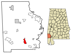 Location of Sims Chapel in Washington County, Alabama. | |
| Coordinates: 31°14′12″N88°08′35″W / 31.23667°N 88.14306°W [1] | |
| Country | United States |
| State | Alabama |
| County | Washington |
| Area | |
• Total | 5.73 sq mi (14.85 km2) |
| • Land | 5.70 sq mi (14.77 km2) |
| • Water | 0.031 sq mi (0.08 km2) |
| Elevation | 112 ft (34 m) |
| Population (2020) | |
• Total | 145 |
| • Density | 25.4/sq mi (9.82/km2) |
| Time zone | UTC-6 (Central (CST)) |
| • Summer (DST) | UTC-5 (CDT) |
| Area code | 251 |
| GNIS feature ID | 2632284 [1] |
Sims Chapel (also Darrah,Grandfield) is a census-designated place and unincorporated community in Washington County, Alabama, United States. Its population was 153 as of the 2010 census. [3]
