Manatee Airport

Last updated
Manatee Airport
Summary
Airport typePrivate
Serves Spanish Lookout, Belize
Elevation  AMSL 343 ft / 105 m
Coordinates 17°16′42″N89°1′25″W / 17.27833°N 89.02361°W / 17.27833; -89.02361 (Manatee Airport (Manatee))
Map
Belize location map.svg
Airplane silhouette.svg
MZE
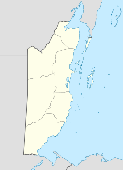
Location of Manatee Airport in Belize
Runways
Direction LengthSurface
mft
09/271,2404,068Gravel
Source: Landings.com [1] Google Maps [2] GCM [3]

Manatee Airport( IATA : MZE, ICAO : MZSL) is a public use airport serving the rural community of Spanish Lookout, Cayo District, Belize.

Contents

The Belize VOR-DME (Ident: BZE) is located 43.5 nautical miles (81 km) east-northeast of the runway. [4]
See also

Related Research Articles

Mbandaka Airport is an airport serving the Congo River port of Mbandaka, capital city of the Équateur District in the Democratic Republic of the Congo. The runway is on the southeast side of the city.

<span class="mw-page-title-main">Hector Silva Airstrip</span> Airport in Belmopan, Belize

Hector Silva airstrip is an airport located in Cayo District serving Belmopan, the capital city of Belize. The runway is on the northern edge of the city off the George Price Highway, and has a small terminal building.

Chan Chich Airstrip is an airport serving the Chan Chich Lodge and the Gallon Jug Estate in the Orange Walk District of Belize. The airport is 6 kilometres (4 mi) east of the border with Guatemala.

<span class="mw-page-title-main">Mocopulli Airport</span> Airport

Mocopulli Airport is an airport serving Dalcahue, a port city on Chiloé Island in the Los Lagos Region of Chile, as well as the city of Castro. The airport is 6 kilometres (3.7 mi) northwest of Dalcahue.

Las Flores Airport is a rural airport serving Las Flores, a town in the Buenos Aires Province of Argentina. The airport is 5 kilometres (3 mi) south of the town.

Marcos Juárez Airport is a public use airport located 4 kilometres (2 mi) west of Marcos Juárez, a city in the Córdoba Province of Argentina.

Tolhuin Lago Fagnano Airport is a public use airport located 2 kilometres (1 mi) northeast of Tolhuin, a lakeside village in the Tierra del Fuego Province of Argentina.

Ñanco Lauquen Airport is a public use airport serving Trenque Lauquen, a town in the Buenos Aires Province of Argentina. The airport is 2 kilometres (1 mi) west of the town.

Independence Airport, also known as Savannah Airport or Mango Creek Airport, is an airport serving Independence and Mango Creek, a coastal community straddling the border between Toledo and Stann Creek Districts in Belize. The airport runs along the Independence Highway, 4 kilometres (2 mi) inland from the coast.

Melinda Airport is an airstrip just east of Hope Creek, a village in the Stann Creek District of Belize. The gravel runway is on the south edge of the Melinda Forest Reserve, and just off the Hummingbird Highway.

Orange Walk Airport is a public use airport 3 kilometres (2 mi) southwest of Orange Walk Town, Orange Walk District, Belize. The airport was also known as Tower Hill Airport.

Silver Creek Airport is an airport serving the Stann Creek District, Belize. The rural airport is 7 kilometres (4 mi) inland from the Caribbean coast, and 6 kilometres (4 mi) northeast of Santa Cruz.

<span class="mw-page-title-main">Matthew Spain Airport</span> Airport in Belize

Matthew Spain Airport, formerly called Central Farm Airstrip, is a public use airport serving San Ignacio, a town in the Cayo District of Belize. The airport is 5 kilometres (3 mi) northeast of Santa Elena.

Pupelde Airport is an airport serving Ancud, a Pacific port city in the Los Lagos Region of Chile. Ancud is on the northern shore of Chiloé Island.

Teniente Vidal Airport is an airport serving Coyhaique, capital of the Aysén Region of Chile. The airport is 3 kilometres (1.9 mi) southwest of Coyhaique.

General Freire Airport is an airport serving Curicó, a city in the Maule Region of Chile. The airport is within the northeast part of the city.

San Rafael Airport Spanish: Aeródromo de San Rafael de Los Andes, is an airport serving Los Andes, a city in the Valparaíso Region of Chile. The airport is 5 kilometres (3.1 mi) west-northwest of the city.

<span class="mw-page-title-main">María Dolores Airport</span> Airport

María Dolores Airport is an airport serving Los Ángeles, capital of Bío Bío Province in the Bío Bío Region of Chile.

El Mirador Airport, is an airport just southeast of Puerto Varas, a city in the Los Lagos Region of Chile. Puerto Varas is on the southwest shore of Llanquihue Lake.

<span class="mw-page-title-main">Ometepe Airport</span> Airport

Ometepe Airport is the only airport on Ometepe, the largest island in Lake Nicaragua. The airport is in the La Paloma comarca of Moyogalpa, Rivas Department, Nicaragua, 1.6 kilometres (1 mi) south of Moyogalpa.

References

  1. Airport record for Manatee Airport at Landings.com. Retrieved 2013-09-02
  2. "location of Manatee Airport" (Map). Google Maps . Retrieved 2013-09-02.
  3. Airport information for Manatee Airport at Great Circle Mapper.
  4. "Belize VOR". Our Airports. Retrieved 29 November 2018.